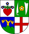
Cotkytle
| Cotkytle | ||||
|---|---|---|---|---|
|
||||
| Basic data | ||||
| State : |
|
|||
| Region : | Pardubický kraj | |||
| District : | Ústí nad Orlicí | |||
| Area : | 1864 ha | |||
| Geographic location : | 49 ° 56 ' N , 16 ° 43' E | |||
| Height: | 618 m nm | |||
| Residents : | 396 (Jan. 1, 2019) | |||
| Postal code : | 561 32 | |||
| structure | ||||
| Status: | local community | |||
| Districts: | 4th | |||
| administration | ||||
| Mayor : | Ivo Berky (as of 2008) | |||
| Address: | Cotkytle 3,561 32 Cotkytle |
|||
| Municipality number: | 579980 | |||
| Website : | www.cotkytle.cz | |||
Cotkytle (German Zottkittl , Zotküttl also Zackiecel ) is a municipality in the Czech Republic . It is located 14 km northeast of the town of Lanškroun in the Okres Ústí nad Orlicí on the historical border between Bohemia and Moravia.
history
The first written mention of Cotkytle comes from the year 1350. The place name Zackiecel or Zockicel is borrowed from the word Zottkittel (hairy smock). The village of Cotkytle was probably founded by German-speaking colonists. Cotkytle is mentioned in 1412 together with Janoušov , which later becomes part of the municipality. Both places originally belonged to the Hohenstadt rule, while the later parts of the municipality Laudon and Herbortice then belonged to the Landskron rule.
After the Munich Agreement , the place was added to the German Empire and belonged to the Hohenstadt district until 1945 .
Community structure
The municipality of Cotkytle consists of four districts
- Cotkytle ( Zottkittl , also Zackiecel )
- Janoušov ( Johannestal )
- Herbortice ( Herbotitz , also Herbortsdorf )
- Mezilesí ( Laudon )
Cotkytle and Janoušov form a common cadastre.

