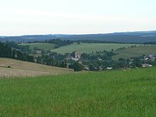
České Petrovice
| České Petrovice | ||||
|---|---|---|---|---|
|
||||
| Basic data | ||||
| State : |
|
|||
| Region : | Pardubický kraj | |||
| District : | Ústí nad Orlicí | |||
| Area : | 626 ha | |||
| Geographic location : | 50 ° 7 ' N , 16 ° 36' E | |||
| Height: | 600 m nm | |||
| Residents : | 156 (Jan 1, 2019) | |||
| Postal code : | 564 01 | |||
| License plate : | E. | |||
| traffic | ||||
| Street: | Mladkov - Rokytnice v Orlických horách | |||
| structure | ||||
| Status: | local community | |||
| Districts: | 1 | |||
| administration | ||||
| Mayor : | Miloš Roušar (as of 2010) | |||
| Address: | České Petrovice 27 564 01 České Petrovice |
|||
| Municipality number: | 580066 | |||
| Website : | www.orlicko.cz/Ceskepetrovice/ | |||
České Petrovice (German Bohemian Petersdorf ) is a municipality in the Okres Ústí nad Orlicí in the Czech Republic . It lies on the Orlička and belongs to the Pardubický kraj region .
geography
České Petrovice is located in a high valley of the Orlička on the south-eastern slope of the Eagle Mountains , right on the border with Poland. Neighboring towns are Mladkov and Lichkov in the south-east, Vlčkovice and Pastviny in the south, Klášterec nad Orlicí in the south-west, Kunvald in the west and Rokytnice v Orlických horách in the north-west. Across the border with Poland are Lesica in the northwest, Międzylesie and Smreczyna in the northeast and Kamienczyk and Boboszów in the east. The place is surrounded by mountains: in the north lies the Čihácký vrch, in the east the Bernardův vrch, in the south the 762 m high Adam and in the west the 672 m high Jedlina.
history
Petersdorf was probably founded as a lumberjack settlement in the first half of the 16th century and was given the addition of Bohemian to distinguish the village of the same name near Wichstadtl , while the name German Petersdorf (now Petrovičky ) became natural for the existing Petersdorf . Böhmisch Petersdorf belonged to the Geiersberg lordship and was first mentioned in 1568 when the lordship boundaries were measured or determined. It was mentioned again on March 19, 1601, when Adam von Waldstein sold the Geiersberg estate to Georg von Stubenberg .
In 1734 the Peter and Paul Church was built in Bohemian Petersdorf, which was elevated to a parish church in 1835, to which Tschihak ( Čihák ) also belonged. It had a three-class elementary school, a finance station that monitored the border traffic to the neighboring, since 1763 Prussian county of Glatz , and a savings bank. Since the end of the 19th century, summer and winter tourism and the manufacture of ski boots have been of economic importance.
After the establishment of Czechoslovakia , a school class for the Czech minority was set up after 1920 and the official place name České Petrovice was introduced. Between 1935 and 1938, several bunker lines of the Czechoslovak Wall were built in the area to secure the Valley of the Silent Eagles. In 1939 there were 466 inhabitants who lived in 148 houses.
After the Munich Agreement , Böhmisch Petersdorf was incorporated into the German Reich and was part of the German district of Grulich until 1945 . After the end of the Second World War, the German residents were expelled in 1945/46 . As a result, the population decreased significantly. An extensive repopulation did not take place during the time of communist rule because of the remote location and the proximity to the border. Since the political change in 1989 there has been an economic upswing due to the increase in summer tourism and the good sports opportunities in the winter season.
Community structure
No other districts belong to the municipality of České Petrovice.
Attractions
- Peter and Paul Church from 1734
- Chapel on Mount Adam. It was donated in 1801 by Anton Bayer, a citizen of Böhmisch Petersdorf, in gratitude for regained health and renovated and refurbished several times by his descendants.
Web links
Individual evidence
- ↑ Český statistický úřad - The population of the Czech municipalities as of January 1, 2019 (PDF; 7.4 MiB)
- ^ Michael Rademacher: German administrative history from the unification of the empire in 1871 to the reunification in 1990. Grulich district. (Online material for the dissertation, Osnabrück 2006).


