Gallipienzo
| Gallipienzo municipality | ||
|---|---|---|
 Gallipienzo - View of the town with the Aragón River
|
||
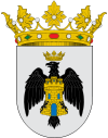
| coat of arms | Map of Spain | |

|
|
|
| Basic data | ||
| Autonomous Community : |
|
|
| Comarca : | Comarca de Sangüesa | |
| Coordinates | 42 ° 32 ′ N , 1 ° 23 ′ W | |
| Height : | 500 msnm | |
| Area : | 56.45 km² | |
| Residents : | 98 (Jan. 1, 2019) | |
| Population density : | 1.74 inhabitants / km² | |
| Postal code : | 31493 | |
| Municipality number ( INE ): | 31110 | |
| administration | ||
| Website : | Gallipienzo | |
Gallipienzo ( Basque Galipentzu ) is a place and a municipality (municipio) with only 98 inhabitants (as of January 1, 2019) in the autonomous community of Navarre in the north of Spain . The place consists of an old and almost abandoned old town center and a new district (Gallipienzo Nuevo) .
Location and climate
The old town of Gallipienzo is located on a hill above the Río Aragón at a height of approx. 500 m and is approx. 57 km (driving distance) in a south-easterly direction from the regional capital Pamplona ; the new district is located approx. 1 km (as the crow flies) northeast and is a good 100 m lower. The climate is temperate to warm; Rain (approx. 790 mm / year) falls over the year.
Population development
| year | 1857 | 1900 | 1950 | 2000 | 2017 |
| Residents | 694 | 748 | 568 | 160 | 99 |
The mechanization of agriculture , the abandonment of small farms and the resulting loss of jobs have led to a significant decline in the population since the middle of the 20th century ( rural exodus ).
economy
Gallipienzo is traditionally oriented towards agriculture, but craftsmen and service providers have also settled in the village; however, they all disappeared in the last decades of the 20th century. Tourism in the form of renting holiday apartments (casas rurales) plays only a minor economic role.
history
Celtic , Roman , Visigoth and even Moorish traces have not yet been discovered. At the end of the 11th century, Peter I of Aragón (ruled 1094–1104) attempted to recapture ( reconquista ) the area, but only King Alfonso II was successful around 1165. In the 1170s the area was disputed between the kingdoms of Castile and Aragón . From 1366 to 1843 Gallipienzu belonged to the historic comarca of Valle de Aibar .
Attractions
- The late Romanesque-late Gothic Iglesia de San Salvador stands on a slope at the highest point in the town. It has a vaulted crypt . The actual nave (nave) dates from the 15th century; it is comparatively high and covered by a sixteenth-century star vault . In the polygonal broken apse have frescoes remains preserved.
- Not far from there rises the outer wall of the otherwise ruined Ermita de la Concepción (or Ermita de Virgen de la Peña ) made of precisely hewn stones . It is believed that a castle (castillo) once stood here, from which the stones could also have come.
- The Iglesia de San Pedro was built around the same time as the upper church of San Salvador (16th century). A multi-tiered archivolt portal leads into the church, the apse of which shows an altarpiece (retablo) from 1629.
Web links
- Gallipienzo, Sights - Info (Spanish)
Individual evidence
- ↑ Cifras oficiales de población resultantes de la revisión del Padrón municipal a 1 de enero . Population statistics from the Instituto Nacional de Estadística (population update).
- ↑ Gallipienzo - Climate table
- ↑ Gallipienzo - Population Development
- ↑ Gallipienzo - Church of San Salvador

