Mañeru
| Mañeru | ||
|---|---|---|
| coat of arms | Map of Spain | |

|
|
|
| Basic data | ||
| Autonomous Community : |
|
|
| Comarca : | Tierra de Estella | |
| Coordinates | 42 ° 40 ′ N , 1 ° 51 ′ W | |
| Height : | 456 msnm | |
| Area : | 13 km² | |
| Residents : | 434 (Jan. 1, 2019) | |
| Population density : | 33.38 inhabitants / km² | |
| Municipality number ( INE ): | 31161 | |
| administration | ||
| Website : | www.maneru.es | |
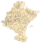
| Location of the city | ||

|
||
Mañeru is a place in the Spanish Camino de Santiago French Way , in the autonomous community of Navarra .
The place belonged to the Order of St. John in the Middle Ages , the remains of their commandery , the hospice of Bargota, can be passed on foot from Puente la Reina .
Today there are remains of the Gothic church in the village, the parish church of San Pedro from the 18th century and a pilgrimage church dedicated to Saint Barbara .
Population development of the municipality

literature
- Míllan Bravo Lozano: Practical pilgrim guide. The Camino de Santiago. Editorial Everest, Léon 1994, ISBN 84-241-3835-X .
Web links
Commons : Mañeru - collection of images, videos and audio files
- Information about the Camino Francés ( Memento of December 21, 2015 in the Internet Archive )
Individual evidence
- ↑ Cifras oficiales de población resultantes de la revisión del Padrón municipal a 1 de enero . Population statistics from the Instituto Nacional de Estadística (population update).
- ↑ Location information from the regional government of Navarre (Spanish)
Navigation bar St. James " Camino Francés "
← Previous location: Puente la Reina 4.5 km | Mañeru | Next town: Cirauqui 3 km →
