Amenal
| O Pino parish: Amenal | ||
|---|---|---|
| coat of arms | Map of Spain | |
 Help on coat of arms |
|
|
| Basic data | ||
| Autonomous Community : |
|
|
| Province : | A Coruña | |
| Coordinates | 42 ° 54 ′ N , 8 ° 24 ′ W | |
| Height : | 240 msnm | |
| Residents : | 90 (January 1, 2011) INE | |
| Postal code : | 15887 | |
| Area code: | 15066120300 | |
| Nearest airport : | Santiago de Compostela Airport | |
| Location of the place | ||

|
||
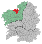
Amenal is a place on the Way of St. James in the province of A Coruña of the Autonomous Community of Galicia , administratively it is dependent on O Pino .
literature
- Míllan Bravo Lozano: Practical pilgrim guide. The Camino de Santiago. Editorial Everest, Léon 1994, ISBN 84-241-3835-X .
swell
- Population figures see INE
- Postcodes on Ingeniuz.com
- For coordinates and heights, see Google Earth
Navigation bar St. James " Camino Francés "
← Previous location: Santa Irene 5.8 km | Amenal | Next town: Lavacolla 5 km →
