Border between Albania and Montenegro
The border between Albania and Montenegro separates the territory of the Republic of Albania from Montenegro . It has a length of around 170 kilometers on approximately 100 kilometers as the crow flies.
Borderline
| Albania | Montenegro | |
|---|---|---|
| Qark | local community | local community |
| Shkodra | Shkodra | Ulcinj |
| bar | ||
| Malësia e Madhe | ||
| Podgorica | ||
| Andrijevica | ||
| Gusinje | ||
| Shkodra | ||
| Kukës | Tropoja | |
| Plav | ||
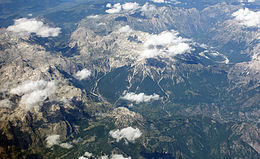
The common state border leads in a north-easterly direction from the Adriatic Sea into the main ridge of the Dinaric Mountains in the Prokletije (Albanian Alps).
The border initially runs in the Buna / Bojana , with the island of Ada in the confluence with Montenegro. It follows the course of this discharge of Skadar Lake (Skadarko Jezero) northeastward to just over half the length. From Samrisht it runs directly north to Lake Skadar between Zogaj and Ckla . In the middle of the lake, it first runs to the northwest, before it leaves the lake on its northeastern arm at Han i Hotit and continues in this direction through the Malësia e Madhe . The northernmost point of the border is Žijeva Glava at 2129 m. i. J. , from where it makes a wide bend south around the region around Plav on the upper Ljuča : It crosses the Ljuča tributary Gmčar in a southward direction, and then leads through the high alpine peaks of the Jezerca group and the Kollata group ( Maja Rosit 2524 m above sea level ) across the ridge between the Ljučatal and Valbonatal eastward to the Zla Kolata ( 2534 m. In the year ), the highest point in Montenegro. Over slightly lower mountains ( Maja e Karafilit 2075 m. I. Y. Y. ) It leads to Tromeđa (approx. 2366 m. Y. Y. Year ), the border triangle with Kosovo .
A large part of the Albanian minority of Montenegro also lives along the border .
Several important protected areas lie in the border area: the Albanian Reservati i Velipojës at the Buna estuary, the Montenegrin Nacionalni park (National Park) Skadarsko Jezero and the Albanian Ramsar area Liqeni i Shkodrës of the Skadar Lake as well as the National Park Valbonatal , the large nature reserve Lugina e Gashit and the adjacent large nature reserve Lugina e Gashit Montenegrin Nacionalni park Prokletije in the mountains.
Buna estuary with the island of Ada
| Territorial waters of the Adriatic |
|
Montenegrin-Albanian border |
|
Montenegrin-Kosovar border |
| Albanian-Kosovar border | ||||
| Buna / Bojana estuary | Tromeđa |
history
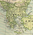
In Ottoman times , the area belonged to the Eyâlet Rumelien , the old European part of the conquered Ostrom (Rum) , and within it to the Sanjak Shkodra . With the collapse of the Ottoman Empire in 1852, the Principality of Montenegro was formed , which became finally independent in 1878, but was still a landlocked state at the time: the coastal area in the north was the Austrian rule of Cattaro (Kotor), the area to the south around Lago de Scutari (Skadar Lake) remained at the Ottoman Shkodra. The border ran north of Spizza (Sagradje / Sutomore) near Ostrowizza (Ostrowitz) as the Ottoman-Austrian border, over the Sutorman mountain, and north of Lake Skadar around the still Ottoman Podgorica , up the Sitnica and to Spuž , and from there eastwards to the mountains. The Albanians united in the League of Prizren fought successfully in the winter of 1879/80 - including the Battle of Nokšić - against the cession of Plav to the Montenegrins. Instead of this area, Montenegro was then assigned to Ulcinj (Olgun / Ulqini). With the restructuring of the Ottoman state in 1867, an independent imperial Vilayet Shkodra was created.
In 1910 Montenegro became a kingdom , in 1913 the Principality of Albania became sovereign. At the London Ambassadorial Conference in 1913, various proposals were made to draw the boundaries, which consistently provided for the border between the two states across the middle of Lake Skadar and, in today's course, in the Plav area according to the Austrian proposal, which assigned the valley to Montenegro. The limit still exists today.
Turkey (Ottoman Empire) , European Part, 1827 (Finley: A New General Altas )
Principality of Zrnagora (Montenegro) , 1862 (Journal of the Society for Geography in Berlin)
Ottoman Rumelia , 1881
- chronology
- (indented for modern times, times of war and sub-areas; in brackets: sub-areas)
- until 1878: no border ( Ottoman Empire ; Rumelien, Eyt .; Shkodra, Sdschk. )
- 1852–1878: Inner-Ottoman border Rumelia , Eyt. (from 1867 Shkodra , Vyt. ) - Montenegro , Fst .; The border was a little further north
- 1878–1912: Border Ottoman Empire - Montenegro , Fst. (1910 Kgr.)
- 1912 (1913 dejure) - 1918 (dejure): border Albania (Fst.) - Montenegro, Kgr .; 1913: today's course determined
- 1920–2006: Border Albania , Rep. , From 1928 Kgr. , From 1944 Soc.VR. , from 1990 Rep. - Yugoslavia , Kgr. , from 1943/45 Social Fund Rep. ; from 1992 Federal Rep. ( Montenegro, Social Rep., Part of the country from 1992)
- 1941–1944: Inner Italian (Kgr.) Border: Albania , Kgr. - Montenegro , Protectorate (1943 German )
- 2003–2006: Border Albania , Rep. - Serbia and Montenegro , Federal Rep .
- since 2006: border Albania , Rep. - Montenegro, Rep .
Border crossing and border traffic
International border crossings between the two states are (the Albanian side mentioned first):
-
Muriqan - Sukobin on the Shkodra
 - Ulcinj - Bar route 2.4
-
Han i Hotit - Tuzi on the Shkodra
 - Podgorica route
-
Vermosh - Gusinje on the route Han i Hotit - Kelmend
 - Plav 9
Individual evidence
- ↑ a b c d Principality of Montenegro established in 1515; Around 1800 Montenegro expanded to the east, becoming de facto independent after the Battle of Grahovac in 1852 , and finally in 1878.
- ↑ a b c After the (First) Balkan War 1912/13 ; London Ambassadors Conference May 30, 1913; Prince Wilhelm ruled only briefly before the war ; After the war, only at the Lushnya Congress in 1920 consolidation of the state


