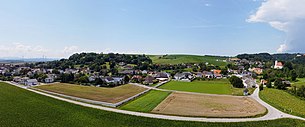
Haunoldstein
|
Haunoldstein
|
||
|---|---|---|
| coat of arms | Austria map | |
|
|
||
| Basic data | ||
| Country: | Austria | |
| State : | Lower Austria | |
| Political District : | Sankt Pölten-Land | |
| License plate : | PL | |
| Surface: | 9.91 km² | |
| Coordinates : | 48 ° 12 ' N , 15 ° 27' E | |
| Height : | 250 m above sea level A. | |
| Residents : | 1,226 (January 1, 2020) | |
| Population density : | 124 inhabitants per km² | |
| Postal code : | 3384 | |
| Area code : | 02749 | |
| Community code : | 3 19 11 | |
| NUTS region | AT123 | |
| Address of the municipal administration: |
Hauptplatz 1 3384 Haunoldstein |
|
| Website: | ||
| politics | ||
| Mayor : | Hubert Luger ( ÖVP ) | |
|
Municipal Council : ( 2020 ) (19 members) |
||
| Location of Haunoldstein in the Sankt Pölten-Land district | ||

|
||
| Source: Municipal data from Statistics Austria | ||
Haunoldstein is a municipality with 1226 inhabitants (as of January 1, 2020) in the district of Sankt Pölten-Land in Lower Austria .
geography
Haunoldstein is located in the Mostviertel in Lower Austria. The area of the municipality covers 9.88 square kilometers. 18.54 percent of the area is forested.
Community structure
The municipality includes the following seven localities (population in brackets as of January 1, 2020):
- Eibelsau (21)
- Eidletzberg (6)
- Gross Sierning (616)
- Haunoldstein (317)
- Osterburg (3)
- Pielachhauser (191)
- Pottschollach (72)
The community consists of the cadastral communities Eibelsau, Groß Sierning, Haunoldstein and Osterburg.
Neighboring communities
| Dunkelsteinerwald | Hafnerbach | |
| Loosdorf |

|
|
| Hürm | Markersdorf-Haindorf |
Coat of arms and colors
The Lower Austria. With a decision of March 28, 1983, according to Section 4 (1) of Lower Austria. Municipal code 1973, the coat of arms of the municipality of Haunoldstein described below:
"A blue shield divided by a fallen silver drawbar, which is covered in the first and third fields with three ears of wheat held by one hand, the drawbar arm, and in the second field with a red-tongued, armored golden panther."
“The golden hand symbolizes the working population, the ears of wheat the rural character of the community. The panther was the coat of arms of the first written owner of the Osterburg, Count Peilstein, and the silver drawbar is the symbol for the rivers Pielach and Sierning. "
At the same time, the community colors “blue-white-yellow” set by the community council of Haunoldstein were approved.
Origin of name
The name of the place appears for the first time in 1161 and is mentioned in 1235 in the document book of the former canon monastery in Sankt Pölten "Hunoldstain". The spelling changes several times over the centuries from "Heinrichstein"; 1578 "Hainoldstein" to today's Haunoldstein.
Etymologically, the name indicates a castle that belonged to a "Hunold". Stein or Steina literally means stony, rocky, poorly fertile soil in Germanic.
history
In ancient times, the area was part of the Noricum province . The place is first mentioned in a document in 1161. The church on the Kirchenberg zu Haunoldstein was first mentioned in 1147; Since 1367 the owners of the Osterburg have been responsible for patronage. The castle changed hands several times between 1514 and 1668 and was then bought by Prince Raimund von Montecuccoli . The Osterburg remained in the family ownership of the Counts Montecuccoli until 1983. The municipality has been independent since 1850. With the establishment of the Reichsstraße (today B1) and the Westbahn in 1892, Groß Sierning developed into the main town of the municipality.
On September 22, 2018, the new municipal office was officially opened.
Population development
According to the results of the 2001 census, there were 940 inhabitants. In 1991 the community had 852 inhabitants, in 1981 789 and in 1971 700 inhabitants.
politics
Mayor of the municipality is Hubert Luger, Vice Mayor Josef Anzenberger and Head of Department Manuela Damböck. After the 2020 municipal council elections, the municipal council has the following distribution of seats with a total of 19 seats: ÖVP 14, SPÖ 3 and FPÖ 2.
Culture and sights
- Parish church hl. Michael
- The church, built in an elevated position, was surrounded by a cemetery and has a Gothic structure. The erection of the tower and the vaulting of the nave took place around 1580. The choir and the western yoke of the nave were built in 1745 and the tower spire dates from the end of the 19th century.
Volunteer firefighter
The FF Haunoldstein was founded in 1888. The fire station is located directly on the B1 in Groß Sierning. The crew stand includes around 75 fire brigade members.
Economy and Infrastructure
There were 27 non-agricultural workplaces in 2001, agricultural and forestry businesses according to the 1999 survey 27. The number of people in work at home was 438 according to the 2001 census. In 2001 the activity rate was 47.44 percent.
Individual evidence
- ↑ Statistics Austria: Population on January 1st, 2020 by locality (area status on January 1st, 2020) , ( CSV )
- ↑ Ferdinand Hierner, Mayor (1983): Festschrift for the school opening and the award of the coat of arms Haunoldstein, October 2, 1983 . Ed .: Haunoldstein community. Haunoldstein October 2, 1983, p. 10 .
Web links
- Municipality of Haunoldstein Homepage of the municipality
- www.Dunkelsteinerwald.net Mysticism & magic as well as history & stories of the Dunkelsteinerwald region
- 31911 - Haunoldstein. Community data, Statistics Austria .


