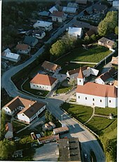
Horný Vadičov
| Horný Vadičov | ||
|---|---|---|
| coat of arms | map | |

|
|
|
| Basic data | ||
| State : | Slovakia | |
| Kraj : | Žilinský kraj | |
| Okres : | Kysucké Nové Mesto | |
| Region : | Severné Považie | |
| Area : | 20.812 km² | |
| Residents : | 1,643 (Dec. 31, 2019) | |
| Population density : | 79 inhabitants per km² | |
| Height : | 487 m nm | |
| Postal code : | 023 45 | |
| Telephone code : | 0 41 | |
| Geographic location : | 49 ° 16 ' N , 18 ° 53' E | |
| License plate : | KM | |
| Kód obce : | 509205 | |
| structure | ||
| Community type : | local community | |
| Structure of the municipality: | 2 cadastral communities | |
| Administration (as of November 2018) | ||
| Mayor : | Miroslav Káčerík | |
| Address: | Obecný úrad Horný Vadičov č. 160 023 45 Horný Vadičov |
|
| Website: | www.hornyvadicov.sk | |
| Statistics information on statistics.sk | ||
Horný Vadičov (until 1927 also "Horný Vajčov"; Hungarian Felsővadas - until 1907 Felsővadicsó ) is a municipality in northwestern Slovakia with 1643 inhabitants (as of December 31, 2019) and is located in Okres Kysucké Nové Mesto , a district of the Žilinský kraj and at the same time in the traditional Kysuce countryside .
geography
The community is located in the Kysucká vrchovina mountains at the top of a valley. The Vadičovský creek , which belongs to the Kysuca river system, flows through the village . The lowest point ( 440 m nm ) of the municipality is the Vadičovský creek when it leaves the village towards Dolný Vadičov. The highest point is Mount Ľadonhora ( 999 m nm ). The center of the village is at an altitude of 487 m nm and is ten kilometers from Kysucké Nové Mesto and 20 kilometers from Žilina .
In addition to the main town, Stredný Vadičov (incorporated after 1907), which is also a cadastral municipality, also belongs to the municipality .
Neighboring municipalities are Povina in the north, Lutiše in the northeast, Lysica in the southeast, Gbeľany and Nededza in the south, Kotrčiná Lúčka in the southwest, Dolný Vadičov in the west and Kysucké Nové Mesto (Budatínska Lehota district) in the northwest.
history
Horný Vadičov was first mentioned in writing in 1385 as Silva Vaditzov and was probably built in the 14th century. Other ancient names are Vadycho (1419), Felse Wadychow (1504) and Horní Wadičow (1773). It was a rather poor village, whose landlords came from the Rudinszky , Nedeczky and Záborszky families. In 1598 there were a total of 35 houses, in 1787 138 houses and 886 inhabitants. In 1828 there were 141 houses and 1,142 inhabitants who were employed in agriculture, forestry, animal husbandry and as wire ties.
Until 1918 the place in Trenčín County belonged to the Kingdom of Hungary and then came to Czechoslovakia or now Slovakia.
population
According to the 2011 census, 1581 inhabitants lived in Horný Vadičov, of which 1540 were Slovaks, three Czechs and one each Magyar, Pole and Russian. 35 residents gave no information in this regard. 1473 residents confessed to the Roman Catholic Church, two residents to the Mormons and one resident each to the Baha'itum , the Evangelical Church AB and the Greek Catholic Church ; one resident professed a different denomination. 33 residents were without a denomination and the denomination of 69 residents was not determined.
Buildings
- Roman Catholic Church of St. Nicholas from 1806
Individual evidence
- ↑ 2011 census by ethnicity (Slovak) ( Memento from October 6, 2014 in the Internet Archive )
- ↑ 2011 census by denomination (Slovak) ( Memento from September 7, 2012 in the Internet Archive )
Web links
- Entry on e-obce.sk (Slovak)

