
Chorweiler
|
district 609 of Cologne |
|
|---|---|
 |
|
| Coordinates | 51 ° 1 '32 " N , 6 ° 53' 46" E |
| surface | 1.919 km² |
| Residents | 13,229 (Dec. 31, 2017) |
| Population density | 6894 inhabitants / km² |
| Incorporation | April 1, 1922 (settled 1972) |
| Post Code | 50765 |
| prefix | 0221 |
| Borough | Chorweiler (6) |
| Transport links | |
| Highway |
|
| Federal road |
|
| Railway connection | Cologne-Chorweiler Cologne-Chorweiler North S 6 S 11 |
| Light rail lines | 15th |
| Bus routes | 120 121 122 123 125 126 |
| Source: 2017 residents . (PDF) Cologne district information | |
Chorweiler is a district in the north of Cologne about 10 kilometers from the city center; it belongs to the eponymous borough of Chorweiler .
location
Chorweiler borders in the east on Neusser Landstrasse, which runs here as the B 9 . Furthermore, Chorweiler borders the Fühlingen district in the east . The Fühlinger See is also located here . This is an artificially created body of water, which consists of various large connected lakes. Seeberg is in the south of Chorweiler, and Volkhoven / Weiler in the west . The A 57 runs behind this . In the north, Chorweiler borders the Blumenberg district , which is joined by the Worringer Bruch.
history
The center of Chorweiler emerged in the 1970s as a new district and a typical example of the urban and housing policy of this era. The idea of a new city by the architect Fritz Schumacher from 1922 was taken up again in 1957 to meet the housing shortage of the post-war period and to create living space near the industrial areas in the north of the city. A small town of its own for 100,000 people was to be created in a confined space, which would connect living, working, trade, leisure and social facilities in a short distance. In the original plans, this initially included an approximately 2-3 km wide green strip for leisure, recreation and pollution control east of Chorweiler and an industrial line from Merkenich to Worringen east of this along the Rhine .
The name was created by combining the names of the choir bush and the district of Weiler .
A basic idea of this urban planning for the New City was the skyline: In the south, low buildings - mostly one to four storeys - started, in the center, the actual district of Chorweiler, it should then rise to up to 30 floors and in the north slowly descend again . The construction of this new city therefore took place from south to north and continues to this day. The two southern districts, Heimersdorf and Seeberg , were completed in the 1960s. The central part, the areas of Seeberg-Nord, Chorweiler and Chorweiler-Nord, were built in the 1970s and 1980s. The result was the largest slab housing estate in North Rhine-Westphalia , into which the first residents moved in 1972; In 1976 a shopping line was completed. In total - contrary to plan - apartments for 40,000 people were built. Many of the planned office buildings were not implemented either, so that the planned infrastructure soon turned out to be too generous and the concept of “living and working” was not realized. Due to the partly 20-storey high -rise buildings , the district is nevertheless characterized by an extremely high population density. Numerous well-known architects worked with various buildings on the New City . In Riphahnstrasse, for example, there is a remarkable complex of ten-story high-rise and a residential street from the Pritzker Prize winner Gottfried Böhm , the social and cultural center by Hans Schilling on Pariser Platz and in neighboring Seeberg an early residential development by Oswald Mathias Ungers .
The northern continuation of the overall project, the Blumenberg district , was built from the 1980s. Numerous private homes were built here again, mostly as terraced houses. To the north-west of Blumenberg, the Kreuzfeld district is to be built over the next few years, which will bring the entire "New City" area to a close.
In order to better distinguish the individual parts of this satellite town , the streets were named according to certain criteria:
- Streets in Heimersdorf after trees
- Streets in Seeberg-Süd for flowers (e.g. asters, columbines)
- Streets in Seeberg-Nord based on people from the history of Cologne (e.g. Karl Marx, Wilhelm Riphahn)
- Streets in the center of Chorweiler to cities in other European countries (e.g. Milan, Oslo, Florence)
- Roads in Chorweiler-Nord to rivers (e.g. Havel, Saale, Moldau, Unstrut)
- Roads in Blumenberg to Bergen (e.g. Langenberg, Geiersberg, Vogelsberg)
- Since a relatively large part of the street names denote geographical terms, the two four-lane main access roads were named after the geographers Gerhard Mercator and Matthäus Merian .

Urban renewal and redevelopment measures

In the 1980s, the negative effects of the housing policy, which has meanwhile been viewed as a failure, became apparent : the renovation of living space in the inner city area and the general trend towards living closer to the city or in old buildings again made life in the satellite town less attractive. Only the low rental costs were another reason to move to Chorweiler. A 41% proportion of foreigners and a strong concentration of socially disadvantaged residents were the result.
Chorweiler developed into a social hotspot . Many apartments were empty and the surrounding infrastructure was neglected. In order to prevent Chorweiler's further social decline, the Cologne city council decided in 1985 to launch a supplementary program to improve the quality of life and housing in the district.
The first stage of the program (1987 to 1989) focused on urban renewal and redevelopment measures. First of all, the Citizen Participation Office was opened in 1987. In general, the supplementary program was characterized by the high level of involvement of the residents. Oversized transport infrastructure was dismantled and traffic-calmed areas and green spaces (Olof-Palme-Park) were created instead . At the same time a youth center was built and an unused swimming pool was converted into a workshop for the Chorweiler Selbsthilfe e. V. , a self-help group .
With the start of the second stage (1989 to 1997), a sponsoring company made up of town planners , architects and social workers , the Gesellschaft für Stadternerung mbH (GfS) , opened its office in Chorweiler. In addition to improving the living environment, the main focus was now on creating jobs and promoting the economic and social situation. As a measure to combat the comparatively high unemployment in the district, a craft yard was founded in which, in addition to craft businesses, various programs for vocational preparation , further training and qualification took place; there were also social advice centers. The craft yard became a model project in North Rhine-Westphalia. The GfS was dissolved in 1996.
In 1997, the redevelopment of the district was included in the NRW state program districts with special need for renewal - social city , which places a strong focus on child and youth work.
In order to promote the social structure , building land in the Chorweiler district is now mainly made available for privately financed projects. In addition, the establishment of leisure and educational organizations that are important beyond the district is specifically promoted. In 2001 the office of Arbeiterwohlfahrt Mittelrhein e. V. to Chorweiler, there is also a Waldorf school , the " Aqualand Cologne " leisure pool and the City Center Chorweiler shopping center .
Demographic statistics
Structure of the population of Cologne-Chorweiler:
- Share of under 18s: 23.5% (2015)
- Proportion of over 64-year-olds: 17.0% (2015)
- Proportion of foreigners: 40.6% (2015)
- Unemployment rate: 21.3% (2014)
In 2015 Chorweiler had a migrant share of 80 percent.
Every second child lived in a family that receives benefits under SGB II. About 80 percent of the apartments in Chorweiler were subsidized by the state in 2015.
Population numbers
| year | Pop. |
|---|---|
| 1990 | 14,721 |
| 1995 | 15,122 |
| 1999 | 14,711 |
| 2000 | 14,848 |
| 2005 | 13,932 |
| 2010 | 13,869 |
| 2015 | 13,861 |
| 2016 | 13,324 |
| 2017 | 13,229 |
Infrastructure
education

The Heinrich Böll Comprehensive School , a primary school and a Waldorf school are located in Chorweiler . Realschule and Hauptschule are located in the immediately south adjoining Seeberg-Nord, the nearest grammar school is in Weiler / Volkhoven, about 1.5 km away.
The adult education center also offers various courses in Chorweiler.
sport and freetime

In addition to the district town hall, the community center complex includes an indoor swimming pool, a branch of the city library, a youth center and an event hall with around 800 seats. Smaller rooms can be rented by the citizens for private celebrations.
Next to the comprehensive school is a district sports facility with three soccer fields. The school gyms are also used for club sports outside of school hours. The Aqualand water park, which is known far beyond the city limits, is located on Merianstraße . In Chorweiler Nord there is a climbing hall next to the Waldorf school.
Already part of the Seeberg district, there is a tennis facility with several outdoor and indoor courts on Merianstrasse. There is also a riding stables in Seeberg on the site of the former Oranjehof estate.
Numerous allotment gardens were laid out between Chorweiler-Nord and Fühlingen, most of which are leased by the residents of Chorweiler and Seeberg-Nord.
The leisure area also includes the spacious parks, which extend to the Fühlinger See recreational area in the east and merge into the outer green belt in the south after crossing the motorway. A transition to the Worringer Bruch nature reserve is also planned in the north, and the forest area around the Weiler waterworks is only a few hundred meters away in the northwest.
Shopping

In the center of Chorweiler is a two-story shopping center with around 120 shops, two supermarkets and numerous restaurants. All everyday goods are available here. In addition, Cologne city center with its numerous shops can be reached by S-Bahn within 15 minutes.
A few more shops can be found in Chorweiler-Nord.
traffic

Chorweiler has a junction with the federal highway 57 . The driveway is only possible in the direction of Cologne, the exit only coming from Cologne. Mercatorstraße is a motor road that connects Chorweiler to the south with the military ring and the Longerich district. In a northerly direction it leads to Blumenberg. Earlier plans included re-routing the road further north in Cologne-Roggendorf onto the A 57. About the Merianstraße, another four-lane road junction is Cologne-Niehl the A1 to reach.
Public transport
Chorweiler is connected to Cologne's public transport network by an S-Bahn line , a city railway line and several bus lines. The S-Bahn line 11 (reinforced by the S6 during rush hour) branches off from the left Lower Rhine route from Cologne Central Station in Cologne-Longerich and crosses Chorweiler, before joining the route to Neuss and Düsseldorf after Cologne-Blumenberg . In Chorweiler, the S-Bahn line runs underground and stops at the Chorweiler and Chorweiler-Nord tunnel stations.
The suburban railway line 15 ends in the station complex of Chorweiler . This line begins at the Ubierring in the Neustadt-Süd district and goes via the rings tunnel , Nippes , Weidenpesch , Longerich and Heimersdorf to Chorweiler. Like the other lines that cross the rings , line 15 is also operated with low-floor vehicles.
There are also five bus routes in Chorweiler:
- 120 Blumenberg - Chorweiler - Fühlingen - Worringen - Roggendorf / Thenhoven
- 121 Langel - Merkenich - Chorweiler - Longerich - Bilderstöckchen - Neusser Straße / Gürtel
- 122 Weidenpesch - Seeberg - Chorweiler - Pesch
- 125 Weiler - Chorweiler - Longerich - Pesch - Esch - Pulheim-Sinnersdorf
- 126 Bocklemünd - Mengenich - Auweiler - Esch - Weiler - Chorweiler
Religions
The Catholic parish church of St. Pope John XXIII is located on Pariser Platz diagonally across from the district town hall . with outbuildings. Until the consecration by Cardinal Meisner in March 2009, the church was named St. John in the New City for 28 years . In 2010 the parishes of Chorweiler, Merkenich and Heimersdorf were merged under the new name.
The parish hall of the Catholic parish was sold at the end of 2007 to the synagogue parish , which converted it into a Jewish community center and opened it in April 2009. It mainly organizes Russian-speaking Jews, who are disproportionately represented in Chorweiler due to immigration from the successor states of the Soviet Union .
In the immediate vicinity is also the city church is evangelical church Cologne New Town , the community area / includes not only Chorweiler the districts Seeberg Heimersdorf, Blumenberg and Volkhoven hamlet. It has the status of a multifunctional building.
Because of the high proportion of immigrants, especially from Turkey and their descendants, the Islamic community and the Christian-Oriental community are also strongly represented in Chorweiler . Originally also planned directly in the center of Chorweiler, the Turkish-Islamic community in Chorweiler built a community center with a mosque in neighboring Feldkassel . Independently of this, another Islamic community center was set up on Elbeallee in Chorweiler-Nord.
The community centers of the Syrian Orthodox parish , the Rum Orthodox parish and the Alevi parish are located in Seeberg. Only about 4 kilometers south, in the Longerich district , is the Cologne church of the Ethiopian Orthodox Church. There is also a New Apostolic Church in Seeberg whose parish area includes the districts of Chorweiler, Blumenberg, Heimersdorf, Lindweiler , Longerich, Pesch and Volkhoven / Weiler in addition to Seeberg .

Catholic parish church

Evangelical town church
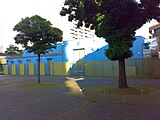
Jewish meeting center

Mosque in Chorweiler-Nord


literature
- Veronika Darius: The architect Gottfried Böhm. Buildings from the sixties . Düsseldorf: Beton-Verlag 1988 (Baumeisterforum), pp. 71-80.
- Gundula Lang: International Modernism on the outskirts of Cologne. Three settlements by the Berlin architects Kirsten & Nather for the new town of Chorweiler . In: INSITU 8 (2/2016), pp. 257–268.
- Kay Löffler Investigation Service Chorweiler , Roman, 1999 (2008 new edition under the title "From a German Ghetto")
- District newspaper Elevator (Ed.): Chorweiler Views, Emons-Verlag Cologne 1993, ISBN 3-924491-38-0
- M. Theleman, D. Wiktorin, The "New City" Cologne-Chorweiler. Garden city or concrete desert. in Cologne and the Cologne area. A geographic excursion guide. Part 1: City and Surroundings. Cologne, pp. 89–98, G. Schweizer (Ed.)
Web links
- Official website of the city of Cologne for the Chorweiler district
- social-stadt.nrw.de - district profile
Individual evidence
- ^ Information from the City of Cologne
- ↑ Inhabitants according to selected age groups - data source: City of Cologne - offenedaten-koeln.de
- ↑ Inhabitants according to selected age groups - data source: City of Cologne - offenedaten-koeln.de
- ↑ Inhabitants by type of migration background - data source: City of Cologne - offenedaten-koeln.de
- ↑ Employed and unemployed part of the city - data source: City of Cologne - offenedaten-koeln.de
- ↑ a b Bernd Dörries: What was the future. In: sueddeutsche.de . August 5, 2015, accessed October 13, 2018 .