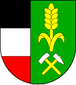
Křesetice
| Křesetice | ||||
|---|---|---|---|---|
|
||||
| Basic data | ||||
| State : |
|
|||
| Region : | Středočeský kraj | |||
| District : | Kutná Hora | |||
| Area : | 1087 ha | |||
| Geographic location : | 49 ° 54 ' N , 15 ° 16' E | |||
| Height: | 300 m nm | |||
| Residents : | 682 (Jan. 1, 2019) | |||
| Postal code : | 285 41 - 285 47 | |||
| License plate : | S. | |||
| traffic | ||||
| Street: | Malešov - Čáslav | |||
| structure | ||||
| Status: | local community | |||
| Districts: | 4th | |||
| administration | ||||
| Mayor : | Marie Jirků (as of 2017) | |||
| Address: | Křesetice 1 285 47 Křesetice |
|||
| Municipality number: | 534161 | |||
| Website : | www.kresetice.cz | |||

Křesetice (German: Kresetitz ) is a municipality in Okres Kutná Hora , Czech Republic . It is located about two kilometers south of Kutná Hora . In 2016 the place had 689 inhabitants.
geography
Křesetice is located in the Čáslavská kotlina ( Czaslauer Basin ) on the Křenovka brook, into which the Ještěrný potok flows here. The Petrovský rybník pond is located in the village, and the Ještěrný potok is dammed in the Grauerák pond to the east of the village. State road II / 337 runs through Křesetice between Malešov and Čáslav .
Neighboring towns are Poličany and Vrchlice in the north, Bažantnice, Perštejnec, Dvůr and Třebešice in the northeast, Pucheř and Olšany in the east, Hájek in the southeast, Chrást, Úmonín and Krupá in the south, Bykáň, Bykáneč, Dubina and Rákosov in the south West and Bílejov, Nová Lhota and Mezholezy in the north-west.
history
The first written mention of the village comes from the year 1290. In 1362 the place was called Cressetin .
After the abolition of patrimonial Křesetice formed a municipality in the judicial district of Kuttenberg. From 1868 the village belonged to the Kuttenberg district .
On July 1, 1961 Bykáň (with Krupá) and Chrást were incorporated.
Community structure
The municipality Křesetice consists of the districts Bykáň ( Bikan ), Chrást ( Chrast ), Krupá ( Krupa ) and Křesetice ( Kresetitz ). Basic settlement units are Bykáň, Bykáneč ( Bikanetz ), Chrást, Krupá and Křesetice. The one-shift Májovka also belongs to Křesetice.
The municipality is divided into the cadastral districts of Bykáň, Chrást u Křesetic, Krupá u Křesetic and Křesetice.
Attractions
- Church of St. Dagmar in Křesetice, the Gothic building on a hill dates from the 14th century
- Křesetice Castle, it was built in the middle of the 17th century from a Renaissance fortress
- Sandstone statues of hll. Wenceslas, Barbara and Sebestian in Křesetice, created around 1720
- Church of the Assumption in Bykáň
Web links
Individual evidence
- ↑ http://www.uir.cz/obec/534161/Kresetice
- ↑ Český statistický úřad - The population of the Czech municipalities as of January 1, 2019 (PDF; 7.4 MiB)
- ↑ Antonín Profous : Místní jména v Čechách. Jejich vznik, původ, význam a změny. Volume 1-5. Česká akademie věd a umění, Prague 1947–1960.
- ↑ http://www.uir.cz/casti-obce-obec/534161/Obec-Kresetice
- ↑ http://www.uir.cz/zsj-obec/534161/Obec-Kresetice
- ↑ http://www.uir.cz/katastralni-uzemi-obec/534161/Obec-Kresetice

