Hostovlice
| Hostovlice | ||||
|---|---|---|---|---|
|
||||
| Basic data | ||||
| State : |
|
|||
| Region : | Středočeský kraj | |||
| District : | Kutná Hora | |||
| Area : | 585 ha | |||
| Geographic location : | 49 ° 52 ' N , 15 ° 28' E | |||
| Height: | 281 m nm | |||
| Residents : | 250 (Jan. 1, 2019) | |||
| Postal code : | 286 01 | |||
| License plate : | S. | |||
| traffic | ||||
| Street: | Golčův Jeníkov - Žleby | |||
| Railway connection: | Znojmo – Nymburk | |||
| structure | ||||
| Status: | local community | |||
| Districts: | 1 | |||
| administration | ||||
| Mayor : | Eduard Kapitán (as of 2019) | |||
| Address: | Hostovlice 25 285 62 Hostovlice u Čáslavi |
|||
| Municipality number: | 534064 | |||
| Website : | www.obec-hostovlice.cz | |||
Hostovlice (German Hostoulitz , also Hostaulitz ) is a municipality in the Czech Republic . It is located eight kilometers southeast of Čáslav and belongs to the Okres Kutná Hora .
geography
Hostovlice is located on a right tributary to the Zehubský potok in the Čáslavská kotlina ( Czaslau basin ). The Znojmo – Nymburk railway and the I / 38 state road between Čáslav and Golčův Jeníkov run west of the village . The Tisá skála (392 m nm) rises to the southwest.
Neighboring towns are Medun, Markovice , Bažantnice u Sv. Anny, Žleby and Velký Dvůr in the north, Zehuby and Biskupice in the Northeast, Kamenné Mosty and Kněžice in the east, Zvěstovice and Hostačov in the southeast, Okřesaneč , Ráj and Pisek in the south, Podmoky , Kocanda and Přibyslavice in the southwest, Vystrkov, Bratčice , Adamov and Tupadly in the west and Potěhy , Horky and Filipov in the northwest.
history
The village was first mentioned in 1244 in connection with Bun von Hostovlice and Žamberk. In 1289 Bleh von Hostovlice is documented as the owner of the Hostovlice estate. Later the brothers of Chlum acquired the property and added it to their rule Chlum . The Slavata von Chlum gentlemen held Hostovlice until Michal Slavata sold the estate in 1529. At the beginning of the 17th century, Hermann Czernin von Chudenitz acquired the Hostovlice estate and united it with the Žleby estate . The next owner was Jan Rudolf Trčka from Lípa . After the murder of Adam Erdmann Trčka von Lípa, Emperor Ferdinand II confiscated his property and those of his father Jan Rudolf Trčka von Lípa on March 29, 1634, the total estimated value of which was 4,000,000 guilders ; the confiscation patent was confirmed in May 1636 by the Reichshofrat in Vienna. From 1736 Josef von Schönfeld and from 1746 the princes Auersperg belonged to the other owners . In 1787 there were 38 houses in Hostaulitz . In the years 1823-1824 the communities of Hostaulitz, Sehub and Wokřesanec built a joint contribution grain storage floor in Hostaulitz at their own expense.
In 1840 the rustic village of Hostaulitz , located in the Caslauer Kreis , consisted of 42 houses in which 306 people, including a Jewish family, lived. A private school was under the patronage of the community. There was also a manorial farm in the village , a Dominical sheep farm, an inn and the contribution store. The parish and administrative center was Žleb . Until the middle of the 19th century, Hostaulitz remained subject to Žleb.
After the abolition of patrimonial Hostovlice formed from 1849 with the districts Okřesaneč and Písek a municipality in the judicial district of Časlau . From 1868 the place belonged to the Časlau district . In 1869 Hostovlice had 473 inhabitants and consisted of 48 houses. Since the end of the 19th century, the village was alternatively called Hostoulice and Hostovlice . In 1900 there were 562 people in Hostoulice , in 1910 there were 673. Since 1924 only Hostovlice is used as an official place name. In 1930 Hostovlice had 583 inhabitants and consisted of 110 houses. In 1956 Okřesaneč broke away and formed its own community. During the territorial reform of 1960, the village was assigned to the Okres Kutná Hora. In the 2001 census, 246 people lived in the village's 112 houses.
Community structure
No districts are shown for the municipality of Hostovlice. The single-layer Medun belongs to Hostovlice.
The municipality forms the cadastral district Hostovlice u Čáslavi .
Attractions
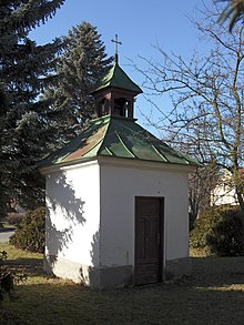
- Bell tower on the village square, built in the first half of the 20th century
- Cast iron cross in the village square
- Stone wayside cross in the garden of house No. 91
- Memorial stone for the nationalization of the soil on June 1, 1925
literature
- Historický lexikon obcí České republiky 1869–2005 , part 1, p. 114
Web links
Individual evidence
- ↑ http://www.uir.cz/obec/534064/Hostovlice
- ↑ Český statistický úřad - The population of the Czech municipalities as of January 1, 2019 (PDF; 7.4 MiB)
- ↑ Jaroslaus Schaller : Topography of the Kingdom of Bohemia. Sixth part. Czaslauer Kreis Prague and Vienna 1787, p. 92
- ^ Johann Gottfried Sommer : The Kingdom of Bohemia; Represented statistically and topographically. Volume 11: Caslauer Kreis. Ehrlich, Prague 1843, p. 30.
- ↑ http://www.uir.cz/katastralni-uzemi/646008/Hostovlice-u-Caslavi


