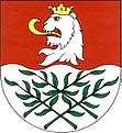
Vrdy
| Vrdy | ||||
|---|---|---|---|---|
|
||||
| Basic data | ||||
| State : |
|
|||
| Region : | Středočeský kraj | |||
| District : | Kutná Hora | |||
| Area : | 1849.5124 ha | |||
| Geographic location : | 49 ° 55 ' N , 15 ° 28' E | |||
| Height: | 225 m nm | |||
| Residents : | 2,952 (Jan 1, 2019) | |||
| Postal code : | 285 71 - 286 01 | |||
| License plate : | S. | |||
| traffic | ||||
| Street: | I / 17 | |||
| Railway connection: | Čáslav – Třemošnice | |||
| structure | ||||
| Status: | local community | |||
| Districts: | 4th | |||
| administration | ||||
| Mayor : | Antonín Šindelář (as of 2017) | |||
| Address: | Smetanovo nám. 28 285 71 Vrdy |
|||
| Municipality number: | 534587 | |||
| Website : | www.obecvrdy.cz | |||
Vrdy (German Wrdy ) is a municipality in Okres Kutná Hora in the Central Bohemian Region in the Czech Republic . The place is about six kilometers northeast of Čáslav .
geography
Vrdy is located on the left of the Doubrava in the Čáslavská kotlina ( Czaslau basin ). North of the village is the road I / 17 between Čáslav and Heřmanův Městec . The Čáslav – Třemošnice railway passes two kilometers south of Vrdy, and the Skovice – Vrdy-Bučice siding branches off at the Skovice station .
Neighboring towns are Zbyslav and Bílé Podolí in the north, Semtěš and Starkoč in the Northeast, Vinice and Vrdský Mlyn in the east, Vinaře and Šmolcov the southeast, Ksiny, Žleby and Markovice in the south, Skovice, Filipov and Čáslav in the southwest, Koudelov the west and Dolni Bučice in the north-west.
history
The village was first mentioned in 1307 in his charter by Ulrich von Lichtenburg . Initially, the place was called Werda , or Werder , later also as Wurdau and Wurd . It belonged to the German-speaking Kuttenberg language island, which existed until the Hussite Wars . Until 1849 Vrdy was subject to the Žleby estate.
After the abolition of patrimonial Vrdy formed a municipality in the judicial district of Časlau with the farms Koudelov and Skovice . In 1856 Alexander von Schoeller founded a sugar factory in Vrdy. From 1868 the village belonged to the Časlau district . In the course of the territorial reform of 1960, the Okres Čáslav was repealed; Vrdy was assigned to the Okres Kutná Hora, at the same time Dolní Bučice, Horní Bučice and Zbyslav (with Polsko) were incorporated.
The sugar factory operates today as Ethanol Energy as
Community structure
The municipality Vrdy consists of the districts Dolní Bučice ( Lower Butschitz ), Horní Bučice ( Upper Butschitz ), Vrdy and Zbyslav ( Sbislaw ), which also form cadastral districts. Basic settlement units are Dolní Bučice, Horní Bučice, Koudelov-Skovice, Polsko, Vrdy and Zbyslav.
Attractions
- Church of All Saints in Dolní Bučice
- Church of St. Trinity in Zbyslav
- Chapel in Vrdy
- Zbyslavská mozaika natural monument near Zbyslav
- Červený mlýn , a former water mill near Dolní Bučice
Web links
Individual evidence
- ↑ http://www.uir.cz/obec/534587/Vrdy
- ↑ Český statistický úřad - The population of the Czech municipalities as of January 1, 2019 (PDF; 7.4 MiB)
- ↑ Antonín Profous : Místní jména v Čechách. Jejich vznik, původ, význam a změny. Volume 1-5. Česká akademie věd a umění, Prague 1947–1960.
- ↑ http://www.ethanolenergy.cz/?3321/historie-spolecnosti
- ↑ http://www.uir.cz/casti-obce-obec/534587/Obec-Vrdy
- ↑ http://www.uir.cz/katastralni-uzemi-obec/534587/Obec-Vrdy
- ↑ http://www.uir.cz/zsj-obec/534587/Obec-Vrdy


