
Sketch of the location of Stanegatestrasse and Hadrian's Wall with fort locations
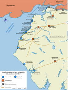
Location sketch for castles on the Cumbrian coast (130 AD)
The Hadrian's Wall was a frontier fortress in the north of the British Isles, the 122 n. Chr. On the orders of Emperor Hadrian was built. He secured the northernmost border ( Limes ) of the Roman Empire. The wall is the most extensively researched fortification on the Limes Britannicus .
Between Fort Segedunum ( Wallsend ) on the River Tyne and Fort Maia ( Bowness-on-Solway ) on the Solway Firth ran an approx. 117 km long, five meter high and two to three meter wide stone wall, which was regularly spaced by 80 small forts , so-called mile forts, was reinforced. In most cases, these fortifications also included two watch and signal towers that secured the sections between the forts. The foundations of these fortifications have often been preserved. Since they were structurally integrated into the wall, the bridges at Chesters and Willowford are also treated in this article .
An almost identical, albeit simpler, security system, presumably made up of up to 26 small forts with attached watchtowers and signal towers, was built on the west coast of what is now Cumbria (Cumberland Coast System). It stretched from the end of the wall at Bowness-on-Solway - probably - to the fort of Ravenglass and was intended to prevent invaders from landing and thus avoiding Hadrian's Wall. This fortress chain was only connected by a wooden palisade , through which there were no passages. Although it was not directly connected to Hadrian's Wall, it is still regarded as a functional part of the wall security system.
Mile Fort
The term "Meilenkastell" was first used around 1708 by Robert Smith for the small fortresses of Hadrian's Wall and may have originated in the language of the local population. Today it is mainly used for the small fort on Hadrian's Wall.
The mile forts were not erected in the most suitable locations for observation and security, but always at a distance of exactly one Roman mile (1500 m). A good example of this is MK 39 west of Housesteads . Even this fort had a north gate, although the terrain in front of it was much too steep to be safely passed with carts or even horses. In most cases, the mile forts only secured a regionally significant passage to the north. Its crew probably numbered between 20 and 30 auxiliary soldiers who were housed in two barracks. Their crews also manned the watchtowers, which were each a third of a mile (500 m) from the forts. The other tasks of the garrisons included monitoring border and trade traffic and collecting customs duties and other charges.
All of the fortifications on the wall were built according to a standard plan with a playing card-shaped floor plan . In the eastern section of the wall they were made of stone, in the western part, however, they were initially only built using peat and wood . The gate of a wooden-earth-mile fort in the archaeological park of Vindolanda , reconstructed in 1973, is already very dilapidated. It seems likely that the Romans had to completely rebuild their wood-earth fortifications after about 10 years. Therefore these were gradually replaced by stone forts. A total of 80 of these small forts have so far been detected on the wall. The different building types of the mile fort are differentiated in research on the basis of the structural design of their passageways and the length of their main axes oriented from north to south. On average, they were 15 mx 18 m. The side walls were particularly massive. The enclosing walls were about three meters wide and between five and six meters high. Its north side was structurally integrated into the wall. They also had two passages in the south and in the north. Sometimes they were also surrounded by a ditch. Due to the strength of their foundations, the north gates must have supported a tower or a guardroom. On either side of the street-like central passage were one or two multi-room barracks, elongated buildings made of wood or stone. They served as depots and accommodation for the guards. An oven was usually located in the north-west corner, while a staircase was built into the north-east corner, which provided access to the battlements and the guardroom of the gate tower. In the early phase of the wall, the gates to the north were still open. The upstream ditch could be passed via a dam made of earth. Most of it was bricked up again in the late 2nd century AD and the causeways were removed. At the mile forts, which remained in use beyond this time, the north gates were narrowed so that they could only be passed on foot. Some mile forts were apparently only used as metal workshops in late antiquity (MK 35 and 39). How many of these forts were still in use until the end of Roman rule over Britain in 410 AD cannot be said at present.
| Assignment
|
description
|
Construction crew
|
| Type I (short axis)
|
Massive pillar structures that protrude slightly on the inside and outside were installed on both sides of these gates. Walls and pillars consisted of large, hewn stone blocks, the gates are relatively wide (from east to west) and deep (from north to south, between the passages). Typical for this type of construction are the MK 37 (Housesteads) and MK 42 (Cawfields).
|
Legio II Augusta
|
| Type II (long axis)
|
The gates of these milestones are much narrower, the side pillars only protrude noticeably on the inside. Their building material consisted of smaller stone blocks than type I. They only occur in those sections where a narrowed version of the rampart wall was raised. A good example of building type II is MK 9 (Chapel House / West Denton).
|
Legio XX Valeria Victrix
|
| Type III – IV (long axis)
|
These gates have - similar to Type I - slightly protruding pillars on both sides and also consist of larger stone blocks. For the goal walls, however, smaller stones were used. Type III includes u. a. MK 47 (Chapel House / Gilsland) and MK 48 (Poltross Burn). The mile forts on the wider section of the wall belong to type IV.
|
Legio VI Victrix
|
Outline plan of the Peat Earth Mile Fort
Outline plan short axis type I
Outline plan of long axis type II – IV
Mile fort 37, short axis type I, view of the north gate
Ideal reconstruction of a mile fort
Watchtowers
The sections between the mile forts were each secured by two watchtowers ( turres, speculae ). They housed about six to eight men and gave them protected access to the battlements of the wall. There is no concrete archaeological or written evidence of how the towers were used or what exactly they were intended for. However, it can be assumed that they were primarily used as observation posts and signal stations, especially where uneven terrain restricted visibility. They were also intended as accommodation for the guards, although it is not clear whether the soldiers also stayed there. It is much more likely that they returned to the neighboring forts every day, so that they were relieved on a rotating basis. Although, in contrast to the mile forts, no ovens were found, various finds and hearths show that the crews also prepared their rations there.
The first watchtowers are likely to have been manned immediately after construction of the wall began (from 122). After the Antonine Wall was completed around 142, they were abandoned. During this time, some of the garrisons that had remained on Hadrian's Wall were demolished, perhaps because of the garrisons that had been able to obtain easily accessible building materials. After the army withdrew from the Antonine Wall (around 162) the towers, which had fallen into disrepair, seem to have been partially rebuilt and reoccupied. For others, the entrances were simply walled up. On the wood-peat wall, which has now been replaced by a stone wall, some new towers were built on the route west of Birdoswald. Few, if any, towers on the Cumbrian coast were reoccupied during this period. Around 180 they were finally given up together with most of the small forts of the coastal defense. A large number of the towers on Hadrian's Wall were restored in the late 2nd or early 3rd century under Septimius Severus or bricked up to the upper floor. An additional tower was built at Peel Gap . At the turn of the second to the third century, the towers in the central sections (between WT 33B and WT 41B ) were abandoned and demolished. The resulting gaps in the wall were filled with demolition material to compensate for structural weaknesses in the wall. In the third century, the remaining towers were gradually abandoned, with very few remaining occupied until the fourth century.
A watchtower covered an area of eight to nine square meters. The height is estimated at nine and a half meters. Since there are no findings to date for stairways made entirely of stone, the upper part of the tower could probably only be reached via a wooden ladder that was set on six stone steps and built into the southern corner of the towers. The length of these structures varies between 2.1 m and 2.4 m, the width was 0.91 m. The height (in WT 18A) is also about 0.91 m. Such platforms have been discovered in two towers on the Cumbrian coast. The excavation results on tower 18A showed that the interior was kept very simple and limited to the bare essentials. The floors consisted of rammed earth, which in many cases was repaired several times; either with secondary stone slabs or sand, in one case also straw. The open hearth was right next to the ladder platform. According to the findings of animal bones and simple pottery, it was probably primarily used by the crew to prepare their rations. Some of the towers were provided with small cisterns or were used as workshops.
Although they were apparently erected at the same time as the foundations of the rampart, their western and eastern wing walls (as with the mile fortifications) were worked into the rampart. This is seen as evidence that they were fully built before the wall was completed. The towers on the wide version of the wall generally had wider wing walls, those of the towers built later were somewhat shorter. However, they were missing from the watchtowers on the Cumbrian coast. The entrance was usually on the south wall (on the Cumbrian coast on the east wall), either at its east or west end. The door closed behind the stone threshold and opened inwards. Two types of sleepers have been identified: they consisted of a block of stone or a series of individual stones. Access routes have also been observed in several towers. Based on wall thickness and door position, the towers could be divided into three types and assigned to the legions involved in the construction of Hadrian's Wall:
It is difficult to say what the towers looked like in detail. There are too few remains or written or pictorial sources of information for an exact reconstruction, especially of the upper floor of the towers. As pragmatic as the Romans were, the usual standard procedure was probably used here as well. There may have been slight variations in the architectural style in sections. Presumably they only had one floor. Some experts believe that they had a tiled roof, and the watchtowers depicted on Trajan's Column also have such roofs. Nothing is known about the presence or appearance of windows either. Glass fragments were found in five specimens, which indicates the presence of windows. Accumulations of garbage (including ceramics) just outside the center of the east wall of WT 7B also indicate a window. Something similar was found next to the west wall of WT 25B. During the excavations at the east gate of Fort Birdoswald , fragments of the superstructure could also be recovered, including several window arches carved from a stone slab. They were u. a. used as a template for the window design during the reconstruction of the west gate in Fort Arbeia . Wooden finds of (probably) roof trusses with nail holes are a vague indication that the towers of Hadrian's Wall were equipped with them. Some researchers, on the other hand, advocate a crenellated tower crown, as it was easier to emit fire or smoke signals. This assumption is based primarily on the discovery of a bronze bowl, the so-called " Rudge Cup" , from the Roman country villa near Froxfield / Wiltshire . It dates from around 150. A wall with towers is evidently depicted on it. In addition, the names of five forts located in the western part of the wall are given in a circumferential tape. Such open platforms would make it difficult to keep the interior of the towers dry in the rainy climate of the ramparts. Stone slabs that may have once covered the upper floor were recovered from some towers.
Standard plan of a wood and peat tower
Standard plan of a stone tower
Drawing of the Rudge Cup, the decoration of which may represent Hadrian's Wall
Reconstructions of a gate tower of a wooden and peat mile fort (left) and a fort tower (right) in the Vindolanda fort
Limes course between Wallsend Fort and Rudchester Fort, County Tyne and Wear
Mile forts and watchtowers were numbered, starting in the east at today's Wallsend. This was a common practice in the organization of Roman limits. The towers to the west of each mile fort, for example from Mile Fort I, were numbered Ia and Ib, from Mile Fort II the numbering was done in the same way.
The numbering of the mile fort begins in the east with no. 0 (Wallsend) and ends at no. 80 (Bowness on Solway) in the west of the wall zone. This classification system was introduced in 1930 by George Collingwood Bruce (1–80), Peter Hill, however, starts his numbering with 0. The numbering of the MK / WT in the following tables is based on the publication by Peter Hill.
- MK = mileage fort,
- WT = watchtower,
Section 0
| ON
|
Name / place
|
Description / condition
|
Illustration
|
location
|
| 0
|
Mile fort Wallsend
|
Not visible above ground, position not known. Peter Hill believes that this mile fort should naturally be located near Fort Wallsend ( Segedunum ). So far, however, no archaeological evidence for this assumption has been found, as the exact course of Hadrian's Wall at Wallsend is also unclear. It is also possible that such a small fort never existed there.
|

Area of the Segedunum fort

Reconstruction of the wall in Wallsend, view from SO
|
54 ° 59 ′ 16.5 " N , 1 ° 31 ′ 56.3" W.54.98791 -1.53231
|
| 0A
|
tower
|
Not investigated.
|
|
54 ° 59 '14.1 " N , 1 ° 32' 11.8" W.54.987261 -1.536619
|
| 0B
|
St. Francis tower
|
The watchtower is located east of the St. Francis Community Center. It was first mentioned in 1732 by the antiquarian John Horsley on the occasion of his investigations into the MK 0 (at Horsley MK 1). It was rediscovered by Canon Fowler in 1877, and John Collingwood-Bruce and Robert Blair identified it as a watchtower on the basis of its foundations during the excavation of 1886. He was mentioned by Grace Simpson in an article in The Evening Chronicle of August 15, 1936, which described an excavation in Stotts Road, Newcastle upon Tyne. This cut into a section of the wall near a homestead. The building material of the tower was later reused for a rock garden of the Carville Chapel. Another section of the watchtower was exposed in 1978.
|
|
54 ° 59 '14.1 " N , 1 ° 32' 11.8" W.54.987261 -1.536619
|
Part 1
| ON
|
Name / place
|
Description / condition
|
Illustration
|
location
|
| 1
|
Mile fort Stott's Pow
|
Not visible above ground. The mile fort stood on the bank of a (now dried up) stream, the Stott's Pow, in today's Miller's Dene amusement park. It was located by John Horsley in 1732. In 1848 John Collingwood Bruce also examined the mile fort: “At the highest point of an elevation, about 80 yards from the stream (Stott's Pow) is the first mile fort. Its soil is used as arable land and is strewn with small stones everywhere. ” From 1852 to 1854, Henry MacLauchlan explored the mile fort and assigned it to type I short axis. In 1928 Grace Simpson examined the area, but found only Roman rubble, and most of the masonry was probably washed away over time. In 1947 she was able to prove a short section of the moat ( vallum ). Simpson also determined the distance of the mile fort from the east gate of Segedunum fort , it was 1,329 m. The distance to the nearest MK 2 was also 1,329 m. In 1975 employees of the English Heritage carried out a field inspection and discovered that the moat and mile fort had now completely disappeared.
|

Area of the MK 1 on Fossway and the A 187
|
54 ° 59 '0.6 " N , 1 ° 33' 1.8" W.54.983494 -1.550492
|
| 1A
|
tower
|
The watchtower was probably near the junction of the A187 with Fossway and Coutts Roads. However, this assumption is only based on distance measurements that are based on comparative values (that is, starting from measurement points on the neighboring fortifications of Hadrian's Wall); archaeological evidence has not been possible so far. The area between Horselys MK 1 and MK 2 can also be considered as an alternative location.
|
|
54 ° 58 '55.2 " N , 1 ° 33" 25.5 " W.54.98199 -1.557071
|
| 1B
|
tower
|
The watchtower was believed to be west of the junction of the A187 with Fossway and Roman Avenues. The location of the archaeologically not proven watchtower is based on the survey results of Grace Simpson.
|
|
54 ° 58 '51.8 " N , 1 ° 33' 47.7" W.54.981069 -1.563253
|
Section 2
| ON
|
Name / place
|
Description / condition
|
Illustration
|
location
|
| 2
|
Walker Mile Fort
|
Not visible above ground as the area is built over. The mile fort was likely near the junction of the A187 with Fossway and Tunstall Avenues. In 1732 John Horsley located it and examined its remains, in 1848 John Collingwood Bruce reported that there was a brick kiln on the site, and from 1852 to 1854 Henry MacLauchlan assigned the mile fort to short-axis type I. At that time, traces of the fortifications were still faintly visible on the fort area used for agriculture. In 1928 Frank Simpson reported that the brick oven had meanwhile disappeared, all he found was antique rubble. Simpson also determined the distance to MK 1, it was 1,339 m. The distance to the nearest MK 3 was 1329 m.
|

Presumed area of MK 2 under the A 187
|
54 ° 58 ′ 44.3 " N , 1 ° 34 ′ 10" W.54.978979 -1.569447
|
| 2A
|
tower
|
No remains could be found. His position was determined in 1961 by Eric Birley, based on Horsley's position measurements of MK 2 and MK 3 and an alternative proposal by Grace Simpsons (1978), which fall back on Henry MacLauchlan's surveys of the neighboring mile fort.
|
|
54 ° 58 ′ 39.1 " N , 1 ° 34 ′ 32.8" W.54.977519 -1.575791
|
| 2 B
|
tower
|
So far no evidence of remains has been found, Eric Birley's 1961 positioning of the tower is based on Horsley's and Grace Simpson's measurements (1978), which in turn fall back on MacLauchlan's localizations of the MK 2 and MK 3.
|
|
54 ° 58 '35.9 " N , 1 ° 34' 49.8" W.54.976636 -1.580487
|
Section 3
| ON
|
Name / place
|
Description / condition
|
Illustration
|
location
|
| 3
|
Mile fort Ouseburn
|
Not visible above ground, the fortification stood in the deeply cut valley of the Ouseburn at the intersection of Elizabeth Street and Stephen Street under the Byker Bridge (A193). Notes that could lead to the determination of the construction type are no longer available. His crew monitored the river valley there. The mile fort was located in 1732 by John Horsley. In 1776 it was examined by William Stukeley , who sketched the fortifications for his Iter Boreale work . In 1789, John Brand committed the site, at which time most of the stone material for the fortifications for the construction of a house had already been removed. In 1858 Henry MacLauchlan visited the site, but also found no more remains. In 1884 John Collingwood Bruce reported a found about 90-100 meters from the east end of the Byker Bridge, heavily weathered Roman consecration altar, which had been donated by a Iulius Maximus. When inspecting the area, he could not find any traces of the mile fort. In 1928 Grace Simpson determined the distance from MK 2 to be 1330 m. In 1979, as part of the construction of the Newcastle Metro, search trenches were dug, but no Roman discoveries were made.
|
|
54 ° 58 '33.2 " N , 1 ° 35' 20.4" W.54.975901 -1.589009
|
| 3A
|
tower
|
Not investigated as the area is completely built over
|
|
54 ° 58 ′ 29.6 " N , 1 ° 35 ′ 46.1" W.54.974892 -1.596128
|
| 3B
|
tower
|
Not investigated, location not known. Its presumed location is completely built over.
|
|
54 ° 58 ′ 20 " N , 1 ° 36 ′ 8.7" W.54.972217 -1.602403
|
Section 4
| ON
|
Name / place
|
Description / condition
|
Illustration
|
location
|
| 4th
|
Westgate Road Mile Fort
|
His remains are at the Newcastle Arts Center on Westgate Road, between Crawhall Road and Jubilee Road. From 1929 to 1930, investigations of the area along the wall in the direction of MK 3 mainly found Roman ceramics. In 1985, the southwest corner of the mile fort was exposed, followed by further excavations. It should have belonged to the long-ax type III or IV, was 14.9 m wide and probably up to 18 m long. The exposed south wall was 2.7 m wide and connected with clay mortar. The foundations on the east and south walls consisted of stone slabs and were 2.9 m wide. The north gate was presumably bricked up again during the Roman occupation.
|

The MK4 is located at the Newcastle Arts Center

Findings sketch of the MK
|
54 ° 58 '11.8 " N , 1 ° 37' 4.1" W.54.969948 -1.617812
|
| 4A
|
tower
|
Nothing is known about the construction of this watchtower. After the MK 4 was discovered, its position could only be roughly estimated.
|
|
|
| 4B
|
tower
|
Nothing is known about the construction of this watchtower either. The location determination carried out by Eric Birley west of WT 4A was only very imprecise.
|
|
54 ° 59 '37.2 " N , 1 ° 44' 12.2" W.54.993672 -1.736733
|
Section 5
| ON
|
Name / place
|
Description / condition
|
Illustration
|
location
|
| 5
|
Quarry House mile fort
|
Not visible above ground as there are no remains. It was the first mile fort west of Fort Pons Aelius and was located at the intersection of the A186 (Westgate Road) with the B1311 (Corporation Street), near the Bay Horse Inn. Little research has been done, the type of construction is unknown. First located in 1732 by John Horsley, who found his remains behind a derelict house. In 1858, Henry MacLauchlan confirmed Horsley's position at a bend in Hadrian's Wall at the end of Westgate Road. In 1968 employees of the English Heritage examined the site, also known as "the Big Lamp junction", but could not find any traces of the mile fort, as it was already completely built over at that time.
|

MK 5 area on Westgate Road (A186)
|
54 ° 58 '17 " N , 1 ° 37" 44.3 " W.54.971402 -1.628967
|
| 5A
|
tower
|
Not investigated, only a rough location determination was made.
|
|
54 ° 58 '38.4 " N , 1 ° 38' 12.3" W.54.9773223 -1.636761
|
| 5B
|
tower
|
Not investigated, only a rough location determination was made.
|
|
54 ° 58 '26.9 " N , 1 ° 38' 40.4" W.54.974144 -1.644564
|
Section 6
| ON
|
Name / place
|
Description / condition
|
Illustration
|
location
|
| 6th
|
Benwell Grove Mile Fort
|
Not visible above ground, the exact position of the mile fort is unknown. In 1966, John Collingwood Bruce suspected that the remains of MK 6 were under Benwell Grove Road in Newcastle. Hadrian's Wall runs under the A186 junction in this area. The area in question is completely built over.
|

Area of the MK 6 on the A186
|
54 ° 58 ′ 28.8 " N , 1 ° 39 ′ 11.1" W.54.974663 -1.653079
|
| 6A
|
tower
|
Not excavated, its position is assumed about 82 m east of the wall fort Benwell ( Condercum ), below the residential houses on the road to Westholme Gardens in Benwell.
|
|
54 ° 58 '35.4 " N , 1 ° 39" 44.8 " W.54.976487 -1.662437
|
| 6B
|
Benwell Hill Tower
|
Discovered by Robert Shafto in 1751 while building roads. His position was about 282 m west of the wall fort Benwell, near today's Two Ball Lonnen Road. It was a square construction, the circumference of which Shafto estimated to be four meters. The last visible remains were destroyed in 1968.
|
|
54 ° 58 '42.2 " N , 1 ° 40' 7.8" W.54.978391 -1.668827
|
Section 7
| ON
|
Name / place
|
Description / condition
|
Illustration
|
location
|
| 7th
|
Mile fort Benwell Bank (also Benwell Hill)
|
The wall runs in this section on a ridge (end of Two Ball Lonnen / Hounds Public House), before it suddenly descends south again into the river valley of the Tyne. MK 7 stood near the Denton Burn, not visible above ground, as the remains of the mile fort are under a residential complex. The construction type is unknown. The mile fort was only examined superficially. Roman-era finds were only found in the area of the neighboring (and now conserved) WT 7B. In 1928 an investigation took place on a small hill, but traces of the mile fort could not be discovered. Only three stones with the stamps of the Legio II Augusta from the late 2nd century could be recovered, which were probably used for repair work on the wall.
|
|
54 ° 58 '48.4 " N , 1 ° 40' 35.3" W.54.980119 -1.676469
|
| 7A
|
tower
|
The watchtower was located between Thorntree Drive and Brignall Gardens, on the A186 at Denton Burn. During construction work in the vicinity of the tower area, a sesterce from the time of Trajan was recovered in 1923, and another Roman coin was found there in 1929.
|
|
54 ° 58 '54.6 " N , 1 ° 40' 57.2" W.54.981843 -1.682549
|
| 7B
|
Denton Hall tower
|
The watchtower is across from East Denton Hall (also known as Bishops House) on West Road in the village of West Denton. It was discovered in 1928 and exposed by employees of the Office of Works in 1929. Another excavation took place in 1936.
The rising sandstone masonry is partially still six stone layers high. The square system measures 4 m on the north-south side, 4.3 m on the west-east side and jumps back approx. 1.5 m from the wall. The south wall is still three stone layers high. The north wall is 2.83 m thick. The masonry of the tower is of a very massive character, the stones of the lower layers sometimes weigh more than a quarter of a ton. On the south side there is a 1.12 m wide entrance in the southeast corner. In the interior, three layers of soil could be identified, dating to the years 122–196, 205–295 and 300–367 AD. The tower was probably repaired or renovated three times. The oldest floor layer consisted of rammed earth, the remains of a hearth and a stone foundation in the south-west - as the basis for a wooden staircase or a ladder that led to the upper floor - could be proven. There was also a mortar in the rubble. The floor was later partially covered with stone slabs or repaired. A lance tip and the metal cover of a shield were found between the plates. Presumably the watchtower was manned by soldiers from the nearby fort Condercum (Benwell). The excavations brought u in the middle of the east wall. a. also a dense collection of ceramic shards to the daylight, probably originally there was a window. Ceramic remains from the 18th century suggest that the tower ruins were built over by a building at that time. The foundations of the wall running past the tower are 3.13 m wide.
In 1971 the site was placed under the protection of English Heritage , the masonry was restored or conserved and made accessible to the public. The tower and the wall section connected to it can be visited free of charge.
|

Ruin of WT 7B and the remains of the wall connected to it, view from the west
|
54 ° 59 '2.9 " N , 1 ° 41' 28.4" W.54.984139 -1.691234
|
Section 8
| ON
|
Name / place
|
Description / condition
|
Illustration
|
location
|
| 8th
|
West Denton Mile Fort
|
Not visible above ground, the area of the MK 8 is in the West Denton district, Newcastle upon Tyne, under the A69 expressway. Its construction type is unknown. Its site and that of its neighboring watchtowers were excavated in 1928–1929. It was found that the rising masonry of the mile fort had already been completely removed by stone robbery. In 1930 Madeleine Hope Dodds determined the distance to the nearest MK 9, it was 1465 m. Between 1969 and 1980, mainly antique ceramic shards and some stone figural heads of Celtic provenance came to light, which probably belonged to a local sanctuary or had been brought there by an auxiliary unit from the European continent. The distance between MK 7 and 8, over 1182 m, was determined between 1928 and 1929 and is the longest interval between two mile forts known on Hadrian's Wall. Unaware of this fact, John Horsley assumed in 1732 that another mile fort existed in this area, east of the Denton. There are still differences of opinion about the exact location of the mile fort. In 1929 it was located 1,488 m east of MK 9. Madeleine Hopp Dodds assumed in 1930 that it was actually 1,465 m away from MK 9. The mean value between these two positions was used to locate it.
|

The A 69 at the presumed area of the MK 8
|
54 ° 59 '11.3 " N , 1 ° 42' 2.3" W.54.986472 -1.70064
|
| 8A
|
West Denton Tower
|
The watchtower is assumed (based on ceramic finds made in 1929) 477 m west of MK 8. The place in question is under a street, no remains are visible.
|
|
54 ° 59 ′ 16.5 " N , 1 ° 42 ′ 27.6" W.54.987926 -1.707661
|
| 8B
|
Union Hall Tower
|
The watchtower was discovered in 1929, it was about 501 m east of MK 9, the sources are contradictory. When it was uncovered, the road route at that time led just past the southern wall of the watchtower. This was 6.5 m long, provided with an entrance and two stone layers high. When the road was moved later, the watchtower was also destroyed. No remains are visible.
|
|
54 ° 59 '21.4 " N , 1 ° 42' 52.9" W.54.989291 -1.714684
|
Section 9
| ON
|
Name / place
|
Description / condition
|
Illustration
|
location
|
| 9
|
Mile fort Chapel House
|
The location of the mile fort can still be seen as a slight elevation in the area. It is located in West Denton (Newcastle upon Tyne), 270 meters from Chapel House Farm. The northern part of the fort area is cut through by the A69. The multi-phase mile fort belonged to the long axis building type II. The fort's defensive wall comprised an area of approx. 14.88 m × 18 m and its corners were rounded. The long side was 2.7 m thick, the passage of the gates about 2.7 m wide. The side walls consisted of a core of clay-bonded rubble stones and a casing made of mortared ashlar stones, from the seventh row of stones on some of the blocks were Roman numerals (five with VIII, one with VIIII and one with IX). It is possible that they were already carved in the quarries. The barracks block was relatively small. In the early days, the crew presumably consisted of only eight men, considerably fewer than at other mile forts. The stone barracks were expanded in the 3rd century with rooms for around 32 men. Two buildings of unknown function were erected in the west at the same time. In 1951 the north gate (type IV) was uncovered.
In 1840 the priest John Hodgson reported that around 1790 massive foundations had come to light at Chapel House (“… on the site called Chapel”) , in 1858 Henry MacLauchlan reported that Chapel House had meanwhile been destroyed. In 1929 the remains of the north and south walls were discovered and the dimensions of the mile fort and the south gate were determined. A post hole was observed in the western part of the area, perhaps an indication of an earlier wooden structure. The 9.8 m wide military road leading past the fort, running from east to west, and the gateway were also uncovered. In 1966 part of the mile fort fell victim to road construction, only the southern part was still preserved. The military road and gateway were also destroyed. In the late 1990s, the remains of the mile fort were seriously endangered by agriculture, and the area had to be placed under protection by English Heritage . In 2000, excavations were carried out again in the southeast corner. It was found that the mile fort had been built over an older previous building. A ditch could still be observed east of the fort; whether it belonged to the fort is unclear. If so, MK 9 would be one of five on the wall that was demonstrably surrounded by a ditch.
The ceramics found at this place cover the entire time spectrum of the wall. Two coins recovered there were minted during the reign of Tetricus I and Valentinian I , making MK 9 one of the ten fort buildings on the Wall that also contained finds from the 4th century. Another notable find was made in an ancient tomb outside the south wall. It contained the skeleton of a 17-year-old individual (the skull was missing), an adult male, and an approximately 20-year-old female.
|

The A69 (B6528) at West Denton
|
54 ° 59 '26.5 " N , 1 ° 43' 20.4" W.54.990701 -1.722327
|
| 9A
|
tower
|
Its exact location is uncertain as there are no visible remains. It is probably overbuilt by a road in what is now Walbottle. The search excavation in 1929 did not lead to any results.
|
|
54 ° 59 '24.8 " N , 1 ° 43' 46.2" W.54.99022 -1.729511
|
| 9B
|
Walbottle Tower
|
The watchtower could be seen under a street at Hawthorn Terrace, west of St. Cuthbert's Primary School. In 1928 an approx. 5.8 m long section of the south wall, which lay under a hedge north of the road, was examined. The exact position of the tower is still controversial, the excavation report locates it 498 m east of MK 10, while other sources indicate the distance to the mile fort as 520 m.
|
|
54 ° 59 '37.2 " N , 1 ° 44' 12.2" W.54.993672 -1.736733
|
Section 10
| ON
|
Name / place
|
Description / condition
|
Illustration
|
location
|
| 10
|
Mile fort Walbottle Dene
|
His remains are near the village of Throckley. The mile fort was almost completely destroyed by agricultural activities over time. Most of it is now under a street, part of the north wall can be seen in the garden of Dene House. The southern part of the mile fort can still be seen as an approx. 0.4 m high elevation on a field, and a remnant of its moat is still visible. The MK is long-axis type IV. Hadrian's Wall changes its direction there by 20 degrees before it crosses the Dene river valley and climbs up the Great Hill at Heddon-on-the-Wall. The fencing comprised an area of 23.83 m (north-south) × 20 m (west-east). The walls were about ten feet wide. The foundations of the eleven meter wide north gate were preserved in the garden of the Dene House. They consist of twelve layers of stone slabs, three stone blocks are still preserved from the rising masonry. Two of the blocks have holes for a gate hinge and one has a so-called wolf hole (Lewis Hole), which was used to lift and position the stone during construction.
During the excavations, it was primarily its defenses that could be located. In 1864 the north and south gates were excavated, two rows of stones were still preserved from the rising brickwork of the north gate. The fragment of an inscription was recovered, the stone is now in the Museum of Antiquities in Newcastle. In 1928 the eastern part of the mile fort was examined by the North of England Excavation Committee, no remains of interior structures could be found. In 1966 employees of the English Heritage carried out a field inspection, in 1979 the English Heritage examined a 6.4 m long section of the foundations of the north wall, in 1988 the Royal Commission of the Historical Monuments of England examined and measured the masonry. In 1999, P. Duffy from the Central Archaeological Services dug two search trenches to determine the state of preservation of the mile fort. The east and west walls were not exposed, however, a stone slab was found on the west side and a stove in the south-east corner. In 2000 the English Heritage investigated the moat near the MK.
|
|
54 ° 59 ′ 42.7 " N , 1 ° 44 ′ 38.5" W.54.995197 -1.744027
|
| 10A
|
Throckley East Tower
|
The watchtower is located approx. 465 m west of MK 10 under Hexham Road (B6528). Excavations were carried out in 1930 and 1980. In 1930 the south wall and above all the south-east corner of the tower were examined. The rising masonry was 0.91 m wide and partly still five stone layers high, that is where the entrance was located. During the emergency excavation in 1980 u. a. also the identification of a total of two different soil layers inside the tower. The tower site was later filled in again and a road built over it. There are no visible remains today.
With a few exceptions, most of the pottery can be dated to the years before AD 140. This could mean that the watchtower was only occupied during the early phase of the ramparts, but there is no evidence of its destruction in the subsequent periods. The masonry consisted of a sandstone-clay core, which was surrounded by roughly hewn and mortared rubble stones. The foundations were made up of stone slabs that sat on the clay ground. Some fire or hearth spots could be found in the entrance area and along the north wall. Also worth mentioning are the finds of a spearhead, four worked flint stones and the remains of a stair or ladder platform in the southwest corner. The oldest layer of soil in the watchtower consisted of rammed earth, on which a series of cross-shaped grooves could be seen. These carvings probably came from the Neolithic or the Early Bronze Age .
|
|
54 ° 59 '45 " N , 1 ° 45' 4.4" W.54.995841 -1.751213
|
| 10B
|
Throckley Tower
|
So far not localized as there are no more visible remains. The tower site is believed to be under what is now Hexham Road. Search excavations in 1928 and 1983 did not lead to any results or findings. Only charred wood residues were found, which could have come from land consolidations in the development phase of the wall.
|
|
54 ° 59 ′ 45.7 " N , 1 ° 45 ′ 31.9" W.54.996036 -1.758871
|
Limes course between Castle and Castle Rudchester Carvoran, County Northumberland
- MK = mileage fort,
- WT = watchtower,
Listed from east to west
Section 11
| ON
|
Name / place
|
Description / condition
|
Illustration
|
location
|
| 11
|
Mile Fort Throckley Bank Top
|
Not visible above ground, its location is assumed to be in the center of Throckley Bank Top, below or near the Working Men's Club. Several unsuccessful attempts were made between 1858 and 2000 to uncover the remains of the mile fort. In 1879, a little further north, a hoard consisting of 5,000 Roman silver coins (244 to 275 AD) was recovered.
|

Presumed location of the MK 11 by the Working Man's Club building
|
54 ° 59 '46.1 " N , 1 ° 46' 2.3" W.54.996142 -1.767306
|
| 11A
|
Heddon Hall tower
|
Investigations carried out in 1928 to locate the WT yielded no results.
|
|
54 ° 59 ′ 47.8 " N , 1 ° 46 ′ 27.2" W.54.996605 -1.774228
|
| 11B
|
Great Hill Tower
|
The watchtower was located on the highest point of Great Hill. There are no visible remains, the tower site is only secured by finds of Roman ceramics made around 1919.
|
|
54 ° 59 ′ 47.1 " N , 1 ° 46 ′ 55.8" W.54.996404 -1.782154
|
Section 12
| ON
|
Name / place
|
Description / condition
|
Illustration
|
location
|
| 12
|
Mile fort Heddon-on-the-Wall
|
Not visible above ground, the remains of the mile fort are located under a farmstead, directly opposite the residential building. Little researched, the type of MK is also unknown. Around 1746, two inscriptions from the second half of the 2nd century were found during the construction of the road, which report on the renovation work of the Legio VI Victrix on Hadrian's Wall. They contained coins that were minted between the reigns of Maximian (286–305 AD) and Arcadius (383–408 AD). In 1926 the north gate was allegedly located, 1928–1929 further, albeit unsuccessful, investigations were carried out. In 1966 and 1989, English Heritage examined the area, but could not find any significant traces of the mile fort.
|

Hadrian's Wall at Heddon-on-the-Wall east of MK 12. In the middle (depression) the remains of a medieval furnace can still be seen.
|
54 ° 59 '48.4 " N , 1 ° 47' 23.3" W.54.996768 -1.789811
|
| 12A
|
Heddon West Tower
|
The watchtower was next to (or below) the B6318 in a north-westerly direction, not far from Heddon-on-the-Wall and 501 m from MK 12. There are no visible remains. It was localized for the first time in 1928 and examined superficially in 1930. Of the masonry, only the foundations up to the edge of the roadway remained. The interior of the tower was already too badly destroyed to be able to draw any useful knowledge from it. The walls were 1.22 m wide, the entrance was in the east.
|
|
54 ° 59 '53.4 " N , 1 ° 47' 51.4" W.54.998174 -1.79762
|
| 12B
|
North Lodge tower
|
The watchtower was right next to an old military road, at a point not far from the B6318, there is still a narrow paved section there. There are no visible remains today. It was first localized in 1928, 496 m from Tower 12A and 483 m from MK 13. During an excavation in 1930 it was found that it was identical to 12A. Remains of a rectangular stair platform were also discovered on its south side.
|
|
54 ° 59 '57 .4 " N , 1 ° 47' 51.4" W.54.999264 -1.79762
|
Section 13
| ON
|
Name / place
|
Description / condition
|
Illustration
|
location
|
| 13
|
Rudchester Burn Mile Fort
|
The remains of the mile fort can still be seen as a slight elevation south of the B6318. It belonged to the short-axis type I and was probably built by the Legio II Augusta . Its dimensions are 15.24 m × 17.91 m, the side walls were 2.34 m wide. The threshold of the north gate was 23 cm wide, the passage may have been made smaller afterwards. In 1776 a vessel with 516 Roman gold and silver coins was found nearby. The final coin was minted in 168 AD. In 1930 the type of construction of the gate and the dimensions of the mile fort were determined. In 1955 the English Heritage carried out a field inspection. It was found that the remnants of the MK were still faintly recognizable. In 1989 the mile fort was re-measured by English Heritage. The remains of the wall were still 0.2 m to 0.4 m high, in the east the terrain drops by 4 m. The fort platform measured approximately 20 m on the east-west side and around 13 m on the north-south side.
|

Hadrian's Wall National Trail near MK 13
|
55 ° 0 ′ 1.2 " N , 1 ° 46 ′ 52.5" W.55.000327 -1.781246
|
| 13A
|
Rudchester East Tower
|
The remains of the watchtower were on the B6318 and were examined in 1930. Differences to the construction of directly neighboring towers could not be determined. A rectangular stair platform on the south side could also be detected inside. The walls, made of mortar and rubble, were 1.22 m wide and the entrance was in the east. The wall itself was 2.82 m wide at this point. Rudchester Fort ( Vindobala ) is located between WT 13A and 13B .
|
|
55 ° 0 '0.5 " N , 1 ° 49' 11.8" W.55.0001399 -1.819958
|
| 13B
|
Rudchester West Tower
|
There are no visible remains of this watchtower. It was believed to be about 73 m west of Rudchester Fort, near an old toll booth.
|
|
55 ° 0 '9.3 " N , 1 ° 49" 39.2 " W.55.002596 -1.827551
|
Section 14
| ON
|
Name / place
|
Description / condition
|
Illustration
|
location
|
| 14th
|
Mile fort March Burn
|
His remains lie on an approx. 0.4 m high elevation, south of the B6318 road and about one kilometer west of the connecting road to the Rudchester farm. The mile fort belonged to the short axis type I. The construction of the north gate is unknown, it probably resembled the gate of MK 37 and was later walled up. The fortification was relatively large, its longitudinal axis was 18.29 m long. A 5.11 m wide barracks could be observed on the west side. In 1930 the location of the mile fort was recognized by a landscape photographer. In 1946, Stevens determined the dimensions of the fortification and examined the north gate; no remains of the south gate could be found. English Heritage investigated the area in 1966 and 1989, but no new findings could be gained from it.
|
|
55 ° 0 ′ 13.3 " N , 1 ° 49 ′ 58.9" W.55.003682 -1.833018
|
| 14A
|
Eppies Hill tower
|
No longer visible above ground. John Horsley still reports clearly visible remains, but his information on the location of the tower was ambiguous and imprecise. In 1966, during a field inspection of the English Heritage on the highest point of Eppies Hill, only a collection of stones under a field hedge was found, which may once belong to this tower.
|
|
55 ° 0 ′ 13.5 " N , 1 ° 50 ′ 36.8" W.55.003741 -1.843555
|
| 14B
|
tower
|
Not investigated.
|
|
55 ° 0 ′ 16.2 " N , 1 ° 50 ′ 56.3" W.55.004493 -1.848977
|
Section 15
| ON
|
Name / place
|
Description / condition
|
Illustration
|
location
|
| 15th
|
Whitchester Mile Fort
|
Not visible above ground, only little investigated, no excavations were carried out. The mile fort was on a slightly sloping terrace south of the B6318, about three kilometers west of the junction with the A69. It belonged to the long axis type II, the design of the gates is unknown. Fortifications of this type were built on Hadrian's Wall by either the Legio VI Victrix or the Legio XX Valeria Victrix . In 1958, the outlines of the milestone fort were recognized on an aerial photo taken by the RAF , and in 1966, English Heritage managed to determine the type of building during a field inspection. In 1989, English Heritage surveyed the location of the mile fort, the terrace was about one meter high, in the west, east and south it was surrounded by a moat.
|
|
55 ° 0 '20.3 " N , 1 ° 51' 25.1" W.55.005644 -1.856962
|
| 15A
|
tower
|
The watchtower was located in 1931. During a field inspection of the English Heritage in 1966, it was found that a road had meanwhile been built over it.
|
|
55 ° 0 ′ 25.2 " N , 1 ° 51 ′ 53" W.55.007001 -1.864727
|
| 15B
|
tower
|
His position was also determined in 1931. According to the excavation report, only the foundations were left. English Heritage examined the tower site in 1966, which was now also covered by a road. However, a further investigation by the English Heritage in 1989 cast doubts on the 1931 location.
|
|
55 ° 0 ′ 29.7 " N , 1 ° 51 ′ 53" W.55.008241 -1.864727
|
Section 16
| ON
|
Name / place
|
Description / condition
|
Illustration
|
location
|
| 16
|
Harlow Hill Mile Fort
|
Nothing is visible above ground. The mile fort is located south of the B6318. It probably stood on a terrace (length of the north-south axis approx. 23 m) on the ridge of Harlow Hill , from where the crew had a good view of the surrounding area. Nothing is known about the construction details or the type of construction. Hadrian's Wall was almost completely removed on this section by the construction of the B6318. In 1732 John Horsley examined the foundations of the mile fort. No remains were found during excavations in the 1920s. In 1930 an attempt was made to determine the exact position of the mile fort. In the 1950s, the two archaeologists Thomas Hepple and Ian Richmond carried out another excavation.
|
|
55 ° 0 ′ 33.1 " N , 1 ° 52 ′ 47" W.55.0092 -1.87973
|
| 16A
|
tower
|
Most of the tower is located under today's B6318. The watchtower stood 42 meters west of a pasture fence on the bank of the Oaten. In 1930 he was allegedly discovered by Thomas Hepple. However, there is no relevant entry in his estate. In a new investigation in 1966, no remains were found.
|
|
55 ° 0 ′ 32.8 " N , 1 ° 53 ′ 15.2" W.55.009118 -1.887548
|
| 16B
|
Great Northern Reservoir tower
|
The watchtower stood 70 m south of the fence of the Great Northern Reservoir (also Whittle Dene reservoir complex), probably just off the B6318. 1930 allegedly located by Thomas Hepple. But there were no notes in his files for this either. The watchtower was last examined in 1966 and no remains were observed.
|

Hadrian's Wall near the Whittle Dene Reservoirs
|
55 ° 0 ′ 31.9 " N , 1 ° 53 ′ 42.8" W.55.008855 -1.89521
|
Section 17
| ON
|
Name / place
|
Description / condition
|
Illustration
|
location
|
| 17th
|
Welton / Whittle Dene mile fort
|
The mile fort of short axis type I can still be recognized as a slight elevation measuring 14.93 m × 17.68 m in the terrain. It is located near the village of Welton, County Northumberland, 200 meters from the Whittle Dene Reservoirs. Its east-west side was 16 m long, the north-south side 15 m, the wing walls were 2.41 m wide. The excavations brought to light numerous finds that prove post-Roman use. Centuries of agricultural activity have almost made the remains of the mile fort disappear. Only on the east side are a few scattered stones of the defense. The structural features of Hadrian's Wall change 174 m west of the fort. Probably another legion's construction phase began there. A milestone discovered near the mile fort (now lost) dates from AD 213 and named the governor Gaius Julius Marcus in its inscription. His name is only known from this specimen for Britain, as it fell out of favor under Emperor Caracalla and his name was removed from all inscriptions. Historian Guy de la Bédoyère believes that Marcus was arrested, charged with high treason, and executed.
In 1732 the mile fort was located by John Horseley. In 1931 it was found that the width of the wall foundations changed east of the fort and that somewhat smaller stones had been used for the wall. Then the northern part of the mile fort was examined by the archaeologist Hepple and its construction type determined. The remnants (0.8 m high, 3.3 m wide) of the north wall were partially exposed. In the same year Birley, Brewis and Simpson explored the narrower section of Hadrian's Wall and measured the perimeter of the mile fort. The north gate was still well preserved, a piece of the hinge lining was recovered and taken to the Black Gate Museum in Newcastle. On July 14, 1997 the area of the fort was placed under protection. In 1999 the Center for Archeology carried out an investigation of the mile fort. Two search trenches were dug, one of which crossed the western fence. It was found that the area was buried under a thick layer of alluvial sand. Outside the ramparts, a Roman septic tank was discovered. Inside the mile fort one came across mainly post-Roman wall remains and a few small finds. The ruins were probably used as a cattle pen after the Roman occupation left. The remains of the wall probably date from the 19th century as they are not mentioned in earlier reports.
The neighboring watchtowers are directly on the B3618. The watchtowers to the east (up to WT 12A) had the entrances in the east and more massive walls, while the western ones up to WT 21A had them in the west and the walls were made narrower again.
|
|
55 ° 0 '31.9 " N , 1 ° 54" 10.9 " W.55.00885 -1.90303
|
| 17A
|
Welton East tower
|
Excavated in 1931, the entrance was discovered in the south-west corner, a stone ladder or stair platform in the south-east and another brick platform with an indefinite function in the north-east. The most remarkable find was a projectile made of tuff stone , which was used for catapults ( ballista ) . There are no visible remains of the watchtower as it is located under the B3618. On July 14, 1997 the tower was placed under monument protection.
|
|
55 ° 0 ′ 33.2 " N , 1 ° 55 ′ 6.6" W.55.009233 -1.918507
|
| 17B
|
tower
|
The watchtower was first mentioned by John Horsley. The tower site was located on June 11, 1931 and examined a year later. It was found that it was identical to 17A. So it should have been built at the same time as it. The entrance was in the southwest corner, the brick ladder platform in the southeast. Since this tower site is largely covered by the B3618, there are no visible remains.
|
|
55 ° 0 ′ 33.2 " N , 1 ° 55 ′ 6.6" W.55.009233 -1.918507
|
Section 18
| ON
|
Name / place
|
Description / condition
|
Illustration
|
location
|
| 18th
|
East Wallhouse Mile Fort
|
Little studied. The mile fort is west of East Wallhouses in Northumberland, near a farm on the B3618. Its remains are still recognizable as a slight, 0.5 m high elevation in the area. The fortification differs in a few details from the other mile forts on Hadrian's Wall. Research suggests that it was started by one of the three legions in Britain but must have been completed by another. The mile fort was discovered and examined in 1931. In 1978, during excavations near the farm, the remains of a paving made of sandstone blocks, which probably belonged to the southern Wallstrasse, were found. In 1999, about 13 m of the southern arterial road, the U-shaped weir ditch that surrounded the mile fort was found. It was between 2.74 and 2.96 m deep, but a transition could not be found. The mile fort was one of the short-axis examples of type I, these forts were usually built by the Legio VI Victrix or the Legio XX Valeria Victrix. The gate would, however, be assigned to the buildings of the Legio II Augusta. The mile fort is the only one of the 80 others on the wall that combines the design features of the long axis type and the type I gate. The latter, however, is simpler than the other models. The north wall is slightly wider than the side walls. The dimensions are 16.36 m from east to west and 18.14 m from north to south. On July 14, 1997 the area was placed under monument protection.
|
|
55 ° 0 '35.2 " N , 1 ° 55' 34.8" W.55.009777 -1.926324
|
| 18A
|
Tower Wallhouses East
|
The watchtower is at the junction of Moorhouse Road and the B3618. Its position can be recognized by a slight elevation on a hedge. When it was discovered in 1931, its six-flight ladder platform was still there. During the excavations, a ballista's sling ball was also recovered. 1980–1981 the moat was identified to the west of the watchtower while a pipeline was being built. At this point it was 8 m wide and 2.29 m deep. The earth walls on either side of the trench were raised during the Antonine period. The area was probably used for agriculture even before Hadrian's Wall was built, as traces of plowshares suggest. The area of WT 18A - at the same time as the mile fort - was placed under protection.
|

Attempted reconstruction from tower 18a to Fields / Spedaliere
|
55 ° 0 ′ 37.2 " N , 1 ° 56 ′ 1.8" W.55.01032 -1.933828
|
| 18B
|
Tower Wallhouses West
|
The tower point is on the edge of the B3618. The watchtower used to be largely built over by a toll booth (has now disappeared). No remains are visible. It was partially excavated by Durham University staff in 1931 and then fully in 1959 . During the excavations, its rammed earth floor and a furnace at the entrance were uncovered. There was probably a metal workshop in the tower, as remains of slag were found in the furnace. Charcoal was stored in a small pit nearby to fire it. A shield boss and 60 shoe nails were recovered from metal objects. Presumably there were u. a. Caligae repairs. Also worth mentioning are some copper fragments, a bone plate, ceramic shards and bones from cows, pigs and fish scraps. On the basis of these findings, two periods of use of the tower can be distinguished, which are stratigraphically separated by a layer of rubble. The results of studies by Durham University suggest that the watchtower was no longer used for military purposes from the late 2nd century AD.
|
|
55 ° 0 '39.1 " N , 1 ° 56" 29.9 " W.55.010863 -1.941646
|
Section 19
| ON
|
Name / place
|
Description / condition
|
Illustration
|
location
|
| 19th
|
Mile fort Matfen Piers
|
The mile fort is located 150 m east of the hamlet of Matfen Piers on the narrow version of Hadrian's Wall. Its area is built over by the B6318. The fort was largely destroyed by centuries of agricultural activity.
In 1858 Henry MacLauchlan discovered the mile fort and mentioned it in his research report on the wall. In 1867 it appears in the book The Roman Wall by John Collingwood Bruce. In 1931, Eric Birley and the North of England Excavation Committee carried out the first scientific excavations on the site during the work on the Carlisle-Newcastle road. Birley discovered a consecration altar of the matron gods at the south gate, a smaller altar specimen was discovered a little later at one of the neighboring watchtowers. In 1935 the mile fort was examined by Frank G. Simpson. In 1980 the wall of a house was exposed during plowing. On July 14, 1997, the site was placed under protection. In 1999 the English Heritage carried out some explorations on the east and south sides. The remains of iron utensils, glass fragments, animal bones, a sesterce from the time of Hadrian (125-138) and ceramic shards (some from pre-Roman times but most from the 2nd to 3rd centuries AD) have been found.
Only an approx. 0.15 m high elevation south of the road is visible, which is partly under a hedge and on a grain field. The mile fort belonged to the long axis type III. The legio VI Victrix , stationed in the legionary camp Eboracum , was responsible for the erection of fortifications of this type of construction . The rather narrow walls compared to other mile forts consisted of processed, mortared blocks that encased a quarry stone core. The fence measures 16.25 m from west to east and 17.2 m from north to south; Integrated into it is a heavily weathered sandstone rock that was either brought there or is of natural origin. The north gate had almost completely disappeared, only a few remains of its foundations were left. Presumably it was walled up again in Roman times. A stove was discovered on the southwest side of the gate. The west side of the mile fort was best preserved. The excavation in the 1990s brought to light, among other things, the remains of the ancient clay soil. In ancient times it was possibly covered by a layer of pounded earth. The remains of the south wall showed a narrow construction of the defense. The east wall had almost completely disappeared due to stone robbery. The width of Hadrian's Wall decreased 27.5 m east of MK 19 in steps to 2.44 m. It was probably damaged or dilapidated there and was then repaired. A little further south there was still a dam path across the moat.
A 0.305 cm × 0.737 cm dedication altar made of sandstone was found in the 1930s and dates from the 2nd century AD. Eric Birley assumed that it belonged to the inventory of a nearby small temple. It is also possible that the mile fort was subsequently converted into a cult building. The discovery of such altars on Hadrian's Wall is nothing unusual, a total of 13 other specimens are known. The inscription in particular makes this altar interesting for the Roman military history of Britain. It was donated by the Cohortis Primae Fida Vardullorum civium Romanorum equitata milliaria Antoniniana . This cohort was u. a. also in the outpost fort of Bremenium (Rochester). The altar is now in the collection of Durham University, Museum of Archeology.
|
|
55 ° 0 ′ 40.7 " N , 1 ° 56 ′ 57.5" W.55.011316 -1.949307
|
| 19A
|
East Clarewood Tower
|
The watchtower is now largely under the B3618. A remnant of the rising masonry consisting of rubble stones, about 5 m long and 0.8 m high, can still be seen on a hedge. The tower entrance was on the southwest corner. It was already abandoned during the Roman occupation, judging by the ceramic finds, it was used until 200 AD. The tower site was examined by Eric Birley in 1932. In terms of its design, it was very similar to the neighboring towers 18 A and B, with the exception of the foundation hollow, which was filled with building material from the rampart from an earlier construction period. A door post and a hypocaust pillar were discovered in the adjacent vallum , and some structural irregularities can also be seen south of WT 19A. The watchtower was placed under protection as a historical monument at the same time as the mile fort.
|
|
55 ° 0 ′ 42.7 " N , 1 ° 57 ′ 24.5" W.55.011858 -1.956812
|
| 19B
|
West Clarewood Tower
|
The watchtower is also partially under the B3618, there are no visible remains. The tower site was examined in 1932. Its walls were made of mortared mud bricks, they were a little wider than comparable towers in this wall section (2.97 m). The entrance was in the southwest corner of the building. A small consecration altar was discovered under the stone-paved floor, the relief of which represented a vessel, a knife and a phallic symbol. There was no inscription on it. To the east of the tower there were some other interesting finds on the southern slope of the vallum . This tower, too, probably lost its military function during the 2nd century AD. Tower 19B - like the altar - was placed under monument protection.
|

The tower point 19B is marked by the nettle vegetation
|
55 ° 0 '44.3 " N , 1 ° 57' 52.1" W.55.01231 -1.964474
|
Section 20
| ON
|
Name / place
|
Description / condition
|
Illustration
|
location
|
| 20th
|
Halton Shields Mile Fort
|
Not investigated, the mile fort is believed to be among the gardens of three houses to the east of Hamlets Halton Shields.
|

Location of the MK 20 in Halton Shields
|
55 ° 0 ′ 45.8 " N , 1 ° 58 ′ 19.4" W.55.012716 -1.972057
|
| 20A
|
Car Hill Tower
|
Located in 1935, it is now covered by a road, but the exact location is unknown. Only a few ceramic fragments were recovered from the tower site.
|
|
|
| 20B
|
Tower Downhill East
|
The watchtower is also covered by a modern road, its exact location is not known.
|
|
|
Section 21
| ON
|
Name / place
|
Description / condition
|
Illustration
|
location
|
| 21st
|
Down Hill Mile Fort
|
The mile fort was proven by ground penetrating radar measurements, visible remains are no longer present due to the use of the building material to pave a street and the nearby quarry. Its area is partly under a pasture and a road. The construction type is not known. In 1966 and 1989 the English Heritage conducted field inspections, but no remains were discovered at that time.
|

The abandoned quarry at the location of the MK 21
|
55 ° 0 ′ 40.3 " N , 1 ° 59 ′ 41.3" W.55.011201 -1.994794
|
| 21A
|
Tower Red House
|
The watchtower was believed to be 73 m east of Halton Chesters ( Onnum ), but its position is uncertain and a road has built over its remains.
|
|
55 ° 0 ′ 39.2 " N , 2 ° 0 ′ 11.1" W.55.010895 -2.003081
|
| 21B
|
Tower Fence Burn
|
The watchtower is partly under the B6318, its position is marked by a small hill. In 1930 some ceramic fragments were found there.
|
|
54 ° 59 '37.2 " N , 1 ° 44' 12.2" W.54.993672 -1.736733
|
Section 22
| ON
|
Name / place
|
Description / condition
|
Illustration
|
location
|
| 22nd
|
Portgate Mile Fort
|
The mile fort is located on a flat, peat-covered terrace, 200 m west of the Portgate roundabout, the connection between the A68 and the B6318. It was on the narrow version of Hadrian's Wall. The terrace is approx. 5 m high on the east side. His remains were examined several times between 1966 and 1992. Presumably it was one of the long-ax type III mile forts, which were built by the Legio VI Victrix from Eboracum . The transverse axis of the fort measures 16.76 m, the dimensions of the longitudinal axis could not be determined. The wall was 3.05 m wide in the area of the fort. Some time after its completion, the north gate was closed with a 1 m thick wall. This was presumably related to the establishment of the nearby Portgate as the only border crossing on this wall section (see also Hadrian's Wall , section “Forts, security systems and defense strategy”). In 1930 the cross-section of the mile fort and the width of its side walls were determined (2.4 m), the north wall was 2.7 m. The rising masonry in the south was partially still five rows high.
|

Area of the MK 22 near Halton
|
55 ° 0 '43.4 " N , 2 ° 1' 3.7" W.55.012062 -2.017702
|
|
|
Walltor Portgate
|
In the town of Halton, Northumberland, there was a fortified and closely guarded wall gate between MK 22 and Tower 22A, now known as Portgate. His remains lie between the Errington Arms pub and the B6318. To the southwest of the Stagshaw Roundabout ( roundabout ), two small remains of the wall from the west tower of the gate are still visible. Approx. The fort at Halton Chesters ( Onnum ) stood 800 meters to the east . A Roman road laid out about 50 years in front of the wall ran through this gate. This street has been known as Dere Street since the Middle Ages . In 1732, John Horsley located the remains of the Wall Gate. In 1955 the English Heritage conducted field surveys. The western tower was found in an excavation in 1966 by Dorothy Charlesworth. The northern moat ran around the gate.
The Portgate crew monitored the traffic on one of the most important long-distance routes to the north of the island (High Rochester / Bremenium and Scotland). The rising brickwork of the gate consisted of unusually large, handcrafted blocks. The gate building probably had a rectangular floor plan and was provided with two flank towers, similar to the west gate of Arbeia . They protruded up to 3.06 m behind or 3.66 m in front of the wall. The ancient name of the gate is not known, the current one is likely to be of Anglo-Saxon origin.
|

Reconstruction of the west gate of Fort Arbeia , presumably the wall gate was constructed similarly

The Errington Arms on the B6318, the remains of the gate are between the restaurant and the roundabout, where this photo was taken
|
55 ° 0 ′ 45.6 " N , 2 ° 1 ′ 17.8" W.55.012663 -2.021612
|
| 22A
|
Portgate Tower
|
Most of the remains of the tower are - with the exception of its south side - under the B6318. The foundations of the south wall can still be seen under a fence, immediately south of the road. During an excavation in 1930 it was found that the rising masonry was still four rows high on the west side and three in the east. The tower has a slightly different type of construction, namely that which the builders used for the models from MK 22. In the immediate vicinity a stone with the inscription "Fulgar divom" (god lightning) was recovered in 1850. Presumably it marked a spot where lightning had struck.
|
|
55 ° 0 '47.3 " N , 2 ° 1' 30.9" W.55.013139 -2.02524
|
| 22B
|
Stanley Tower
|
The watchtower was located in 1930. It is located under the B6318 about nine meters west of the entrance to Portgate Farm. No remains are visible. According to the historian William Hutton, the surrounding moat was still clearly visible in the 18th century.
|
|
55 ° 0 '50.7 " N , 2 ° 1' 59.5" W.55.014081 -2.033184
|
Section 23
| ON
|
Name / place
|
Description / condition
|
Illustration
|
location
|
| 23
|
Stanley Mile Fort
|
The mile fort is still recognizable as an approximately one meter high elevation on a pasture south of the B6318, around 1.5 km west of the junction with the A68. It was almost completely eroded by agricultural activity. The only superficial traces that have been preserved are the remains of a surrounding ditch in the south and east. It probably belonged to the long axis type III or IV. Its transverse axis measures 15.24 m and has relatively wide east and west walls, and Hadrian's Wall becomes wider again at this point. The dimensions of the south wall of the fort are unknown. The trench of Hadrian's Wall has a bottom profile that differs slightly from the usual standard in this section. In addition, there is an eight-meter-wide interruption, presumably the remains of a causeway that was later removed. In 1930 Thomas Hepple located the mile fort and identified its type of construction. In 1952 the ditch and the dam path were examined. English Heritage carried out two site inspections there in 1966 and 1989 .
|
|
55 ° 0 '53.8 " N , 2 ° 2' 25.4" W.55.014932 -2.040394
|
| 23A
|
Stanley Plantation Tower
|
The watchtower, discovered in 1920, has completely disappeared as its remains are under the B6318.
|
|
55 ° 0 ′ 57.5 " N , 2 ° 2 ′ 52.6" W.55.015963 -2.047949
|
| 23B
|
Tower Wall Fell
|
Also no traces on the surface. Its location could only be determined with the help of the position of tower 23A. The remains are now under the B6318.
|
|
54 ° 59 '37.2 " N , 1 ° 44' 12.2" W.54.993672 -1.736733
|
Section 24
| ON
|
Name / place
|
Description / condition
|
Illustration
|
location
|
| 24
|
Mile Fort Wall Fell
|
Its remains are still recognizable as small elevations. It is south of the B6318, around three kilometers west of the junction with the A68. Structurally, it probably belongs to the long axis type, the construction type of the north gate is unknown. The fort had relatively wide side walls, its transverse axis measured 15.24 m. Hadrian's Wall is also made wider at this point. Changes in the vegetation on the ditch section of the south gate suggest a crossing (causeway), which was removed again during the Roman occupation. The mile fort was first examined and described by James Irwin Coates in 1879. In 1930 the exact location and some construction details could be determined. In 1966, English Heritage examined the area. His position was confirmed again. The fence was still recognizable as a 0.5 m high elevation, traces of the masonry were detectable in the northeast. In 1989, English Heritage found signs of a robbery excavation during another field inspection.
|
|
55 ° 1 '4.2 " N , 2 ° 3' 47" W.55.017825 -2.063043
|
| 24A
|
Green Field Tower
|
The watchtower was excavated in February 1930 and is now located under the B6318. Its masonry was still up to three layers high in the northwest corner. There are no visible remains.
|
|
55 ° 1 ′ 7.6 " N , 2 ° 4 ′ 15.9" W.55.018791 -2.071083
|
| 24B
|
Tithe Barn Tower
|
The watchtower was excavated in February 1930 and was in a similar state of preservation to 24A. Today it is also covered by the B6318. There are no visible remains.
|
|
55 ° 1 ′ 8.7 " N , 2 ° 4 ′ 41.3" W.55.019083 -2.078152
|
Section 25
| ON
|
Name / place
|
Description / condition
|
Illustration
|
location
|
| 25th
|
Codlaw Hill Mile Fort
|
The mile fort is about three kilometers from the village of Low Brunton, Northumberland south of the B6318, five kilometers west of the junction with the A68. His remains can still be made out as an approx. 1 m high, grass-covered elevation in the area. It belongs to the long-ax type and was therefore probably built by the legio VI Victrix . The fort was located for the first time in 1930 and then examined by Thomas Hepple. In 1946, Royal Air Force pilots took aerial photographs of the fort area. Ten years later, the English Heritage carried out a field inspection, but no new knowledge could be gained. The transverse axis of the fortification measures 15.24 m, the west and east walls are relatively wide, just like Hadrian's Wall on this section. The north gate and north wall are now under the road. In the south, traces of the defensive moat at the rear have been found, no remains of the Roman military road running behind the border wall have yet been discovered. The mile fort probably secured a wall passage or a border checkpoint there.
|

Location of the MK 25 at Low Brunton
|
55 ° 1 ′ 9 ″ N , 2 ° 5 ′ 10 ″ W.55.019177 -2.086113
|
| 25A
|
Tower Hill Head
|
The watchtower was probably a little east of Hill Head Farm. He was examined by Thomas Hepple in 1930. Its dimensions were given by him as 3 m × 1.2 m. In 1959, attempts were made to locate the tower again at the location indicated by Heple, but this failed. Hepple had probably mistakenly considered a pile of sandstones to be the remains of the watchtower.
|

The wall at St Oswalds. Drawing from: "The History of the Roman Wall", William Hutton, 1802
|
55 ° 1 ′ 10.3 " N , 2 ° 5 ′ 40" W.55.01953 -2.09445
|
| 25B
|
St. Oswald tower
|
The watchtower was to the southwest of St. Oswald's Church in Heavenfield. There are no visible remains. It was first examined by Thomas Hepple in 1930. The rising masonry was still three to four layers high on the south wall. Another excavation took place in 1959, during which the dimensions were documented (3.45 m × 4.16 m). The strength of the north wall was 1.6 m, that of the remaining walls 0.91 m. Its construction features suggest that it was built by members of Legio XX Valeria Victrix . It was probably built towards the end of the reign of Antoninus Pius. The masonry consisted of quarry stone bonded with mortar, the floor of rammed earth, on which an additional layer of mortar had been applied. The location of the southwest corner had been marked with boulders during construction.
Ceramic fragments ( amphorae ) and five game stones outside the north-west corner of the tower were found as findings , possibly the west wall there was originally pierced by a window. Objects made of copper and iron, including an arrowhead, were also recovered. The interior includes u. a. an oven that had been renewed twice. On the south wall there were the remains of a ladder or stair platform.
|
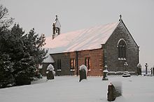
St. Oswalds at Heavenfield
|
55 ° 1 '10.7 " N , 2 ° 6' 6.6" W.55.019641 -2.101832
|
Section 26
| ON
|
Name / place
|
Description / condition
|
Illustration
|
location
|
| 26th
|
Mile fort Plantrees
|
The mile fort is located south of the B6318. It is located approx. 700 m east of the intersection of the B6318 with the A6079, on the wide version of the wall. No visible remains of the complex have survived. The dimensions are the same as for the MK 23, 24 and 25, length 15.24 m. It was a mile fort of the long axis type, the construction of its gates is unknown. Such fortifications were built by the Legio VI Victrix . It was surrounded by a ditch, which was probably crossed by a causeway. The fort was excavated on February 5, 1930 by Thomas Hepple. The location and dimensions of the facility were documented and the site was sketched. In 1956, two iron wedges (260 mm long) were discovered in the rubble behind the north wall, which were probably used to split stones. In 1966, English Heritage employees conducted a field inspection. It was found that there were no visible remains, as the site had meanwhile been destroyed by road construction. In 1989 the English Heritage carried out another investigation and no remains of the mile fort could be seen. The area was already completely covered by the road and a plane tree grove.
|
|
55 ° 1 ′ 13.7 " N , 2 ° 6 ′ 34.8" W.55.020461 -2.10967
|
| 26A
|
High Brunton Tower
|
It was located in 1930 right next to the B6318 at the High Brunton House by Thomas Hepple. Another investigation in 1959 revealed that its interior floor was made of rammed earth and mortar, but was also partly paved with stone slabs. It had been piled up twice with a layer of sand. The fireplace was renewed every time. A small area was surrounded by a stone wreath, it existed during the entire service life of the tower, its purpose is unknown. In the tower, some utensils that were used for bronze casting were also excavated ( crucible , grindstone). Ceramic fragments as well as two jugs and an amphora were subsequently found. Some of these fragments come from the Legio VI Victrix . Probably one of their vexillations had built the tower. The finds could be dated to the late second century.
|
|
55 ° 1 ′ 18 " N , 2 ° 6 ′ 58.7" W.55.021668 -2.116305
|
| 26B
|
Brunton Tower
|
This watchtower was west of Brunton House, just off the A6079. Its remains have been preserved, some of the walls are still up to 2.8 m high and are part of a 69 m long preserved section of Hadrian's Wall. The tower was discovered by John Clayton in 1873 and examined by Thomas Hepple in 1930. The building measured 3.88 m × 3.5 m. The entrance was four feet wide. The side walls were 0.84 m thick. Hadrian's Wall formed the north wall of the watchtower, in 1947 it was still eleven rows high there. The south wall was still almost 1.22 m high. There was a small altar inside the tower. To the east of it, the wide version of Hadrian's Wall changes into the narrow version. 27 m west of the tower, the building inscription of an auxiliary troop cohort (centurial stone) was recovered from the southern stone facing of the wall. It is now kept in the Chesters Museum.
|
|
55 ° 1 '22.9 " N , 2 ° 7' 27.5" W.55.023025 -2.124308
|
|
|
Wall section at Planetrees
|
The remains of the wall are located 250 m west of the Planetrees Farm. You can clearly see the transition of the wall construction from the wide to the narrow version. In 1801 its demolition (to obtain building material for a farm house) could just be prevented by intervention by William Hutton. The section is about 35 m long. Its eastern part (20 m long, 1.75 m wide) was developed as a Breitverson, the western part (about 15 m long, 2.8 m wide) was listed much narrower, but still stood on a much wider foundation. A number of seepage water drains were built into the narrow construction of the wall and cut through the entire width of the foundations. This means that these culverts were created at the same time as the foundations and not only when the masonry was erected. In September 1989 employees of the English Heritage investigated this section of the wall as part of their Hadrian's Wall project.
|

Remnants of the wall at Planetrees Farm

Southern section of the wall section, the transition from the wide to the narrow version can be clearly seen here
|
55 ° 1 '15.8 " N , 2 ° 7' 27.5" W.55.021042 -2.124308
|
Section 27
| ON
|
Name / place
|
Description / condition
|
Illustration
|
location
|
| 27
|
Low Brunton Mile Fort
|
Little researched, no remains of the fort or the wall visible above ground. The location of the mile fort is west of the village of Low Brunton, on a pasture near the - now abandoned - railway line of the Border Counties Railway and the wall bridge at the auxiliary troop camp of Chesters ( Cilurnum ).
|
|
55 ° 1 '27.6 " N , 2 ° 7' 54.6" W.55.024321 -2.131845
|
| 27A
|
Chester Tower
|
The WT was discovered in 1945 during excavations on the site of the Reiterkastell. From him only a 3.36 m long piece of the foundation walls has been preserved, which consists of a layer of quarry stone bound in clay. They are about 42 m west of the east gate, close to the principia of the fort. The tower was never completed. Only its foundations and a few rows of stones were bricked up before the decision was made to build the Chesters fort on this site.
|
|
55 ° 1 '33.3 " N , 2 ° 8' 20.9" W.55.025912 -2.139139
|
| 27B
|
tower
|
There are no remains. His position could only be estimated.
|
|
55 ° 1 '39.5 " N , 2 ° 8" 44.5 " W.55.027639 -2.145684
|
|
|
Chester Wall Bridge
|
The multi-phase bridge enabled the passage over the upper Tyne (North Tyne) at Chollerford and was one of the earliest structures of this type on Hadrian's Wall. It is one of the most impressive surviving Roman buildings on this section. The Wall and the Southern Military Road crossed the river at the Chesters Bridge. On her one reached u. a. the ramparts of Chesters, which stood immediately after the bridge on the west bank. It can be reached today on a footpath from the nearby Chollerford Bridge. The foundation walls of the eastern abutment of Bridge II and its watchtower have been preserved. When the water level is low, the remains of the western abutment and the substructures of two pillars in the middle of the river bed are visible.
|

The remains of the eastern abutment
|
55 ° 1 '30 " N , 2 ° 8' 16.8" W.55,025 -2,138
|
Section 28
| ON
|
Name / place
|
Description / condition
|
Illustration
|
location
|
| 28
|
Walwick Mile Fort
|
The mile fort probably belonged to the long axis type. The construction of his gates could no longer be determined. It was built by either the Legio VI Victrix or the Legio XX Valeria Victrix . The fort was discovered in 1957 and was located south of Walwick Hall in Chesters on a dirt road. In 1967 employees of the English Heritage investigated the site. It was found that the complex was only visible from a slight elevation, probably a remnant of the south wall. In 1989 the area was again assessed by English Heritage. Remains of the mile fort could not be observed this time. The elevation observed in 1967 actually came from modern times and was also too far away from Hadrian's Wall.
|

The B6318 near the MK 28 area
|
55 ° 1 '44.7 " N , 2 ° 9' 10.2" W.55.029086 -2.152839
|
| 28A
|
Walwick Hall tower
|
No more visible remains. It was first described by Alexander Gordon in the Iter Septentrionale in 1727 :
"A small exploratory excavation uncovered a wall of hewn stone, a little more than 12 feet long, a little less wide, and about five rows high."
In 1920 the tower site could be located about 270 m west of Walwick Hall.
|
|
55 ° 1 ′ 51.7 " N , 2 ° 9 ′ 37.8" W.55.031035 -2.160512
|
| 28B
|
Rye Hill Tower
|
The watchtower was located in 1920 and was first examined by English Heritage in 1965. The tower was only recognizable from the heavily overgrown wall remnants (square structure, dimensions about 4 m north-south wall or 5 m east-west wall).
|
|
55 ° 1 '57.6 " N , 2 ° 10' 3.7" W.55.03266 -2.167699
|
Section 29
| ON
|
Name / place
|
Description / condition
|
Illustration
|
location
|
| 29
|
Tower Tye Mile Fort
|
The mile fort was located in 1732 by John Horsley. He assumed it wasn't built directly on the wall. However, no evidence of this could be found afterwards. In 1840, Reverent John Hodgson surveyed the facility, and 18 years later Henry MacLauchlan reported that its remains had since been removed. Only raised areas covered with lawn were visible. In 1957 it was described in more detail in the Handbook to the Roman Wall, No. 11. In 1989 employees of the English Heritage examined the area. It was found that the mile fort was surrounded by a drainage ditch lined with stones and an additional defensive ditch (observed on the south and west sides). A slightly raised earth terrace, surrounded by a moat, can still be seen from the fort (south-west corner, east wall). It is right next to the B6318. Circumferential trenches of this kind were also observed in the MK 9, 23, 25 and 51. Presumably, they originally served to drain the construction site. It was a long-axis type of fastening, although the construction of the main gate could not be clearly determined. Its dimensions were 19 m × 18 m. The corners were rounded. The remains of a causeway were still visible at the south and north gates. To the north of the fort there was a wall passage and a dam path over the ditch in front of it. The wall in this section was probably built by a cohors VIIII of the auxiliary troops under the command of Aelius Aelianus. However, there is still disagreement in research as to whether the relevant inscription comes from the area around the MK or the WT 27b.
|
|
55 ° 2 '3.4 " N , 2 ° 10' 31.6" W.55.034267 -2.175435
|
| 29A
|
Tower Black Carts
|
The watchtower is about 100 meters east of the back road to Simonburn. The place name Carts is derived from the Old English word ceart , rocky and rough. It is part of a 460 meter long stretch of the narrow version of the wall with clearly visible foundations. The tower was probably built by a team of Legio XX Valeria Victrix at the same time as the wall. Its south side has been completely destroyed. In the north, however, the rising is still up to eleven rows of stones. The threshold of the entrance door consists of massive stone blocks. The internal dimensions of the tower are 3.45 meters × 3.40 meters. The entrance is 0.9 m wide and was located on the eastern corner of the south wall. The tower site was first examined in 1873, 1912 and the last time in 1971. Then the remains of the wall were restored and preserved. During the excavations, millstone fragments, along with an exceptionally high number of coins from the time of the emperors Vespasian , Trajan , Hadrian and Constantine I, were found.
|

Preserved remains of the WT

A short piece of the wide version of the wall can still be seen in the foreground of the ruined tower, probably built before the Roman architects decided to continue the wall only as a narrow version.
|
55 ° 2 '9.6 " N , 2 ° 10' 56.8" W.55.036009 -2.182452
|
| 29B
|
Limestone Bank Tower
|
Only a slight elevation and little masonry are visible of the watchtower. The connecting route to the Roman Wallstrasse is still partially visible. The excavations in 1912 showed that the watchtower was almost identical to WT 29A. There were also roof tiles in the rubble, many with nail holes, and three large stone slabs. The floor consisted of rammed earth and was partly paved. In the southwest corner was a brick platform on which the ladder to the upper floor was placed. An amphora had been set into the ground next to the east wall, the fireplace was on the west wall. During the excavations, a shield hump, a spearhead, a coat fibula, a game board, millstone fragments and two flints were found. The pottery finds suggest that the tower was not manned beyond the 2nd century.
|
|
55 ° 2 '14.9 " N , 2 ° 11' 22.1" W.55.037481 -2.189484
|
Section 30
| ON
|
Name / place
|
Description / condition
|
Illustration
|
location
|
| 30th
|
Limestone Corner Mile Fort
|
The fort is located in the western part of the so-called Limestone Corner, in the immediate vicinity of the B6318. MK 30 was probably a long-axis type of attachment. However, the entrance gates could never be exposed, which is why this type of assignment is uncertain. Such mile forts were usually built by construction crews of Legio VI Victrix or Legio XX Valeria Victrix . The remains of the fort can be recognized by a 0.8 m high embankment and masonry on the east wall (both sides). The latter is 3.1 m long, approx. 2.25 m wide and has been preserved up to a height of 0.6 m. The fort measures about 20 m on its north-south side. In 1927 the mile fort was first examined by Grace Simpson. It measured its north-south length and part of the Roman military road. In 1951 the wing walls and the upstream wall section were excavated. It was found that it had been continued here as a narrow version on a wide foundation. In 1965, a field inspection was carried out by employees of English Heritage. At that time, a 3 m high rise in the ground and fragments of the east wall (NE corner) could still be seen from the mile fort. Remains of the substructure were still visible from Wallstrasse. In 1989 there was another inspection by English Heritage as part of the Hadrian's Wall Project. The earlier observations could be confirmed.
|
|
55 ° 2 ′ 18.6 " N , 2 ° 11 ′ 47.6" W.55.038503 -2.196562
|
| 30A
|
Carrawburgh East Tower
|
The tower point is mostly under the B6138. In 1912 the south side was allegedly examined. The watchtower is thought to be located 40 meters west of MK 30, on the highest point of Tuppermoor Hill. During field inspections by employees of the English Heritage in 1966, 1965 and 1989, no remains of the tower were found.
|

Hadrian's Wall at Limestone Corner
|
55 ° 2 ′ 13.6 " N , 2 ° 12 ′ 16" W.55.037115 -2.204441
|
| 30B
|
Carrawburgh West Tower
|
The watchtower is located on a 0.6 meter high elevation 40 meters west of the access road to Carrawburgh Farm. Its western wall was examined in 1912. In 1966 R. W. Harris excavated the tower site. In 1966 and 1989 employees of the English Heritage also visited the site.
|

Tower location 30B near Carrawbrough Farm
|
55 ° 2 ′ 11.3 " N , 2 ° 12 ′ 43.8" W.55.036473 -2.212167
|
|
|
Limestone Corner marching camp
|
On the highest point of Teppermore Hill (near Limestone Corner) the remains of a Roman marshals were discovered in 1912. It is 150 meters south of a curve on the B6318. Its layout was almost square. The dimensions were about 50 × 50 meters and it covered an area of around 0.2 hectares. The remains of the fence, a ditch and the four gates were always visible. Inside, the foundations of some buildings were observed. The camp was probably used several times by soldiers. The pottery found on the fort area dates from the second and late third or early fourth centuries. Later a homestead (only recognizable from a series of elevations) was built over the camp.
|
|
55 ° 2 '18 " N , 2 ° 11' 33.7" W.55.038321 -2.192696
|
Section 31
| ON
|
Name / place
|
Description / condition
|
Illustration
|
location
|
| 31
|
Carrawburgh Mile Fort
|
The mile fort is now under a parking lot in Carrawburgh. Little is known about the fort. Only its western wall and the remains of the 0.15 m high dam on Wallstrasse could be observed. At the beginning of the 19th century, some bones were first discovered between the mile fort and the fort of Carrawburgh ( Brocolitia ). In 1934 they looked again for the remains of the fortification. But only one coin from the reign of Victorinus could be recovered. In 1964, excavations were carried out in the run-up to the parking garage there. The western wall of the fort, which was almost completely destroyed by stone robbery, could be proven. A year later, employees of the English Heritage carried out a field inspection there. It was found that the north wall of the fortification lies below a car road. From the rest of the mile fort, only a slight, 0.25 m high (west side) elevation was recognizable. The last time the English Heritage carried out another investigation of the site in 1989 as part of its Hadrian's Wall project. However, only the previous level of knowledge could be confirmed here.
|

Area of MK 31 east of Carrawburgh Fort
|
55 ° 2 '5.6 " N , 2 ° 13" 40.5 " W.55.034899 -2.227914
|
| 31A
|
The Strands tower
|
The watchtower is now below the B6318. There are no visible remains. Despite research in 1966 by R. W. Harris, Durham University, the tower could not be located at its assumed location.
|
|
55 ° 2 '2.7 " N , 2 ° 13' 38.6" W.55.034072 -2.227382
|
| 31B
|
Carraw East Tower
|
The watchtower is located on private property south of the B6318, just a few meters east of the Carraw Farm. From the tower point, a slightly raised, square elevation is still visible. An excavation by R. W. Harris in 1966 found that the entrance to the tower was on the east side of the south wall. Presumably it was built by a construction team from Legio XX Valeria Victrix . In the late 2nd century the threshold of the entrance was raised again a little.
|
|
55 ° 2 ′ 3 ″ N , 2 ° 14 ′ 6 ″ W.55.034166 -2.234997
|
Section 32
| ON
|
Name / place
|
Description / condition
|
Illustration
|
location
|
| 32
|
Carraw Mile Fort
|
There are no visible remains of the mile fort 32. Only an elevation and a 0.3 m deep ditch mark the course of the north side of the fort, which is covered by a modern wall. In 1961 his position was determined by Eric Birley. In 1966, English Heritage employees conducted a field inspection. It was found that the remains of the fort could only be recognized by a raised ground and a surrounding ditch dug by treasure hunters. Antique masonry was no longer visible. In 1971 the area of the southern entrance gate was examined. Due to years of stone robbery, the gate was already too badly damaged to gain new knowledge about the construction of the mile fort. Ceramic fragments from the 4th century were subsequently recovered. In 1989, English Heritage was able to confirm the previous observations as part of the Hadrian's Wall Project.
The attachment is probably a specimen of the long-ax type. It was built either by a construction team of the Legio VI or by the Legio XX . Its dimensions (edges of the elevation) are 20 meters × 16.5 meters. Possibly the surrounding ditch was bridged by a causeway.
|
|
55 ° 1 ′ 59.5 " N , 2 ° 14 ′ 34.8" W.55.033207 -2.243002
|
| 32A
|
Carraw West Tower
|
Some remains of the watchtower were partially removed in 1920, but most of it is overbuilt by the B6318.
|
|
55 ° 1 ′ 56.7 " N , 2 ° 15 ′ 1" W.55.032411 -2.250272
|
| 32B
|
Brown Moor Tower
|
To determine the location, the distances to the neighboring mile forts and watchtowers were measured. Presumably it is completely covered by the B6318.
|
|
55 ° 1 ′ 54.8 " N , 2 ° 15 ′ 32" W.55.031898 -2.258889
|
Section 33
| ON
|
Name / place
|
Description / condition
|
Illustration
|
location
|
| 33
|
Mile fort Shield on the Wall
|
His remains were located a few meters from the B6318 and are still clearly visible. In 1930 a fragment of a relief stone, decorated with foliage ornaments, was discovered at the north gate. 1935-1936 the mile fort was excavated and measured. In 1966 a field inspection was carried out by the English Heritage, and the results were confirmed from 1935 to 1936. In 1988 the area was examined and surveyed again by employees of the English Heritage. The fort belongs to the long axis type II and was probably built by the legio XX Valeria Victrix . The wall segments of the north and south gates have been preserved, some of which are still 1.2 m high. The fortification had a circumference of 24 m × 21 m. Their relatively large and massive door sills correspond to those of MK 13, 17 and 53.
|

The remains of the north gate
|
55 ° 1 ′ 51.1 " N , 2 ° 15 ′ 58" W.55.030867 -2.26611
|
| 33A
|
tower
|
Located in 1920, remains are no longer visible, the watchtower was completely demolished over the centuries by stone robbery. Eric Birley described his position in 1961 as follows: "... 150 yards east of the 27th milestone from the bridge that crosses the Coesike."
|
|
55 ° 1 '48.5 " N , 2 ° 16" 24.2 " W.55.030132 -2.27338
|
| 33B
|
Coesike tower
|
The watchtower is located about 150 m west of the B6318. The rising masonry is partially preserved up to a height of 1.1 m. The entrance with a slightly raised door threshold was at the eastern end of the south wall. The ladder platform and a hearth stood in the southwest corner. Its floor was heaped up and partly paved. The tower walls were 0.9 m thick. The tower is located on the narrower section of the wall, but the wing walls were remarkably made somewhat wider than usual. The discovery of an inscription stone that names the “ legio VI Victrix ” suggests that it was built by this legion. After the crews had been relocated to the Antonine Wall, initially unoccupied for a long time, but it was put back into operation for a short time after the Romans withdrew from Scotland. The entrance was walled up in the late 2nd century as the tower was probably no longer used from that point on. Eventually it was demolished except for the side walls leaning against the wall and four rows of stones in the front wall. During the excavations, fragments of vessels, cooking utensils and animal bones (calves, sheep and piglets) were recovered from small finds.
|
|
55 ° 1 '45.1 " N , 2 ° 16' 51.9" W.55.029189 -2.28107
|
Section 34
| ON
|
Name / place
|
Description / condition
|
Illustration
|
location
|
| 34
|
Grindon Mile Fort
|
There are no visible remains of the mile fort; its location is marked by a row of trees and a dry stone wall around 0.5 kilometers east of Sewingshields Farm. In 1947 it could be determined that the fort belonged to the long-ax type II, built by the Legio XX Valeria Victrix . In 1965 and 1988 the English Heritage conducted field inspections. Visible remains were not found. Only his position and previous investigation results could be confirmed.
|
|
55 ° 1 ′ 43.3 " N , 2 ° 17 ′ 15.8" W.55.028706 -2.287715
|
| 34A
|
Grindon West Tower
|
The watchtower is located east of Sewingshields Farm. Its walls (about 0.95 m wide) consisted of a mortar core with stone facing on both sides. Like some other specimens on Hadrian's Wall, it had unusually short wing walls (9 m × 6 m), which suggests that it was one of the last fortifications built on the wall. In the core of the wall (at least at this point) and also in the wing walls of the tower were u. a. large basalt blocks installed. The ladder platform was presumably in the south-west corner, the entrance door was on the east side of the south wall. It measured 1.15 m in width, a badly worn swell stone, anchors for stone posts and a socket hole in the door were also preserved. The internal dimensions of the tower are 3.9 m (east) and 2.3 m (west). Outside the tower, a cobblestone access path and fragments of amphorae were found.
The watchtower was discovered by Frank Gerald Simpson in 1912. Simpson partially excavated the tower the following year, but did not publish his findings. The site was also dug in 1947 and 1958. In 1971 Dorothy Charlesworth completely exposed the tower for the Department of the Environment. When the fortification was abandoned, in the late 2nd or early 3rd century, could not be determined without a doubt. It was only recognizable that the upper floor was demolished during this period. In the Middle Ages, the tower ruins were used to produce green glass. During the excavations, a spearhead, a brooch, a coin from the time of Vespasian and fragments of terra sigillata were found. In the vicinity of the tower three hearths (later replaced by one) and a heap of rubbish made of bones and potsherds (mostly cooking utensils) could be observed.
|
|
54 ° 59 '37.2 " N , 1 ° 44' 12.2" W.54.993672 -1.736733
|
| 34B
|
Sewingshields Farm tower
|
The tower is covered by a building from Sewingshields Farm, which has numerous Roman stones in its masonry. Therefore there are no more visible remains.
|
|
55 ° 1 '36.2 " N , 2 ° 18' 0.8" W.55.026726 -2.30023
|
Section 35
| ON
|
Name / place
|
Description / condition
|
Illustration
|
location
|
| 35
|
Mile fort Sewingshields Crags
|
The mile fort is located on an eastern slope of Sewingshields Crags. Only its foundations are still visible. Its internal dimensions are 18.3 mx 15.2 m, the walls are up to 3.2 m wide. According to the southern gate, it was one of the long axis specimens, gate type IV. The Roman connecting road from the fort to Wallstraße runs a little further south, it is 5.5 m wide, the road embankment was up to 20 cm high. The fortification had no north gate. It was built by the Legio XX and extensively renovated again in the early 3rd century.
The fort was excavated and thoroughly explored between 1947 and 1982. A total of four construction phases could be distinguished on the inner buildings. A phase I barracks measured 4.25 m × 7.45 m and stood on stone foundations. Phase II likely fell in the late 2nd or early 3rd century. At this time, new buildings were erected on the east and west sides, which took up almost the entire interior and later fell into disrepair. The buildings of phase III were only very simple (wood or turf brick walls on stone foundations) and probably served as metal workshops, since bronze and iron remains, two melting furnaces and cast crucibles were found there. New stone foundations were erected for the phase IV buildings.
The post-ancient use of the fort fell into the period between the 13th and 15th centuries. At that time, three long rectangular buildings with stone floors, Buildings A, B and C, which were used for residential purposes and livestock farming, were built there. In the course of the excavations, their remains were removed again.
|
|
55 ° 1 '32.9 " N , 2 ° 18" 23.9 " W.55.025812 -2.306637
|
| 35A
|
Sewingshields Crag tower
|
The watchtower stands west of MK 35 and was examined in 1958 by J. Birch on behalf of the Ministry of Public Building Works. It was abandoned in Roman times and then almost completely destroyed. Its masonry has been preserved up to three layers of stone (height 0.75 m). Inside, the tower measures 3.7 m (west-east) × 2.4 m (north-south). The wing walls are unusually narrow, 1 m (west-east), the foundations are 0.7 m deep. In 1958, a roughly executed inscription plate was also found approx. 19 m east of the tower. It is now in the Museum of Antiquities, Newcastle upon Tyne.
|

The remains of the WT 35A
|
|
| 35B
|
Tower Busy Gap
|
The watchtower is on a cliff before descending to Busy Gap. It was discovered in 1913 and exposed in 1946. The tower only had relatively narrow walls, the entrance door was on the east side of the south wall. There are no visible remains of the masonry. The tower can only be recognized by a 3.8 m × 5.5 m and up to 0.5 m high elevation.
|

Hadrian's Wall near the WT 35B
|
|
Section 36
| ON
|
Name / place
|
Description / condition
|
Illustration
|
location
|
| 36
|
Kings Hill Mile Fort
|
Little can be seen of the mile fort. It is located on Kings Hill, half a mile northeast of Housesteads Fort ( Vercovicium ). The masonry in the east and west was removed in 1831 and pulled out down to the foundations. An inscription from the Legio II Augusta was also discovered. The rest was gradually destroyed by stone robbery. The interior is covered with fallen stones from the wall. The fort was excavated in 1946. It was found that it was a fixation of the long axis type. Its wing walls were made relatively narrow. The south gate was destroyed in post-Hadrian times and the north gate walled up.
|

Hadrian's Wall on Kings Hill
|
55 ° 1 ′ 4.7 ″ N , 2 ° 19 ′ 7 ″ W.55.017963 -2.318619
|
| 36A
|
Tower Kennel Crags
|
The remains of the watchtower can still be seen as a slight elevation. The tower was located in 1911 and excavated in 1946. It only had very narrow side walls and the entrance was in the east. It is believed that it was abandoned before the withdrawal of the Roman army from Hadrian's Wall.
|
|
|
|
|
Walltor Knag Burn
|
The gate was discovered in 1855 and excavated, restored and preserved in 1936 and 1988. It was erected a long time after the rampart was completed, probably in the course of the 4th century, and is located in a valley east of Housesteads Fort . A small stream (Knag Burn) crosses the wall a few meters through a recess to the west of the gate. It is one of the few passages on the wall that is outside a mile fort or fort ( extra muros ). The gate building consisted of the 3.7 m wide passage through the actual wall, flanked on its south side by guard houses, dimensions 4.65 m × 3.25 m and another gate at its southern end. The entrances to the guard rooms were 0.95 m wide. Since the steep ascent to the north gate of the fort was difficult or impossible for carts and riders to pass, the border crossing was set up in the valley. The gate, which can be locked on both sides, is comparable to today's security gates and was, so to speak, a small-scale mile fort. At the same time, such a surprise attack or breakthrough by attackers from the north was impossible. IA Richmond believed the gate was only used for a short time.
|

The remains of the gate to the south of the ramparts, to the west on the hill is Housesteads Fort

The passage seen from the northeast

Attempt to reconstruct the gate system, view from SW
|
55 ° 0 ′ 52.8 " N , 2 ° 19 ′ 43.1" W.55.01466 -2.32865
|
| 36B
|
Housesteads Tower
|
The watchtower is located inside Housesteads Fort. His remains were discovered in 1945, roughly in the middle of the north wall during an excavation carried out by F. G. Simpson and I. A. Richmond, on the north wall. It was located 30 meters west of the north gate, between the fort wall and building VI and - together with the wall - was demolished when the camp was built. Only its foundations remained (0.7 m high). From its location you can clearly see how the fort was built exactly along the steep northern slope.
|

Findings plan of the wall section at Housesteads, status 1945
|
55 ° 0 ′ 49.3 " N , 2 ° 19 ′ 51.6" W.55.0137 -2331
|
Section 37
| ON
|
Name / place
|
Description / condition
|
Illustration
|
location
|
| 37
|
Housesteads West Mile Fort
|
The mile fort is approximately 400 meters west of Housesteads Fort . Excavation campaigns were carried out in 1853, 1907, 1933, and the late 1980s. During the investigations of 1853, a reused honorary inscription ( Spolie ) for Hadrian and two altars for the god Cocidius and the supreme imperial god Iupiter, the latter donated by the Legio II Augusta , were found near the mile fort . The remains have been partially reconstructed and subsequently conserved and are under the protection of the English Heritage. Some of the remains of the wall still reach a height of 2.2 meters. It was a copy of the short-axis type I and was built by a construction team of Legio II Augusta on the foundations of the wide version of the wall. The north-south walls are shorter than the east-west specimens. The findings of the investigation from 1988 to 1989 showed that the north gate had gone through three construction periods. Shortly after its completion, it was bricked up again and partially demolished in Roman times. The flanks of the north gate are made of solid stone blocks, another feature of the work of the Legio II. The construction is preserved up to the beginnings of the passage arch. Six of the blocks are in their usual place, four of them have been positioned there in recent years. The fence must have been at least 4.6 meters high. It is unknown whether the gate also supported a tower. The construction would have been strong enough for that. However, it may have been in little use. The reason for this was probably that the passage was later narrowed. The blockage can still be seen. On the east side there were two one-room barracks, the northern one served as sleeping quarters, the southern one as a depot for the equipment of the guards. The walls are still up to a meter high. Since they were roughly the size of a standard two-room barrack in an auxiliary fort, it is assumed that they could accommodate 16 men. They were probably provided by the garrison of the wall fort. The adjacent reconstruction is based on the findings of the archaeologists involved in the excavations. The wall is shown with a plastering, remains of it could be proven in archaeological investigations.
|

Preserved remains of the MK 37

Attempt to reconstruct Mile Fort 37
|
55 ° 0 ′ 44 " N , 2 ° 20 ′ 15.5" W.55.012234 -2.337652
|
| 37A
|
Rapishaw Gap Tower
|
The watchtower was discovered during exploratory excavations in 1911. However, it seems to have been torn down again in Roman times. Its remains can be seen as a slight elevation in the ground and in aerial photographs.
|
|
|
| 37B
|
Hotbank Crag Tower
|
The watchtower was also located during exploratory excavations in 1911. Only a few stone blocks and an elevation can be seen.
|
|
|
Section 38
| ON
|
Name / place
|
Description / condition
|
Illustration
|
location
|
| 38
|
Hotbank Farm mile fort
|
The remains of the mile fort are near the Hotbank Farm. You can still see small remains of its walls and trenches that were dug by robbery graves. The fort was excavated in 1935. Its dimensions are 18 m (east-west) × 15 m (north-south). According to the findings, it could be assigned to short-axis type I. In the southwest corner, the remains of a rectangular building could be observed. To the east, traces of a 3.6 m wide road embankment were found. At the south gate a tombstone was found that had been reused as a pivot for the gate. He was probably dragged there from a burial ground off the Military Road on the west side of Housesteads Fort. Ceramic finds testify to the occupation of the fort up to the 4th century. At the western end of the cliff, the wall leads past the Hotbank Farm and the mile fort and bends at a right angle to the west to the Highshield Crags.
The most important find is a 1.016 m × 0.61 m building inscription made of sandstone, which was probably excavated there and named Emperor Hadrian , the Legio II Augusta and Aulus Platorius Nepos , his British governor. It therefore dates from the time the wall was built (122–125) and proved beyond doubt that the wall was commissioned by Hadrian and not much later by Septimius Severus . One half was found around 1715, the other half in 1829.
|

Building inscription of the Legio II Augusta
|
55 ° 0 '26.1 " N , 2 ° 21' 24.6" W.55.007253 -2.35684
|
| 38A
|
Tower Milking Gap
|
Located in 1911. There are no visible remains of this watchtower.
|

Hadrian's Wall hiking trail near WT 38A
|
|
| 38B
|
Tower Highshield Crag
|
Located in 1911. Only a slight elevation can be seen from the watchtower.
|

The rampart above Crag Lough near WT 38B
|
|
Section 39
| ON
|
Name / place
|
Description / condition
|
Illustration
|
location
|
| 39
|
Mile fort Nick
|
The mile fort was discovered in 1854 northeast of the Twice Brewed and was partially exposed by archaeologists between 1908 and 1911. In the mid-1980s it was completely excavated and preserved. Its dimensions are 19 m (long side) × 15.5 m (broad side). The fort could be assigned to the long axis type II. The walls are still 1.75 m high today. The barracks in the southwest corner were replaced by simpler and smaller wooden buildings in late antiquity. There was a hearth in the southeast corner. The fort was probably used until the end of the 4th century AD. In the 18th century a milking parlor was possibly built in the west corner.
|

The remains of MK 39, near Steel Rigg
|
55 ° 0 ′ 13 " N , 2 ° 22 ′ 32.6" W.55.003602 -2.375725
|
| 39A
|
Tower Peel Crag
|
The tower was located in 1909 and excavated in 1911. It can only be recognized by means of an approx. 20 cm deep depression. It stood at the foot of the Peel Crags and was not built at the standard distance from MK 39. The location was chosen because there was an easy crossing over the Whin-Sill ridge. It was probably given up and demolished at the end of the 2nd century. The graves of a man and a woman were found in the immediate vicinity of its northwest corner.
|
|
|
|
|
Tower Peel Gap
|
In the summer of 1987, the National Trust and English Heritage jointly carried out excavations along Hadrian's Wall. The foundations of a square building were encountered between 39A and 39B. It stood 345 m west of WT 39A at the foot of Peel Crag. From a structural point of view, it is not integrated into the wall, but rather attached to it afterwards (extra tower). It was almost certainly another watchtower that was built shortly after the wall was completed. Its dimensions were 4 m (east-west) × 3.59 m (north-south), its walls were 0.91 m wide. The entrance door was at the eastern end of the south wall and should have been bricked up again during the Roman occupation. Another square foundation was found on the outside of the west wall. It probably served to secure the extraordinarily wide distance (the largest on Hadrian's Wall) between 39A and 39B and an easily passable cut in the terrain through the Whin Sills.
|
|
55 ° 0 '4.75 " N , 2 ° 23" 13.91 " W.55.001319444444 -2.3871972222222
|
| 39B
|
Tower steel rig
|
The tower, with its long and broad sides oriented almost exactly to the cardinal points, was excavated in 1911 by Frank Gerald Simpson. Its building history is typical of many other towers in the central area of the wall. A short section of the rampart wall to the west and east of the tower was widened. The tower was built at the same time as the wall, its enemy-side front in the east ended directly with the rising facade of the wall. The entrance to the east was located in the south wall. At the end of the 2nd century AD, the tower was demolished down to its foundations. The wall was closed again in this area, but reduced to a width of approx. 1.83 meters.
|
|
55 ° 0 ′ 8.02 " N , 2 ° 23 ′ 29.56" W.55.002227777778 -2.3915444444444
|
Section 40
| ON
|
Name / place
|
Description / condition
|
Illustration
|
location
|
| 40
|
Whinshields Mile Fort
|
The mile fort is northwest of the Twice Brewed Inn, just below the summit of Winshields. Only mounds of wall rubble covered with grass, some up to a meter high, can be seen of it. The fortification, which had already been badly damaged by treasure hunts and stone robberies, was excavated in 1908. Only the south wall was still ten rows high. Internally it measured 16.76 m from east to west and 18.89 m from north to south. The fort belonged to Langachs type II. The inner buildings could not be examined. However, there were indications of several construction phases. There was probably a hearth on the east side. A detailed description of the first excavation and the finds recovered at the time was written by Frank Simpson.
|

Area of the MK 40, the elongated building in the background is the Twice Brewed Inn on the B6318
|
55 ° 0 ′ 7.8 " N , 2 ° 23 ′ 57" W.55.002179 -2.399161
|
| 40a
|
Winshields Tower
|
The watchtower was examined in 1912 and 1946. It had relatively narrow walls and was almost completely demolished during the Roman occupation. There are no visible remains.
|
|
|
| 40b
|
Melkridge tower
|
The watchtower stood on the highest point of the ridge above the Lodhams Slack depression and was also examined in 1912 and 1946. When it was uncovered, it was very poorly preserved, only the entrance in the east was clearly visible. It was unusually wide for a watchtower on Hadrian's Wall. Its internal width was 2.7 m. Due to its position, it could also have served as a observation tower and therefore also have been a little higher than usual. There are no visible remains.
|

Hadrian's Wall Trail west of Winshield Crag visible in the background. Lodhams Slack lies in the depression between the wall in the foreground and the hill.
|
|
Section 41
| ON
|
Name / place
|
Description / condition
|
Illustration
|
location
|
| 41
|
Melkridge Mile Fort
|
The mile fort stood east of the Caw Gap. It was examined in 1946 and presumably belonged to the short-axis type I. It was probably also rebuilt once during its period of use. It was once built over by a cottage house. The building materials for the house came mainly from the walls of the fort. Therefore, only a 0.5 m to 1.2 m high rise in the ground and holes dug by predatory graves can be seen of the fortification. A slight depression marks the northeast corner.
|
|
54 ° 59 '50.4 " N , 2 ° 25' 23.5" W.54.997335 -2.423185
|
| 41A
|
Tower Caw Gap
|
The watchtower stood to the west of the Caw Gap and was discovered during an exploratory excavation in 1912. The front door was on the east side of the south wall. In the Severan period (early 3rd century) the tower was probably demolished and the gap in the wall that was created as a result was built up again. In 1967 Dorothy Charlesworth excavated the tower site on behalf of the Ministry of Public Buildings and Works. The remains of the tower, which are up to 20 cm high, were preserved from 1972 to 1973.
|
|
54 ° 59 '44.8 " N , 2 ° 25' 49.85" W.54.995777777778 -2.4305138888889
|
| 41B
|
Thorny Doors tower
|
The watchtower stood across the Thorny Doors Gap and was also discovered during explorations in 1912. In 1967, Dorothy Charlesworth excavated the tower site on behalf of the Ministry of Public Buildings and Works, but found no significant remains. It was probably also removed at the time of Severus. To the east of the tower, an inscription from the Legio XX was found in the 19th century .
|
|
|
Section 42
| ON
|
Name / place
|
Description / condition
|
Illustration
|
location
|
| 42
|
Cawfields Crag Mile Fort
|
The mile fort is located on the ridge of the Cawfields Crags and is one of the most famous structures of this type on Hadrian's Wall. The choice of location shows how uncompromisingly the distances between the individual mile forts were adhered to by the Roman engineers. Its north gate opens onto a steep slope that is impassable for carts and riders, although to the west there is a much more suitable passage (hole gap) just a few meters away. The mile fort measures 19 m × 15 m and covers an area of 0.03 hectares. Its walls are 2.4 m wide, while the wall at this point is only 1.8 m wide. Presumably it was built according to the original plans, but when the wall section at Cawfields was built, a more massive construction was probably omitted in order to speed up the completion of the wall.
Some temporary marching camps are also known in the region north of Cawfields. One is directly north of the wall, four south of the vallum at Haltwhistle Burn , two more at Markham Cottage in the southwest, another in the southeast near Stanegate at Milestone House and two in the apron of the wall northwest at Burn Head and Chesters Pike. At Cawfields, some milestones could also be found along the Military Road. Two are now in the Chesters Museum, the third in situ south of the mile fort.
|
|
54 ° 59 ′ 38.4 " N , 2 ° 26 ′ 45" W.54.993992 -2.445829
|
| 42A
|
Burn Head Tower
|
There are no remains, the watchtower was probably destroyed during quarrying.
|

Well-preserved wall section between Cawfields Quarry and Caw Gap
|
|
| 42B
|
Great Chesters Tower
|
It was discovered during an exploratory excavation in 1912. The tower is still recognizable from a 0.5 meter high elevation.
|
|
|
Section 43
| ON
|
Name / place
|
Description / condition
|
Illustration
|
location
|
| 43
|
Great Chesters Mile Fort
|
There are no visible remains as it was built over in the late 2nd century AD by the Great Chesters ( Aesica ) fort. Its foundations were discovered during an excavation in 1939 by Frank Gerald Simpson under the fort wall and the rampart between the north gate and the north-west corner. The wall was made in the narrow version on this section. In the same year it was also found that the mile fort was structurally connected to the foundations of the wide version of the wall. It belonged to the short axis type I. The fort wall ran behind the wall foundations (wide version) and directly through the east and west walls of the mile fort.
|

Position of the mile fort (red) on the area of the Aesica fort
|
54 ° 59 '43.1 " N , 2 ° 27' 53.6" W.54.995296 -2.464897
|
| 43A
|
Cockmount Hill tower
|
The watchtower was discovered during exploratory excavations in 1912. The tower site is completely covered with lawn and stones from Hadrian's Wall. No remains can be seen.
|
|
|
| 43B
|
Alloa Lea East tower
|
Discovered in 1912, no visible remains.
|

The Alloa Lea Farm south of Hadrian's Wall
|
|
Section 44
| ON
|
Name / place
|
Description / condition
|
Illustration
|
location
|
| 44
|
Mile fort Alloa Lea
|
The mile fort is about 1.5 kilometers west of Great Chesters ( Aesica ) fort near Alloa Lea Farm. The fortification was almost completely destroyed by stone robbery. All that can be seen are a pair of bricks from the wall facing and an approx. 3.5 m wide raised ground covered with peat. The facility is also visible on aerial photographs. The fort could be assigned to the long axis type (dimensions: 20.3 m from north-south and 17.0 m from east-west). Only its inner surface was excavated, but the results were not published. The substructure of the connection path to Wallstrasse was also recognizable (dimensions: 3.5 m wide and 0.2 m high).
|
|
54 ° 59 ′ 46 " N , 2 ° 29 ′ 16.4" W.54.996104 -2.487884
|
| 44A
|
Alloa Lea West tower
|
The watchtower was discovered during an exploratory excavation in 1912. Only a square, approx. 30 cm high elevation can be seen of it.
|

Hadrian's Wall at Alloa Lea
|
|
| 44B
|
Mucklebank tower
|
The watchtower is located on Mucklebank Crag, west of Walltown Farm, at a point where the course of the rampart turns at right angles from south to west. It was exposed in 1892. During the excavations, a coin from the reign of Valens , a building inscription and another outside the southeast corner were found. Rising masonry is visible from the tower up to a height of 1.9 m.
|

View from the west of Walltown Farm and the region north of the Walltown Crags, in the foreground the remains of the watchtower
|
54 ° 59 '37.97 " N , 2 ° 29" 58.39 " W.54.993880555556 -2.4995527777778
|
Section 45
| ON
|
Name / place
|
Description / condition
|
Illustration
|
location
|
| 45
|
Walltown Crag Mile Fort
|
The mile fort is located on the highest point of Walltown Crag and is a long-ax type. Due to the complete destruction of its walls by stone robbery, little can be seen of it (some moats and elevations). The outlines of the fort can otherwise only be seen clearly in aerial photographs. A few blocks of stone from one of the castle gates are built into a wall at the back of a cattle trough east of Walltown Farm.
|
|
54 ° 59 '33.7 " N , 2 ° 30' 22.1" W.54.992705 -2.50613
|
| 45A
|
Walltown tower
|
The tower site is west of Walltown Farm, 90 meters east of the position originally assumed by the researchers. It measures 5.8 mx 5.5 m (outside). It was discovered and exposed in 1883. In 1912 and 1959 further excavations took place, during which two inscriptions could be found west of the watchtower. The masonry, which has been preserved up to a meter high, has been restored and preserved. The tower is structurally not integrated into the rampart wall. It is believed that it was built at the time of Hadrian, but before the wall was completed, and that it was originally a free-standing building. Presumably it was part of the chain of watch and signal towers in front of the Stanegate . According to the interpretation of the ceramic finds, the tower was probably not occupied beyond the 2nd century.
|
|
54 ° 59 '26.32 " N , 2 ° 30' 39.4" W.54.990644444444 -2.5109444444444
|
| 45B
|
Walltown West Tower
|
The watchtower was discovered and excavated in 1883. It measured 3.8 mx 4 m, its walls were almost a meter thick and at that time a little more than a meter high. It was destroyed during quarrying work soon after it was exposed.
|
|
|
Section 46
| ON
|
Name / place
|
Description / condition
|
Illustration
|
location
|
| 46
|
Mile fort
|
The mile fort lies to the west of a deviation in the course of Hadrian's Wall, north of the Carvoran wall fort ( Magnis ) on a steep slope running to the west. The crew secured u. a. the valley of the Tipalt Burn, west of the fort. Its remains were first mentioned by Lingard in 1807, located by Gibson and Simpson in 1910, and re-examined in 1946. There are no visible remains. Its location can only be identified from a 0.3 meter high elevation and aerial photographs. In the north one could still see traces of the moat.
|
|
54 ° 59 '15.3 " N , 2 ° 31' 32.2" W.54.98759 -2.5256
|
| 46A
|
Holmhead Tower
|
The tower location has not yet been located, its position was calculated using the length of the distance between MK 46 and MK 47. According to this, the watchtower should be located in a garden southwest of Holmhead.
|
|
|
| 46B
|
Churning tower
|
The tower location has not yet been located, its position was calculated using the length of the distance between MK 46 and MK 47. Accordingly, the watchtower should be under the outbuilding of the Wallend Farm.
|
|
|
Section 47
| ON
|
Name / place
|
Description / condition
|
Illustration
|
location
|
| 47
|
Mile fort Chapel House
|
The mile fort stood about 270 m east of the Chapel House in a pasture near the village of Gilsland. There are no visible remains. The area of the fort can only be recognized by a slight elevation in the ground. The fortification fell victim to stone robbery over time. For this purpose, explosives were used in the 19th century. The mile fort was examined in 1935. According to the findings of the north gate, it belonged to long axis type II (internal dimensions: 22 m from north to south, 18.28 m from east to west).
|

Findings sketch, status 1935
|
54 ° 59 '16.9 " N , 2 ° 32' 59.9" W.54.988021 -2.549985
|
| 47A
|
Foultown Tower
|
The watchtower was discovered in 1912 during an exploratory excavation on a pasture west of MK 47. There are no visible remains.
|
|
|
| 47B
|
Tower Gap
|
The watchtower was also discovered in 1912 during an exploratory excavation beyond the village of Gap ('Meadow View'). There are no visible remains, the tower is built over by farm buildings.
|
|
|
Limes course between Castle and Castle Carvoran Bowness-on-Solway, county Cumbria
- MK = mileage fort,
- WT = watchtower,
Listed from east to west
Section 48
| ON
|
Name / place
|
Description / condition
|
Illustration
|
location
|
| 48
|
Mile fort Poltross Burn
|
The mile fort is located in the village of Gilsland, between a tributary of the Irthing and the railway line of the Tyne Valley Line, directly behind the station building. The square is also known by the local population as "The King's Stables". The fort is also described on a display board set up for visitors by English Heritage. It is located on the best-preserved section or near the transition between the wide and narrow version of Hadrian's Wall. The neighboring MK 47 is around 1521 m west and MK 49 1458 m east of Poltross Burn, the Stanegate fort Throp 200 m south. It is one of the best preserved small forts on the wall. Its remains were discovered in 1909 by J. P. Gibson and F. G. Simpson. The remains of the wall were restored or conserved and made accessible to visitors in a display area.
The castle was built by the Legio VI . It was probably used until the 4th century AD. It belongs to the long axis type III, has rounded corners, measures 18.5 m (west-east axis) × 21.3 m (N / S axis) and is thus one of the largest mile forts on Hadrian's Wall. In addition to a considerable part of the surrounding wall and the north and south gates, the foundations of two camp barracks have also been preserved. Two other notable architectural details are a stove and a stair platform in the northeast corner, of which the first step still remains. Based on this step, the original height of the battlements could be determined fairly precisely (3.6 m). The height of the wall including parapet probably reached a height of 4.6 m. Presumably, in addition to a wall passage, his crew was also monitoring the road to the Irthing Bridge at Willowford, which was about half a mile to the west
|

View of the mile fort area, the rising terrain is clearly visible
|
54 ° 59 '20.4 " N , 2 ° 34' 24.7" W.54.988991 -2.573518
|
| 48A
|
Willowford East Tower
|
The tower is located on an alluvial terrace on the southern bank of the Irthing, approx. 455 m west of the MK 48. The watchtower was excavated in 1923. It was about 4.1 m wide. The north wall is still up to a height of 1.3 m, the east wall rises 7, the west wall 5 and the south wall 6 rows of stones. The entrance is in the western part of the south wall. Several fireplaces could be observed inside. There was probably a workshop there that worked bronze and iron. The tower ruins were first demolished, but were partially rebuilt between 1951 and 1952 and the masonry was preserved.
|

Preserved remains of the WT 48A
|
54 ° 59 '23.51 " N , 2 ° 34' 49.37" W.54.989863888889 -2.5803805555556
|
| 48B
|
Willowford West Tower
|
The tower site is on the south bank of the River Irthing, approximately 505 m from WT 48A, immediately east of Willowford Farm. Rising masonry, partly up to a height of 8 stone layers, has been preserved. The watchtower was excavated by R. C. Shaw in 1923.
|
|
54 ° 59 '30.21 " N , 2 ° 35' 14.69" W.54.991725 -2.5874138888889
|
Section 49
| ON
|
Name / place
|
Description / condition
|
Illustration
|
location
|
| 49
|
Harrow's Scar Mile Fort
|
The mile fort stood on a cliff - known today as "Harrow's Scar" - on the western edge of the Irthing Gorge. In 1939 an inscription was found in the rubble. It is now in the Tullie House Museum in Carlisle. The fortification itself was excavated by Ian Archibald Richmond in 1953 . He uncovered the remains of one of the gates and the previous building, a wood-earth fortification. The latter measured 16.6 meters from north to south and 15.4 meters from east to west. Archaeological investigations carried out on the west wall of the mile fort in 1967 confirmed the results of Ian Richmond. The crew barracks inside could not be examined. The MK was probably surrounded by a double moat. It was built in stone in the 2nd century and measured 23 meters from north to south and 20 meters from east to west. Sections of the western and eastern part of the wall and remnants of the interior buildings are still visible. An altar dedicated to the forest god Silvanus was also found near the fort (today in the collection of the Tullie House Museum).
The section of Hadrian's Wall west of the Irthing River was initially closed with a peat wall; there was probably too little stone material in the area. It stretched from Harrow Scar to the south side of the east gate of Birdoswold Fort, then continued on the west side to the west gate. The peat wall was also replaced by a stone wall at the end of the second century AD. This 874-meter-long section was 2.2 meters wide on average and stood on a three-meter-wide foundation that was over a meter deep. The fort area is under the protection of the English Heritage.
|
|
54 ° 59 ′ 26.9 " N , 2 ° 35 ′ 42" W.54.990793 -2.594987
|
|
|
Willowford Wall Bridge
|
The remnants of the eastern abutment on the banks of the Irthing can still be seen from the rampart bridge at Willowford. Its area has silted up because the river bed of the Irthing has shifted further west over time. The excavations in the 20th century uncovered two towers and the foundation walls of the multi-phase eastern abutment. The building history was similar to that of the bridge over the North Tyne at Chesters Castle . The foundations of the two bridge piers are buried under the eastern bank of the river.
|

Remains of the rampart bridge at Willowford
|
54 ° 35 '34.4 " N , 2 ° 21' 11.2" W.54.5929 -2.3531
|
| 49A
|
tower
|
The watchtower was close to the Principia of the Birdoswald ( Banna ) wall fort and secured the early peat wall. When the fort was built, it was removed again. Traces of him could be observed in 1945. Today there are no visible remains.
|

Attempt to reconstruct the watchtower
|
54 ° 59 '21.8 " N , 2 ° 36" 8.3 " W.54.9894 -2.6023
|
| 49B
|
Waterhed West Tower
|
The tower was first located by John Collingwood-Bruce in 1863 and described by him as already very badly damaged. The tower was then forgotten again, but was rediscovered in 1911, some distance from the west wall of Fort Birdoswald. Photos were taken of the excavations. He replaced a wooden tower of the peat wall. Remnants of him are still visible.
|
|
54 ° 59 ′ 21.8 " N , 2 ° 36 ′ 9" W.54.9894 -2.6025
|
Section 50
| ON
|
Name / place
|
Description / condition
|
Illustration
|
location
|
| 50
|
Mile fort High House I
|
One of the two mile forts to secure the temporary peat wall, which have been explored a little more thoroughly. The other was at MK 25. It stood west of the Birdoswald Fort and was excavated in 1934. The defensive walls were made of heaped peat, the northern gate tower was made of wood. It belonged to the long axis type (dimensions of the surrounding wall: 20.12 m × 16.76 m), the stone foundations were 6.1 m wide. According to an inscription on an oak panel - it contained the names of the emperor Hadrian and his governor Aulus Platorius Nepos - the castle was built in the 2nd century. There are no visible remains. The support structure of the north gate consisted of five 23 cm wide posts. The south gate was slightly smaller and supported on six posts (three on each side). During the investigations, traces of the internal development could also be observed. On the east wall stood a 9.14 m × 3.66 m large, rectangular wooden building. It was divided into two unequally large rooms, one with a fireplace. To the north of the building there was another fireplace, to the northeast were the remains of the staircase leading to the battlement. Next to the south gate was a ceramic pot that was partly buried in the ground and had a drain. Presumably it was used as a toilet. The northern moat could be crossed by a stone-paved dam. This was later widened. There were traces of a wooden drainage channel under the dam, which had subsequently been lined with stones. The excavations of 1934 showed that the mile fort was demolished according to plan as part of the first phase of the stone wall expansion (west of MK 49).
The mile fort was located and completely excavated by Frank Simpson and Ian Richmond between 1933 and 1934. The construction details were documented. Ceramics from the 2nd century, the remains of a leather tent, fragments of a wooden writing board and a drinking cup were found. In 1971, English Heritage employees conducted a field inspection. The lack of visible remains was determined and the location of the fortifications confirmed. In 1990 the area was examined again as part of the Hadrian's Wall project. Except for the dam path there were no visible remains.
|

Sketch of the wood-peat mile fort
|
54 ° 59 ′ 8 " N , 2 ° 36 ′ 55.5" W.54.985551 -2.615428
|
| 50
|
Mile fort High House II
|
The mile fort stood three kilometers from the village of Gilsland, west of the Birdoswald fort, on the highest point of the road between Birdoswald and Wall Bowers, 1391 m west of MK 49 and 1501 meters east of MK 51. The stone fort replaced the above. Predecessor building made of wood and peat, which stood about 200 m south. Nothing has been preserved above ground, only a slight (0.2 m high) elevation can be seen. Two elevations on the roadside mark the position of the east and west walls. Fragments of inscriptions were found on its site in 1849 and 1811. The fortification itself was excavated in 1911 (dimensions: 18.3 m from east to west and 23.2 m from north to south). Its wing walls were only narrow and structurally connected to Hadrian's Wall on both sides. The fort belonged to the long axis type III and was very similar to the MK 48 and 49.
|
|
54 ° 59 ′ 13.8 " N , 2 ° 36 ′ 57.9" W.54.987165 -2.616077
|
| 50A
|
Tower High House
|
The wooden tower was discovered in 1934, it is located 507 m west of the wooden tower of MK 50. There were still enough traces to verify the type of construction of the tower. It was 6.1 meters square. Its walls were 76 cm wide. When this section of the wall was built in stone, the wooden tower was removed again.
The following stone tower was located in 1911. Its northern half is buried under a road. The southern half can still be seen as a slight elevation on the edge of an adjacent field.
|

Findings sketch wooden tower
|
|
| 50B
|
Tower Appletree
|
The remains of the wooden tower were discovered 477 m east of the MK 51. Its external dimensions were 6.1 meters square. The north and south walls stood on a kind of pedestal. In the center there was a fireplace a little east of the center of the floor. This suggests that the entrance was on the west side of the south wall.
The stone tower was excavated in 1911. It was about 80 meters east of the abandoned Appletree manor. No remains are visible on the surface. A raised ground on the southern edge of the street marks the former southern wall of the tower. It replaced the wooden tower that was dismantled when the stone wall was being built there. During the excavations, finds from the time of Hadrian were found.
|

Findings sketch wooden tower
|
|
Section 51
| ON
|
Name / place
|
Description / condition
|
Illustration
|
location
|
| 51
|
Wall Bowers Mile Fort
|
The mile fort is located west of Fort Birdoswald, exactly at the point where the wood-peat wall ended. It belonged to the long-ax type III and replaced an early wood-peat fort. The fortification was excavated and examined between 1895, 1927, 1931 and 1936. The excavations brought u. a. the foundations of two stone-built barracks exposed, the neighboring western MK 50 was 1.5 km and MK 52 in the east 1.484 km away. Today no remains of the facility can be seen in the area.
|
|
54 ° 58 '56.6 " N , 2 ° 38' 14.7" W.54.982382 -2.637411
|
| 51A
|
Piper Sike tower
|
The watchtower replaced a wooden tower on the peat wall. It is visible on the northern edge of today's road. Its wall remains have been preserved up to a height of 0.8 m. Perhaps it originally had three floors and was covered with a pitched roof with tiles, thatch or shingles. On the information board on site, it is shown with a crenellated platform. It was located in 1927 and exposed by Dorothy Charlesworth in 1970. In 1972 aerial photographs were taken of the tower site. The entrance was on the east side, a brick platform on the north wall. Dimensioned too small to be a staircase base, it probably had some function in the living area. Some cooking pits and rubbish were found scattered throughout the rest of the tower interior. Presumably, the tower was not occupied by the Roman military beyond the 2nd century. The remains of the rising masonry were preserved after they were completely exposed in 1970 and made accessible as a display area.
|
|
|
| 51B
|
Leahill Tower
|
The watchtower is located on Lanercost Road near the Parish of Waterhead, on the lower slope of Allieshaw Rigg. The tower site was first examined in 1927. This also led to the exposure of a section of the peat wall that preceded the stone wall. Most of the watchtower was still under Lanercost Road in 1927. It was moved a little to the south in 1958 and the tower was then completely excavated and its masonry preserved. In 1972 aerial photographs were taken of the tower site. It was probably built shortly after 122. In the time of Emperor Septimius Severus it fell into disrepair. It was apparently used again in the late 4th century. Maybe it was only manned by patrols for a short time. The watchtower wasn't directly on the wall, but a little away from it. Its internal dimensions were 4.1 m × 4.3 m (from east to west). The watchtower was badly damaged by stone robbery. a. used in the construction of buildings for Leahill Farm. The rising masonry is partially preserved up to nine stone layers high (approx. 1 m). In the middle of the north wall was a brick platform. The entrance was in the south. In the 4th century a kind of shelter was built on the south wall. A keystone found in the tower suggests that it had an open guard platform.
|

The remains of WT 51B, view from the east
|
|
Section 52
| ON
|
Name / place
|
Description / condition
|
Illustration
|
location
|
| 52
|
Bankshead Mile Fort
|
The mile fort, which is no longer visible above ground, is located west of Fort Birdoswald, in the garden of the bank headhouse and was examined in 1934. Multi-phase system, it belonged to the long axis type III and replaced a previous wood-peat building, its dimensions were 27.5 m (east-west) × 23.4 m (north-south). The neighboring MK 53 is 1.520 km away. In 1808 two consecration altars for a local deity, Cocidius, were discovered there. One of the altars was commissioned by Legio XX soldiers in the years 262-266. In 1862 a fragment of an inscription with Hadrian's name was found.
|
|
54 ° 58 '37.1 " N , 2 ° 39' 30.9" W.54.976967 -2.658574
|
| 52A
|
Banks East Tower
|
The watchtower is on a road east of the village of Banks, about 170 m west of the signal tower on Pike Hill. The remains of the tower and this section of Hadrian's Wall can also be seen on aerial photographs. The tower was located in 1927. During the 1933 excavations by F. G. Simpson and I. A. Richmond, remnants of the peat wall were discovered near the east wall of the tower. The tower was in use from the early 2nd century until at least the end of the 3rd century. The entrance is on the southeast side, traces of two fire places and a stone bench on the northwest wall have been found inside. The remaining 14 stone layers, approx. 1.25–1.75 m high, were preserved and restored by employees of the Ministry of Works after completing the investigations. The tower was the first on this section of Hadrian's Wall to be placed under the protection of the Department of Ancient Monuments in 1934. A drainage ditch can be seen in the wall foundation near the tower.
|

Preserved remnants of WT 52A
|
|
| 52B
|
tower
|
Not investigated. No traces of the watchtower have survived above ground. At this section, the wall lies below a modern road. The exact position of the tower therefore remains uncertain.
|
|
|
|
|
Pike Hill signal tower
|
The watchtower on Pike Hill was part of a chain of signal stations built along a Roman road called Stanegate in the early 2nd century. Until the construction of Hadrian's Wall, the road marked the northern border of the Roman Empire in Britain. The crew at Pike Hill was supposed to pass signals to the two neighboring stations, Gillalees Beacon and Barrock Fell. Gillalees Beacon stood on the road that connected the Wallkastell Birdoswald with Bewcastle. With the construction of Hadrian's Wall, the border was extended to the north. The tower was integrated into the wall because of its favorable location. The crew was probably provided by the MK 52, one of the largest on the wall.
The remains of the tower are at a crossroads or a field wall, near the parish of Waterhead. The tower location is about 200 m east of the WT 52A and west of the WT 51B. The largest part is built over by a street, a fragment of its south-east wall, 2 m long and 0.8 m wide, stands on the southern edge of the street and has been made accessible to visitors. In 1931 its remains were excavated and preserved. Ceramics from the Hadrianic period and fragments of cooking utensils (so-called Huntcliffware) from the second half of the 4th century were found. In 1971, English Heritage employees made a field visit. It was found that a large part of the tower had been destroyed by the road construction. Only part of the southeast wall was still upright. The archaeological investigations proved that the tower existed before the peat wall was built. It stood at an angle of 45 ° to the line of the wall in order to ensure better visibility of the signals emitted from there. A trench ran in a zigzag line to the north. The tower was about 6 meters square. The foundations, which reached deep into the natural ground, consisted of mortared rubble stones. So it should have been a little higher than the other specimens on the wall. Its masonry had also been built much more carefully.
|

The remains of the watchtower on Pike Hill

Attempted reconstruction of the tower, as it was in the 2nd century
|
54 ° 58 '33.4 " N , 2 ° 39' 46.6" W.54.975955 -2.662937
|
Section 53
| ON
|
Name / place
|
Description / condition
|
Illustration
|
location
|
| 53
|
Banks Burn Mile Fort
|
The fortification is west of the small village of Banks, in Cumbria and northeast of Lanercost Priory Abbey. The next mile fort, No. 54, is 1,436 m to the east. The fort was examined in 1932, its dimensions were 21.9 m (east-west) × 23.3 m (north-south). It belongs to the long axis type III. In the same year traces of the peat wall were found inside.
|

Findings sketch of the MK
|
54 ° 58 '26.9 " N , 2 ° 40' 52.8" W.54.974146 -2.681336
|
| 53A
|
Hare Hill Tower
|
At the tower point, only a 0.15 m high elevation can be seen, which marks the east and west side of the tower. The watchtower was located about 400 m from Hare Hill in 1854 or 1855 by Henry McLauchlan and excavated in 1932 by F. G. Simpson. McLauchlan described the building as a straight-line structure, 14 feet 6 inches in size, protruding 3 feet north from the wall. The wall foundations were remarkably interrupted there. There were ash deposits in the interior. A coin from the time of Constantine I was found as an accompanying find.
|

The rampart on Hare Hill, west of the location of MK 53
|
|
| 53B
|
Craggle Hill tower
|
Only an approx. 0.1 m high elevation is visible at the tower point. The watchtower was examined in 1932, field inspections were carried out there in 1957 and 1972. It was the easternmost structure of the rampart using red sandstone.
|
|
|
Section 54
| ON
|
Name / place
|
Description / condition
|
Illustration
|
location
|
| 54
|
Randylands Mile Fort
|
The mile fort is located on a mountainside tapering to the west, northwest of the village of Lanercost. Approx. 1 km to the south stood the Stanegate fort Castle Hill (Boothby). It was built over the ruins of an earlier wood and peat fortification. There are no visible remains. Only a few elevations can be seen, otherwise it can only be seen clearly on aerial photographs. 250 meters west of the mile fort (west side of the Burtholme Beck) you can still see the remains of the wall, a 1.7 meter high block of the cast mortar core. The fort was excavated in 1934. Its dimensions (internal) were 19.3 meters from east to west and 23.3 meters from north to south. The gates on the north and south sides belonged to type III. The north wall was shifted slightly to the northeast. From the internal structures, a crew barrack with two chambers could be detected on the western wall. In one there were stone benches, a hearth and a millstone. In 1959 and 1960 two building inscriptions were found there.
|
|
54 ° 58 ′ 21.3 " N , 2 ° 42 ′ 12.6" W.54.972582 -2.703493
|
| 54A
|
Garthside tower
|
The tower site was examined in 1933. A total of two construction phases could be distinguished. Tower I stood a little away from digging a mud wall. Its north wall is likely to have collapsed again towards the end of Hadrian's reign - together with large parts of the mud wall - because it stood on eroding ground. Then the gap in this wall section was closed with a peat wall. Tower II was rebuilt directly behind Tower I on the ridge and was later integrated into the new stone wall. Around 197, at the time of Septimius Severus, Tower II was demolished again. Judging by the pottery finds, the two towers were built in the early 2nd century. Tower II was occupied until around 180. There are no visible remains.
|

Findings sketch of tower point 54A
|
|
| 54B
|
Howgill Tower
|
The tower site was located and excavated in 1933, 487 m west of WT 54a. Presumably the structure replaced a wood and peat tower. The rising masonry made of red sandstone was still four stone layers high. There are no visible remains. Remains of the first peat wall were found 8 m north of the wall. A small inscription plaque was found around 1717 190 m southwest of the watchtower. It's walled into the eastern outer wall of a Howgill Farm building. From this inscription it is known that this wall section was rebuilt in 369 by a cohort of the Catuvellauni, a Celtic tribe who settled in south-east Britain.
|
|
|
Section 55
| ON
|
Name / place
|
Description / condition
|
Illustration
|
location
|
| 55
|
Mile fort Low Wall
|
The area of the mile fort is on a pasture east of the village of Walton. There are no more remains, only a slight elevation can be seen on a hedge. It measured 22 meters from east to west. Its north-south length is unknown. Remains of the ramparts (1.4 m high) have also been preserved near the fort.
|
Hadrian's Wall Trial near the MK 55
|
54 ° 58 '18.5 " N , 2 ° 43' 35.2" W.54.971818 -2.726444
|
| 55A
|
Dovecote tower
|
The tower site was located in 1933. It's about 170 meters north of the High Dovecote hallway. There are no visible remains.
|
|
|
| 55B
|
Townhead Croft Tower
|
The watchtower was not discovered until 1959 (a first attempt in 1933 failed) by K. S. Hodgson. It is located about 40 m west of the Dovecote Bridge. No remains are visible. A part of the wall, 1 meter high and 20 meters long, has been preserved near the tower. It is currently covered by a mound to protect the fragile masonry from further deterioration.
|

Hadrian's Wall near WT 55B
|
|
Section 56
| ON
|
Name / place
|
Description / condition
|
Illustration
|
location
|
| 56
|
Walton Mile Fort
|
The mile fort could not be located. There are no visible remains. The fort was northeast of a former restaurant, the Centurion Inn in Walton. Hadrian's Wall runs under the densely built-up town center. The mile fort was probably completely demolished over time. It was probably in a field called Bendle's Croft. Today there are only a few beeches and a small hill at a bend in the road from Walton to King Water. Traces of the fortification could be proven in 1858 by Henry MacLauchlan southeast of the village church. Surveys of the local population about the remnants of the mile fort that still existed in 1900 remained inconclusive.
|
|
54 ° 58 '17.3 " N , 2 ° 44' 50.8" W.54.971466 -2.747448
|
| 56A
|
Sandyside Tower
|
As distance measurements from neighboring fortifications of Hadrian's Wall revealed, the watchtower is likely to have been to the east of Sandysike Farm. Localization attempts in 1933 brought no results. A remnant of the rampart, 5.6 m long and 0.5 m high, can be viewed in a forest west of the farm. In one of the farm buildings, a Roman altar was walled in 0.7 m above the ground.
|
|
|
| 56B
|
Cambeck Tower
|
The watchtower was 140 m east of the Cambeck corridor on a gravel terrace. There are no visible remains. It was located in 1933, its width was 6.2 m. He was about three feet from Hadrian's Wall. It is therefore assumed that it originally belonged to the peat wall. The Castlesteads wall fort is about 440 m from the watchtower.
|
|
|
Section 57
| ON
|
Name / place
|
Description / condition
|
Illustration
|
location
|
| 57
|
Cambeckhill Mile Fort
|
The exact location of the mile fort is unknown. Finds and visible remains of the wall are not known. Henry MacLauchlan suggested that it was on the west bank of the river. But that would be 1/8 mile too close to the Walton Mile Fort. Based on the measurement of the distance to the neighboring towers, it should be directly under Cambeckhill Farm. Before the construction of a stable building, an exploratory excavation was carried out by employees of the Ministry of Public Building and Works on Cambeckhill Farm in the 1960s. The foundation of the wall was found, which consisted of red sandstone blocks and rubble in this section. Traces of the upstream trench can be seen on the edge of a field west of the courtyard. The further course of the wall can be seen from a wide elevation southwest of the farm. The Castlesteads ( Camboglanna ) fort is 430 m southeast of the mile fort .
|
|
54 ° 57 '55.3 " N , 2 ° 46' 11.1" W.54.965351 -2.769748
|
| 57A
|
Beck Tower
|
The watchtower is about 180 meters southwest of Dodgson's Beck Farm. The tower is recognizable by a slight elevation in the ground, otherwise there are no visible remains. It was discovered in 1933. The excavations confirmed that it was a tower of the peat wall. Its dimensions were 6.1 × 6.9 meters. A large amount of pottery, including some Terra Sigillata fragments, was found.
|

The Hadrian's Wall hiking trail at WT 57A
|
|
| 57B
|
tower
|
The watchtower has not yet been located and there are no visible remains. Its location was believed to be 110 meters northeast of Newtown Farm.
|
Presumed location of the WT 57B in a field at Newtown Farm
|
|
Section 58
| ON
|
Name / place
|
Description / condition
|
Illustration
|
location
|
| 58
|
Newtown Mile Fort
|
The mile fort was near a road leading southwest out of Newtown. It was probably on the north side of a hedge. There were u. a. Elevations and an unusually large amount of stones. Around 1853, an inscription from the Legio II Augusta was also found there. Excavations in 1902 only clarified the course of Hadrian's Wall in southwest Newtown. In order to find the mile fort, geophysical surveys were carried out between 1980 and 1981. However, no useful results could be achieved.
|

Presumed area of the MK 58 in Newton, looking west, the fortification was on the hedge on the southern edge of the road
|
54 ° 57 '19.3 " N , 2 ° 47' 8.3" W.54.955364 -2.785641
|
| 58A
|
tower
|
Not investigated. There are no visible remains. Presumably he was about 300 meters east of Cumrenton Farm.
|

Hadrian's Wall Trail near the tower site
|
|
| 58B
|
tower
|
The watchtower was apparently discovered in 1894 by members of the Society of Antiquities of Newcastle, but its exact location was not recorded in writing at the time. It was probably northeast of Chapel Field.
|

Presumed area of the watchtower
|
|
Section 59
| ON
|
Name / place
|
Description / condition
|
Illustration
|
location
|
| 59
|
Old Wall mile fort
|
The mile fort was in a pasture 450 yards east of Old Wall, halfway to Chapel Field, Irthington Parish. The village is north of Carlisle Airport. The remains of the mile fort are only visible on aerial photographs. Its construction type is unknown. The fortification was reportedly discovered in 1894 by a man named Hodgson. During excavations, the stone foundations made of rubble stones bonded with lime mortar and Roman-British pottery came to light. A geophysical investigation carried out in 1981 showed that only remnants of the south wall were left, the side walls had completely disappeared due to agricultural activity and stone robbery. About 150 meters south of the fortification an inscription of the Cohors IV Lingonum was found on the wall . A milestone from the time of Diocletian was discovered in the foundations of the rampart west of the fort in 1813 (305-306). A consecration altar, also found near the Mile Fort, was dedicated to the god Mars Cocidius and donated by a centurion of the Cohors I Batavorum , the first Batavian cohort .
|

Hadrian's Wall hiking trail near MK 59
|
54 ° 56 ′ 51.7 " N , 2 ° 48 ′ 17.5" W.54.94769 -2.804851
|
| 59A
|
tower
|
Not investigated. Its approximate position could only be estimated (based on measurement points on neighboring fortifications). Probably east of the hamlet of Old Wall. In 1981 geophysical surveys took place there, but the watchtower could not be located.
|
|
|
| 59B
|
tower
|
Not investigated, location unknown. Its approximate position could only be estimated (based on measurement points on neighboring fortifications). Only a few of the watchtowers between MK 59 and 72 could be found and identified before 1961.
|
|
|
Section 60
| ON
|
Name / place
|
Description / condition
|
Illustration
|
location
|
| 60
|
Mile Fort High Strand
|
Not investigated, the position of the mile fort is uncertain and there are no visible remains. Henry MacLauchlan suspected it was near the village of Irthington, about 450 yards northeast of Bleatarn Farm, Hall High Strand, halfway to Oldwall, about 60 yards west of the end of a dirt road that runs along the moat. In 1851 an altar of Mars Cocidius came to light on this spot while plowing. It was donated by soldiers of the Legio VI.
|

Hadrian's Wall Trail near Bleatarn Farm
|
54 ° 56 '40.2 " N , 2 ° 49' 33.1" W.54.944493 -2.825862
|
| 60A
|
tower
|
Not investigated, location unknown.
|
|
|
| 60B
|
tower
|
Not investigated, location unknown.
|
|
|
Section 61
| ON
|
Name / place
|
Description / condition
|
Illustration
|
location
|
| 61
|
Mile Fort Wallhead
|
The location of the mile fort is unknown, there are no remains above ground. It is believed to be east of Wallhead Farm, village of Stanwix Rural. In 1981 a geophysical survey was carried out there. Approx. In 1949, 400 m to the south, the remains of two Roman marching camps lying one above the other were observed.
|

Presumed area of the mile fort near Wallhead Farm
|
54 ° 56 '22.7 " N , 2 ° 51' 3.2" W.54.939648 -2.850894
|
| 61A
|
tower
|
Not investigated, its location is unknown.
|
|
|
| 61B
|
tower
|
Not investigated, its location is unknown.
|
|
|
Section 62
| ON
|
Name / place
|
Description / condition
|
Illustration
|
location
|
| 62
|
Walby East Mile Fort
|
The mile fort was localized by a geophysical survey between 1980/1981. In 1999 exploratory excavations took place there. The fort was badly damaged by stone robbery. Only the remnants of the north gate and a building of undetermined function were recognizable. It was a long-axis type and measured (internally) 16.5 × 24 meters. Traces of the original wood and peat fortification were also found among the remains of the stone fort.
|
|
54 ° 56 '9.6 " N , 2 ° 52' 14.9" W.54.936002 -2.870795
|
| 62A
|
tower
|
Not investigated, its position could not yet be determined exactly.
|
|
|
| 62B
|
tower
|
Not investigated, its position could not yet be determined exactly.
|
|
|
Section 63
| ON
|
Name / place
|
Description / condition
|
Illustration
|
location
|
| 63
|
Walby West Mile Fort
|
The mile fort was located about 800 meters southwest of the hamlet of Walby, Stanwix Rural. There are no visible remains. In 1980 a geophysical survey was carried out near the point where Henry MacLauchlan had already suspected the mile fort. However, a follow-up investigation in 2000 found that the soil anomalies were in fact a section of Hadrian's Wall. The mile fort is probably a little further south of the investigated area, directly under Hadrian's Wall hiking trail.
|
|
54 ° 55 '44.6 " N , 2 ° 53' 18.9" W.54.929043 -2.888591
|
| 63A
|
tower
|
Not investigated, the exact location of the tower is not known.
|
|
|
| 63B
|
tower
|
Not investigated, the exact location of the tower is not known.
|
|
|
Section 64
| ON
|
Name / place
|
Description / condition
|
Illustration
|
location
|
| 64
|
Mile Fort Drawdykes
|
The mile fort was excavated in 1962 by P. F. Fane-Gladwin. It was a short-axis type fort, internal dimensions: 17.8 m × 14.6 m. The walls were almost completely destroyed by stone robbery. The north gate was 3 m wide and was bricked up again in ancient times. In the middle of the fortification ran a 5 m wide paved road that connected the two gates. Subsequently, a fragment of a Roman milestone (inscription "MP") was recovered on the west side of the mile fort. It is in the collection of the Carlisle Museum.
|
|
54 ° 55 '12 " N , 2 ° 54' 35.7" W.54.919989 -2.909922
|
| 64A
|
tower
|
Not investigated, the exact location of the watchtower is unknown.
|
|
|
| 64B
|
tower
|
Not investigated, the exact location of the watchtower is unknown.
|
|
|
Section 65
| ON
|
Name / place
|
Description / condition
|
Illustration
|
location
|
| 65
|
Tarraby Mile Fort
|
The mile fort stood on a sloping westward slope, about 180 meters southwest of Tarraby, a district of Carlisle . There are no visible remains. In 1976 an exploratory excavation was carried out at the southwest corner of the Mile Fort, followed by a geophysical investigation. Remnants of the foundations could be observed. The geophysical survey showed that the internal area was paved with cobblestones. The attachment was probably of the short axis type. A Roman altar and sword were supposedly found near it in the 19th century (between 1840 and 1850). To the south of the mile fort, parallel to the B6264, you can still see traces of the wall (a 10 meter wide and 0.5 meter deep depression) in a short section.
|
|
54 ° 54 '45.4 " N , 2 ° 55' 26.8" W.54.912602 -2.924106
|
| 65A
|
tower
|
Not investigated, the watchtower was believed to be about 250 meters east of Beech Grove.
|
|
|
| 65B
|
tower
|
The watchtower was on the area of Fort Stanwix ( Uxelodunum / Petrianis ) . It was probably removed when the stone warehouse was built. During the excavations in 1975 by Charles Daniels, only the remains of a wall core could be observed. It is also not known whether the watchtower was built before or after the peat-earth wall was demolished. If it had been built at the same time as the earth wall, it would have been the standard width of 6 meters, the same as the earth wall
|
|
Section 66
| ON
|
Name / place
|
Description / condition
|
Illustration
|
location
|
| 66
|
Stanwix Bank mile fort
|
The mile fort was south of the Stanwix fort, on the north bank of the Eden near Carlisle. Its area is now used as a cricket ground. The Romans had built a bridge over the Eden and the Caldew at this point. On the south bank there was another fort and the fortified city of Luguvalium . The remains of the bridge were discovered by William Camden in the 16th century. During dredging work in the river bed, almost one hundred of their stones were recovered in 1951. Most of them were deposited in Bitts Park and can be viewed there. The mile fort was inspected a little more closely by Thomas Pennant on his trip to Scotland in 1772. He describes the remains, which were still visible at the time, as "... slight elevations in the ground around a small square ..." His crew was supposed to secure a pass there. Today nothing can be seen of the mile fort.
|

Area of the MK in Bitts Park (Carlisle), view from the north

Stones of the Roman Bridge in Bitts Park
|
54 ° 54 '7.7 " N , 2 ° 56" 28.8 " W.54.902135 -2.941333
|
| 66A
|
tower
|
Not examined, the tower could not be precisely located.
|
|
|
| 66B
|
tower
|
Not examined, the tower could not be precisely located.
|
|
|
Section 67
| ON
|
Name / place
|
Description / condition
|
Illustration
|
location
|
| 67
|
Stainton Mile Fort
|
The location of the mile fort was determined by measuring the distance from neighboring mile forts. In 1861, some Roman coins were recovered from this point at the southern end of the railway viaduct over the Eden. However, upon follow-up examination, no remains or other evidence of its existence could be found.
|

View towards the Silloth Viaduct, the presumed location of the MK
|
54 ° 53 '55.7 " N , 2 ° 57' 55" W.54.898802 -2.965269
|
| 67A
|
tower
|
Not investigated, location unknown.
|
|
|
| 67B
|
tower
|
Not investigated, location unknown.
|
|
|
Section 68
| ON
|
Name / place
|
Description / condition
|
Illustration
|
location
|
| 68
|
Boomby Gill Mile Fort
|
The location of the mile fort could only be determined by measuring the distance to the neighboring fortifications of Hadrian's Wall. So far, however, no remains of the fort have been discovered. In 1969 employees of the English Heritage carried out a first field inspection. Remnants of the mile fort could not be found. In 1972 employees of the English Heritage investigated an old exploratory trench there, it was probably dug to uncover the northwest corner of the mile fort, but these efforts were unsuccessful. There were many loose stones in the trench, some of them very large. In 1990, another field inspection was carried out as part of the Hadrian's Wall project. Visible remains could not be observed, and there was no trace of the exploratory trench either.
|

Footbridge near Boomby Gill
|
54 ° 54 '15.3 " N , 2 ° 58' 15.1" W.54.90424 -2.970858
|
| 68A
|
tower
|
Not investigated, and the exact location of the watchtower is not known either.
|
|
|
| 68B
|
tower
|
Not investigated, and the exact location of the watchtower is not known either.
|
|
|
Section 69
| ON
|
Name / place
|
Description / condition
|
Illustration
|
location
|
| 69
|
Sourmilk Bridge mile fort
|
The mile fort was probably located near Beaumont, in the district of Grinsdale. Its exact location is not known. It was probably somewhere between Sourmilk Bridge (east side) and Park Farm west of Grinsdale. In 1858 a large number of stones were found near the bridge. A map from 1746 showed that a mill had stood on the east bank during this time, which was later demolished. The stones probably came from there too.
|

The Sourmilk Bridge, between Burgh-by-Sands and Grinsdale
|
54 ° 54 '49.3 " N , 2 ° 59" 27.2 " W.54.913694 -2.990897
|
| 69A
|
tower
|
Not investigated, exact location not known. The watchtower was probably between the Sourmilk Bridge and the section where Holme Lane runs directly along Hadrian's Wall.
|
|
|
| 69B
|
tower
|
Not investigated, exact location not known. The watchtower is likely located just below St. Andrews Church in the village of Kirkandrews-on-Eden.
|
|
|
Section 70
| ON
|
Name / place
|
Description / condition
|
Illustration
|
location
|
| 70
|
Mile fort Braelees
|
The mile fort was located between the villages of Kirkandrews-on-Eden and Beaumont to the north of Cowen Bank on the River Eden. Its exact location has not yet been determined. The position measured from other fortifications of the wall is 300 meters north of Braelees towards Monkhill Beck. A geophysical survey carried out there in 2000 did not produce any usable results. The mile fort was probably completely destroyed by centuries of stone robbery. Remnants of Hadrian's Wall were discovered during an excavation nearby. To the south of it, a large number of hewn stone blocks were reportedly discovered by a gardener who used them for his rock garden. To the north, on both sides of the Monkhill Beck, remains of the moat can be seen up to two meters deep. Over time, they became part of a dirt road. A 110 m long section of the Vallum can also be seen in the southwest . In 1820 a fragment of a Roman building inscription was found in the river bed of the Eden. It was later inserted into a house wall in Beaumont. According to the text, the construction work on this wall section was carried out by the fifth cohort of Legio XX Valeria Victrix from Chesters ( Deva ). In 1934 a country house in Beaumont was demolished. A Roman altar was found in the foundations, which was dedicated to the supreme imperial god Iupiter and the genius of a number unit . Their relatives, Aurelian Moors, Valerianus and Gallienus donated the altar. A year later a gardener found a Roman coin in Braeless.
|

View to the NW of the Eden and the location of the MK 70
|
54 ° 55 '16.8 " N , 3 ° 0' 47.7" W.54.921328 -3.01324
|
| 70A
|
tower
|
Not examined, there are no visible traces. It is believed that the watchtower was at a point on the wall where it changed direction, possibly under the area of the motte of the medieval castle in Beaumont. During an exploratory excavation carried out in 1928 in the churchyard of Beaumontchurch, west of the castle, remains of Hadrian's Wall were uncovered. The measured location of this tower would also be there. Both Collingwood Bruce and MacLauchlan suggested that a number of Roman stones in the churchyard indicate a tower structure.
|

St. Mary's church in Beaumont, presumed location of WT 70, view from SW
|
54 ° 55 '26.7 " N , 3 ° 1' 7.6" W.54.924072 -3.018774
|
| 70B
|
tower
|
Not investigated, exact location not known. The watchtower was probably 540 meters west of St Mary's Church, on the southern edge of Milldikes Lane. In 1858 Henry MacLauchlan reported a noticeable discoloration of the soil on the bank of a pond near this position. This prominent place could still be seen in 1961.
|
|
54 ° 55 '26.7 " N , 3 ° 1' 38.5" W.54.924091 -3.027356
|
Section 71
| ON
|
Name / place
|
Description / condition
|
Illustration
|
location
|
| 71
|
Wormanby Mile Fort
|
The mile fort was southeast of the west end of Milldikes Lane, between the towns of Burgh-by-Sands and Beaumont. There are no visible remains. It was located and partially excavated in 1960 by S. H. Bartle. During the excavations, the remains of the sandstone south and west wall (approx. 2.98 m) and a street in the fort could be observed. The east wall was at the edge of a field and could not be excavated. Two flint scraping tools were found as accessories. During an exploratory excavation near the foundations, fragments of Roman pottery were found. In 2000, five exploratory trenches were dug as part of Hadrian's Wall project. A section of Hadrian's Wall two layers of stone was also preserved near the mile fort. As a result, traces of the peat wall could also be detected in the lower layers. Structures of interior buildings could not be found, possibly they were on the east side of the small fort.
|

Hadrian's Wall Trail at Burgh by Sands
|
54 ° 55 '23.3 " N , 3 ° 2' 3.7" W.54.923127 -3.03435
|
| 71A
|
tower
|
The watchtower was west of the footbridge over Greathill Beck, east of Burgh-by-Sands. There are no visible remains. Until the 1960s, stone blocks, bricks and a fragment of a column were allegedly still to be seen in the stream bed near the bridge.
|
|
|
| 71B
|
tower
|
Not investigated, its position is unclear. It is believed that the watchtower stood on the area of the Burgh-by-Sands ( Aballava ) fort, near the Sandwath Fjord, probably at the present-day cemetery or at the east gate of Fort II.
|
|
|
Section 72
| ON
|
Name / place
|
Description / condition
|
Illustration
|
location
|
| 72
|
Fauld Farm mile fort
|
The mile fort was in the town of Burgh-by-Sands, right on the access road to Fauld Farm. It was about 400 meters west of the Aballava fort . There are no visible remains. The first reports of the fortification come from John Horsley. It was located and partially excavated by S. H. Bartle in 1960. Further excavations were carried out between 1977 and 1989. The walls in the north, west and east and the north gate were examined in particular. The stone fort overlaid structures originally made of turf and wood. The previous building was probably replaced by the stone fort in the second half of the 2nd century. During this time the peat wall was also replaced by the stone wall. It was a long-axis type and was 24.3 meters long and 19 meters wide. The walls were 2.2 meters wide. The south side could not be excavated. Its design was very similar to the MK 79 . Most of the ceramic fragments recovered there date from the 2nd century, the rest could not be assigned.
|

Main street from Burgh by Sands by the Greyhound Inn near the MK
|
54 ° 55 '20.3 " N , 3 ° 3' 21.7" W.54.922312 -3.056017
|
| 72A
|
tower
|
Not investigated further, its location was determined from a measuring point at the neighboring mile fort. At the end of the line, on the western outskirts of Burgh-by-Sands (West End district), ceramic finds from the Hadrianic period came to light in 1986, but no remains of the tower could be found.
|
|
|
| 72B
|
Rindle Hill Tower
|
The watchtower was located in 1948. The tower site was 19 meters from the easternmost hedge of the field (cadastral number 1004), north of Rindle House. It was geophysically examined and partially excavated by Frank Simpson in the same year. It turned out that it was one of the early wooden specimens. The peat wall was located 1.2 meters north of the line of the later stone wall and sat on an approximately 5 meter wide rubble foundation. There are no visible remains.
|
|
|
Section 73
| ON
|
Name / place
|
Description / condition
|
Illustration
|
location
|
| 73
|
Dykesfield Mile Fort
|
The mile fort was about 1.6 km west of Burgh-by-Sands, 496 meters west of watchtower 72B. John Horsley reported an unusually large number of stones at the fort site. There are no visible remains. It was located in 1948 and partially excavated. Its internal dimensions were 19.2 meters (from north to south) and 18.7 meters (from east to west). The walls were 2 meters wide. In the course of a geophysical investigation, the outer circumference could also be determined, 24.75 meters (from north to south) and 26 meters (from east to west). It should have belonged to long-axis type III or IV. In the interior there were also traces of a street and three buildings, divided by rooms, on the east and west walls.
|

Dykesfield Junction, the mile fort is north of the road west from Burgh by Sands
|
54 ° 55 '27.4 " N , 3 ° 4' 42.7" W.54.924271 -3.078538
|
| 73A
|
tower
|
The exact location of the watchtower could not be determined. Presumably he was in the swamp area of the Burgh Marsh, but so far no wall structures have been seen.
|
|
|
| 73B
|
tower
|
The exact location of the watchtower could not be determined either. Presumably he was also standing in the bog of Burgh Marsh.
|
|
|
Section 74
| ON
|
Name / place
|
Description / condition
|
Illustration
|
location
|
| 74
|
Burgh Marsh Mile Fort
|
Not investigated, there are no visible remains. The mile fort was probably near the road from Burgh-by-Sands to Drumburgh. Its presumed position could only be determined from measuring points on neighboring fortifications and is located in the wet meadows of Burgh Marsh, where no remains of Hadrian's Wall have yet been found.
|

Road from Burgh-by-Sands to Drumburgh near MK 74
|
54 ° 55 '35.7 " N , 3 ° 6' 1.6" W.54.92659 -3.100446
|
| 74A
|
tower
|
Not investigated, position unclear (Burgh Marsh), no visible remains.
|
|
|
| 74B
|
tower
|
Not investigated, position unclear (Burgh Marsh), no visible remains.
|
|
|
Section 75
| ON
|
Name / place
|
Description / condition
|
Illustration
|
location
|
| 75
|
Easton Mile Fort
|
The mile fort could not yet be examined. There are no visible remains and its location is unclear. It is believed to have stood near the road from Burgh by Sands to Drumburgh. Its approximate position could only be determined on the basis of measuring points based on neighboring wall structures. The area of the fort lies in the wet meadows of the Burgh Marsh. So far, however, no remains of Hadrian's Wall have been found there.
|

Section of the Drumburgh to Burgh by Sands road near the MK
|
54 ° 55 '38.2 " N , 3 ° 7' 23.1" W.54.927282 -3.123093
|
| 75A
|
tower
|
Not investigated, position unclear (Burgh Marsh), no visible remains.
|
|
|
| 75B
|
tower
|
Not investigated, position unclear (Burgh Marsh), no visible remains.
|
|
|
Section 76
| ON
|
Name / place
|
Description / condition
|
Illustration
|
location
|
| 76
|
Drumburgh Mile Fort
|
The mile fort was on the eastern outskirts of Drumburgh, probably about 200 meters east of the Concavata fort , on the slope above an abandoned railway line. The exact location has not yet been confirmed archaeologically. A slight, irregular elevation can be seen at the presumed location, but it is unclear whether it is actually the remains of the mile fort. In 1962, about 100 meters to the east, the remains of Hadrian's Wall were still visible in the marshes of Burgh Marsh.
|

Road to Drumburgh, near the presumed location of the MK
|
54 ° 55 '41.3 " N , 3 ° 8' 44.1" W.54.92815 -3.145589
|
| 76A
|
Drumburgh School Tower
|
The watchtower was located in 1948 by Simpson, Hodgson and Richmond immediately east of the south garden gate of the Drumburgh schoolhouse. There are no visible remains.
|
|
|
| 76B
|
tower
|
Not investigated, the watchtower has not yet been located. Presumably he was a little east of Glasson, 90 meters south of a former railway line that crosses Hadrian's Wall there.
|
|
|
Section 77
| ON
|
Name / place
|
Description / condition
|
Illustration
|
location
|
| 77
|
Raven Bank Mile Fort
|
The mile fort was likely to be northeast of the village of Glasson, about 50 yards south of the junction of the Glasson Strait with the Straits of Bowness-on-Solway and Carlisle. Its exact location is not known. In the area in question, an excavation was carried out in 1973 by Dorothy Charlesworth, but it did not produce any useful results. Only remnants of the moat have survived southwest of the mile fort.
|

View towards the Solway Firth near the presumed location of the MK 77
|
54 ° 56 '7 " N , 3 ° 9" 42.2 " W.54.935277 -3.161712
|
| 77A
|
Tower Lowton House
|
Not investigated as its exact location is not known. Presumably it was about 140 yards southeast of Lowtown House.
|
|
|
| 77B
|
Westfield House tower
|
Not investigated, exact location is also not known. His remains are believed to be right under Westfield House or his courtyard.
|
|
|
Section 78
| ON
|
Name / place
|
Description / condition
|
Illustration
|
location
|
| 78
|
Kirkland Mile Fort
|
The mile fort is halfway between Glasson and Carlisle Harbor, in a field northwest of the access road to the Cottage and Glendale Holiday trailer park. There are no visible remains. The mile fort was discovered in 1938 and partially excavated. The west wall was about 2.8 meters wide. Only a row of stones on the inside facing was preserved, the rest was destroyed by stone robbery. In 2000 it was re-examined by English Heritage staff as part of the Milecastles project. The surrounding trench was exposed in the west, south and east. The mile fort was 19.2 m wide (from east to west) and 20.7 m long (from north to south). The foundations of the walls were 2.5 meters wide. In the southwest corner, traces of a fire were observed, possibly once the location of a stove or an oven. Remains of the earlier wood and peat fortification have not been preserved. Hadrian's Wall was there 2.35 m wide. The moat ( vallum ) can still be seen in this area as a 0.8 m deep depression.
|

Hadrian's Wall Trail near Port Carlisle
|
54 ° 56 '27.9 " N , 3 ° 10' 45.4" W.54.941084 -3.179285
|
| 78A
|
Kirkland Farm Tower
|
The watchtower was 20 meters northwest of Kirkland Farm, on the southern edge of a road that leads to Port Carlisle. It was discovered by John Horsley in the 18th century. The tower site was examined as part of an excavation in 1948. There are no remains.
|
|
|
| 78B
|
tower
|
The watchtower could not be precisely located. Near its position, which was determined by measurements of neighboring fortifications of the wall, a small mound or tumulus once stood on it, allegedly a medieval stone cross, Fisher's Cross Mound. J. C. Bruce reported the discovery of Roman coins on the hill. Nothing has survived from the watchtower, the mound or the stone cross.
|

The presumed location of the watchtower
|
|
Section 79
| ON
|
Name / place
|
Description / condition
|
Illustration
|
location
|
| 79
|
Mile fort Solway House
|
Multi-phase system, the early wood-peat fort was later removed and rebuilt in stone. The mile fort is 350 meters west of Field View Lane and Port Carlisle. The place is marked by a slight elevation in the ground, otherwise no visible residues have remained on the surface. The antiquarian William Hutton carried out a field inspection on this section of Hadrian's Wall in 1801. The section around the mile fort was the only place west of Carlisle where he found visible remains of the ramparts. Hutton describes it as follows: “... five or six hundred yards long and three feet high ... in two places it is six feet high, eight wide, and three thick; but without stone facing .. ". Hutton also met a farmer who bragged that he had already destroyed large parts of the wall. However, he was able to make him promise to spare the remaining parts of the wall. John Kenneth Sinclair St. Joseph made aerial photographs of the area in 1949. The first excavations were carried out by Richmond and Gillam that same year. Since the area was not used for agriculture there, the mile fort was still relatively well preserved. The original wood-peat fortification measured (internally) 14.9 meters from east to west and 12.5 meters from north to south. The coastal marshes around the fort were probably constantly threatened by flooding. This would explain why it was built on a 1.5 meter high man-made platform. It was replaced in the late 2nd century by the slightly larger stone mile fort (internal: 17.7 meters square). The passages of its gates were subsequently made smaller. Traces of a half-timbered building were found in the eastern half.
|

Findings sketch 1949–1999
|
54 ° 56 '56.3 " N , 3 ° 11' 39.9" W.54.948979 -3.194427
|
| 79A
|
tower
|
Only the approximate position of this watchtower is known. It is believed that it was about 400 meters west of the MK 79. There Hadrian's Wall changes its direction a little. The remnants of the wall are still preserved at this point up to a height of one meter.
|
|
|
| 79B
|
Jeffrey Croft Tower
|
The watchtower is located about 250 meters southeast of the outskirts of Bowness-on-Solway, in the Jeffrey Croft corridor. The tower is only recognizable from a very low elevation. In 1934 its south and west walls were examined by members of the Cumberland Excavation Committee (Simpson, Richmond, MacIntyre). They also wanted to clarify whether the wood-earth wall extended to the western end of the wall at Bowness. Its south wall was 1.12 m, the west wall, 0.96 m wide, the latter could be followed over a length of 4.64 m from the southwest corner. The foundation consisted of two layers of paving stones connected with red clay. There were still three rows of stones left of the rising masonry. Obviously it was a free-standing stone tower that stood near the peat wall. Proof of this was the difference in the width of its south and west walls. It is the westernmost watchtower of Hadrian's Wall that has been archaeologically proven.
|
|
|
Section 80
| ON
|
Name / place
|
Description / condition
|
Illustration
|
location
|
| 80
|
Bowness Mile Fort
|
The mile fort was in the village of Bowness-on-Solway . It probably stood on the area of the Maia Wall Fort , which secured the westernmost end of Hadrian's Wall. It was probably completely removed during its construction or destroyed by the erosion of the coast, as no traces could be found there. Hadrian's Wall was believed to end there. From the 16th to the 19th centuries, however, eyewitness reports kept appearing that the wall continued beyond Bowness a little further west. This would be the equivalent of closing the wall on the banks of the Tyne, east of the Segedunum fort . However, this information has not yet been confirmed by the archaeologists.
If Hadrian's Wall actually only extended as far as Maia Wall Fort , the fortifications to the west of it would already be part of Cumbria's coastal protection. The camp was on a cliff near the high water mark, this would be an ideal position for the end point of the wall. The watchtowers between MK 80 of Hadrian's Wall and KK 1 would then be classified as WT 0A and WT 0B of the coastal protection. It is believed that coastal protection began at this fort. WT 0A could e.g. B. have stood on the western slope of the Bownesser beach cliff, near the west gate of Maia. However, to date there is no archaeological evidence for the existence of these two towers.
|

Sketch of the position of the MK 80
|
54 ° 57 '10.5 " N , 3 ° 12' 54.6" W.54.952908 -3.215155
|
Limes on the west coast of Cumbria
The small fort chain in Cumbria, sometimes referred to as the "western extension" of Hadrian's Wall, begins at KK No. 1 (Bowness on Solway) and ends at KK No. 26 (Flimby), south of Maryport. The originally 35 km long fortification line was interrupted by the deeply carved estuaries of the Wampool and Waver. It ended in the north at Cadurnock (KK 5) and continued in the south at Skinburness (KK 9). The numbering of the small fort therefore leaves out four sections, the number of which results from the standard distances between the KK and WT. So far, no military buildings have been archaeologically proven on its banks. It is also possible that fortifications never existed there. But given the density of the chain of fortifications on either side of the estuary, it would be surprising if this vast gap had been left completely unguarded, especially given its proximity to the Scottish and Irish coasts.
Coast section 1
KK = small fort, WT = watchtower
| ON
|
Name / place
|
Description / condition
|
Illustration
|
location
|
| 1
|
Biglands House fort
|
The small fort stood in a field next to the Biglands House farm, on an east-west ridge that was 4.5 meters high, 60 meters from the coast and about 1.6 km from the Bowness-on-Solway fort. There was a good view of the Cardurnock Peninsula, the Solway Estuary and the Galloway Mountains from here. On aerial photographs taken by K. S. St. Joseph in 1949, an approx. 50 meter wide, square elevation surrounded by ditches can be seen. All that can be seen is a slight, grassy bump on the south side, and to a lesser extent on the west side. The north side is no longer preserved. The small fort was explored in 1954 and completely uncovered from 1974 to 1975 by archaeologists from the University of Lancaster (led by Elizabeth Tutty). The excavation in 1975 showed that the small fort was occupied until the end of the 2nd century, probably with interruptions, namely when the ramparts were moved to the Antoninuswall (until 180?). The ceramic finds date from the time of Hadrian. The crew consisted of eight to ten men.
The fort had a much longer and more complex building history than was initially assumed. It was a three-phase, rectangular, north-south oriented fortification of the long axis type, measuring 40 × 50 meters. It consisted of wood and sod on sand and gravel foundations. Phase I presumably dates to the years 125–140, phase II fell to the years 155–159 and phase III was created towards the end of the 2nd century. The fence was 7–9 m wide and 6.6 m high. The south gate stood on six support posts. In phase III it was blocked with peat blocks. Instead, a 1.5 m wide passage was broken through the wall. A road led east from the gate. The small fort was also surrounded by a pointed ditch 4–4.5 m wide and 1.3–1.5 m deep. The berm was 6 m wide. The infrastructure consisted of cooking facilities and a barracks building made of sod and wood on the north wall. The aerial photos also showed traces of a palisade, the basic structure of which, as the test trenches from 1954 showed, was made up of bank sand. In a field east of the small fort, traces of two parallel trenches were found, aligned with the rear of the fort. These could have been part of a marking of a military exclusion zone along the Cardurnock peninsula.
|

The Solway Firth at Campfield Marsh, near KK 1

Findings sketch of the fort
|
54 ° 56 '43.9 " N , 3 ° 14' 13.6" W.54.9455407 -3.237098
|
| 1A
|
Bellhouse tower
|
Not investigated, the exact location of this watchtower is uncertain. A rise in the ground could be seen at the presumed location (Bellhouse corridor), but it was leveled during road construction in the 1960s.
|
|
|
| 2A
|
tower
|
Not investigated, the exact location of this watchtower is unknown.
|
|
|
Coast section 2
| ON
|
Name / place
|
Description / condition
|
Illustration
|
location
|
| 2
|
Small fort
|
The exact location of the KK is unknown. It was probably near the coast, near Scargavel Point (Bowness-on-Solway). The coordinates of the neighboring fortifications were used as the starting point for determining its position. The RCHME carried out field investigations but could not find anything there as the erosion of the coast there has progressed continuously over the centuries. Its remains may be under the farm buildings of the North Plaine Farm and the neighboring salt marshes. The farm stands on a slightly elevated ridge with an unobstructed view of the Solway Firth. A good location for a fort or a watchtower.
|

Scargavel Point on the Solway Firth
|
54 ° 56 ′ 28.4 " N , 3 ° 15 ′ 15.2" W.54.941232 -3.25422
|
| 2A
|
tower
|
Its location is not known. It may have been completely eroded by coastal erosion.
|
|
|
| 2 B
|
tower
|
The tower location can be clearly seen on aerial photographs. There are no visible remains. They were recorded in 1975 and show the location of the WT on a small hill and traces of a buried trench about 7 m in front of it. A report from 1929 speaks of several truckloads of stones that were removed from an "old building" about 400 m southwest of Campfield Farm. The WT, which is square in its ground plan, was excavated by G. Jones in 1993, and a timber construction phase followed by a stone construction phase could be observed.
|
|
|
Coastline 3
| ON
|
Name / place
|
Description / condition
|
Illustration
|
location
|
| 3
|
Small fort Pasture House
|
The KK is located on a field of Pasture House Farm in the village of Bowness-on-Solway. In 1880 some fragments of terra sigillata and hand-worked sandstone blocks were picked up on the grounds of J. Robinson. In 1945 some blocks of peat were found directly by a stream northeast of the farm. It was the remains of a peat and wooden structure. The KK is a rare example of such a Roman fortification of which the remains of the masonry can still be seen. The location of the KK can still be recognized today from a slightly raised terrace that rises slightly towards the coast. In the SW it drops off slightly. In 1946, JK St.Joseph took aerial photographs on which the contours of the fortifications (especially the east wall and the rounded NE corner) can be seen.
|

Road to Cardurnock near Pasture House Farm
|
54 ° 55 '57.2 " N , 3 ° 42' 59.9" W.54.932558 -3.71664
|
| 3A
|
tower
|
The position of the WT is uncertain. It is believed to be located on a gravel hill in a field about 400 meters west of the Pasture House Farm. The distance from KK 3 to the presumed tower location is 988 m in a straight line. Apparently a small remnant of one of its walls was still visible for a long time. The sandstone blocks were later used to build a latrine. There is also no indication of the shape of the tower's floor plan.
|
|
|
| 3B
|
Herd Hill North Tower
|
The tower site, which is now a listed building, was examined for the first time in 1880. It can still be recognized today by means of an elevation in the ground. During the excavation by R. S. Ferguson in the 19th century, the remains of ancient pottery, the handle of an amphora, human bones and large quantities of mussel shells were found. Internally, the WT had a stone floor. The foundations consisted of mortared stone blocks.
|
|
|
Coastal section 4
| ON
|
Name / place
|
Description / condition
|
Illustration
|
location
|
| 4th
|
Herd Hill small fort
|
The KK is located on the lake edge, 91 m southeast of a small hill, the Herd Hill, near Bowness, north of the hamlet of Cardurnock. From here you had a good view of the coast. In 1880, R. S. Ferguson examined the WT on Herd Hill and the area around the hill, but could not find anything. determine. In 1945 F. G. Simpson and K. S. Hodgson found remains of a peat fortification there. Above ground nothing can be seen of the KK today, it was only through a geophysical investigation in 1994 that it was possible to identify the north side and northwest corner of the fort.
|

Fields on the Solway Firth, near the location of KK 4
|
54 ° 55 '34.9 " N , 3 ° 17' 21.3" W.54.926352 -3.289258
|
| 4A
|
tower
|
Not investigated, the exact position of the WT is not known. According to statements from the local population, it is believed that it was standing near a large ash tree on an elevation with a good view of the coast, a ridge of sand between Herd Hill and Cardurnock, about seven strips of field (counting from Herd Hill) away.
|
|
|
| 4B
|
Cardurnock tower
|
The WT is located on a gravel hill west of Cardurnock. It was recognized or located by F. G. Simpson and K. S. Hodgson based on scattered stones and examined by G. D. B. Jones in 1977. Three sides are marked by trenches, the western side is completely eroded. Today no remains can be seen. The tower probably went through three construction phases.
Phase I consisted of a viewing platform raised from earth which was surrounded by a palisade.
In Phase II a second palisade was added to the rear that cut through the earth platform. Traces of a patrol route could be observed behind the palisades.
In phase III, the HT weir system was replaced by a stone building. The WT was built directly over the silted up ditch. Its foundation consisted of a 3 m thick layer of clay on large pebbles that was interspersed with fragments of Roman bricks.
|
|
|
Coast section 5
| ON
|
Name / place
|
Description / condition
|
Illustration
|
location
|
| 5
|
Cardurnock small fort
|
The KK was on a ridge of sand in the Castlesteads corridor, 405 meters south of Cardurnock, Bowness Parish. The location is on a disused military airfield which is now used as pasture. It was excavated by F. G. Simpson and K. S. Hodgson from 1943 to 1944 (before it was completely destroyed in 1944). A total of three construction periods could be distinguished from one another. Nothing can be seen above ground today. On aerial photos from 2006 only the northern defenses of the KK can be seen.
Phase I: The walls of 7.6 m wide turf surrounded an area of 39 × 30 m. The fort was also surrounded by a 5.4 m wide and 1.98 m deep moat. The gate was about 1 m wide and was at the western end of the north side. A 4.2 m square wooden tower stood on the SW corner. Inside there were traces of two other wooden buildings.
Phase II: The fortification was reduced to 32 × 22.8 m. The southern and western walls were retained. In the north and east, a new, 5.7 m wide turf wall, broken through by a slightly wider north gate, was raised. An additional palisade was built on the south and west sides.
Phase III: The fortification walls in the south, west and north were repaired. Inside, a stone building was pulled up to the rear of the west wall, a little north of the center of the fort. There was also a platform for setting up a sling gun.
Coins or inscriptions could not be found during the excavations. Instead, in the foundation of phase I, abundant, roughly executed ceramics from the time of Hadrian (probably from 128) came to light. Phase II falls in Antonine times, when the Romans occupied part of Scotland between 139 and 197. It is not known whether the fort was occupied by Roman soldiers during the 3rd century. The renovation of the walls and the discovery of numerous ceramic shards from the 4th century indicate that the fort was reoccupied during this period. This could have happened between 297 and 343. The KK was probably in use until 369. A Roman road that passed in the southwest of the KK was excavated in 1992-1993. The area was used even after the end of the Roman occupation. It is possible that the site was also occupied in the Middle Ages. In Elizabethan times, the castle ruins were used as a lookout to protect against pirate attacks. At the north-west corner, the archaeologists came across a pit that was probably used by cattle herders as a shelter. Inside was a piece of glass from the late 16th or early 17th century.
|

View over the Solway Marshes, north of the KK 5 site

Findings sketch of the KK
|
54 ° 54 '48 " N , 3 ° 17" 44 " W.54.913343 -3.29555
|
| 5A
|
tower
|
Not investigated, location unknown. The coast is interrupted in the south by Moricambe Bay. The next known KK is number 9. It is believed that KK 6, 7 and 8 were destroyed by the erosion-related widening of Moricambe Bay. There is therefore no archaeological evidence that forts or watchtowers have ever stood here.
|
|
|
| 5B
|
tower
|
Not investigated, location unknown.
|
|
|
The archaeologically undetectable sections 5 - 8 were at the mouths of the Wampool and the Weaver.
Coastline 9
| ON
|
Name / place
|
Description / condition
|
Illustration
|
location
|
| 9
|
Skinburness small fort
|
The KK was in a field northeast of Skinburness (Silloth parish). There are no visible remains. It lay on the crest of a gravel ridge that stretches from east to west along a crevice. This location offers an excellent view of the country around, especially in the north over the mouth of Moricambe Bay to KK 5. The fortification was first recognized in 1949 on aerial photographs taken by KS St. Joseph. It measured 65 × 61 meters (outline). Traces of a surrounding ditch could be observed in the SW and SE. In the vicinity of the KK various pits, trenches and inside the fort a discoloration of the soil (so-called macula) could be seen. Maybe traces of stone robbery. In the southwest there are two roughly parallel trenches, one of which runs around a curved corner. These probably belonged to temporary marchers. A Roman altar dedicated to the matrons was found on the coast in the summer of 1866. It is now in the British Museum in London. J. C. Bruce reported that the foundations were clay and pebbles. In 1954, RL Bellhouse found Roman ceramics here and mussel shells in the trenches.
|

View towards skinburness and the location of KK 9
|
54 ° 53 '32.4 " N , 3 ° 21' 31.7" W.54.892341 -3.358803
|
| 9A
|
tower
|
Not investigated, its approximate position could only be determined by measuring the distance from the neighboring Roman fortresses. The place in question is built over today.
|
|
|
| 9B
|
tower
|
Not investigated, its probable position could also only be determined by measuring the distance from the neighboring Roman fortresses. Even the landowner could not see any remains of a tower. A parking garage has been built over the area in question since 1992.
|
|
|
Coast section 10
| ON
|
Name / place
|
Description / condition
|
Illustration
|
location
|
| 10
|
East Cote fort
|
Not investigated, positioning is imprecise. Very little is known about the construction details of the KK. Its remains were probably destroyed by the erosion of the coast, which had progressed steadily over the centuries, and during the construction of the Silloth Pier (1855). In 1949 the site near the East Cote Farm was visited by JK St. Joseph. In 1955, English Heritage employees conducted a field inspection. A slight bump in the ground, approx. 0.2 m high, and traces of a rounded corner were found. In 1991 some exploratory trenches were dug. However, only sand deposits, created by natural dune formation, separated by a layer of gravel, which had probably formed during a flood, could be found. In 1992 the area was built over. No remains of the KK could be observed during the construction work either.
|

Coastline between Skinburness and Silloth, the presumed location of the KK
|
54 ° 53 '1.7 " N , 3 ° 22' 30.1" W.54.883801 -3.375039
|
| 10A
|
tower
|
Not investigated or localized, its approximate position could only be determined by measuring the distance from the neighboring Roman fortresses. There was also no evidence of wall structures. The place in question (next to Skinburness Drive) is built over today.
|
|
|
| 10B
|
tower
|
During a field inspection by employees of the English Heritage in 1993, it was found that the area in question is now under private gardens. There were no visible remains.
|
|
|
Coast section 11
| ON
|
Name / place
|
Description / condition
|
Illustration
|
location
|
| 11
|
Small fort
|
The KK was never located and there are no visible remains. Presumably it was on the north end of the village of Silloth, near a former school (now the Solway Coast Discovery Center). The presumed location is marked by a depression about 2 meters deep, which apparently was a little deeper in the past; Archaeologists have not yet examined the site. Its approximate position could be calculated from measurement points at the other small forts along the Cumbrian coast. The remains of a 250-meter-long section of the coastal fortification were found about 200 meters northeast of KK 11. The outlines of two trenches running parallel to the coast were clearly visible in aerial photographs. Exploratory excavations showed that it was the foundation trenches of the picket fence. Traces of a street were found behind the palisades. At some distance, on three sides, the remains of a kind of enclosure were found, which perhaps belonged to a former Roman camp, about 50 × 50 m in size. However, this interpretation of the findings was rejected by some other archaeologists. 500 meters east of the KK, some buildings of a Roman settlement from the 3rd century were excavated between 1974 and 1977.
|
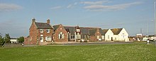
Solway Coast Discovery Center on Wigton Road, formerly the National School of 1857
|
54 ° 52 '18.5 " N , 3 ° 23" 9.1 " W.54.871814 -3.385852
|
| 11A
|
tower
|
The WT has not yet been examined. The tower site is now under Station Road in Silloth; there are no visible remains.
|
|
|
| 11B
|
tower
|
The WT has not yet been examined. The tower site is now on the area of the Bitterlees golf course. The presumed location is in a trough running from north to south, but Roman-era structures have not yet been proven there.
|
|
|
Coast section 12
| ON
|
Name / place
|
Description / condition
|
Illustration
|
location
|
| 12
|
Blitterlees small fort
|
The KK is located near the hamlet of Blitterlees, municipality of Holme Low, southwest of Silloth. Today nothing can be seen above ground. Part of the wood and peat fortification was destroyed over time by erosion and quarrying. The rest of the area is covered by thick vegetation. It was located in January 1963 and examined in 1967. It is estimated that its peat wall was at least 1.8 meters high. A heavily corroded nail recovered there and a pot handle are believed to date from between 270 and 340. 700 meters east of the fort, at the "Greenrow School", a Roman hoard was discovered in 1841 containing 30 coins from the time of Emperor Vespasian.
|
|
54 ° 51 '35 " N , 3 ° 23' 49.1" W.54.859734 -3.396966
|
| 12A
|
tower
|
The WT was located on a hill near the Bitterlees golf course at the beginning of 1963. It was excavated by R. L. Bellhouse in 1966. It was found to be 6 by 6 meters square. The walls were made of sandstone. After later repairs, its size was reduced to 6 × 4.5 meters. The ceramic fragments recovered there date from before 140.
|
|
|
| 12B
|
tower
|
The WT was discovered in 1955 by JA Inglis on the slope of a dune, on the southern edge of the golf course and examined in 1956 by R. L. Bellhouse. Remains are no longer visible. The rather narrow walls of the tower consisted of obviously reused sandstone blocks (internal dimensions 2.4 × 2.4 meters) which probably came from a previous building. During the excavations, traces of five fireplaces and ceramic shards from cooking pots were subsequently found. One of them had been mended with lead rivets.
|
|
|
Coastline 13
| ON
|
Name / place
|
Description / condition
|
Illustration
|
location
|
| 13
|
Small fort
|
The exact location of the KK is unknown and there are no visible remains. It stood on the coast between the districts of Blitterlees and Beckfoot, municipality of Holme Low. Its approximate position could be determined from the distance to the other Roman KKs. During exploratory excavations in 1954 (Bellhouse) no traces of the fortification could be observed there. Surveys in the population about possible observations did not provide any additional information. A geophysical survey carried out in 1994 revealed a presumed weir ditch and three parallel lines in the ground. Possibly the foundation trenches of the coastal palisade.
|

Road between Blitterlees and Beckfoot at Wolsty Farm, near the presumed fort site
|
54 ° 50 '47.9 " N , 3 ° 24' 13.2" W.54.846625 -3.403677
|
| 13A
|
tower
|
The tower was first visible on aerial photographs taken by the RAF in 1948. During excavations in 1954, R. L. Bellhouse was able to locate the WT on a 13 m high ridge with a good view of the coast and the surrounding area in the north and south. The tower's sandstone foundations measured - internally - 3.75 meters square. Chisel traces could still be clearly seen on the sandstone blocks. Pottery shards and a coin from Hadrian came to light as additional finds. The tower was probably built during his reign. Today the tower is overlaid from east to west by an embankment.
|
|
|
| 13B
|
tower
|
The WT was located in a field on a hill and was located and exposed in 1880 on a 13 meter high ridge with excellent all-round visibility. The tower site is 1.6 km northeast of Beckfoot, about 800 m west of Wolsty Castle and was confirmed in 1972 by excavations by R. L. Belhouse. Traces of the excavations can still be seen today. In 2006 aerial photographs of the area were taken. Its foundations were oriented towards the cardinal points and measured 6 meters square outside and 3.75 meters inside. The entrance was probably in the southeast. In addition, some pottery shards were found there. During the excavations in the 19th century, traces of an average 2 × 1 m paved section of the guard path between WT 13A and 13B were also observed at a distance of about 400 m.
|
|
|
Coast section 14
| ON
|
Name / place
|
Description / condition
|
Illustration
|
location
|
| 14th
|
Small fort
|
So far, the KK could not be located exactly. There are no visible remains. It is believed to be under the northern end of Beckfoot, a district of the Holme St. Cuthbert parish. The coastal fort Bibra , which was occupied from the 2nd to the 4th century, stood 500 meters to the southwest . Its presumed position could be determined from measuring points on the neighboring Roman fortifications. Accordingly, it was on a low ridge that runs parallel to the B5300 coastal road, about 40 meters east of it. Today there is a bungalow and a caravan there. Roman pottery was found in the surrounding dunes. Bibra may have replaced the KK.
|

Beach house in Beckfoot near KK 14
|
54 ° 50 '6.9 " N , 3 ° 24' 40.7" W.54.835258 -3.411301
|
| 14A
|
tower
|
Not investigated, exact location is unknown. Its presumed position could only be determined from measuring points on the neighboring Roman fortifications. Presumably he was standing on a small hill right on the coast. H. Duff found some fragments of Roman-British ceramics (so-called Castorware) there.
|
|
|
| 14B
|
tower
|
Not investigated, exact location is unknown. Its presumed position could also only be determined from measuring points on the neighboring Roman fortifications. Either it was destroyed by soil erosion or it was removed during the construction of the Bibra fort .
|
|
|
Coastline 15
| ON
|
Name / place
|
Description / condition
|
Illustration
|
location
|
| 15th
|
Small fort
|
There are no remains to be seen today. It was completely destroyed by centuries of coastal erosion. The KK was located on a dune between the districts of Beckfoot and Mawbray, municipality of Holme-St. Cuthbert, about 350 meters southwest of Bibra Castle . In 1954, R. L. Bellhouse carried out an exploratory excavation in the area of the presumed eastern corner of the wall. A gravel road led to the rear gate. The wood-peat wall was probably multi-phase. During a follow-up examination in 1980, the last remains of the KK had also disappeared.
In the vicinity of the fort site, Roman burials from the 3rd century were found. A cremation grave was located right next to the KK. The dead of the Bibra fort and the surrounding vicus were buried in the cemetery.
|

Looking north to Mawbray Bank near KK 15
|
54 ° 49 '21.1 " N , 3 ° 25' 23.9" W.54.822535 -3.42331
|
| 15A
|
Tower Bank Mill
|
The two-phase WT stood on a high dune about 75 meters from the sea. During the excavations in 1954, R. L. Bellhouse was able to uncover the east wall of the square, 6 × 6 meter building, which was still preserved at a height of two rows of sandstone, 0.9 m wide. On the other sides only the clay and quarry stone foundations remained, each about 1.2 m wide. In a subsequent excavation - in 1957 - the 0.99 meter wide door sill was exposed on the northeast corner of the tower. It should have been renewed once. Inside, two hearths were found on the east and west walls and some ceramic fragments from the Hadrianic period (AD 117-138). Traces of a gravel path were found outside. A layer of rubble over the remains of the tower indicates deliberate destruction in Roman times after only a short period of occupation. There are no visible remains, as the excavation site was later filled in again and greened.
|
|
|
| 15B
|
tower
|
In 1969 an attempt was made to determine the position of the WT from measuring points on the adjacent tower and the KK. However, its remains have not been found to this day, as the area in question is covered by high sand dunes.
|
|
|
Coastline 16
| ON
|
Name / place
|
Description / condition
|
Illustration
|
location
|
| 16
|
Small fort
|
The KK is located on the coast west of Mawbray, municipality of Holme-St. Cuthbert, on an abandoned quarry. The fortification is now partially buried under sand dunes and has been severely damaged over time by wind erosion and stone mining. Only remnants of the rear eastern wall were still visible. An investigation by RL Bellhouse revealed two post pits, 0.6 m in diameter and 2.7 m apart, presumably the pillars of a gate tower and traces of an arched gravel road substructure, 1.8 m wide (presumably it led through the gate on the land side ) to be watched. Today nothing can be seen of the fort above ground.
|
|
54 ° 48 ′ 34.8 " N , 3 ° 25 ′ 41.6" W.54.80967 -3.428225
|
| 16A
|
tower
|
WT 16A was unearthed by F. G. Simpson and I. A. Richmond in 1937; the finds date back to the 2nd and 3rd centuries. Three large machined sandstone blocks that were located near the tower site could have come from the substance of the wall.
|
|
|
| 16B
|
Mawpray Sandpit Tower
|
The tower is located on a sand dune, southeast of a disused gravel pit. From this WT, the foundations of its west and one half of the north wall were excavated in November 1954 by R. L. Bellhouse. The foundations consisted of rolling stones and the walls of sandstone. From the WT, the outer stone facing of the north wall (approx. 3.3 m long and 15 cm high) can still be seen today.
The multi-phase tower I stood on a sand dune. Its north wall was 0.15 m high and 3.3 m long. The inside was examined using probes, the wall thickness was approx. 1.1 meters. During another excavation by Richard Bellhouse in 1954, the west wall of the tower was also located, which was two rows of stones high and about 1.2 meters wide. Only the foundations were left on the other sides. The tower should originally have measured about 3.8 meters × 6.2 meters square. Findings from an excavation in 1970 indicated that the tower had once been completely rebuilt. A 1.5 meter wide wall of tower II made of sandstone and clay was located right next to the foundations of tower I, at its entrance and the gravel access path. A layer of rubble made of clay, sandstone and gravel overlying the remains of the tower indicates that it was destroyed during the Roman occupation.
Several hearths were found inside, along with animal bones and shellfish. Others were found on a stone platform (staircase?) In the southeast corner, three spearheads, nails, metal fragments, bronze wire, the rest of a shield boss, as well as ceramic and glass fragments. Of particular interest were the shards of a larger storage jar with an inscription, which was probably imported from Hispania . Four fragments could be put together. They had the following letters: IIS VRI CIIIKYIIPT INSVLSAI. First line: "I'm hungry". The second line states the filling capacity of the jar (9.94 liters) and the third line declares the original contents as "unsalted". It appears that such vessels were used to ship food from Spain to Britain. The finds date to the 2nd and 3rd centuries. They are now in the collection of the Carlisle Museum.
|
|
|
Coast section 17
| ON
|
Name / place
|
Description / condition
|
Illustration
|
location
|
| 17th
|
Dubmill Point fort
|
The KK is located southwest of Mawbray, municipality of Holme-St.-Cuthbert. It could be located near the beach, on the west side of Dubmill Point hill. Apart from a slight elevation in the ground and traces of a ditch on the east and south sides, nothing can be seen there. The fort area rises slightly on the east side. Most of its building fabric has been lost over the centuries due to soil erosion. Its area was first made on aerial photographs - made by GB Jones in 1977. A first - limited - excavation was carried out in 1983. Only a few badly worn ceramic fragments and nails could be recovered. A geophysical survey was carried out in January 1994. The exact position of the KK and the weir trench could be determined on three sides. The east side with the main entrance and parts of the north and south sides were best preserved. The dimensions of the fortress were 46–48 m square. The berm was unusually wide at 6 m. A paved road ran through the east gate. The excavators found no evidence that it had ever been repaired or that the paving had been renewed. Within 9-10 m north of the east gate, another square structure could be detected, probably a building of unknown function from a later period. In the east of the fort area, the archaeologists interpreted some trenches as the remains of another small fortification or a marshal. The west side is now built over by a street.
|

Beach section at Dubmill Point near KK 17
|
54 ° 47 '50.1 " N , 3 ° 26' 14.2" W.54.797251 -3.437276
|
| 17A
|
tower
|
The position of this WT is unknown. It was probably completely destroyed by the centuries of soil erosion, together with the three neighboring towers (17B, 18A and 18B) and two KK (18 and 19), which were probably very close to the coast. According to R. L. Bellhouse, 17A may have been on a hill on Allonby Bay. However, no traces of Roman wall structures were ever observed there. Nothing of this kind could be discovered in aerial photographs taken in 1948.
|
|
|
| 17B
|
tower
|
The position of the WT is unknown. It was probably also on the tide line of Allonby Bay, near the village of Allonby. (Bellhouse).
|
|
|
Coastline 18
No data.
Coastline 19
No data.
Coast section 20
| ON
|
Name / place
|
Description / condition
|
Illustration
|
location
|
| 20th
|
Small Fort Low Mire (Heather Bank)
|
The KK was located directly on the coast of the municipality of Oughterside and Allerby. It stood on a hill running from SE to NW, on a gently sloping slope to the southeast, north of the Heather Bank Farm. The slope is a little steeper on the lake side. In the NE, the hill is cut off by a dry stream. Its remains can also be seen in aerial photographs.
The fortification was of the long axis type and was uncovered by R. Bellhouse in 1969 and 1980. The exploratory trenches from this period can still be seen today. The small fort probably went through several construction phases in the second century: I (120), II (160) and III (180). In 1969 the earth wall and the east gate were examined. The wall had once been extensively repaired on the west and south sides and enclosed an area of 14 × 18 meters (internal). The earth wall was 6.6 meters wide and measured 32 × 30 meters (external dimensions). The two gates were placed centrally on the west and east sides. Each gate stood on six support posts. The KK was divided into two equally sized halves by a gravel road. There were also traces of wooden floors and a large number of nails suggesting that the internal buildings were made entirely of wood. The excavations carried out by R. L. Bellhouse in 1980 concentrated on the sea-side front of the small fort. The archaeologists found the west gate and a stove in the SE corner and a stove in the NW corner in the remains of a wooden building. Most of the glass and ceramic shards found there date from the period between 117 and 138. In construction period I, both gates were still in use. In construction period II the earth wall was repaired again, the west gate was rebuilt and the east gate was blocked. In construction period III, the KK was reduced in area and the west gate narrowed. At the end of the 2nd century it was abandoned by its occupants. However, there are indications (fireplace, ceramic) that it was used again as a base for coast guards during the fourth century.
|

Findings sketch of the small fort
|
54 ° 45 ′ 23.6 " N , 3 ° 26 ′ 9" W.54.756555 -3.435834
|
| 20A
|
tower
|
Not investigated, the position is unclear. Presumably it was on the same hill as the KK 20. It may be under the buildings of the Blue Dial Farm. Allegedly the landowner found some remains of the WT in the 1960s.
|
|
|
| 20B
|
Swarty Hill North Tower
|
The WT was located and partially excavated in 1962 on the northeast slope of Swarty Hill, about 6 m from the cliff. Its foundations were made of sandstone and measured 6.3 by 6.6 meters square. Only a single shard of a cooking vessel could be recovered from the found items.
|
|
|
Coast section 21
| ON
|
Name / place
|
Description / condition
|
Illustration
|
location
|
| 21st
|
Swarthy Hill small fort
|
The KK was probably built at the same time as Hadrian's Wall. It was located on a coastal cliff, north of the village of Crosscanonby, east of the coastal road and is the only KK in Cumbria that has been completely excavated or explored. The attachment was of the long axis type. Its ramparts were originally 6 m high wood and earth walls, the gates were made entirely of wood. A ramp made of sand and clad with peat bricks served as a battlement. The inner area measured 14.5 m × 18 m. The west gate, 3 m wide and square, on the coast, stood on four posts. Except on the lake side, the fort was surrounded by a moat. In the east it was interrupted by an earth dam (as an access route).
In 1968 the outlines of the moat were first discovered in landscape photographs, approx. 70 m northeast of the previously assumed position of the KK. It was completely exposed between 1990 and 1991. The earth walls were later backfilled up to a height of 1 m and the trenches were re-dug up to their original profile. The remains of a street were also found inside, and traces of it were lost outside of the KK. There were three buildings to the southwest of Lagerstrasse; all were built on stone foundations in different designs. The sea-side barracks were built directly onto the wall, the third was completely free. The lakeside and the centrally located buildings were heated with stoves or simple fireplaces. To the north-east of Lagerstraße was another 18 m × 5 m building. It consisted of four chambers, in which the remains of fireplaces and stoves could also be detected. The most noteworthy finds are black-polished and gray-ware ceramics, a fragment of a pearl, a game board and a knife. A metal object that cannot be precisely identified could have been part of an ax. The pottery comes from the Hadrian era.
|
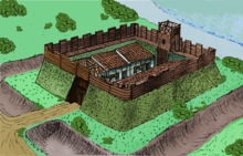
Attempted reconstruction of the wood-earth fort (2nd century)
|
54 ° 44 '47.9 " N , 3 ° 27' 1.4" W.54.746648 -3.450398
|
| 21A
|
Saltpans Tower
|
The WT was located south of the junction of the B5300 and Crosscanonby Road. Its remains were discovered before World War II by a worker who described it as roughly identical to the WT 15A. Today nothing can be seen above ground.
|
|
54 ° 44 '23.7 " N , 3 ° 27' 37.7" W.54.739903 -3.460486
|
| 21B
|
Brownrigg North Tower
|
The WT was on the sea-side slope of Brown Rigg Hill, a total of two layers of fire could be detected. Remains are no longer visible, the outlines of the structure can only be seen in aerial photographs taken in 1946 by pilots of the Royal Air Force. Between 1962 and 1966, RL Bellhouse explored the tower area and determined its structural features.
|
|
54 ° 44 '20.1 " N , 3 ° 27' 36.8" W.54.738918 -3.460218
|
Coast section 22
| ON
|
Name / place
|
Description / condition
|
Illustration
|
location
|
| 22nd
|
Brownrigg fort
|
The KK is located in the parish of Crosscanonby. The fortification, a peat / wood structure (internal dimensions 20 × 17 meters), stood on the edge of a cliff near the Maryport golf course. It was excavated by R. L. Bellhouse between 1962 and 1968. During the excavations in 1962, a horseshoe-shaped trench (about 1.5 meters deep) and the wall were excavated. At the base it was 9 meters wide and 0.7 meters high. The battlement was paved with flat stones. The berm was 2.7 meters wide. Inside, traces of floors and pottery fragments from the Hadrian era have been found. At 140 the KK had apparently been abandoned and the trench filled in again. The coastal gate was exposed during the investigations in 1968. It was six feet wide. From the wall you had a good view of the coast. The gravel access road ran along the cliff.
|
|
54 ° 44 '10.5 " N , 3 ° 27' 57.7" W.54.736241 -3.466024
|
| 22A
|
Tower Maryport Golf Course
|
The WT was located and probed in 1962 by R. L. Bellhouse. He was standing on a small hill that runs parallel to the coast, next to the access road to the Maryport golf course. The tower is 485 m away from KK 22 and is now covered with lawn and sandstones.
|
|
|
| 22B
|
tower
|
The WT has not yet been found. Presumably he was standing in a pasture 1.5 km away from KK 22 at the foot of an east-facing slope (not visible from KK 23). There are no visible remains.
|
|
|
Coastline 23
| ON
|
Name / place
|
Description / condition
|
Illustration
|
location
|
| 23
|
Sea Brows small fort
|
The KK stood north of Maryport, on the edge of the southeast slope of a steep cliff about 1 km northeast of the coastal fort Alauna . Today nothing can be seen of the fortification. The remains of the KK can only be seen in aerial photographs as weak soil discolouration. During a geophysical survey in 1994, traces of a 4 m wide weir ditch were discovered on three sides. The fort gate was in the southeast. The west side of the KK had already completely disappeared due to quarrying work. Further structural features within the fortress were identified during a further geophysical investigation of the Alauna fort and its vicus between 2000 and 2004.
|

Coastal section near the KK 23
|
54 ° 43 '40.5 " N , 3 ° 29" 6.5 " W.54.72792 -3.485135
|
| 23A
|
tower
|
Not investigated, the location of the tower is uncertain, its position could only be estimated by measurements from adjacent fortifications.
|
|
|
| 23B
|
tower
|
Not investigated, position unclear. It was probably overbuilt by buildings from the Alauna Castle .
|
|
|
Coast section 24
No data.
Coastline 25
| ON
|
Name / place
|
Description / condition
|
Illustration
|
location
|
| 25th
|
Small fort Risehow Bank
|
The KK is the southernmost on the Cumbrian coast. His area is now in an industrial area in the south of Maryport. There are no visible remains, as the area has been continuously expanded in recent years. According to measurements, the KK must have been about 2 km southwest of the Alauna Fort . During an exploratory excavation in 1969, near the Risehow Bank cliff, a gravel path, Roman pottery and, in two places, traces of a ditch were found. However, further excavations between 1981 and 1982 led to the conclusion that there was probably a WT there. The KK must therefore have been a little further north.
|

View of the industrial area of Maryport
|
54 ° 42 '16.7 " N , 3 ° 30' 28.9" W.54.704629 -3.508029
|
| 25A
|
Risehow I tower (Fothergill)
|
The WT stood near the ridge of the Risehow Cliff, about 150 m south of its highest point. It was first excavated and examined by Richard Bellhouse in 1969 and again between 1981/1982. At first it was assumed that KK 26 was at this position, but the excavations showed that the wall structures discovered there were in fact only a tower. It measured 6 m square, presumably externally, since the measurement results from Bellhouse were not specified exactly. The foundations were 1.40 m wide and 0.38 m deep. Its sandstone walls were almost 1 m wide. The WT was built on a pre-Roman burial mound. The ceramic finds date from around 120. In the early Middle Ages, the tower ruins were used as a kiln .
|
|
|
| 25B
|
Risehow II tower
|
The foundations of this WT were discovered in 1880 when a coke oven was being built. The tower site is now under a re-greened overburden dump from a former coal mine. This tower is the last known of the Roman coastal defense system in Cumbria. The building was 4 meters square (inside), its walls were 1 meter wide. The floor consisted of a layer of rammed earth on which Roman ceramic shards were also found.
|
|
|
Coastline 26
No data.
Remarks
- RIB Roman Inscriptions in Britain
-
^ Eric Birley: Research on Hadrian's Wall. Titus Wilson & Son, Kendal 1961.
-
↑ Margot Klee: 2006, pp. 15-16 and 31, Peter Hill 2004, pp. 23-25.
-
^ A b c Tony Wilmot: Hadrian's Wall: Archaeological Research by English Heritage 1976-2000, Frank Graham, pp. 137-138, ISBN 978-1-905624-71-3
-
↑ MAIS (Bowness-on-Solway), ABALLAVA (Burgh-by-Sands), VXELODUM (Stanwix), CAMBOGLANS (Castlesteads), BANNA (Birdoswald)
-
^ Margot Klee: 2006, p. 16, David Breeze: (1934), Handbook to the Roman Wall. (14th revised edition - November 2006), Society of Antiquaries of Newcastle upon Tyne, pp. 68–73, Peter Hill 2004, p. 27.
-
↑ Peter Hill: Archaeologia Aeliana: or miscellaneous tracts relating to antiquity (5th Series - Vol. 29-2001) Society of Antiquaries of Newcastle upon Tyne 2001.
-
↑ Frank Graham: 1974.
-
↑ RIB 1314
-
^ William Stukeley: Iter Boreale , 1776, p. 66, John Horsley: Britannia Romana, 1732, p. 136, John Brand: History of Newcastle, Vol. 1, 1789S. 138, Henry MacLauchlan: Survey of the Roman Wall. Memoir, 1858, John Collingwood Bruce: Proceedings of the Society of Antiquaries of Newcastle upon Tyne, No. 1, 1884, pp. 357-359, p. 8; Eric Birley: Archaeologia Aeliana or miscellaneous tracts relating to antiquity. No. 38, 1960, pp. 42-44
-
↑ Madeleine Hope Dodds: 1930 A history of Northumberland. Vol. 13: the parishes of Heddon-on-the-Wall, Newburn, Long Benton and Wallsend […] the townships of Benwell, Elswick, Heaton, Byker, Fenham and Jesmond, A history of Northumberland, No. 15 (1893– 1940), p. 498, Eric Birley: Research on Hadrian's Wall. 1961, p. 162, Barbara Harbottle, R. Fraser, Burton FC: The Westgate Road milecastle, Newcastle upon Tyne. Britannia: a journal of Romano-British and kindred studies, No. 19, 1988, pp. 153-162.
-
↑ Madeleine Hope Dodds: 1930, A history of Northumberland, Vol. 13: the parishes of Heddon-on-the-Wall, Newburn, Long Benton and Wallsend […] the townships of Benwell, Elswick, Heaton, Byker, Fenham and Jesmond . A history of Northumberland, No. 15 (1893-1940), p. 516, Eric Birley: Research on Hadrian's Wall. 1961, p. 100
-
^ David Breeze: 2006, p. 158.
-
^ David Breeze: 2006, p. 162.
-
↑ a b c d e f g h Brian Dobson, David J. Breeze: The building of Hadrian's Wall . 4th edition. Graham, Newcastle upon Tyne 1970, pp. 14-15 .
-
↑ David Breeze: 2006, pp. 162-164.
-
^ Henry MacLauchlan: p. 14.
-
↑ Eric Birley: 1930, pp. 152-174.
-
↑ Tony Willmott: Hadrian's Wall Milecastle 9 (Chapel House), Tyne and Wear: Interim Report on Archaeological Evaluation, September 2000. Center for Archeology Report 100, 2001, pp. 1-10.
-
^ Charles Daniels: 1979, p. 362.
-
^ David J. Breeze, Brian Dobson: 1976, p. 164.
-
↑ RIB 1380 (C [ENTVRIA] CAR [...] = ... the Century of the Car ...)
-
^ Britannia 2000, p. 389.
-
↑ David J. Breeze: 2006, p. 165.
-
↑ RIB 1389 :, LEG VI VPF REF TER ET SAC COS (... the 6th Legion Victrix Pia Fidelis built this under the consulate of Tertullus and Sacerdos), note: Tertullus and Sacerdos were the consuls of the year 158 AD.
-
↑ Madeleine Hope-Dodds: 1930, p. 537, David J. Breeze: 2006, pp. 166-167, Guy de la Bedoyere 1998, p. 48.
-
↑ David J. Breeze: 2006, pp. 167-172.
-
↑ Frank Gerald Simpson: 1931, pp. 305-327.
-
↑ David J. Breeze: 2006, pp. 172-173.
-
↑ David J. Breeze: 2006, p. 173.
-
^ David J. Breeze, Brian Dobson: 1976, p. 173.
-
↑ Guy de la Bédoyère: People of Roman Britain, 2010.
-
^ CfA Reports from 1999, Center for Archeology, 2010 and Tony Wilmott: 2009.
-
^ WP Hedley: 1947, pp. 50-63.
-
↑ RIB 1421: "MATRIB TEMPL CVM ARA VEX COH I VARD INSTANTE PDV VSLM" Translation: "For the mother goddesses, this temple and its altar [was built] by the first cohort of Varduli, under the command of P [ublius] D [ omitius?] V [?], who fulfilled their vows with joy and humility. "
-
↑ John Collingwood Bruce: Handbook to the Roman Wall (14th edition).
-
^ Archaeologia Aeliana: or miscellaneous tracts relating to antiquity, No. 13, 1936, p. 259; John C. Bruce: Handbook to the Roman Wall, 11th Edition, 1957, p. 71.
-
↑ David J. Breeze: 2006, pp. 184-185.
-
^ David J. Breeze: Handbook to the Roman Wall. 14th Revised Edition, November 2006, Society of Antiquaries of Newcastle upon Tyne, 1934, ISBN 0-901082-65-1 , The Journal of Roman Studies (London: Society for Promotion of Roman Studies) 57: 177. 1967, Charles Daniels : Review: Fact and Theory on Hadrian's Wall , Britannia 10, 1979, pp. 357-364, JSTOR 526069.
-
↑ David J. Breeze: 2006, pp. 185-186.
-
^ Alan Whitworth: A 19th-century condition survey of Hadrian's Wall: the James Irwin Coates archive, 1877-1896. In: Tony Wilmott (Ed.): Hadrian's Wall. Archaeological research by English Heritage 1976-2000. English Heritage, Swindon 2009, ISBN 978-1-84802-158-7 , pp. 8–49, here p. 16 ( digitized version of the entire volume ).
-
^ David J. Breeze, Brian Dobson: 1976, p. 15.
-
^ Frank Gerald Simpson: 1931, pp. 317-319.
-
^ A b Charmian Woodfield: Six Turrets on Hadrian's Wall. Archaeologia Aeliana or miscellaneous tracts relating to antiquity . The Society of Antiquaries of Newcastle upon Tyne, 1965, No. 43, pp. 120-121.
-
↑ David J. Breeze: Handbook to the Roman Wall , 14th revised edition, November 2006, Society of Antiquaries of Newcastle upon Tyne, 1934, pp. 186-187
-
↑ RIB 1444. Centurial stone of Paulius Aper RIB 1444: COH IX PAV.APRI = The ninth cohort of Paulius Aper
-
^ David J. Breeze, Handbook to the Roman Wall (14th revised edition - Nov 2006), Society of Antiquaries of Newcastle upon Tyne, p. 189.
-
↑ J. Collingwood Bruce: Handbook to Roman Wall, 1957, p. 101, Eric Birley: Research on Hadrian's Wall. 1961, p. 73.
-
↑ RIB 1498
-
^ Nic Fields: Hadrian's Wall AD 122-410, Fortress 2, Osprey Publishing 2003, ISBN 978-1-84176-430-6 .
-
↑ David E. Johnston: Discovering Roman Britain (272 of Shire Discovering) (3rd edition), Osprey Publishing 2002, ISBN 978-0-7478-0452-9 and Martin Marix Evans: The military heritage of Britain & Ireland, André Deutsch 1998, ISBN 978-0-233-99150-4
-
↑ Turret 29B. Pastscape website, English Heritage. Retrieved July 29, 2015.
-
↑ David J. Breeze: (1934), Handbook to the Roman Wall (14th revised edition - Nov. 2006), Society of Antiquaries of Newcastle upon Tyne, pp. 211-212, ISBN 0-901082-65-1
-
^ A b c David J. Breeze, Brian Dobson: Hadrian's Wall, Allen Lane 1976, pp. 14-15, ISBN 0-14-027182-1 , David J. Breeze: Handbook to the Roman Wall (14th revised edition - Nov. 2006), Society of Antiquaries of Newcastle upon Tyne, pp. 214-215, ISBN 0-901082-65-1
-
↑ David J. Breeze: Handbook to the Roman Wall (14th Revised edition - Nov 2006), Society of Antiquaries of Newcastle upon Tyne 1934, pp. 214-215, ISBN 0-901082-65-1
-
^ David J. Breeze: Handbook to the Roman Wall (14th Revised edition - Nov 2006), Society of Antiquaries of Newcastle upon Tyne, 1934, pp. 213-214, ISBN 0-901082-65-1
-
^ David J. Breeze: Handbook to the Roman Wall. (14th revised edition - Nov. 2006), Society of Antiquaries of Newcastle upon Tyne, p. 215, ISBN 0-901082-65-1
-
↑ Eric B. Birley: Research on Hadrian's Wall. Titus Wilson & Son, 1961, p. 100.
-
↑ David J. Breeze, Handbook to the Roman Wall (14th Revised edition - Nov 2006), Society of Antiquaries of Newcastle upon Tyne, pp. 224 and 225, ISBN 0-901082-65-1
-
^ IA Richmond: Handbook to the Roman Wall. 11th Edition, 1957, p. 116, Eric Birley: Research on Hadrian's Wall. 1961, p. 100, Mark Savage: Sewingshields - a new look at the milecastles of Hadrian's Wall. Northern archeology, Vol. 1, 1980-1 (2), pp. 24-29, Stephen Johnson, 2004, pp. 105-107
-
^ IA Richmond: Handbook to the Roman Wall. 11th Edition, 1957, p. 116, C. Woodfield: Archaeologia Aeliana: or miscellaneous tracts relating to antiquity. No. 43, 1965, pp. 151-161.
-
^ RIB 1574
-
^ David J. Breeze: Handbook to the Roman Wall. (14th revised edition - Nov. 2006), Society of Antiquaries of Newcastle upon Tyne
-
^ David J. Breeze, Brian Dobson: Hadrian's Wall, Allen Lane 1976, ISBN 0-14-027182-1 .
-
↑ JMC Toynbee: Review: The Impact of Roman on Native in North Britain. (June 1960). The Classical Review (Cambridge University Press) 10 (2): pp. 164-166; Guy de la Bedoyere, 1998, pp. 77-78.
-
↑ Guy de la Bedoyere, 1998, p. 78.
-
↑ RIB 1582 , RIB 1633 , Guy de la Bedoyere 1997, pp. 81-82.
-
↑ Nikolaus Pevsner, John Grundy, Grace McCombie, Peter Ryder, Humphrey Welfare: Northumberland, Yale University Press 1992, ISBN 978-0-300-09638-5 .
-
↑ RIB 1639 : “… us… xit Annis… mensibus du… ebus quinque” ([…] lived… years, two months, five days).
-
↑ Roger JAWilson: A Guide to the Roman remains in Britain , Constable, London, 2002, p 467, ISBN 1-84119-318-6 , RIB 1638. Dedication to Emperor Hadrian RIB 1638: IMP CAES TRAIAN AVG Hadriani LEG II AVG APLATORIONEPOTELEGPRPR (This building for the Emperor Caesar Trajan Hadrian Augustus (was built by) the Legio II Augusta under Aulus Platorius Nepos, propreetorical legate)
-
↑ Lodhams Slack at 54 ° 59 ′ 57.55 " N , 2 ° 24 ′ 38.59" W.54.999319444444 -2.4107194444444
-
^ Frank Gerald Simpson; edited by Grace Simpson: Watermills and military works on Hadrian's Wall: excavations in Northumberland, 1907-13, 1976, p. 108
-
^ Society for Promotion of Roman Studies. The journal of Roman studies No. 58, 1968, p. 179
-
↑ RIB 1645
-
↑ RIB 2307. Milestone of Numerian RIB 2307: Milestone of Numerianus (282/283 AD) IMP CAES NVBERIANO NC "Our Emperor Caesar [Marcus Aurelius] Numerianus, the pious and happy Augustus".
-
↑ RIB 2306. Milestone of Severus Alexander RIB 2306: Milestone of Severus Alexander (222/223 AD) IMP CAES M AVREL SEVERO ALEXANDRO PI FEL AVG PM TR P II COS PP CVR CL XENEPHON TE LEG AVG PR PRAET MP XVIII " To the emperor Caesar Marcus Aurelius Severus Alexander, the happy and pious Augustus, supreme priest, holder of the tribunician power for the second time, consul, father of the fatherland; during the reign of Claudius Xenephon, Legatus Augustae Pro-Praetore, 18 miles from […]. ”, Claudius Xenephon was governor in Britain from 222 to 223.
-
↑ 18 miles east of MK 42 is the Portgate crossing, but no road station could be made out to the west.
-
^ Alan Whitworth: A 19th-century condition survey of Hadrian's Wall: the James Irwin Coates archive, 1877-1896. In: Tony Wilmott (Ed.): Hadrian's Wall. Archaeological research by English Heritage 1976-2000. English Heritage, Swindon 2009, ISBN 978-1-84802-158-7 , pp. 8–49, here p. 36 ( digitized version of the entire volume ).
-
^ Eric Birley: Research on Hadrian's Wall. 1961, pp. 71, 75
-
↑ RIB 1762. Centurial stone of Julius Florentinus RIB 1762: leg XX VV o XI Flo ini, from the XX. Legion Valeria Victrix, X. Cohort, the Century of Julius Florentinus (who built this), now in the Great North Museum: Hancock and RIB 1763. Centurial stone of Flavius Crescens RIB 1763: Coh Ic Flau Cve, from the first cohort, the Centurion des Flavius Crescens (who built this), now in the Museum of Antiquities, Newcastle
-
^ R. G. Collingwood, RP Wright: The Roman inscriptions of Britain. Volume 1. Inscriptions on stone, 1965, p. 551.
-
↑ a b c Bruce, Richmond: Handbook to Roman Wall. Issue 11, 1957, p. 161.
-
^ A b c d e Eric Birley: Research on Hadrian's Wall. 1961, p. 75.
-
↑ JC Bruce, IA Richmond: Handbook to Roman Wall. 11th edition, 1957, p. 164
-
^ Eric Birley: Research on Hadrian's Wall. 1961, pp. 71 and 75.
-
↑ a b c J. C. Bruce, IA Richmond: Handbook of Roman Wall. Issue 11, 1957, p. 166.
-
^ J. P. Gibson, F. G. Simpson: The Milecastle on the Wall of Hadrian at the Poltross Burn. Trans. CWAAS XI (New Series) Art XXIII, 1911, pp. 390-461, W. G. Bird: Gilsland and Neighborhood. Gregg, Gilsland 1913.
-
↑ Bruce / Richmond: Handbook to the Roman Wall, 12th Edition, 1966, p. 160; R. C. Shaw: Transactions of the Cumberland and Westmorland Antiquarian & Archaeological Society, No. 26, 1926, pp. 437-450.
-
↑ Bruce / Richmond: Handbook to the Roman Wall, 12th Edition, 1966, p. 160, R. C. Shaw: Transactions of the Cumberland and Westmorland Antiquarian & Archaeological Society, No. 26, 1926, pp. 426-437.
-
↑ centurial stone RIB 1868
-
^ RIB 1870 Silvanus Altar
-
↑ Bruce, Richmond: Handbook to the Roman Wall. 12th Edition, 1966, pp. 160-162, Shepard Frere: Society for the Promotion of Roman Studies Britannia: a journal of Romano-British and kindred studies. No. 16, 1985 p. 271 and No. 17, 1986 p. 381-382
-
↑ JC Bruce, IA Richmond: Handbook to the Roman Wall. 12th edition, 1966, pp. 164 and 168.
-
↑ JC Bruce, IA Richmond: Handbook to the Roman Wall. 12th edition, 1966, p. 187.
-
↑ RIB 1935 [Imp (eratoris) Caes (aris) Traiani] [Had] ria [ni Augusti] [leg (io)…] [A (ulo)] Pl [atorio Nepote] [leg (ato) pr (o) pr (aetore)] (= (on behalf of) the Emperor Caesar Trajan Hadrian Augustus: the ... Legion ... (established this) under Aulus Platorius Nepos as propraetorian governor)
-
^ David J. Breeze: Handbook to the Roman Wall (14th Edition - November 2006), Society of Antiquaries of Newcastle upon Tyne, pp. 309-310, ISBN 0-901082-65-1 , Frank Simpson, Ian Richmond, John Collingwood Bruc, K. St Joseph: Report of the Cumberland Excavation Committee for 1934 , Transactions of the Cumberland & Westmorland Antiquarian & Archaeological Society, new series (Titus Wilson & Son 1935) No. 35: pp. 220-236.
-
↑ RIB 1932: [ LEG ] IONIS [ II AUG ] USTAE [ COH ] HORS [ VII SU ] B [ CU ] RA…, "[built] by the second Augusta Legion, the seventh cohort under the command of…" This inscription is incomplete.
-
^ Frank Gerald Simpson: Transactions of the Cumberland and Westmorland Antiquarian & Archaeological Society, No. 13, 1913, pp. 312-332
-
↑ David J. Breeze: Handbook to the Roman Wall (14th revised edition - November 2006), Society of Antiquaries of Newcastle upon Tyne, pp. 309-310, ISBN 0-901082-65-1
-
^ F. G. Simpson: Transactions of the Cumberland and Westmorland. Antiquarian & Archaeological Society, No. 13, 1913, pp. 312-332, RG Collingwood, RP Wright: The Roman inscriptions of Britain, 1. Inscriptions on stone, 1965, p. 596
-
↑ David J. Breeze: Handbook to the Roman Wall (14th revised edition - November 2006), Society of Antiquaries of Newcastle upon Tyne, pp. 309-310, ISBN 0-901082-65-1
-
^ FG Simpson, F. Haverfield, P. Newbold: Transactions of the Cumberland and Westmorland Antiquarian & Archaeological Society, No. 13, 1913, p. 309, JC Bruce, IA Richmond: Handbook to Roman Wall. Issue 12, 1966, p. 172
-
^ Frank Gerald Simpson and IA Richmond: The Turf Wall of Hadrian, 1895-1935. In: The Journal of Roman Studies , Volume 25, pp. 1-18, Society for the Promotion of Roman Studies, 1935.
-
^ Frank G. Simpson: Transactions of the Cumberland and Westmorland Antiquarian & Archaeological Society, 'Excavations on Hadrian's Wall' 28, 1928, pp. 382-383, Bruce / Richmond: Handbook to Roman Wall, Issue 12, 1966, p. 177 , Dorothy Charlesworth: Transactions of the Cumberland and Westmorland Antiquarian & Archaeological Society, Hadrian's Wall, Turret 51A (Piper Sike) '73, 1973, p. 67.
-
^ FG Simpson: Transactions of the Cumberland and Westmorland Antiquarian & Archaeological Society, `` Excavations on Hadrian's Wall ', 28, 1928, Charmian Woodfield: Archaeologia Aeliana, or miscellaneous tracts relating to antiquity, 43, 1965, pp. 170-200 and' Six Turrets on Hadrian's Wall '43, 1965, pp. 170-200, Bruce / Richmond: Handbook to the Roman Wall, 12th Edition, 1966, pp. 181-182.
-
↑ Bruce / Richmond: Handbook to the Roman Wall 12th Edition, 1966, p. 177, RG Collingwood / RP Wright: The Roman inscriptions of Britain, 1. 1965, Inscriptions on stone, pp. 600-601.
-
↑ Bruce / Richmond: Handbook to the Roman Wall, 12th Edition, 1966, p. 178, Eric Birley: Research on Hadrian's Wall. 1961, p. 75, Simpson / Richmond: Transactions of the Cumberland and Westmorland Antiquarian & Archaeological Society, No. 34, 1934, pp. 148–152, Margot Klee, 2006, p. 17.
-
^ Mark Richards: The Spirit of Hadrian's Wall. Cicerone Press, 2008, p. 161, ISBN 1-85284-558-9 .
-
^ J. C. Bruce: Handbook to the Roman Wall. 14th edition, Newcastle-upon-Tyne: Society of Antiquaries of Newcastle upon Tyne, ISBN 0-901082-65-1
-
^ "Transactions of the Cumberland and Westmorland Antiquarian & Archaeological Society", No. 33, 1933, pp. 271-272.
-
^ David J. Breeze: Handbook to the Roman Wall (14th revised edition - Nov 2006), Society of Antiquaries of Newcastle upon Tyne, p. 65, ISBN 0-901082-65-1
-
^ Henry MacLauchlan: Memoir written during a survey of the Roman Wall. 1858, p. 58, FG Simpson, J. McIntyre: Transactions of the Cumberland and Westmorland. Antiquarian & Archaeological Society, No. 33, 1933, pp. 263-265.
-
^ F. G. Simpson, J. McIntyre: Transactions of the Cumberland and Westmorland. Antiquarian & Archaeological Society, No. 33, 1933, p. 270.
-
^ JC Bruce. IA Richmond: Handbook to the Roman Wall. 12th Edition, 1966, pp. 180-182, F. G. Simpson, I. A. Richmond: Transactions of the Cumberland and Westmorland. Antiquarian & Archaeological Society, No. 35, 1935, pp. 236-237, RG Collingwood, RP Wright: The Roman inscriptions of Britain, 1. Inscriptions on Stone. 1965, p. 602, L. Allason-Jones, J. Bennett, D. Welsby: Archaeologia Aeliana, or miscellaneous tracts relating to antiquity. No. 7, 1984, pp. 228-235
-
↑ F. G. Simpson, I. A. Richmond, J. McIntyre: Transactions of the Cumberland and Westmorland. Antiquarian & Archaeological Society, No. 34, 1934, pp. 138-144, D. A. Welsby: The pottery from the two turrets at Garthside on Hadrian's Wall. 1985, Transactions of the Cumberland and Westmorland Antiquarian & Archaeological Society, New series, Vol. 1 (1901) - Vol. 100 (2000), No. 85, pp. 71-76, N. Hodgson: Hadrian's Wall 1999-2009, 2009, pp. 136-137, Margot Klee, 2006, p. 16, J. C. Bruce 1966, p. 183.
-
^ A b c F. G. Simpson, I. A. Richmond, J. McIntyre: Transactions of the Cumberland and Westmorland. Antiquarian & Archaeological Society, No. 34, 1934, p. 131.
-
^ D. A. Welsby: The pottery from the two turrets at Garthside on Hadrian's Wall. 1985, Transactions of the Cumberland and Westmorland Antiquarian & Archaeological Society, New series, Vol. 1 (1901) - Vol. 100 (2000), No. 85, pp. 71-76.
-
↑ Bruce / Richmond: Handbook to Roman Wall, 12th Edition, pp. 183-184.
-
^ A b c Eric Birley: Research on Hadrian's Wall. 1961, p. 76.
-
^ H. MacLauchlan: Memoir written during a Survey of the Roman Wall, 1858, p. 60, Bruce / Richmond: Handbook to Roman Wall, 12th Edition, 1966, p. 184, F. Haverfield: Transactions of the Cumberland and Westmorland Antiquarian & Archaeological Society, 1902, p. 391.
-
^ Frank Gerald Simpson: Transactions of the Cumberland and Westmorland. Antiquarian & Archaeological Society, No. 34, 1934, p. 331
-
^ F. G. Simpson, KS Hodgson, IA Richmond: Transactions of the Cumberland and Westmorland. Antiquarian & Archaeological Society, No. 34, 1934, p. 132
-
^ Henry MacLauchlan; Memoir written during a survey of the Roman Wall, 1858, p. 61, Bruce / Richmond: Handbook to Roman Wall, 12th Edition, 1966, p. 189, Dorothy Charlesworth: Transactions of the Cumberland and Westmorland Antiquarian & Archaeological Society, No. . 69, 1969, p. 346.
-
↑ F. G. Simpson, K. S. Hodgson, I. A. Richmond: Transactions of the Cumberland and Westmorland. Antiquarian & Archaeological Society, No. 34, 1934, p. 132, Bruce, Richmond: Handbook to Roman Wall. 12th edition, 1966, p. 189
-
↑ RIB 2012 "LEG (io) II AUG (usta) FECIT" (= the second legion of Augustus established this)
-
↑ J. C. Bruce: Handbook to Roman Wall. 12th edition, 1966, p. 189.
-
^ Proceedings of the Society of Antiquaries of Newcastle upon Tyne, The 3rd pilgrimage of the Roman Wall 7, 1894, p. 221.
-
↑ RIB 2014 : C (ohors) IIII LIN (gonum) F (ecit) (= the fourth cohort of the Lingons established this)
-
^ RIB 2015 , RIB 2311 (milestone), F. Haverfield: Transactions of the Cumberland and Westmorland Antiquarian & Archaeological Society, 1895, p. 465, J. C. Bruce: Handbook to Roman Wall. 12th edition, 1966, p. 189.
-
↑ Eric Birley: Research on Hadrian's Wall , 1961, pp. 76-77.
-
↑ RIB 2020 , Henry MacLauchlan: Memoir written during a Survey of the Roman Wall, 1858, Bruce / Richmond: Handbook to Roman Wall 12th edition, 1966, p. 191, Collingwood / Wright: The Roman inscriptions of Britain, volume 1 , Inscriptions on stone, 1965, p. 618.
-
↑ Bruce / Richmond: Handbook to Roman Wall, 12th edition, 1966, p. 192, J. Gater: Ancient Monuments Laboratory report 3508, Geophysics 24/1981 (not published).
-
↑ Bruce / Richmond: Handbook of Roman Wall, 12th Edition, 1966, p. 192
-
^ Henry MacLauchlan: Memoir on Roman Wall 1858, p. 73, JC Bruce: Handbook to the Roman Wall, 1957, p. 205, Tony Wilmott (Ed.): Hadrian's Wall: archaeological research by English Heritage 1976-2000, 'Milecastle 63 (Walby West): 2000 ', 2009, pp. 174-177, N. Hodgson Hadrian's Wall 1999-2009, 2009, pp. 139-140.
-
^ Society for Promotion of Roman Studies, The journal of Roman studies, No. 53, 1963, pp. 161-162, No. 58, 1968, pp. 209-210, No. 1, 1970, p. 31, Transactions of the Cumberland and Westmorland Antiquarian & Archaeological Society: I. Caruna / PF Fane Gladwin, 'Unpublished excavations on the line of the Roman Wall in Hadrian's Camp, Carlisle' No. 80, 1980, pp. 17-22.
-
↑ Bruce / Richmond: Handbook to the Roman Wall, 12th Edition, 1965, p. 193, GH Smith: Excavations near Hadrian's Wall at Tarraby Lane 1976, Britannia: a journal of Romano-British and kindred studies, No. 9, 1978 , Pp. 35-36.
-
^ Eric Birley: Research on Hadrian's Wall. 1961, p. 208
-
^ Thomas Pennant: A Tour in Scotland 1772. P. 72, Eric Birley: Hadrian's Wall. 1961, p. 208, Mark Richards: Hadrian's Wall Path. Two-way national trail description, Cicerone Press 2011, p. 187, ISBN 1-84965-426-3 , Frank Graham, The Roman Wall: comprehensive history and guide, 1979, p. 178, ISBN 0-85983-140-X .
-
^ J. C. Bruce: Handbook to the Roman Wall. 1957, p. 210
-
^ Charles Daniels: Review: Fact and Theory on Hadrian's Wall ", Britannia 10, 1979, pp. 357-364, J. C. Bruce: Handbook to the Roman Wall. 1957, p. 210.
-
↑ Plan in The Gentleman's Magazine, May 16, 1746, Henry MacLauchlan: Memoir to the Survey of the Roman Wall , 1858, p. 79, Eric Birley: Research on Hadrian's Wall , 1961, p. 77.
-
^ Mark Bowden: Field Investigators Comments, Hadrian's Wall Project, July 3, 1990
-
↑ RIB 2035
-
^ N. Hodgson: Hadrian's Wall 1999-2009, p. 151, Tony Wilmott: Hadrian's Wall: archaeological research by English Heritage 1976-2000, 2009, p. 182
-
↑ SH Bartle: Transactions of the Cumberland and Westmorland Antiquarian & Archaeological Society No. 61, 1961, pp. 39-40, Nick Hodgson: Hadrian's Wall 1999-2009, 2009, p. 151, Tony Wilmott: Hadrian's Wall: archaeological research by English Heritage 1976-2000, 2009, pp. 182-186
-
^ S. H. Bartle: Transactions of the Cumberland and Westmorland Antiquarian & Archaeological Society, No. 61, 1961, p. 39
-
↑ John Collingwood-Bruce: Handbook to the Roman Wall. 12th edition. Newcastle-upon-Tyne 1966, p. 201
-
^ Britannia Romana, 1732, p. 156, SH Bartle: Transactions of the Cumberland and Westmorland Antiquarian & Archaeological Society, No. 61, 1961, pp. 34-38, Hassall / Tomlin: Society for the Promotion of Roman Studies Britannia: a journal of Romano-British and kindred studies, No. 21, 1990, p. 319.
-
^ S. H. Bartle: Transactions of the Cumberland and Westmorland Antiquarian & Archaeological Society, No. 61, 1961, p. 34.
-
^ FG Simpson, KS Hodgson, IA Richmond: Transactions of the Cumberland and Westmorland Antiquarian & Archaeological Society, No. 52, 1953, pp. 14-15, N. Hodgson: Hadrian's Wall 1999-2009, 2009, pp. 154-156 .
-
^ Britannia Romana, 1732, p. 156, FG Simpson: Transactions of the Cumberland and Westmorland Antiquarian & Archaeological Society, No. 52, 1953, pp. 151-156.
-
^ Eric Birley: Research on Hadrian's Wall. 1961, pp. 77 and 211, FG Simpson, IA Richmond: Transactions of the Cumberland and Westmorland. Antiquarian & Archaeological Society, No. 52, 1953, p. 149.
-
^ FG Simpson / IA Richmond: Transactions of the Cumberland and Westmorland Antiquarian & Archaeological Society, No. 52, 1953, p. 14.
-
↑ JC Bruce, IA Richmond: Handbook to the Roman Wall. 12th edition, 1966, p. 206, Society for the Promotion of Roman Studies Britannia: a journal of Romano-British and kindred studies, No. 1974, p. 412.
-
↑ Frank Simpson / Ian Richmond / J.McIntyre: Transactions of the Cumberland and Westmorland Antiquarian & Archaeological Society, No. 35, 1935, p. 217, N. Hodgson: Hadrian's Wall 1999-2009, 2009, pp. 156–157, Tony Wilmott: 2009 Hadrian's Wall: archaeological research by English Heritage 1976–2000, TW Eigenverlag 2009, pp. 186–193.
-
↑ Transactions of the Cumberland and Westmorland Antiquarian & Archaeological Society, No. 52, 1953, p. 14.
-
^ A. Gordon: Itinerarium Septentrionale, 1726, p. 82, Henry MacLauchlan: Memoir of the Roman Wall, 1858, p. 86, J. C. Bruce: Handbook to the Roman Wall, 1867, p. 303.
-
^ IA Richmond, JP Gillam: Transactions of the Cumberland and Westmorland Antiquarian & Archaeological Society, No. 52, 1953, pp. 17-40, JC Bruce: Handbook to the Roman Wall. 1957, p. 221, Tony Wilmott (Ed.): Hadrian's Wall: archaeological research by English Heritage 1976-2000 , 'Milecastle 79 (Solway House): 1999', 2009, pp. 193-197, Nick Hodgson: Hadrian's Wall 1999 -2009 , 2009, p. 156.
-
↑ Simpson / Richmond / MacIntyre: Transactions of the Cumberland and Westmorland Antiquarian & Archaeological Society, Turf Wall and Vallum West of Burgh By Sands, No. 35, 1935, pp. 217-218
-
^ Eric Birley: Research on Hadrian's Wall. 1961, p. 214, report in Transactions of the Cumberland and Westmorland Antiquarian & Archaeological Society, No. 4, 1904.
-
↑ Transactions of the Cumberland and Westmorland Antiquarian & Archaeological Society (Bellhouse RL) No. 54, 1955, pp. 35-36 and No. 62, 1962, p. 67, Timothy Potter: The Biglands milefortlet and the Cumberland coast defenses, Britannia : a journal of Romano-British and kindred studies, No. 8, 1977, pp. 149-183, SS Frere / J. K. S. St. Joseph: Roman Britain from the air, Cambridge air surveys, 1983, pp. 70-71, G.D. B Jones / D. J. Woolliscroft: Hadrian's Wall from the air, 2001, p. 123, Timothy Potter, DCA Shotter 1977, pp. 149-183.
-
^ RL Bellhouse: Roman sites on the Cumberland coast: a new schedule of coastal sites, Cumberland and Westmorland. Antiquarian and Archaeological Society research series (1979) No. 3, p. 31
-
↑ Eric Birley: Research on Hadrian's Wall, 1961, p. 29, RL Bellhouse: Transactions of the Cumberland and Westmorland Antiquarian & Archaeological Society, No. 69, 1969, p. 69
-
^ RL Bellhouse: Roman sites on the Cumberland coast: a new schedule of coastal sites, Cumberland and Westmorland Antiquarian and Archaeological Society research series1 (1979) - No. 3, 1989, p. 31
-
^ FG Simpson, K. Hodgson: Transactions of the Cumberland and Westmorland Antiquarian & Archaeological Society, No. 47, 1947, p. 82, RG Collingwood: Transactions of the Cumberland and Westmorland Antiquarian & Archaeological Society, No. 29, 1929, p 150, NJ Higham, GDB Jones: Frontier, Forts and Farmers, Cumbrian Aerial Survey 1974-5. , Royal Archaeological Institute The Archaeological Journal, No. 132, 1975, pp. 16-53, Society for the Promotion of Roman Studies Britannia: a journal of Romano-British and kindred studies, No. 25, 1994, pp. 261-262 .
-
↑ RS Ferguson: Transactions of the Cumberland and Westmorland Antiquarian & Archaeological Society, 1881, p. 128, F. G. Simpson, K. S. Hodgson: Transactions of the Cumberland and Westmorland Antiquarian & Archaeological Society, No. 47, 1947, p. 82
-
^ RG Collingwood: Transactions of the Cumberland and Westmorland Antiquarian & Archaeological Society, No. 29, 1929, p. 145, RS Ferguson, No. 5, 1881, p. 128 and FG Simpson, K. Hodgson: 1947, p. 82 -83
-
^ RG Collingwood: Transactions of the Cumberland and Westmorland Antiquarian & Archaeological Society, No. 29, 1929, p. 146, RS Ferguson, No. 5, 1881, p. 128 and FG Simpson, K. Hodgson: 1947, Plan p. 82-83
-
^ RS Ferguson: Transactions of the Cumberland and Westmorland Antiquarian & Archaeological Society. No. 5, 1881, F. G. Simpson, K. S. Hodgson: No. 47, 1947, pp. 82, 83 and R. L. Bellhouse: No. 54, 1955, p. 54.
-
^ R. G. Collingwood: Transactions of the Cumberland and Westmorland Antiquarian & Archaeological Society, No. 29, 1929, p. 152, F. G. Simpson, K. S. Hodgson: No. 47, 1947, p. 80.
-
↑ Transactions of the Cumberland and Westmorland Antiquarian & Archaeological Society, No. 29, 1929, pp. 152-153 and No. 47, 1947, pp. 79, 80, 82, GDB Jones: The Solway frontier, interim report 1976-1981 , Britannia: a journal of Romano-British and kindred studies, No. 13, pp. 283-297.
-
^ FG Simpson, KS Hodgson, IA Richmond: Transactions of the Cumberland and Westmorland Antiquarian & Archaeological Society, No. 47, 1947, pp. 78 and 127, David Colin Arthur Shotter: The Roman frontier in Britain: Hadrian's Wall, the Antonine Wall , and Roman policy in the north. 73, 1995, Carnegie Pub, John Collingwood Bruce, Charles Daniels: Handbook to the Roman Wall, with the Cumbrian coast and outpost forts, p. 34, 1978, H. Hill.
-
^ RIB 881 (Matronenaltar) , Transactions of the Cumberland and Westmorland Antiquarian & Archaeological Society, No. 54, 1955, p. 36, J. C. Bruce: The Roman Wall. 1957, p. 226
-
^ A b c d Eric Birley: Research on Hadrian's Wall. 1961, p. 129.
-
^ RL Bellhouse: Roman sites on the Cumberland coast: a new schedule of coastal sites, Cumberland and Westmorland Antiquarian and Archaeological Society research series 1 (1979), Issue 3, 1989, pp. 128-129.
-
↑ a b c Eric Birley: Research on Hadrian's Wall, 1961, pp. 128-129
-
↑ Eric Birley: Research on Hadrian's Wall, 1961, p. 12, P. Turnbul: Transactions of the Cumberland and Westmorland Antiquarian & Archaeological Society, No. 91, 1991, pp. 267-268, RL Bellhouse: Roman sites on the Cumberland coast: a new schedule of coastal sites, Cumberland and Westmorland Antiquarian and Archaeological Society research series 1 (1979), 3rd edition, 1989, p. 72.
-
↑ R. L. Bellhouse: Transactions of the Cumberland and Westmorland Antiquarian & Archaeological Society, No. 66, 1966, p. 38 and No. 69, 1969, pp. 60-64.
-
^ R. L. Bellhouse: Transactions of the Cumberland and Westmorland Antiquarian & Archaeological Society, No. 66, 1966, p. 38 and No. 69, 1969, pp. 55-60.
-
↑ Transactions of the Cumberland and Westmorland Antiquarian & Archaeological Society, No. 57, 1958, pp. 22-24, and No. 66, 1966, p. 39
-
↑ Eric Birley: Research on Hadrian's Wall, 1961, p. 129, R. L. Bellhouse: Transactions of the Cumberland and Westmorland Antiquarian & Archaeological Society, No. 54, 1955, p. 47.
-
↑ Transactions of the Cumberland and Westmorland Antiquarian & Archaeological Society, No. 54, 1954, pp. 40-41, 49-50.
-
^ J. Robinson: Transactions of the Cumberland and Westmorland Antiquarian & Archaeological Society, No. 5, 1881, pp. 258-260 and R. L. Bellhouse: No. 66, 1966, pp. 40-41.
-
↑ Transactions of the Cumberland and Westmorland Antiquarian & Archaeological Society, No. 21, 1921, pp. 270-271.
-
^ R. L. Bellhouse: Roman sites on the Cumberland coast: a new schedule of coastal sites. Cumberland and Westmorland Antiquarian and Archaeological Society research series1 (1979), 1989, No. 3, p. 47.
-
^ RL Bellhouse: Transactions of the Cumberland and Westmorland Antiquarian & Archaeological Society, No. 54, 1955, p. 47, the same: Roman sites on the Cumberland coast: a new schedule of coastal sites, Cumberland and Westmorland Antiquarian and Archaeological Society research series 1 (1979), Issue 3, 1989, pp. 47-48, N. Hodgson: Hadrian's Wall 1999-2009, A summary of excavation and research prepared for the 13th pilgrimage of Hadrian's Wall, 8-14 August 2009, 2009, pp 160-161.
-
^ R. L. Bellhouse: Transactions of the Cumberland and Westmorland Antiquarian & Archaeological Society, No. 54, 1954, pp. 36-40
-
^ R. L. Bellhouse: Roman sites on the Cumberland coast: a new schedule of coastal sites, Cumberland and Westmorland Antiquarian and Archaeological Society research series 1 (1979), Issue 3, 1989, p. 48.
-
↑ RL Bellhouse: Transactions of the Cumberland and Westmorland Antiquarian & Archaeological Society, No. 54, 1954, pp. 28-55 and No. 70, 1970, pp. 19-21, the same, Society for the Promotion of Roman Studies Britannia: a journal of Romano-British and kindred studies, No. 4, 1973, p. 277
-
^ IA Richmond: Society for Promotion of Roman Studies The journal of Roman studies, pt II, 1938, p. 37, H. Duff: Transactions of the Cumberland and Westmorland Antiquarian & Archaeological Society, No. 38, 1938, p. 157.
-
↑ Transactions of the Cumberland and Westmorland Antiquarian & Archaeological Society, No. 54, 1954, pp. 42-47.
-
^ RL Bellhouse: Transactions of the Cumberland and Westmorland Antiquarian & Archaeological Society, No. 54, 1954, pp. 28-55 and No. 86, 2000, pp. 41-47, R. Goodburn: Field Investigators Comments, Society for the Promotion of Roman Studies Britannia: a journal of Romano-British and kindred studies, No. 9, 1978, p. 424, GDB Jones: Transactions of the Cumberland and Westmorland Antiquarian & Archaeological Society, No. 6, 1982, The Solway frontier: interim report 1976-1981 [contra RL Bellhouse], Britannia: a journal of Romano-British and kindred studies, No. 13, pp. 283-297, RL Bellhouse: 1989 Roman sites on the Cumberland coast: a new schedule of coastal sites , Cumberland and Westmorland Antiquarian and Archaeological Society research, Series 1, 1979, Vol. 3.
-
↑ R. L. Bellhouse: Roman sites on the Cumberland coast: a new schedule of coastal sites, Cumberland and Westmorland Antiquarian and Archaeological Society research series 1 (1979), Vol. 3, 1989, pp. 44, 48.
-
↑ R. L. Bellhouse: Roman sites on the Cumberland coast: a new schedule of coastal sites, Cumberland and Westmorland Antiquarian and Archaeological Society research series 1 (1979), Vol. 3, 1989, pp. 44, 48.
-
^ RL Bellhouse: Transactions of the Cumberland and Westmorland Antiquarian & Archaeological Society, No. 70, 1970, pp. 23-32, Council for British Archeology Group 3: Archaeological newsbulletin for Northumberland, Cumberland and Westmorland, No. 8, 1970, p 9, Society for the Promotion of Roman Studies Britannia: a journal of Romano-British and kindred studies, No. 1, 1970, p. 277, RL Bellhouse: Current archeology, No. 74, 1980, S-. 79-83, FO Grew: Society for the Promotion of Roman Studies Britannia: a journal of Romano-British and kindred studies, No. 12, 1981, p. 325
-
^ R. L. Bellhouse: Roman sites on the Cumberland coast: a new schedule of coastal sites. Cumberland and Westmorland Antiquarian and Archaeological Society research series 1 (1979), Vol. 3, 1989, p. 48.
-
↑ Transactions of the Cumberland and Westmorland Antiquarian & Archaeological Society, No. 63, 1963, pp. 140-142.
-
↑ David J. Breeze: 2006, pp. 394-395.
-
↑ Bellhouse RL: Transactions of the Cumberland and Westmorland Antiquarian & Archaeological Society, No. 63, 1963, pp. 143-144 and No. 70, 1970, pp. 9-19, General reference DOE (IAM) Ancient Monuments in England and Wales, No. 1, 1978, p. 15.
-
^ R. L. Bellhouse: Transactions of the Cumberland and Westmorland Antiquarian & Archaeological Society, No. 63, 1963, p. 141.
-
^ R. L. Bellhouse: Roman sites on the Cumberland coast: a new schedule of coastal sites. Cumberland and Westmorland Antiquarian and Archaeological Society research, series 1 (1979), Issue 3, 1989, p. 48, N. Hodgson: Hadrian's Wall 1999-2009. A summary of excavation and research prepared for the 13th pilgrimage of Hadrian's Wall, 8-14 August 2009, 2009, p. 162.
-
↑ J.A. Bigins, D.JA. Taylor: The Roman fort and vicus at Maryport: geophysical survey, 2000-2004. Cumberland and Westmorland Antiquarian and Archaeological Society Extra Series. 2004, Vol. 31, pp. 102-133, G.D.B. Jones, D.J. Woolliscroft: Hadrian's Wall from the air. 1976, p. 131.
-
^ RL Bellhouse: Society for the Promotion of Roman Studies Britannia: a journal of Romano-British and kindred studies, No. 1, 1970, p. 277, Transactions of the Cumberland and Westmorland Antiquarian & Archaeological Society, No. 70, 1970, P. 46, Roman sites on the Cumberland coast: the new tower on Rise How, 1984, New series Vol. 1 (1901) - Vol. 100 (2000), No. 84, pp. 41-59, N. Hodgson: Hadrian's Wall 1999-2009, A summary of excavation and research prepared for the 13th pilgrimage of Hadrian's Wall, 8.-14. August 2009, pp. 163-165.
-
↑ R. L. Bellhouse: 1984 Roman sites on the Cumberland coast: the new tower on Rise How, Transactions of the Cumberland and Westmorland Antiquarian & Archaeological Society, New series Vol. 1 (1901) - Vol. 100 (2000), No. 84, 1984, pp. 41-59, and 'Rise How: An AMS date for the Iron Age Burial' in 'Notes', No. 91, 1991, pp. 266-267, N. Hodgson: Hadrian's Wall 1999-2009, 'A summary of excavation an research for the 13th pilgrimage of Hadrian's Wall, 8-14 August 2009', 2009, pp. 163-165.
-
^ RG Collingwood: Transactions of the Cumberland and Westmorland Antiquarian & Archaeological Society, No. 29, 1929, pp. 144-145, J. Robinson: Transactions of the Cumberland and Westmorland Antiquarian & Archaeological Society, No. 5, 1880, pp. 124, RL Bellhouse: Transactions of the Cumberland and Westmorland Antiquarian & Archaeological Society, No. 70, 1970, p. 45, RG Collingwood / Ian Richmond; with a chapter by BR Hartley on Samian war 1969. The archeology of Roman Britain Methuen's handbooks of archeology. P. 78, R. L. Bellhouse: 1984 Roman sites on the Cumberland coast: the new tower on Rise How, Transactions of the Cumberland and Westmorland Antiquarian & Archaeological Society, New series Vol. 1 (1901) - Vol. 100 (2000), No. 84, 1984, pp. 41, 59 and Roman sites on the Cumberland coast: a new schedule of coastal sites, Cumberland and Westmorland Antiquarian and Archaeological Society research series 1 (1979) - Vol. 3, 1989 , N. Hodgson: Hadrian's Wall 1999-2009, 'A summary of excavation an research for the 13th pilgrimage of Hadrian's Wall, 8-14 August 2009', 2009, pp. 163-165.
literature
- Robin Birley: The Building of Hadrian's Wall . Roman Army Museum Publications, Greenhead 1991, ISBN 1-873136-07-2 .
- David J. Breeze, Brian Dobson: The Building of Hadrian's Wall . Graham, Newcastle upon Tyne, 1970.
- John Collingwood Bruce, David J. Breeze: Handbook to the Roman Wall. 14th edition. Society of Antiquaries, Newcastle upon Tyne 2006, ISBN 0-901082-65-1 .
- WP Hedley: A Record of Milecastle 18 (East Wallhouses) in 1687. Proceedings of the Society of Antiquaries of Newcastle upon Tyne 1947.
- Peter Hill: The construction of Hadrian's wall . BAR British Series 375, 2004, ISBN 1-84171-646-4 .
- Madeleine Hope-Dodds: Northumberland County History. Vol. 13: The Parishes of Heddon-on-the-Wall, Newburn, Longbenton, Wallsend, the Chapelries of Gosforth and Cramlington, the Townships of Benwell, Elswick, Heaton, Byker, Fenham, & Jesmond in Newcastle-upon-Tyne. The Northumberland County History Committee, 1930.
- John Horsley: Britannia Romana or the Roman Antiquities of Britain. Ed. Frank Graham. 1974, ISBN 0-85983-090-X .
- Henry MacLauchlan: Memoir written during a survey of the Roman Wall: Through the counties of Northumberland and Cumberland in the years 1852-1854. Kessinger Publishing Co., 1858, ISBN 1-4370-5803-5 .
- Grace Simpson: Excavations on Hadrian's Wall between Heddon-on-the-Wall and North Tyne in 1930. In: The Society of Antiquaries of Newcastle upon Tyne. 1931, pp. 308, 317-319.
- William Stukeley: Itinerarium Curiosum or an account of the antiquities, and remarkable curiosities in nature or art, observed in travels through Great Britain. 2nd Edition. 2 volumes. Baker & Leigh, London, 1776 (online: Volume 1 , Volume 2 ).
- Tony Wilmott: The Hadrian's Wall Milecastles Project: 1999-2000. In: The same (ed.): Hadrian's Wall. Archaeological research by English Heritage 1976-2000. English Heritage, Swindon 2009, ISBN 978-1-84802-158-7 , pp. 137-202 ( digitized version of the entire volume ).
- Frank Graham: The Roman Wall , 1979.
- David Divine: The North East Frontier of Rome , 1969.
- English Heritage: Booklet Guide to Housesteads Roman Fort , new edition 2008.
- Timothy Potter, David Shotter: The Biglands Milefortlet and the Cumberland Coast Defences . Britannia, Volume 8, November 1977.
- Stephen Johnson: Hadrian's Wall . Batsford, London 2004, ISBN 0-7134-8840-9 .
Web links


.jpg)


.jpg)
_heading_west_-_geograph.org.uk_-_2879622.jpg)
_-_geograph.org.uk_-_2879628.jpg)


_-_geograph.org.uk_-_3582844.jpg)
_-_geograph.org.uk_-_3582849.jpg)
_-_geograph.org.uk_-_4421551.jpg)


_-_geograph.org.uk_-_4421672_-_cropped.jpg)


.jpg)


_Milecastle_14_-_geograph.org.uk_-_2603260.jpg)
_-_geograph.org.uk_-_2601508.jpg)


_Hadrian%27s_Wall_by_the_site_of_Milecastle_18_-_geograph.org.uk_-_2599664.jpg)

_Hadrian%27s_Wall_west_of_Piers_Gate_-_geograph.org.uk_-_2599435.jpg)

_Milecastle_20_(Halton_Shields)_-_geograph.org.uk_-_1377065.jpg)
.jpg)
_Turret_21b_(Fence_Burn)_-_geograph.org.uk_-_1376060.jpg)

_Milecastle_22_(Portgate)_-_geograph.org.uk_-_1234711.jpg)

_Turret_22a_-_geograph.org.uk_-_1234724.jpg)
_Turret_22b_-_geograph.org.uk_-_1234730.jpg)


_Milecastle_25_(Codlawhill)_(2)_-_geograph.org.uk_-_1278858.jpg)


_(2)_-_geograph.org.uk_-_1220037.jpg)
_-_geograph.org.uk_-_1220036.jpg)


_-_geograph.org.uk_-_809597.jpg)
_Turret_27a_-_geograph.org.uk_-_1057787.jpg)


_Turret_28b_(near_Rye_Hill)_-_geograph.org.uk_-_1250150.jpg)
_Milecastle_29_-_Tower_Tye_-_geograph.org.uk_-_1129286.jpg)


_-_geograph.org.uk_-_1172650.jpg)
_Turret_29b_-_geograph.org.uk_-_1129255.jpg)


_Turret_30b_on_Hadrian%27s_Wall_near_Carrawbrough_Farm_-_geograph.org.uk_-_1110724.jpg)
_Roman_Camp_south_of_Limestone_Corner_-_geograph.org.uk_-_1205934.jpg)
_Milecastle_31_just_east_of_Brocolitia_-_geograph.org.uk_-_1075156.jpg)
_Turret_31b_on_Hadrian%27s_Wall_near_Carraw_Farm_-_geograph.org.uk_-_1075166.jpg)
_Milecastle_32_-_geograph.org.uk_-_592657.jpg)
_Milecastle_33_-_geograph.org.uk_-_592666.jpg)

_Turret_33a_-_geograph.org.uk_-_592676.jpg)


_Milecastle_34_-_geograph.org.uk_-_592694.jpg)
_-_geograph.org.uk_-_592713.jpg)


_Milecastle_38_-_geograph.org.uk_-_674778.jpg)


_Turret_39a_-_geograph.org.uk_-_599514.jpg)

_Turret_39b_-_geograph.org.uk_-_599723.jpg)
_Milecastle_40_-_geograph.org.uk_-_610092.jpg)


_Milecastle_41_-_geograph.org.uk_-_610141.jpg)
_-_geograph.org.uk_-_846929.jpg)


_Roman_Fort_-_geograph.org.uk_-_46710.jpg)

_Milecastle_44_-_geograph.org.uk_-_578353.jpg)


_and_Walltown_Farm_-_geograph.org.uk_-_1459974.jpg)
_Milecastle_45_-_geograph.org.uk_-_578487.jpg)
_and_Hadrian%27s_Wall_west_of_Walltown_Farm_-_geograph.org.uk_-_2784026.jpg)
_Milecastle_46_(Carvoran)_-_geograph.org.uk_-_1374335.jpg)
_Milecastle_47_(2)_-_geograph.org.uk_-_1551268.jpg)
.png)

_(2)_-_geograph.org.uk_-_844535.jpg)


_-_geograph.org.uk_-_1367651.jpg)

_-_geograph.org.uk_-_1359263.jpg)


_-_geograph.org.uk_-_1357791.jpg)

_Milecastle_50_(Stone_Wall)_(High_House)_-_geograph.org.uk_-_1356771.jpg)


_Milecastle_51_(Wall_Bowers)_-_geograph.org.uk_-_1354753.jpg)
_-_geograph.org.uk_-_1337649.jpg)


_-_geograph.org.uk_-_1337362.jpg)


,_Blick_aus_Nord.png)


.jpg)


.png)


.jpg)


