Goor-Muglitz nature reserve
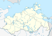
Location of the NSG in Mecklenburg-Western Pomerania |
The Goor-Muglitz nature reserve is a 157 hectare nature reserve in Mecklenburg-Western Pomerania on the north bank of the Greifswald Bodden . It was placed under protection on September 12, 1990 as part of the establishment of the Southeast Rügen Biosphere Reserve . The protection goal of the nature reserve, which consists of two parts, is on the one hand the preservation and development of a deciduous forest area with old trees in the Goor and the preservation of the Freetzer lowland and on the other hand the protection of a wooded steep slope near Muglitz, which is interspersed with wild fruit. The areas belong to protection zone 2 (maintenance zone) of the biosphere reserve. The stony shallow water areas of the Bodden also belong to the protected area.
Surrounding places are Lauterbach in the west and Freetz in the north.
Overall, the state of the area is classified as good, as the areas develop largely undisturbed. However, interventions from the past must be mitigated, such as afforestation with conifers in some areas and the drainage of the Freetzer lowland.
Parts of the area are owned by the Foundation for Environment and Nature Conservation MV and the Michael Succow Foundation.
According to EU law, the nature reserve is part of the FFH area coastal landscape of Southeast Rügen . There are several public paths to enter the areas. A nature trail was set up by the Succow Foundation.
history
The Goor was formed during the last ice age . The sandy soils indicate a kames . The Goor, which is up to 36 meters high today, is joined to the east by the Freetz lowland, which is located in a ground moraine area and became marshy after the Ice Age with a flow moor . The peat thickness reached up to two meters, but decreased due to drainage over the past 150 years.
The hill grave north of Lauterbach and the megalithic stone graves near Lonvitz are evidence of human settlement since the Neolithic Age . The name Goor is of Slavic origin and refers to the hillside location. The Swedish matriculation card from 1696 shows the Goor as wooded with oaks and beeches. An area in the north was used as arable land until afforestation in the 19th century. With the bathhouse in the west, completed in 1818, the areas were also viewed as a recreational area. This type of use was intensified by the construction of a children's holiday camp in GDR times. The buildings were demolished in 2009.
Flora and fauna

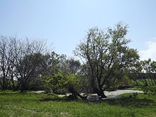
The moraine cliff of the Goor is planted with forest, which is mainly determined by beech , quivering poplar , English oak , hornbeam and robinia . Inland there are small-scale swamp forests with birch and peat moss in depressions . The former arable land was reforested with spruce , larch , Douglas fir and poplar .
The Freetzer Lowlands cover reeds with water cane , real angelica , marsh lice herb , millet sedge , marsh heart leaf and other types of mesotrophic wet meadows .
In subdivision Muglitz falter wild shrubs such as wild pear and wild apple , on the Moränenkliffs together with ash , pine , English oak , rowan , euonymus , viburnum and elderberry .
On the cliffs brooding sand martin . Other notable breeding birds are the miniature flycatcher , tawny owl and quail .
literature
- Goor-Muglitz 187 . In: Ministry of Environment Mecklenburg-Western Pomerania (Hrsg.): The nature reserves in Mecklenburg-Western Pomerania . Demmler-Verlag, Schwerin 2003, ISBN 3-910150-52-7 , p. 252 f .
- Steffi Deickert: In the field of tension between culture and "wilderness" - a conceptual theme trail for the forest NSG "Goor" in the biosphere reserve of Southeast Rügen. (PDF; 3.2 MB) January 1, 2007, p. 133 , accessed on July 29, 2012 .
Web links
- NSG regulation (from § 4)
- Let yourself be touched by the Goor forest!
- Map portal environment of the State Office for the Environment, Nature Conservation and Geology Mecklenburg-Western Pomerania ( information ) with geodata
Individual evidence
- ↑ Foundation-owned areas (No. 39)
- ↑ Standard data sheet FFH area Greifswalder Bodden, parts of the Strelasund and northern tip of Usedom (PDF; 103 kB)
- ^ Tumulus (Vilmnitz 2) in the KLEKs
- ↑ Large stone grave (Lonvitz 5) in the KLEKs
- ↑ Excerpt from the Swedish matriculation card on page 95 (PDF; 3.2 MB)
- ↑ Annual report 2008/2009 of the Southeast Rügen Biosphere Reserve (PDF; 3.2 MB)
- ↑ Biotope arch moraine cliff along the Goor (Rügenscher Bodden) (PDF; 17 kB)
- ↑ Birkenbruch biotope arch in the center of the Goor (PDF; 17 kB)
- ↑ Sand cliff biotope arch west of Groß Stresow (PDF; 17 kB)
Coordinates: 54 ° 20 ′ 35.3 " N , 13 ° 31 ′ 11.9" E


