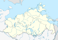
Mannhagener Moor nature reserve
Coordinates: 54 ° 11 ′ 2.6 ″ N , 13 ° 12 ′ 32.3 ″ E
The nature reserve man Hagen Moor is a 43.5 hectare wide nature reserve in Mecklenburg-Vorpommern .
location
The area is a habitat island for numerous animal and plant species in the middle of an intensively used arable landscape 2.5 km southwest of Miltzow . The eponymous place Mannhagen is one kilometer south. The area belongs to the landscape unit of clay panels north of the Peene and thus at an altitude between 23 and 25 meters above sea level .
History and water balance
The areas of the nature reserve are embedded as depressions in a ground moraine that was formed during the last ice age . After the ice had thawed, several blocks of dead ice remained in the area of today's bog due to a lack of drainage , which after thawing formed bodies of water and mossed. In the course of time, layers of peat two to eight meters thick formed. The Mannhagener Moor consists of six hydrologically separated moor bodies, each of which lies in individual depressions. The Mannhagener Moor is drained through a ditch in the direction of Strelasund .
Human use of the areas started late. The maps of the Prussian Urmes table sheet from 1830 show the moor free of forests. However, commercial peat use began in the first half of the 19th century. Drainage ditches and peat ditches were dug and used for peat extraction until 1920. On July 30, 1920, the competent authority placed the first 25 hectares under protection as a natural monument; it was established on March 16, 1938. The areas that had fallen dry were afforested. In 1984 marginal trenches were dug around the moor, with which the area was damaged again. Therefore, on July 13, 1984, the area was expanded to approximately 44 hectares. According to EU law, the nature reserve is classified as an FFH area Moore between Greifswald and Miltzow. The protection goal is the preservation and regeneration of the moor.
Flora and fauna
In the area there are bog areas of the first three trophic levels : oligotrophic-acidic, mesotrophic-acidic and eutrophic. In the center of the Mannhagener Moor there is a four hectare high moor area with peat moss swinging lawn, round-leaved sundew , swamp porst , cranberries and cutting cotton grass . The central high moor area is surrounded by an intermediate moor with peat moss swinging lawns, willows , buckthorn trees , pipe grass and swamp forests made of pine and birch . To the north, in the area of the former peat cuttings, there is an area with cotton grass, buckthorn and ear willow . The comparatively rare king fern thrives in the northwest . The rush can also be found in some areas . A forest of alder trees grows on the eutrophic areas , while the ash willow and bog birch grow on the drained areas .
The main reason of the protected status was the presence of up to 65 day and moth species , the oligotrophic sour on conditions depend. Today's species numbers are lower, as the forested moorland changed the structure of the area and the necessary food plants for the caterpillars are missing. In 1995 four amphibian and four reptile species were detected, including a population of adder .
Current state of the area
The current state of the area is viewed as unsatisfactory, since the edge areas of the moor have been heavily drained since the construction of trenches in 1984. This is in stark contrast to the intended protection goal of the nature reserve. In order to achieve an improvement, these trenches would have to be closed. Nevertheless, an analysis and evaluation of the landscape potential on behalf of the Ministry of the Environment in 1994 came to the conclusion that the nature reserve had a "high degree of uniqueness in the study area". With effect from October 13, 2011, a foundation took over the care of the moor and wants to carry out renaturation measures there.
use
The area is used for hunting and beekeeping. There is a plate path that leads from Mannhagen to the northwestern area of the nature reserve to a refuge. There is another hiking trail within the nature reserve, but it is not open to the public.
literature
- Mannhagener Moor 9 . In: Ministry of Environment Mecklenburg-Western Pomerania (Hrsg.): The nature reserves in Mecklenburg-Western Pomerania . Demmler-Verlag, Schwerin 2003, ISBN 3-910150-52-7 , p. 214 f .
Web links
- Map portal Umwelt MV with geodata (protected area borders, biotope mapping, etc.)
- NSG Mannhagener Moor , website of the Foundation for the Environment and Nature Conservation MV, accessed on August 20, 2016.
Individual evidence
- ↑ Biotope arch high moor area in Mannhagener Moor (PDF; 23 kB)
- ↑ Biotope arch intermediate moor area in Mannhagener Moor (PDF; 23 kB)
- ↑ Biotope arch peat cutting and regeneration zone in Mannhagener Moor (PDF; 22 kB)
- ↑ Landscape image designation of the Mannhagener Moors , (PDF), accessed on August 20, 2016.
- ↑ New Wilderness Islands , website of the Michael Sucow Foundation, accessed on August 20, 2016.


