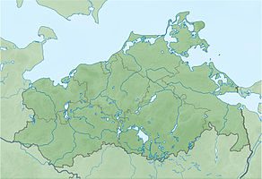
Pulitz nature reserve
|
Pulitz nature reserve
|
||
|
Stedar Bay and Pulitz Peninsula |
||
| location | Northeast of mountains in the small Jasmund in Vorpommern District Vorpommern-Greifswald | |
| surface | 218 ha | |
| Identifier | LU MV 4 | |
| WDPA ID | 14340 | |
| FFH area | 218 ha | |
| Bird sanctuary | 218 ha | |
| Geographical location | 54 ° 26 ' N , 13 ° 30' E | |
|
|
||
| Sea level | from -2 m to 53 m | |
| Setup date | June 28, 1937 | |
| administration | LUNG | |
The Pulitz nature reserve is a nature reserve in Mecklenburg-Western Pomerania . It is embedded in the Kleiner Jasmunder Bodden about five kilometers northeast of Bergen and is divided into the Pulitz peninsula and the Altrügen peninsula to the west and the surrounding shallow water areas of the shallow Stedar Bay. Surrounding places are Buschvitz and Stedar. It was placed under protection on June 28, 1937 as a bird sanctuary. The largest German cormorant colony had settled in the area since the beginning of the 20th century , but its breeding success was severely impaired by the pursuit of fishermen and ultimately led to the abandonment of the site in the 1950s. Changes in the size of the nature reserve took place in 1950 (reduction) as well as 1964 and 1972 (each enlargement). The current protection purpose consists in the preservation of an old forest area with a natural forest character in places as well as the protection of the bank areas.
The state of the area is classified as very good due to its secluded location and privacy. The area can be reached via a dirt road from Stedar and can be walked on hiking trails. However, entry is only permitted from July 16 to January 14 of the following year.
In 2009 the area was taken over by the German Federal Environment Foundation . According to EU law, the nature reserve is part of the FFH area Kleiner Jasmunder Bodden with peninsulas and Schmaler Heide as well as the bird sanctuary in the Inner Bodden of Rügen .
history
The Pulitz peninsula was formed as a terminal moraine during the last ice age . The surrounding water surface is due to the thawing glacial ice. Human settlement has been documented directly on Pulitz since 1318. The picture of the Swedish register card from 1695 shows arable land in the central part of the island with a surrounding forest of oak, beech and pine. From 1886 the fields were afforested with conifers. In 1890 Pulitz was connected to the island of Rügen by a narrow dam. There are plans to open the dam between Stedar and the peninsula.
Flora and fauna
The Pulitz peninsula is almost completely covered with forest. In addition to the naturally occurring tree species with beech , oak , hornbeam and maple, there are also conifers in the northern part. Alder break forest grows in more humid locations . A deciduous forest also grows on steep slopes on the moraine cliffs to the east. In the southern part there is an intermediate sour moor with cotton grass , peat moss and rush . It is the only boiler bog on the island of Rügen. Suspended blankets made of peat moss and reed beds can be found around Altrügen.
The original importance of the area for cormorants and gray herons was lost due to deterrent measures . Nevertheless, the areas have a high ornithological value as a breeding area for birds of prey such as hawks , marsh harriers and sea eagles .
literature
- Pulitz 4 . In: Ministry of Environment Mecklenburg-Western Pomerania (Hrsg.): The nature reserves in Mecklenburg-Western Pomerania . Demmler-Verlag, Schwerin 2003, ISBN 3-910150-52-7 , p. 128 f .
Web links
- Map portal environment of the State Office for the Environment, Nature Conservation and Geology Mecklenburg-Western Pomerania ( information ) with geodata
Individual evidence
- ^ DBU profile of the NSG with photo and map
- ↑ Standard data sheet FFH area Kleiner Jasmunder Bodden with peninsulas and Schmaler Heide (PDF; 77 kB)
- ↑ Standard data sheet in the inner soil of Rügen (PDF; 96 kB)
- ↑ The dam between the bay is to be opened
- ↑ Biotope arches Erlen-Bruchwald in the north of the island of Puhlitz (PDF; 17 kB)
- ↑ Biotope arch moraine cliff on Pulitz Island (PDF; 18 kB)
- ↑ Sauer-Zwischenmoor biotope arch in the NSG Insel Puhlitz (PDF; 20 kB)


