Neuensiener and Selliner See nature reserve
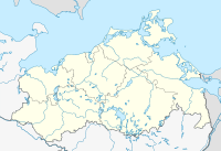
Location of the NSG in Mecklenburg-Western Pomerania |
The Neuensiener and Selliner See nature reserve is a 234 hectare nature reserve in Mecklenburg-Western Pomerania consisting of three parts . It was placed under protection on September 12, 1990 as part of the establishment of the Southeast Rügen Biosphere Reserve . The nature reserve encompasses the entire Neuensiener See with the adjacent lowland to the west, the west bank of the Selliner See and the Hohen Berg in between. The protection goal is the preservation and regeneration of humid habitats as feeding, resting and breeding areas for numerous bird species and amphibians.
Surrounding places are Lancken-Granitz , Seedorf , Sellin and Baabe .
Overall, the state of the area is classified as unsatisfactory, since the consequences of the disadvantageous management during the GDR era could not yet be reversed. However, renaturation projects were carried out in the western and northeastern part of the Neuensiener See as part of the major nature conservation project Ostrügensche Boddenlandschaft .
According to EU law, the nature reserve is part of the FFH area coastal landscape of Southeast Rügen and the bird sanctuary Greifswalder Bodden and southern Strelasund .
history
The two lakes emerged as dead ice forms after the last ice age . The subsequent sea level rise of the Littorina transgression led to the flooding and the connection to the Rügische Bodden . Both bays are moored with flow-through and flood bogs. Today the lakes are polytrophic .
The Hohe Berg, which belongs to the nature reserve, goes back to a kame and is characterized by sandy substrate.
Human settlement of the areas has been documented by numerous large stone graves , such as near Altensien or to the west near Lancken-Granitz and Burtevitz , since the Neolithic . The Swedish matriculation cards from 1696 show the areas free of wood. Two hundred years later, the western areas of both lakes are criss-crossed by drainage ditches on the original data sheet . In the western part of the Neuensiener See there were peat cuttings at that time. In the 1970s, the Neuensiener See was diked and drained by means of a pumping station. The areas were used for agriculture: after drainage and plowing, seed grassland was sown. Since 1996, renaturation measures have been initiated by dismantling the drainage and extensive use.
The west bank of the Selliner See was used as a salt pasture until 1990. The centuries-old grazing was then stopped.
The cliffs of Nord- and Südperd were cut off from active processes of the compensation coast by coastal protection measures.
Flora and fauna
In Neuensiener See you can still find candelabrum algae and the great mermaid . Both lakes are lined with extensive reed beds. In Neuensiener See this still consists of common beach rush , salt pond rush, meadow elephant and beach aster. Species-poor seed grassland continues to grow on the diked areas. Moist meadow areas of the two lakes are covered with marsh marigold , sedges , pennywort , fever clover and quiver grass . Salt marshes can be found northeast of the villages of Moritzdorf and Altensien. A small-scale alder forest continues to grow on Selliner See .
On the high mountain to grow broom -Gebüsche and Vorwald of oak and mountain ash .
The areas are of great value for bird life. Ducks, geese and swans use them throughout the year as a retreat, including gray , seeds and white-fronted goose and Stock- , heron , Tableware and wigeon .
literature
- Neuensiener and Selliner See 190 . In: Ministry of Environment Mecklenburg-Western Pomerania (Hrsg.): The nature reserves in Mecklenburg-Western Pomerania . Demmler-Verlag, Schwerin 2003, ISBN 3-910150-52-7 , p. 142 f .
Web links
- NSG regulation (from § 4)
- Map portal environment of the State Office for the Environment, Nature Conservation and Geology Mecklenburg-Western Pomerania ( information ) with geodata
- Water sports in the Bodden: driving regulations ( memento from June 29, 2007 in the Internet Archive )
Individual evidence
- ^ Renaturation of the Neuensien polder
- ^ Renaturation of the north-east polder of Neuensien
- ↑ Standard data sheet FFH area coastal landscape Southeast Rügen (PDF; 60 kB)
- ↑ Standard data sheet EU bird sanctuary Greifswalder Bodden and southern Strelasund (PDF; 114 kB)
- ↑ Boddenröhricht biotope arch west of Baabe (PDF; 18 kB)
- ↑ Biotope arch salt marsh complex northeast of Moritzdorf (PDF; 22 kB)
- ↑ Biotope arch salt marshes northeast of Altensien (PDF; 19 kB)
- ↑ Biotope arch quarry forest northeast of Altensien (PDF; 19 kB)
- ↑ Biotope arch dry lawn complex on the western slope of the Hohe Berg (PDF; 20 kB)
Coordinates: 54 ° 21 ′ 39.5 ″ N , 13 ° 38 ′ 55.7 ″ E


