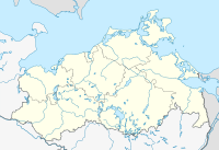
Schmachter See nature reserve and Fangerien
Coordinates: 54 ° 23 ′ 40 " N , 13 ° 35 ′ 28" E

The Schmachter See and Fangerien nature reserve is a 262 hectare nature reserve in Mecklenburg-Western Pomerania . It was placed under protection on December 7, 1994 with the aim of maintaining and developing a section of the east-west hilly landscape with a silting lake and adjacent wet meadows, moors and forests.
The Schmachter See is located immediately southwest of Binz . The eponymous place Schmacht is on the west bank of the lake. The nature reserve borders the village of Serams and the federal highway 196 to the south . A beech forest on the north-western shore of the lake is known as a fangery. The state of the forest is classified as good. The unsatisfactory condition of the Schmachter See was improved by a renaturation measure as part of the major nature conservation project Ostrügensche Boddenlandschaft .
history
The Schmachter See was created from a block of dead ice during the last ice age . Due to the rise in sea level of the Littorina transgression , the areas flooded and got a connection to the Baltic Sea . The Schmachter See was a bay between the mountain ranges of the Granitz and the Hagen mountains. The steep slopes on today's west bank of the lake were the active bank areas at that time. By coastal processes balance the enlarged beach ridge system of the north lying Schmale Heide and led to the closure of the lake from the Baltic Sea 2,500 years ago. The village of Binz is located on the beach walls today. The lake silted up and a belt of trees and reeds formed. In the west, throughflow and spring bogs were created .
The large stone grave in Schmacht indicates human settlement since the Neolithic Age . The Swedish matriculation card from 1700 and the original messtable from 1866 show the fishing with the forest and in hat use . The flow moor in the south was drained through ditches in the 19th century and used for agriculture. In the 1970s, the bog was converted to seed grassland and grazed. After 1990 some of these areas fell fallow. Due to extensive sewage discharges into the Schmachter See during the GDR era, the quality of the lake deteriorated considerably. The polytrophic lake was extensively desludged in 2004.
Flora and fauna
The Schmachter See has largely lost its original vegetation of a mesotrophic lake. The milfoil and hornwort still grow with duckweed and reeds in the bank area. In the north, west and south alder forest with irises , swamp blood-eye , water feather and tongue buttercup surrounds the lake. Wet meadows with sedges and reeds can be found to the south. In the very south of the nature reserve, the areas with bushes of gray willow and birch are made up. In the fangery, beech forest grows with oak and hornbeam , as well as pearl grass in the undergrowth.
The Schmachter See is an important feeding and resting area for ducks , divers and sawyers . Over 1000 resting dwarfs were observed. Notable breeding birds are the bittern , the marsh harrier , the swamp , the great reed warbler , the common snipe , the corncrake and the stock dove . Over 90 species of snails and mussels as well as five types of cancer have been identified.
literature
- Schmachter See and Fangerien 292 . In: Ministry of Environment Mecklenburg-Western Pomerania (Hrsg.): The nature reserves in Mecklenburg-Western Pomerania . Demmler-Verlag, Schwerin 2003, ISBN 3-910150-52-7 , p. 136 f .
Web links
- NSG regulation
- Presentation of the area on the website of the German Federal Environment Foundation
- Map portal environment of the State Office for the Environment, Nature Conservation and Geology Mecklenburg-Western Pomerania ( information ) with geodata
Individual evidence
- ^ Restoration Schmachter See
- ^ Great stone grave Schmacht in KLEKs
- ↑ Biotope arch alder-quarry forest in the silting area of the Schmachter See (PDF; 26 kB)
- ↑ Biotope arches, bushy wet meadow fallow south of the Schmachter See (PDF; 23 kB)
- ↑ Biotope arch wet grassland south of Binz am Schmachter See (PDF; 25 kB)
- ↑ Biotope arch wet meadow-wet fallow complex northwest of Pantow (PDF; 26 kB)
- ↑ Biotope arches of birch-gray willow bushes north of Pantow (PDF; 24 kB)
- ↑ Biotope arches between humid bushes and birch trees north of Serams (PDF; 24 kB)


