Mönchgut nature reserve
|
"Mönchgut" nature reserve
|
||
|
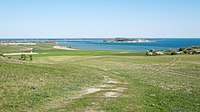
View of the Zicker sub-area |
||
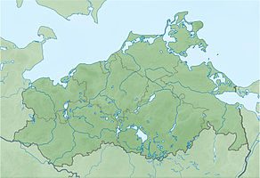
| location | Mönchgut , Göhren , Sellin , Baabe , Lancken-Granitz , District of Western Pomerania-Rügen (and coastal waters of Mecklenburg-Western Pomerania ( KMV )), Mecklenburg-Western Pomerania , DE | |
| surface | 23.4 km² | |
| Identifier | N 189 | |
| WDPA ID | 64692 | |
| Geographical location | 54 ° 20 ' N , 13 ° 41' E | |
|
|
||
| Setup date | 1990 (first areas from 1981) | |
The Mönchgut nature reserve is a nature reserve on the peninsula of the same name in the district of Vorpommern-Rügen on the island of Rügen in Mecklenburg-Western Pomerania .
description
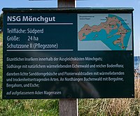
The total area of around 2340 hectares is divided into eight non-contiguous areas. It was placed under protection on April 2, 1981 with an extensive expansion in 1990 to establish the Southeast Rügen Biosphere Reserve . The protection goal is on the one hand to maintain or develop the character of the landscape that has evolved over time, and on the other hand to protect the surrounding shallow water areas of the Greifswalder Bodden and the Baltic Sea from damage.
Surrounding places are Lancken-Granitz , Sellin , Baabe , Göhren , Middelhagen , Lobbe , Groß Zicker , Gager , Thiessow and Klein Zicker .
Overall, the state of the area is rated as good. The extensive cultivation of the areas will be continued. Impairments come from dikes and ongoing drainage of the wetlands. Several hiking trails allow walking on the areas. A survey in 2002 showed a high level of tourist appreciation among the tens of thousands of visitors for the nature conservation-friendly arable sites, which is also reflected in an economic willingness to pay .
Part of the area is owned by the Foundation for Environment and Nature Conservation MV.
According to EU law, the nature reserve is part of the FFH area coastal landscape of Southeast Rügen and the bird sanctuary Greifswalder Bodden and southern Strelasund .
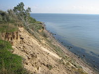
There are also some geotopes in the designated areas . Mostly these are boulders and cliffs.
Sub-areas (from south to north)
| Partial area | number | size | image | image | description | Coordinates |
|---|---|---|---|---|---|---|
| Südperd | N 189a | 27 ha |  |
 |
with arable land, wooded cliff and pilot tower Thiessow | 54 ° 16 '26.6 " N , 13 ° 43' 21.7" E |
| Zicker | N 189b | 933 ha |  |
Already expelled on April 2, 1981, with dry grass , cliffs, moored beach ridges , grasslands and the like. a. on the peninsulas Groß Zicker and Klein Zicker as well as the Zicker See bay in between | 54 ° 17 '35.2 " N , 13 ° 41' 2.4" E | |
| Lobber place | N 189c | 9 ha |  |
on the edge of Lobbe with a wooded cliff, beach and shallow water areas of the Baltic Sea | 54 ° 19 '5.5 " N , 13 ° 43' 45.8" E | |
| Salt marshes near Middelhagen | N 189d | 71 ha | south of Middelhagen with grassland, salt marshes and shallow water areas of the Greifswald Bodden | 54 ° 19 '24.2 " N , 13 ° 42' 19.1" E | ||
| Schafberg near Mariendorf | N 189e | 19 ha |  |
between Mariendorf and Middelhagen with poor grassland and shallow water areas of the Bodden | 54 ° 19 '37.9 " N , 13 ° 41' 14.3" E | |
| Nordperd | N 189f | 69 hectares |  |
immediately west of Göhren with dry grass, wooded cliff, beach and shallow water areas of the Baltic Sea | 54 ° 20 ′ 27.2 " N , 13 ° 45 ′ 28.8" E | |
| Göhrener Litorinakliff and Baaber Heide | N 189g | 159 hectares |  |
 |
south of Baabe and west of the B 196 with swamps, heather, quarry forest and beech forest | 54 ° 20 ′ 38.8 " N , 13 ° 42 ′ 16.6" E |
| Having and Reddevitzer Höft | N 189h | 1033 ha |  |
 |
the Bodden Bay Having whose shallow water areas adjacent coast, neglected grassland and wooded cliffs | 54 ° 20 '26.9 " N , 13 ° 38' 39.1" E |
history

The parts of the nature reserve were decisively shaped by the last ice age and the rise in sea level since the Littorina transgression . The bays Having, Hagensche Wiek and Zicker-See go back to glacier excavations, the peninsulas Reddevitz, Groß Zicker and Klein Zicker emerged as terminal moraine and were overlaid by meltwater sands. Extensive marl cliffs were pushed up by the ice and are interspersed with numerous large debris. The Buskam not far north of Nordperd is a witness of this time .
Human settlement in the area has been documented by numerous large stone graves , such as the Baaber Ducal Grave , since the Neolithic Age . In the 13th century, the Eldena Monastery became the owner of the peninsula that got its name. After the Reformation , the monastic estate became the property of the sovereign. The Swedish registration cards from 1696 show the nutrient-rich moraine areas in arable land. Lowlands and cliffs were used as pasture. Forest only grew on the steep cliff edges of Nord- and Südperd, on Göhrener Littorina-Kliff and on Groß Zicker.
From the 19th century, the nutrient-poor locations such as Baaber Heide and Nordperd were reforested with pines . The measuring table from 1886 already shows the current forest distribution. Further afforestation with larch, pine and poplar took place in GDR times at the heights of Groß Zicker. In the following years, poor-yielding fields often fell fallow after centuries of small - scale farming , as their use no longer seemed profitable. These areas developed into poor grassland and are still grazed by sheep today.
In the high-yielding lowlands, however, agricultural use was intensified. Dikes and drainage between Gager and Middelhagen took place. The original beach wall fan was lost, except for small remnants, at the expense of seed grassland. Brackish reed beds formed on too moist areas of the lowlands.
The cliffs of Nord- and Südperd were cut off from active processes of the compensation coast by coastal protection measures.
With the establishment of the Southeast Rügen Biosphere Reserve, a large part of the area was placed under nature protection. The cliff and the deciduous forest area in the previous NSG Zickersches Höft belong to the core zone of the biosphere reserve and should no longer be subject to economic use in order to ensure undisturbed development. The other sub-areas of the Mönchgut nature reserve are located in protection zone II (development and maintenance zone) with the aim of preserving the landscape through sustainable agricultural , forestry , fishing and tourism use.
Flora and fauna
Due to the special landscape and the centuries of historical use, a typical flora and fauna could develop. Skimmed lawn and thermophilic Waldgesellschaften with oak , hornbeam , Elsbeere and Solomon's seal are found at higher layers. Over 90 species on the Red List have been identified in the area. Meadow cowslip , nodular saxifrage , buttercup , timothy , mountain hairline , common dost , white swallow root , peach-leaved bellflower , schillergrass and eyebright are worth highlighting .
Salt marshes, swamps and reeds dominate the lower areas. Typical species are reed , beach trident , milkweed , salty bulrush , beach plantain and yellow asparagus pea .
The lagoon waters are important spawning areas for herring . In the shallow waters of the bay is growing pondweed , while at the sections of the Baltic coast seaweed and bladderwrack occur.
Breeding birds in the area are buzzard , marsh harrier , goshawk , kestrel and tree falcon, as well as quail , snipe , redshank and wheatear . The sand martin breeds in 17 colonies in the area. There are numerous endangered butterfly species , including the swallowtail , mourning mantle , rust bandage , plantain pied butterflies , blue sunflower and common green ram .
literature
- Monks 189 . In: Ministry of Environment Mecklenburg-Western Pomerania (Hrsg.): The nature reserves in Mecklenburg-Western Pomerania . Demmler-Verlag, Schwerin 2003, ISBN 3-910150-52-7 , p. 144 f .
Web links
- NSG regulation (from § 4)
- Map portal environment of the State Office for the Environment, Nature Conservation and Geology Mecklenburg-Western Pomerania ( information ) with geodata
- Water sports in the Bodden: driving regulations
Individual evidence
- ↑ Karkow, K. (2003): Appreciation of visitors to the recreational area Groß Zicker on Rügen for arable sites in Germany that are used in accordance with nature conservation. (PDF; 8.9 MB)
- ↑ Foundation-owned areas (No. 39)
- ↑ Standard data sheet FFH area coastal landscape of Southeast Rügen (PDF; 61 kB)
- ↑ Standard data sheet EU bird sanctuary Greifswalder Bodden and southern Strelasund (PDF; 116 kB)
- ↑ Biotope arch cliff on Südperd (PDF; 25 kB)
- ↑ Biotope arch dry grass north of Klein Zicker (PDF; 21 kB)
- ↑ Biotope arch west cliff on the Saalsufer (PDF; 23 kB)
- ↑ Biotope arch cliff Groß Zicker (PDF; 28 kB)
- ↑ Biotope arch Strandwall-Moor-Complex (PDF; 25 kB)
- ↑ Biotope arch lean grassland Zicker peninsula (PDF; 30 kB)
- ↑ Map portal environment of the State Office for the Environment, Nature Conservation and Geology Mecklenburg-Western Pomerania ( information )
- ↑ Biotope arch cliff "Lobber Ort" (PDF; 27 kB)
- ↑ Salt meadow biotope arch 1.2 km south of Middelhagen (PDF; 19 kB)
- ↑ Salt meadow biotope arch south of Kleinhagen (PDF; 22 kB)
- ↑ Biotope arches on the Schafberg near Mariendorf (PDF; 25 kB)
- ↑ Biotope arch dry lawn NSG Bakenberg, Göhren (PDF; 24 kB)
- ↑ Biotope arch cliff in the NSG "Nordperd" (PDF; 25 kB)
- ↑ Biotope arch active cliff north of NSG "Nordperd" (PDF; 26 kB)
- ↑ Biotope arch of tall herbaceous in the Baaber Heide (PDF; 19 kB)
- ↑ Biotope arches for young alder in the Baaber Heide (PDF; 19 kB)
- ↑ Biotope arch Litorinakliff in the NSG "Baaber Heide" (PDF; 17 kB)
- ↑ Biotope arch Boddenröhricht east of Neu Reddevitz (PDF; 17 kB)
- ↑ Gobbiner Haken Biotope Arch (PDF; 19 kB)
- ↑ Biotope arch cliffs of the Reddevitz peninsula (PDF; 25 kB)
- ↑ Biotope arch dry grassland south of Seedorf (PDF; 18 kB)
- ↑ Biotope arch dry vegetation complex north of Moritzburg (PDF; 23 kB)
- ↑ § 5 of the Biosphere Reserve Ordinance


