Island Vilm nature reserve
|
Island Vilm nature reserve
|
||
|
View from the southern tip |
||
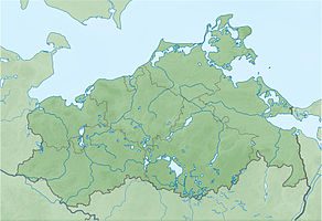
| location | Southeast of Putbus in the Bay of Greifswald in Vorpommern District Vorpommern-Greifswald | |
| surface | 171 ha | |
| Identifier | LU MV 3 | |
| WDPA ID | 11796 | |
| Geographical location | 54 ° 19 ' N , 13 ° 32' E | |
|
|
||
| Sea level | from 0 m to 36 m | |
| Setup date | December 2, 1936 | |
| administration | LUNG | |
The Insel Vilm nature reserve is a 171 hectare nature reserve in Mecklenburg-Western Pomerania . It includes the island of Vilm and the surrounding shallow water areas of the Greifswald Bodden . The nature reserve is one of the oldest in the state and was designated on December 2, 1936. The area was expanded in 1990 with the establishment of the Southeast Rügen Biosphere Reserve . The island of Vilm, together with parts of Mönchgut, Zicker and Granitz, forms the core zone of the reserve.
The state of the area is considered to be very good, as the areas develop largely undisturbed. The island of Vilm may only be entered as part of public tours with a limited number of 30 participants.
According to EU law, the nature reserve is part of the FFH area coastal landscape of Southeast Rügen and the bird sanctuary Greifswalder Bodden and southern Strelasund . Part of the island is a natural forest reserve and is scientifically researched. The island of Vilm is the seat of the International Nature Conservation Academy of the Federal Agency for Nature Conservation .
history
The last ice age left three debris in the area of today's island of Vilm, which as island cores (Großer Vilm, Mittelvilm and Kleiner Vilm) form the base of the island. By processes of coastal compensation, beach ridges were formed, which connected the island cores and gave the Vilm its current shape. There are numerous boulders in the surrounding shallow water. Different water levels, e.g. B. at the time of the Littorina transgression, led to the formation of fossil cliffs today on the north side of the island.
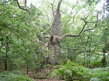
Human settlement has been documented by the Slavs since the Middle Ages . The name of the island is derived from the Slavic word for elm. Beeches and alders were felled on the island from the 16th to the beginning of the 18th century. The oaks were left standing as hat trees and today, in places, are 600 years old. There has been no logging for around 300 years.
Flora and fauna
The majority of the island is covered with a mixed forest of red beech , English oak and sycamore maple . There are bushes with roses and wild pears interspersed . Beach trident and beach bulrush grow on an abandoned salt marsh in the southwest of the island . Lean sand grass with red ostrich grass and beach carnation were detected between the buildings. The cliff coast is covered with beech, oak and other trees. Sand hooks and dunes form biotopes for ringed plovers and other Limikolen.
Mapping for the GEO Day of Species Diversity in 2002 revealed 1312 species.
In recent years, an increasing number of gray seals have been sighted in the surrounding shallow water areas.
literature
- Vilm Island 3 . In: Ministry of Environment Mecklenburg-Western Pomerania (Hrsg.): The nature reserves in Mecklenburg-Western Pomerania . Demmler-Verlag, Schwerin 2003, ISBN 3-910150-52-7 , p. 130 f .
Web links
- NSG regulation (from § 4)
- Excursion to the island of Vilm with map and photo documentation
- Map portal Umwelt MV with geodata (protected area borders, biotope mapping, etc.)
Individual evidence
- ↑ Standard data sheet FFH area Greifswalder Bodden, parts of the Strelasund and northern tip of Usedom (PDF; 103 kB)
- ↑ Standard data sheet EU bird sanctuary Greifswalder Bodden and southern Strelasund (PDF; 116 kB)
- ↑ Profile of the natural forest reserve Insel Vilm
- ↑ Biotope arch of rose and wild pear bushes on Kl. Haken (Vilm) (PDF; 17 kB)
- ↑ Biotope arches of rose and wild pear bushes on the Mittelvilm (PDF; 17 kB)
- ↑ Biotope arch abandoned salt marsh and reed beds on Kl. Haken (Vilm) (PDF; 18 kB)
- ↑ Biotope arch ruderalized sandy grassland on the Großer Vilm (PDF; 19 kB)
- ↑ Biotope arch sand / moraine cliff on d. east side of the Kleiner Vilms (PDF; 20 kB)
- ↑ Biotope arch sand / glacial marl cliff on northeast. Side d. Vilm Island (PDF; 18 kB)
- ↑ Dune biotope arch at the northern end of the island of Vilm (Großer Haken) (PDF; 19 kB)
- ↑ Federal Agency for Nature Conservation: GEO day of biodiversity on the island of Vilm with amazing results
- ↑ 4th GEO day of biodiversity on the island of Vilm (Rügen)


