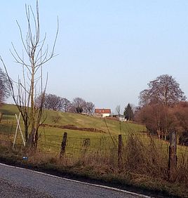
New egg pass
|
New egg pass
City of Solingen
Coordinates: 51 ° 12 ′ 17 ″ N , 7 ° 3 ′ 23 ″ E
|
||
|---|---|---|
| Height : | about 205 m | |
| Postal code : | 42719 | |
| Area code : | 0212 | |
|
Location of Neu-Eipaß in Solingen |
||
|
New egg pass
|
||
Neu-Eipaß is a location in the mountainous city of Solingen .
geography
Neu-Eipaß is located in the west of the Solingen district of Gräfrath . The place is on a slope halfway up the mountain between the Itter valley in the east and the ridge in the northwest, on which the farms Eipaß and Buxhaus are located. Neu-Eipaß can be reached via a small cul-de-sac from Buxhaus. In the north are Grund and the Blumental . In the south, following the course of the Itter, first Itterbruch and then Eschbach are located . To the west are Gütchen , Backesheide and Holz .
etymology
The place name Neu-Eipaß is likely to have been chosen based on the nearby Gut Eipaß. What the word means is unclear.
history
The Neu-Eipaß location was probably not created until the second half of the 19th century. The topographical survey of the Rhineland from 1824 shows the and the Prussian first survey of 1843 does not yet record the place. The place is also not recorded in the topographic map of the Düsseldorf administrative district from 1871. The location is only recorded on the measuring table from 1892 to 1894. New Eipaß belonged in the early years still to mayoralty forest , there he was in the corridor II. ( Wood ).
The municipality and estate district statistics of the Rhine Province list the place Neueneipass 1871 with two houses and seven inhabitants. In the municipality lexicon for the Rhineland province of 1888, two houses with 17 residents are given for Neueneipaß . In 1895 the district had two houses with nine inhabitants, in 1905 three houses and eight inhabitants are given.
With the town union of Groß-Solingen in 1929 Neu-Eipaß became a district of Solingen.
swell
- ^ City of Solingen: Street and place names in our city of Solingen , self-published, Solingen 1972
- ^ Topographic map of the Düsseldorf administrative district . Designed and executed according to the cadastral recordings and the same underlying and other trigonometric work by the Royal Government Secretary W. Werner. Edited by the royal government secretary FW Grube. 4th rev. Edition / published by A. Bagel in Wesel, 1859 / Ddf., Dec. 17, 1870. J. Emmerich, Landbaumeister. - Corrected after the ministerial amendments. Ddf. d. Sept. 1, 1871. Bruns.
- ↑ Royal Statistical Bureau Prussia (ed.): The communities and manor districts of the Prussian state and their population . The Rhine Province, No. XI . Berlin 1874.
- ↑ Königliches Statistisches Bureau (Prussia) (Ed.): Community encyclopedia for the Rhineland Province, based on the materials of the census of December 1, 1885 and other official sources, (Community encyclopedia for the Kingdom of Prussia, Volume XII), Berlin 1888.
- ↑ Königliches Statistisches Bureau (Prussia) (Ed.): Community encyclopedia for the Rhineland Province, based on the materials of the census of December 1, 1895 and other official sources, (Community encyclopedia for the Kingdom of Prussia, Volume XII), Berlin 1897.
- ↑ Royal Statistical Bureau (Prussia) (Ed.): Community encyclopedia for the Rhineland Province, based on the materials of the census of December 1, 1905 and other official sources, (Community encyclopedia for the Kingdom of Prussia, Volume XII), Berlin 1909

