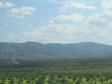
Palagonia
| Palagonia | ||
|---|---|---|

|
|
|
| Country | Italy | |
| region | Sicily | |
| Metropolitan city | Catania (CT) | |
| Local name | Pala (g) unìa | |
| Coordinates | 37 ° 20 ' N , 14 ° 45' E | |
| height | 200 m slm | |
| surface | 57 km² | |
| Residents | 16,298 (Dec. 31, 2019) | |
| Population density | 286 inhabitants / km² | |
| Post Code | 95046 | |
| prefix | 095 | |
| ISTAT number | 087032 | |
| Popular name | Palagonesi | |
| Patron saint | Santa Febronia | |
| Website | Palagonia | |
Palagonia is a town and municipality of the Metropolitan city of Catania in the Region of Sicily in Italy with 16,298 inhabitants (December 31, 2019).
Location and dates
Palagonia is 49 km southwest of Catania . The inhabitants work mainly in agriculture, animal husbandry and industry. Olive oil production is also important.
The neighboring municipalities are Lentini ( SR ), Militello in Val di Catania , Mineo and Ramacca .
history
The place is of Norman origin.
Attractions
- Parish church dedicated to the patron saint of Palagonia, Santa Febronia
Individual evidence
- ↑ Statistiche demografiche ISTAT. Monthly population statistics of the Istituto Nazionale di Statistica , as of December 31 of 2019.
Web links
Commons : Palagonia - collection of images, videos and audio files
- Information on Palagonia (English and Italian)


