
Floreşti district
| Floreşti district | |
|---|---|
  |
|
| Basic data | |
| Country | Republic of Moldova |
| Capital | Florești |
| surface | 790 km² |
| Residents | 76,457 (2014) |
| density | 97 inhabitants per km² |
| founding | 2003 |
| ISO 3166-2 | MD-FL |
Coordinates: 47 ° 50 ' N , 28 ° 20' E
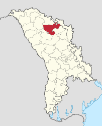
The Floreşti Raion is a raion in the Republic of Moldova . The capital of the Rajons is Florești .
geography
The Rajon is located in the northeast of the country on the Dniester River . Floreşti borders the Drochia , Rezina , Sîngerei , Soroca and Teleneşti Rajons and the breakaway region of Transnistria .
In addition to the capital, Ghindeşti and Mărculeşti have city rights, the remaining area of the Rajons is distributed among rural communities.
history
The Floreşti Rajon has existed since 2003. Between 1918 and 1940, the area was part of the Romanian Soroca District (Județul Soroca).
population
Population development
In 1959, 97,939 people lived in the area of today's Rajons. By 1970 the population rose to 109,262. Until the next census in 1979, the number of inhabitants decreased, was now 104,385 and remained almost constant until 1989 at 104,680. In 2004 only 89,389 inhabitants were counted in the Rajon and thus also fell below the value of 1959. In 2014 it was 76,457.
Ethnic groups
According to the 2004 census, the Moldovans make up the largest ethnic group in the Floreşti Raion with 84.8%, followed by the Ukrainians with 9.0% and the Russians with 5.2%. Smaller minorities are the Romanians with 0.5% and the Gagauz and Bulgarians with 0.1% each.
Web links
Individual evidence
- ↑ a b http://www.statistica.md/public/files/Recensamint/Recensamintul_populatiei/vol_1/1_Toate_recensaminteleRne_ro.xls
- ^ Moldova: administrative structure (districts and municipalities) - population figures, graphics and map. Retrieved May 9, 2018 .
- ↑ http://www.statistica.md/public/files/Recensamint/Recensamintul_populatiei/vol_1/6_Nationalitati_de_baza_ro.xls
Rajons:
Anenii Noi |
Basarabeasca |
Briceni |
Cahul |
Cantemir |
Călărași |
Căușeni |
Cimișlia |
Criuleni |
Dondușeni |
Drochia |
Dubăsari |
Edineț |
Fălești |
Florești |
Glodeni |
Hînceşti |
Ialoveni |
Leova |
Nisporeni |
Ocnița |
Orhei |
Rezina |
Rîșcani |
Singing |
Soroca |
Strășeni |
Șoldăneşti |
Ștefan Vodă |
Taraclia |
Teleneşti |
Ungheni
Autonomous regions: Gagauzia |
Transnistria
![]()
![]()