
Ramersdorf (Bonn)
|
Ramersdorf
Federal city of Bonn
Coordinates: 50 ° 43 ′ 28 ″ N , 7 ° 9 ′ 16 ″ E
|
|
|---|---|
| Height : | 65 m above sea level NHN |
| Residents : | 1863 (Dec. 31, 2018) |
| Incorporation : | 1st August 1969 |
| Postal code : | 53227 |
| Area code : | 0228 |
  |
|
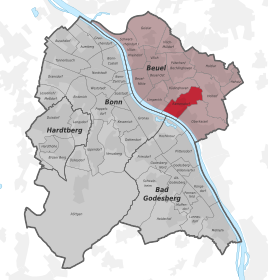
Ramersdorf is a district of the federal city of Bonn in the Beuel district . Ramersdorf extends on the right bank of the Rhine from the banks of the Rhine to the slopes of the Ennert and has been part of the federal district with its area near the Rhine since the 1990s . The district includes the southernmost part of the statistical district Li-Kü-Ra , which also includes the neighboring districts Küdinghoven and Limperich , the southernmost part of the statistical district Beuel-Süd, the northwest corner of the statistical district Ramersdorf and part of the Ennert.
history
Ramersdorf is first mentioned in a document in the 9th century. The Bonn Cassius Stift had properties there. In 1136 the monastery received a papal confirmation that it owned a property in Ramersdorf that the canons had acquired from the Siegburg Abbey . The monastery received further ownership in 1142 through a donation from a Bonn citizen named Roingus. The Heisterbach Abbey in Ramersdorf received interest and tithes as well as a mill before 1246 .

The Kommende Ramersdorf of the German Order was founded around 1230 and is now run as a hotel and is located at the motorway triangle of A 59 and A 562 .
Since Ramersdorf became a district of Bonn in 1969 and was connected to the government district on the left bank of the A 562 by the motorway bridge, the district has experienced enormous growth. In 1979, for the Federal Garden Show , part of the banks of the Rhine was transformed into the Rheinaue landscape park, which is linked to the main part of the park on the left bank of the Rhine by the motorway bridge. Several industrial parks are grouped around the park, which have become focal points of work. Today the former headquarters of T-Mobile (the Telekom Campus ) are located here; meanwhile merged with Telekom Deutschland GmbH . The Bonn police moved into the new police headquarters for Bonn in October 2006 . The dynamic development especially since the 1990s can also be traced back to the federal quarter development measure , parts of which were located in Ramersdorf.
In the south of Ramersdorf there is the site of a former cement factory, which has been extensively redesigned since 2003 as part of the “ Bonner Bogen ” urban development project . Here, under the direction of the Bonn architect Karl-Heinz Schommer, residential and office buildings, event rooms and a hotel were built. Some listed buildings of the old factory have been preserved and have been extensively renovated, including the director's villa, the administration building and the water tower. The more than 600 graves from the Merovingian period found in this area are of great archaeological importance.

Ramersdorf, aerial photo (2017)

Center / Lindenstrasse in Ramersdorf

Chapel of the Sacred Heart Convent

former headquarters of T-Mobile


Population development
| year | Residents |
|---|---|
| 1816 | 303 |
| 1843 | 389 |
| 1871 | 486 |
| 1905 | 832 |
| 1961 | 1.312 |
Personalities
- Henriette Brey (born November 15, 1875 in Capellen near Geldern, † May 27, 1953 in Ramersdorf), writer
- Max Rendschmidt (born December 12, 1993 in Bonn), canoeist, grew up in Ramersdorf
See also
- List of architectural monuments in the Ramersdorf district of Bonn
- List of streets in the Ramersdorf district of Bonn
- List of crosses and wayside shrines in the Ramersdorf district of Bonn
Web links
Individual evidence
- ↑ Population in Bonn by districts (according to the main statute) on December 31 , 2018 , Federal City of Bonn - Statistics Office, February 2019
- ^ Heinrich Pauen: The monastery manor Heisterbach. (= Contributions to the history of old monasticism and the Benedictine order, edited by the Abbot Herwegen Institute Maria Laach, vol. 4), Aschendorff , Münster 1913, pp. 67 and 137.
- ^ Robert Kulka: 1000 officials sort 4.5 kilometers of files. In: general-anzeiger-bonn.de. General-Anzeiger , Bonn, October 17, 2006, accessed on January 12, 2016 .
- ↑ Hans-Eckart Joachim: Remarkable prehistoric and early historical finds and sites in Bonn on the right bank of the Rhine (= Monument and History Association Bonn-Rechtsrheinisch eV [Ed.]: Contributions to memorials and history in Bonn on the right bank of the Rhine . Volume 10 ). Bonn 2018, ISBN 978-3-9812164-6-2 , pp. 39-42 .
- ↑ G. White; U. Schönfelder: A Franconian cemetery in Bonn-Ramersdorf . In: Jürgen Kunow (Ed.): 25 Years of Arch. In the Rhineland 1987–2011 . Theiss, Stuttgart 2012, ISBN 978-3-8062-2687-4 , pp. 143-145 .
- ^ Community encyclopedia Prussia , 1871 and 1905; Overview ... of the government district of Cologne , 1816 and 1843.
- ^ Contributions to the statistics of the state of North Rhine-Westphalia, special series of the population census 1961. Issue 2b, Düsseldorf 1963, p. 59.
- ↑ Bernd Koch and Berthold Mertes: Half-time with Max Rendschmidt - The canoe world champion from Bonn on motivation and training. In: General-Anzeiger Bonn. October 11, 2013, accessed March 2, 2019 .

City districts: Bad Godesberg | Bulge | Bonn | Hardtberg
Districts: Alt-Godesberg | Auerberg | Beuel center | Beuel-Ost | Bonn-Castell | Bonn Center | Brüser Berg | Buschdorf | Dottendorf | Dransdorf | Duisdorf | Endeich | Friesdorf | Geislar | Godesberg-North | Godesberg villa district | Graurheindorf | Gronau | Hard height | Heiderhof | Hochkreuz | Wood | Holtorf | Holzlar | Ippendorf | Kessenich | Küdinghoven | Lannesdorf | Lengsdorf | Lessenich / Meßdorf | Limperic | Flour | Muffendorf | Nordstadt | Oberkassel | Pennenfeld | Plittersdorf | Poppelsdorf | Pützchen / Bechlinghoven | Ramersdorf | Röttgen | Rüngsdorf | Schwarzrheindorf / Vilich-Rheindorf | Schweinheim | Südstadt | Fir bush | Ückesdorf | Venusberg | Vilich | Vilich-Müldorf | West town