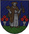
Smolinské
| Smolinské | ||
|---|---|---|
| coat of arms | map | |

|
|
|
| Basic data | ||
| State : | Slovakia | |
| Kraj : | Trnavský kraj | |
| Okres : | Senica | |
| Region : | Záhoria | |
| Area : | 15.692 km² | |
| Residents : | 900 (Dec. 31, 2019) | |
| Population density : | 57 inhabitants per km² | |
| Height : | 184 m nm | |
| Postal code : | 908 42 | |
| Telephone code : | 0 34 | |
| Geographic location : | 48 ° 40 ' N , 17 ° 8' E | |
| License plate : | SE | |
| Kód obce : | 504823 | |
| structure | ||
| Community type : | local community | |
| Administration (as of November 2018) | ||
| Mayor : | Vladimír Smolinský | |
| Address: | Obecný úrad Smolinské č. 334 908 42 Smolinské |
|
| Website: | www.smolinske.sk | |
| Statistics information on statistics.sk | ||
Smolinské (until 1927 Slovak also "Smolensko"; Hungarian Szomolánka - until 1907 Szmolinszkó ) is a municipality in western Slovakia with 900 inhabitants (as of December 31, 2019), which belongs to Okres Senica , a district of Trnavský kraj .
geography
The municipality is located in the north of the Záhorská nížina lowlands and on the edge of the Chvojnická pahorkatina hills , in the valley of a tributary of Myjava . The municipality is slightly hilly and largely agricultural; mixed forest grows in the western part. The center of the village is at an altitude of 184 m nm and is five kilometers from Šaštín-Stráže and 22 kilometers from Senica .
Neighboring municipalities are Gbely in the north, Letničie in the northeast, Šaštín-Stráže in the east and south, and Čáry in the southwest.
history
Smolinské was mentioned in writing for the first time in 1392 as Somola and belonged to the estate of the Šaštín castle. At the end of the 15th century, the Czobor family became landowners who had a farmyard built near the village. In the middle of the 16th century Habaners came to Smolinské and built a Bruderhof in the village. In 1738 the Habsburgs became landowners. In 1828 there were 152 houses and 1,062 inhabitants, whose main sources of income were agriculture and viticulture.
The place in Neutra County belonged to the Kingdom of Hungary until 1918 and then came to Czechoslovakia and Slovakia.
The place name is intended to indicate that pitch ( smola in Slovak ) used to be extracted from the pines in the area .
population
According to the 2011 census, there were 978 inhabitants in Smolinské, of which 948 were Slovaks , two Magyars and two Czechs and one Roma . 25 residents did not provide any information on ethnicity . 892 residents supported the Roman Catholic Church and two residents supported the Evangelical Church AB. 48 residents were non-denominational and the denomination of 36 residents was not determined.
Buildings
- Roman Catholic Church of St. James in Baroque style from 1720
- Neo-Romanesque style chapel from the 19th century
- Bell tower from the end of the 18th century
Individual evidence
Web links
- Entry on e-obce.sk (Slovak)


