Souillé
| Souillé | ||
|---|---|---|
|
|
||
| region | Pays de la Loire | |
| Department | Sarthe | |
| Arrondissement | Le Mans | |
| Canton | Bonnétable | |
| Community association | Maine Coeur de Sarthe | |
| Coordinates | 48 ° 7 ' N , 0 ° 11' E | |
| height | 49-87 m | |
| surface | 4.57 km 2 | |
| Residents | 690 (January 1, 2017) | |
| Population density | 151 inhabitants / km 2 | |
| Post Code | 72380 | |
| INSEE code | 72338 | |
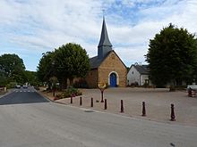
 Town hall (Mairie) of Souillé |
||
Souillé is a French municipality with 690 inhabitants (as of January 1 2017) in the department of Sarthe in the region Pays de la Loire . It belongs to the Arrondissement of Le Mans and the Canton of Bonnétable (until 2015: Canton Ballon ). The inhabitants are called souilléens .
geography
Souillé is about twelve kilometers north of Le Mans . The Sarthe limits the community in the east. Souillé is surrounded by the neighboring communities of Sainte-Jamme-sur-Sarthe in the north, Montbizot in the north and northeast, La Guierche in the east and La Bazoge in the south and west.
Population development
| year | 1962 | 1968 | 1975 | 1982 | 1990 | 1999 | 2006 | 2013 |
| Residents | 227 | 210 | 276 | 274 | 308 | 365 | 547 | 675 |
| Source: Cassini and INSEE | ||||||||
Attractions
- Saint Martin Church
- Chapel of Sainte-Anne
- Watermill
literature
- Le Patrimoine des Communes de la Sarthe. Flohic Editions, Volume 1, Paris 2000, ISBN 2-84234-106-6 , pp. 125-127.
Web links
Commons : Souillé - collection of images, videos and audio files

