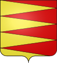
Saint-Saturnin (Sarthe)
| Saint-Saturnin | ||
|---|---|---|

|
|
|
| region | Pays de la Loire | |
| Department | Sarthe | |
| Arrondissement | Le Mans | |
| Canton | Le Mans-2 | |
| Community association | Le Mans metropolis | |
| Coordinates | 48 ° 3 ' N , 0 ° 9' E | |
| height | 43-100 m | |
| surface | 9.66 km 2 | |
| Residents | 2,529 (January 1, 2017) | |
| Population density | 262 inhabitants / km 2 | |
| Post Code | 72650 | |
| INSEE code | 72320 | |
| Website | http://saint-saturnin72.fr/ | |
 Entrance to Saint-Saturnin |
||
Saint-Saturnin is a French commune with 2,529 inhabitants (as of January 1 2017) in the department of Sarthe in the region Pays de la Loire ; it belongs to the Arrondissement of Le Mans and the canton of Le Mans-2 (until 2015: canton of Le Mans-Nord-Ouest ). The inhabitants are called Saint-Sanyens .
geography
Saint-Saturnin is about six kilometers north-north-west of Le Mans . The river Sarthe forms the southeastern boundary of the municipality. Saint-Saturnin is surrounded by the neighboring communities of La Bazoge in the north, Neuville-sur-Sarthe in the east, Saint-Pavace in the southeast, La Chapelle-Saint-Aubin in the south and La Milesse in the west.
The motorway triangle of the Autoroute A11 with the Autoroute A28 is located in the municipality .
Population development
| 1962 | 1968 | 1975 | 1982 | 1990 | 1999 | 2006 | 2012 |
|---|---|---|---|---|---|---|---|
| 497 | 592 | 849 | 1,206 | 1,697 | 1.995 | 2,236 | 2,516 |
Attractions
- Saint-Saturnin church with statue of the Virgin ( Monument historique )
- Les Étrichets chapel from the 14th and 17th centuries, monument historique since 1978
