
Wilhering
|
market community Wilhering
|
||
|---|---|---|
| coat of arms | Austria map | |
 |
|
|
| Basic data | ||
| Country: | Austria | |
| State : | Upper Austria | |
| Political District : | Linz Land | |
| License plate : | LL | |
| Surface: | 29.99 km² | |
| Coordinates : | 48 ° 19 ' N , 14 ° 11' E | |
| Height : | 270 m above sea level A. | |
| Residents : | 5,919 (January 1, 2020) | |
| Population density : | 197 inhabitants per km² | |
| Postal code : | 4073 | |
| Area code : | 0 72 26, 0 72 21 | |
| Community code : | 4 10 22 | |
| NUTS region | AT312 | |
| Address of the municipal administration: |
Linzer Strasse 14 4073 Wilhering |
|
| Website: | ||
| politics | ||
| Mayor : | Mario Wolfgang Mühlböck ( SPÖ ) | |
|
Municipal Council : (2015) (31 members) |
||
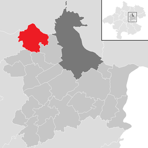
| Location of Wilhering in the Linz-Land district | ||
  |
||
| Source: Municipal data from Statistics Austria | ||


Wilhering is a market town in Upper Austria in the Linz-Land district in the central area with 5919 inhabitants (as of January 1, 2020). The responsible judicial district is the judicial district of Traun . The Cistercian Wilhering Abbey is located in the village .
geography
Wilhering is at an altitude of 270 m above sea level. A. in the central region of Upper Austria west of Linz. The municipality is bounded in the north by the Danube, the east and northeast is covered by the Kürnberger Forest , the east is dominated by agriculture. Neighboring communities are Leonding in the east and southeast, Pasching and Kirchberg-Thening in the south, Alkoven ( Eferding district ) in the west and Ottensheim and Puchenau (both Urfahr-Umgebung district ) in the north. The extension is 7 km from north to south and from west to east. The community area covers 29.99 km², making Wilhering the fifth largest community in the district. The municipality is 40 percent covered by forest, 44 percent is used for agricultural land. Gardens make up 8 percent of the community area, water four percent, building areas one percent and other areas three percent.
Community structure
Wilhering consists of the cadastral communities (KG) Dörnbach (679.17 hectares), Schönering (975.97 hectares) and Wilhering (1,341.90 hectares). KG Wilhering covers the north and east of the municipality, with the cadastral community in the east extending roughly to the Mühlbach and housing most of the Kürnberger Forest. The districts Fall, Höf, Mühlbach, Wilhering and Ufer are in the cadastral community. The Wilhering market ( 270 m above sea level ) with the Cistercian Wilhering Abbey is the main town of the community. It is located in the north of the cadastral community near the Danube. The village of Höf adjoins the market to the west, the village of Ufer ( 280 m above sea level ) is north-west of Wilhering on the Danube. In the northeast of the cadastral community, near the Innbach, is also the village of Fall, which also includes part of the Ottensheim-Wilhering power plant. The Rotte Mühlbach ( 280 m above sea level ) extends in the west of the cadastral community over the valley of the Mühlbach. KG Schönering is located in the east of the municipality. While the north and east of the cadastral community are uninhabited and characterized by alluvial forest and agricultural areas, the large districts of Edramsberg and Schönering are located on Eferdinger Straße (B 129). In addition, the districts of Winkeln, Reith and Thalham are located in the southeast of the cadastral community. The village of Edramsberg ( 321 m above sea level ) extends between the Eferdinger Straße and the Mühltal, to the south of the Eferdinger Straße is the village ( 269 m above sea level ), to which the Piesmayr and the The Schönering im Steinfeld settlement. The village of Winklern is east of Schönering and has already merged with Schönering. Even further to the east is the village of Reith ( 339 m above sea level ), to the south the village of Thalham with the settlement Thalham am Zunderfeld. The cadastral municipality Dörnbach is located in the south of the municipality. The cadastral community comprises several districts, with the village of Katzing in the north of the cadastral community on Mühlbachstrasse (L 1390). If you follow the road to the south, follow the Rotte Dörnbach ( 314 m above sea level ) and the Rotte Hitzing ( 330 m above sea level ). The scattered settlement of Lohnharting and the village of Appersberg are located east of the state road.
The municipality includes the following localities (population in brackets as of January 1, 2020):
- Appersberg (234)
- Dörnbach (685)
- Edramsberg (638)
- Case (51)
- Hitzing (503)
- Court (197)
- Katzing (280)
- Lohnharting (40)
- Muhlbach (684)
- Reith (617)
- Schoenering (1043)
- Thalham (263)
- Shore (272)
- Wilhering (265)
- Angles (147)
geology
The municipality of Wilhering has several geological zones, which are mainly attributed to the northern Alpine foothills . However, the Kürnberger Forest, as the foothills of the Mühlviertel highlands, belongs to the Bohemian masses . Apart from the Bohemian Massif, the landscape was shaped or overprinted in the Tertiary and Quaternary periods , with the subsoil of the area being created by silting up the Molasse Sea. The resulting streak was covered by gravel layers, which were filled up and removed again during the cold and warm periods. This created terraces on which loess and clay were deposited. In the north and north-west there are recently formed floodplain areas, which mainly consist of fine alluvial material. This is followed by low terraces in the north and west that were graveled during the Würm kaltzeit. The hill country in the south as well as the central municipal areas consist of a Schliesockel covered by gravel, the Kürnberger Forest of granites and gneisses.
Floors
The soils of the municipal area can be roughly divided into the soils of the Auzone, the soils of the low-floor terraces and the soils of the hill country. In the outer area of the Innbach there are deep, partly weakly glazed brown soils. With the construction of the Ottensheim-Wilhering power plant, there are no more gray soils due to the low flooding. The floors of the lower terraces are richly shaded. Depending on their age, they can be carbonated or already decarbonised and lamed or gullied. The most common soil forms in this area are light to medium-weight loose sediment brown soils and pseudoglye. Just like the lower terraces, the soil forms of the hill country are heterogeneous. At the transitions to the lower terraces there are gullied, moderately moist loose sediment brown earth made of streak material. There are also pseudo-gleyed, calcareous loose sediment brown soils. On the hills there are, in turn, surface gravel overlaid with cover clay, which has formed deep, loose sediment brown soils, well supplied with water. The main part of the soil formation is made up of ballast, clay, loess, streak and alluvial material.
climate
The municipality of Wilhering is included in the CFB climate , which, according to Köppen, means a warm, fully humid, rainy climate in the cool, temperate climate zone . Wilhering is located in the milder, less precipitation part of the Alpine foothills . There is no separate climate measurement data for Wilhering, but the data from the nearest climate station in Hörsching can be used for comparison. In 2004 it recorded an annual precipitation of 768 mm, an average annual temperature of 9.4 ° C, an average January temperature of –1.6 ° C and an average July temperature of 19.1 ° C.
history
The first documentary mention took place in 985 and is "Williheringa". This means settlement of the Williheri . The current spelling Wilhering is first attested in 1241.
Originally located in the eastern part of the Duchy of Bavaria, the place belonged to the Duchy of Austria since the 12th century.
In 1146 the Cistercian monastery Wilhering was founded. Since 1490 the place has been assigned to the Principality of Austria ob der Enns .
In 1733 the monastery was almost completely destroyed by fire, and the church was rebuilt in rococo style .
After the annexation of Austria to the German Reich on March 13, 1938, the place belonged to the Gau Oberdonau . From 1943 to 1945 the Technical University of Linz was housed in Wilhering Abbey . After 1945 the restoration of Upper Austria took place.
1975 Wilhering was raised to a market town.
population
Population structure
In 2013 there were 5,791 people in the municipality of Wilhering, placing Wilhering in the upper middle range of the 22 municipalities in the district. Even with the population density, Wilhering was in the upper middle range of these communities. At the end of 2001, 95.4 percent of the population were Austrian citizens (Upper Austria 92.8 percent, Linz-Land district 91.4 percent); by the beginning of 2013, the value fell slightly to 94.9 percent (Upper Austria 91.1 percent, Linz district -Land 89.0 percent). A total of 294 foreigners were counted in the municipality in 2013, 88 percent of whom came from Europe and 7 percent from Asia. The largest contingent was made up of people with citizenship from EU countries (57 percent), plus 23 from the former Yugoslavia (excluding Slovenia). Of the Kronstorfer population, 526 were born abroad in 2013. In 2001, 76.6 percent of the population (Upper Austria: 79.4 percent), 9.3 percent were Protestant, 8.1 percent without a denomination and 2.7 percent of Islamic faith were affiliated with the Roman Catholic Church .
The average age of the community population in 2001 was roughly the national average. 18.7 percent of the residents of Wilhering were younger than 15 years old (Upper Austria: 18.8 percent), 63.4 percent between 15 and 59 years old (Upper Austria: 61.6 percent). The proportion of residents over 59 years of age was 17.9 percent, below the national average of 20.2 percent. The average age of the population of Wilhering changed little compared to other communities in the district. The proportion of people under the age of 15 fell sharply to 17.1 percent on January 1, 2013, while the proportion of people between 15 and 59 years of age increased to 66.2 percent. The proportion of people over 59 years of age, however, fell to 16.8 percent. According to marital status, in 2001 41.8 percent of Wilhering's residents were single, 48.4 percent married, 5.5 percent widowed and 4.4 percent divorced.
Population development
The community of Wilhering recorded only a slight population growth of around 14 percent between the late 19th century and 1934, although this increase was only slightly below that of the district and the province of Upper Austria. From 1934 the population of the municipality began to rise continuously, whereby the growth rates until the beginning of the 1960s were still on average for the province of Upper Austria but below the district average. However, there was an enormous population growth in the 1960s, during which the population increased by 59 percent, or around 1,500 residents, in just 10 years. After stagnating in the 1970s, the community has been recording high growth rates again since the 1980s, which has led to an increase in the population of around 500 people per decade. While population growth in the 1970s was still characterized by a strongly positive birth balance and the emigration of residents, from the 1980s onwards, Wilhering benefited from both a strongly positive birth balance and strong immigration, although this trend will continue into the 21st century .

coat of arms
Blazon : Divided by a silver wavy bar; above, in green, a golden oat panicle, placed obliquely to the left, below, in red, a silver, winged angel head wearing a miter.
The wavy band characterizes the location of the place on the Danube. The panicle underlines the importance of agriculture in the community. The winged putto head points to the Cistercian monastery founded in 1146. The community colors are green-yellow-red.
politics
Municipal council
The municipal council, as the highest body of the municipality, has 31 seats and is elected every six years in the course of Upper Austria-wide municipal council elections. The community board consists of seven members, with the Social Democratic Party of Austria (SPÖ) having three members since 2009 and the Austrian People's Party (ÖVP) having four members. The strongest force in community politics was predominantly the ÖVP, which between 1973 and 1997 always had the majority of votes and mandates. Between 1973 and 1985 the ÖVP even had an absolute majority of votes and mandates, in 1973 it was even able to gain a two-thirds majority with 67.4 percent. As the population grew, the ÖVP gradually lost its share of the vote, which meant that in 2003 it was only able to achieve 35.5 percent, its worst result to date. Conversely to the losses of the ÖVP, the SPÖ was able to grow more and more with the increasing population. In 1973 it had only 26.0 percent of the vote, but it was able to gain more votes from year to year. The SPÖ always took second place between 1973 and 1997, before landing in 2003 with 48.8 percent and their best result to date. At the same time, the SPÖ was able to win an absolute majority of mandates this year. The FPÖ was always the third strongest force in Wilhering between 1973 and 1997. and recorded its best result so far in 1997 with 14.4 percent. In 2003, however, the FPÖ fell behind the Greens, who came to 10.7 percent when they first ran. In the municipal council elections in 2009, the ÖVP was able to recapture first place with 42.0 percent. The SPÖ took second place with 39.1 percent, but like the ÖVP, it was able to win 13 seats. The ÖVP won two seats in the election, the SPÖ lost three. The Greens lost slightly to 9.6 percent, but were able to keep their three mandates. The FPÖ got 7.4 percent and two mandates (plus one mandate).
mayor
The mayor has been determined by direct election since 1997 , with no absolute majority for a candidate in a runoff election . In the first direct mayor elections in 1997, Mario Mühlböck (SPÖ) was able to prevail against the ÖVP candidate with just 51.4 percent. In 2003 and 2009 he was able to prevail with 71.2 and 58.5 percent respectively in the first ballot. The Vice Mayor is provided by the ÖVP.
Other options
The state ÖVP also used the strength of the ÖVP in municipal elections in state elections. The ÖVP achieved first place in state elections between 1973 and 2009 or between 42.7 and 57.6 percent of the votes. From 1973 to 1985 it was enough for the ÖVP for an absolute majority of votes. The SPÖ took second place in every election, with 36.7 percent in 2003 and its worst result in 2003 with 23.5 percent. The FPÖ was the third strongest force in the municipality until 1997 and was able to achieve its best result so far this year with 16.8 percent. After that, however, the FPÖ fell behind the Greens. In the last state election in 2009, the ÖVP was again first with 47.9 percent. It was followed by the SPÖ with 23.5 percent and the Greens with 13.8 percent. The FPÖ came to 10.8 percent, the BZÖ to 2.7 percent.
Economy and Infrastructure
Workplaces and employees
In 2001 Wilhering was home to six companies with 20 or more employees. In total, the workplaces census carried out as part of the census showed 141 workplaces with 667 employees (excluding agriculture), 81 percent of which were employees. The number of workplaces had risen by 55 (plus 64 percent) compared to 1991, and the number of employees by as much as 258 people (plus 63 percent). In 2001, the most important branch of the economy was manufacturing with 13 companies and 145 employees (22 percent of all employees), followed by education with 12 workplaces and 121 employees (18 percent), real estate affairs and business services with 28 workplaces and 98 employees (15 percent) and trading with 29 workplaces and 80 employees (12 percent). 40 percent of the employees in Wilhering were salaried employees or civil servants, 37 percent blue-collar workers and 17 percent business owners.
health
- Rehabilitation clinic: founded in 2005.
education
- three elementary schools: in the villages of Wilhering, Schönering, Dörnbach
- Stiftsgymnasium : private high school in the monastery, founded in 1895.
- two Caritas kindergartens: in Dörnbach and Schönering
- Crawl space
- Hoard
Culture and sights
- Stiftsmeierhof: shows the collection of the painter Fritz Fröhlich
- Wilhering Abbey : Abbey complex from 1146, Romanesque, Gothic and Rococo elements
- Wilhering collegiate church: rebuilding of the church after the great fire of 1733; one of the most magnificent Rococo churches in the German-speaking area
- Pilgrimage Church Dörnbach : first mentioned in 985; the pilgrimage church is also the parish church of Dörnbach. The location is on the southern foothills of the Kürnberg in the market town of Wilhering. A late Gothic stone pulpit on the outer wall of the church (1501) - unique in this form in terms of church architecture - suggests that the church played an important role as a pilgrimage church early on. The last extensions were made in 1875 (choir and the mighty tower on the west side).
- Parish church Schönering
- Fish educational trail: The educational trail shows a total of 83 showcases, 4 water regions, 60 native fish species, and 15 animals living in and around the water
Town twinning
![]() Bogen in Lower Bavaria , Germany , since 2002
Bogen in Lower Bavaria , Germany , since 2002
Personalities
Sons and daughters of the church
- Hans Lenz (1873–1953), politician of the Social Democratic Workers' Party
- Gerhard Bernhard Winkler (* 1931), Roman Catholic clergyman, Cistercian and church historian
- Mario Mühlböck (* 1958), SPÖ politician
Personalities associated with the community
- Josef Beyerl (1898–1934), gendarme, victim of National Socialism
- Bernhard Burgstaller (1886–1941), Abbot of Wilhering Abbey 1938–1941
- Eberhard († after 1219), Abbot of Wilhering Monastery 1208–1215
- Gabriel Fazeny (1862–1938), Abbot of Wilhering Abbey 1915–1938
- Theobald Grasböck (1846–1915), Abbot of Wilhering Monastery 1892–1915
- Johann Jascha (* 1942), painter, draftsman, medalist and sculptor
- Alexander a Lacu (1550–1613), abbot of Wilhering Abbey 1587–1600
- Anton Wolfradt (1582–1639), abbot of Wilhering Monastery 1612–1613
Individual evidence
- ↑ a b c d Province of Upper Austria: Mapping of natural areas in Upper Austria. Landscape survey of the market town of Wilhering. Final report. Kirchdorf an der Krems, 2008.
- ↑ Statistics Austria: Upper Austria Directory 2005
- ↑ Statistics Austria: Population on January 1st, 2020 by locality (area status on January 1st, 2020) , ( CSV )
- ↑ a b Province of Upper Austria ( Memento of the original from November 29, 2014 in the Internet Archive ) Info: The archive link was inserted automatically and has not yet been checked. Please check the original and archive link according to the instructions and then remove this notice. Population levels in Upper Austria in comparison by citizenship
- ↑ Statistics Austria: Population by religion and federal states 1951 to 2001 (accessed on October 2, 2013)
- ↑ a b c Statistics Austria municipality data from Kronstorf
- ↑ a b Province of Upper Austria ( Memento of the original from October 29, 2013 in the Internet Archive ) Info: The archive link was automatically inserted and not yet checked. Please check the original and archive link according to the instructions and then remove this notice. Resident population in Upper Austria compared by age group
- ^ Province of Upper Austria (PDF; 210 kB) Wilhering municipal council elections
- ↑ Province of Upper Austria (PDF; 202 kB) Result of mayoral elections in the municipality of Wilhering
- ^ Province of Upper Austria (PDF; 201 kB) State election results
See also
Web links
- Site of the municipality of Wilhering
- 41022 - Wilhering. Community data, Statistics Austria .
- Further information about the municipality of Wilhering can be found on the geographic information system of the federal state of Upper Austria .

Allhaming | Ansfelden | Branches | Eggendorf im Traunkreis | Enns | Hargelsberg | Hofkirchen im Traunkreis | Hörsching | Kematen an der Krems | Kirchberg-Thening | Kronstorf | Leonding | Neuhofen an der Krems | Niederneukirchen | Oftering | Pasching | Piberbach | Pucking | St. Florian | St. Mary's | Traun | Wilhering