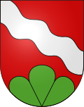
Ursenbach BE
| BE is the abbreviation for the canton of Bern in Switzerland and is used to avoid confusion with other entries of the name Ursenbach . |
| Ursenbach | |
|---|---|
| State : |
|
| Canton : |
|
| Administrative district : | Oberaargau |
| BFS no. : | 0344 |
| Postal code : | 4937 |
| Coordinates : | 625 412 / 220779 |
| Height : | 582 m above sea level M. |
| Height range : | 550–788 m above sea level M. |
| Area : | 9.17 km² |
| Residents: | 896 (December 31, 2018) |
| Population density : | 98 inhabitants per km² |
| Website: | www.ursenbach.ch |
|
Ursenbach BE |
|
| Location of the municipality | |
Ursenbach is a municipality in the Oberaargau administrative district in the canton of Bern in Switzerland .
In addition to the resident community, there is also an Evangelical Reformed church community and a civic community under the name Ursenbach .
geography
Ursenbach is located in Oberaargau in the Swiss Mittelland , where Öschenbach, Moosbach and Walterswilbach flow together to form the Ursenbach. The relatively short Ursenbach flows into the Langete at the northeastern municipal boundary . The neighboring communities are Madiswil , Rohrbachgraben , Walterswil , Oeschenbach and Ochlenberg . Ursenbach consists of a town center and many individual houses and the hamlets of Hirseren, Richisberg, Lünisberg and Hofen.
Attractions
photos
literature
- Max Jufer (Red.): The Aarwangen district and its communities . Published by the Aarwangen district and the 25 municipalities. Merkur, Langenthal 1991, ISBN 3-9070-1210-0 .
Web links
Commons : Ursenbach - Collection of images, videos and audio files
- Official website of the municipality of Ursenbach
- Anne-Marie Dubler : Ursenbach BE. In: Historical Lexicon of Switzerland .
Individual evidence
- ↑ Permanent resident population from STAT-TAB of the BfS , municipalities see also regional portraits 2020 on bfs.admin.ch, accessed on May 29, 2020


