
Aarwangen
| Aarwangen | |
|---|---|
 |
|
| State : |
|
| Canton : |
|
| Administrative district : | Oberaargau |
| BFS no. : | 0321 |
| Postal code : | 4912 |
| Coordinates : | 625062 / 232187 |
| Height : | 436 m above sea level M. |
| Height range : | 408-513 m above sea level M. |
| Area : | 9.90 km² |
| Residents: | 4561 (December 31, 2018) |
| Population density : | 461 inhabitants per km² |
| Mayor : | Kurt Bläuenstein ( FDP ) |
| Website: | www.aarwangen.ch |
 Aarwangen |
|
| Location of the municipality | |
  |
|
Aarwangen (in the local dialect : [ ɑrˈʋɑŋːgə ]) is a municipality in the Oberaargau administrative district in the canton of Bern in Switzerland .
geography
Aarwangen is located in Oberaargau in the Swiss plateau on both banks of the Aare, with by far the largest part of the municipality on the southern bank. The settlement structure consists of the village of Aarwangen with the districts Bleuerain, Riedgass, Hard, Farnere, Hof and Mumenthal as well as the hamlet Meiniswil. On the northern bank of the Aare, in the Schürhof district, there is a small bridgehead in the Aarwang area. Aarwangen Castle is south of the bridge.
The neighboring communities are Bannwil , Schwarzhäusern , Wynau , Roggwil , Langenthal and Thunstetten . Aarwangen developed next to Langenthal and the municipality of Herzogenbuchsee to the third largest municipality in Oberaargau. The agricultural and settlement area of the municipality of Aarwangen covers 599 hectares. The agricultural area is still cultivated by 29 farms today.
politics
Currently (as of 2019) the municipal council is composed as follows:
- Kurt Bläuenstein, community council president, FDP
- Thomas Beutler, Vice President of the Municipality / Municipal Council, SVP
- Gerda Graber, secretary
- Daniel Bader, SP
- Renate Klay Shillova, SP
- Remo Schär, FDP
- Gabriela Seiler, SVP
- Martin Winkelmann, SVP
traffic
From a traffic point of view, Aarwangen is well developed. The meter-gauge railway line of the former Langenthal-Jura-Bahn runs through Aarwangen , which is now operated by Aare Seeland mobil (ASm) and has several stops in the village. The following lines are used every half hour at rush hour, otherwise every hour:
- Aarwangen – Langenthal – St. Urban; with connection to Bern / Zurich in Langenthal
- Aarwangen – Niederbipp – Solothurn; with connection to Biel in Niederbipp and Solothurn
The A1 motorway junction 43 in Niederbipp can be reached in a good 10 minutes by car .
history
_p29_AARWANGEN.jpg)

Aarwangen was built on the right bank of the Aare at the river crossing on the way from Langenthal via Balsthal to Basel . The place name is attested in 1251 and in later copies of two documents from around 1200 / '25 as Arwangen . It is originally a composite field names with ahd. Wang , gently sloping meadow, Au, stockpile, Field, Plain, country 'as hindlimb .
Until the artificial roads were built in the 18th century and the railroad in the 19th century, the Aare River was a busy trading route . Aarwangen was the transshipment point for goods from western Switzerland and eastern Switzerland. Aarwangen already had a covered wooden bridge in the 16th century. The passage was secured by the castle and financed by a customs post. In the High Middle Ages, the border between Burgundians (in western Switzerland) and Alemanni (in eastern Switzerland) was near Aarwangen .
The municipal coat of arms is in black and silver. It corresponds to the seal of the Lords of Aarwangen . When they died out in 1341, the village and the rulers went to the Barons of Grünenberg (see the Grünenberg ruins in Melchnau ), who were also ministerials of the Habsburgs . In the 14th century, the city of Bern became a major regional power . When the Confederates snatched Aargau from the Habsburgs in 1415 , the Grünenbergers had to reorient themselves and finally sold the Aarwangen dominion to Bern in 1432.
This laid the foundation stone for the Landvogtei in Aarwangen Castle . It lasted until the end of the Bernese city-state in spring 1798. A total of 75 bailiffs resided in Aarwangen Castle, where their coats of arms still adorn a wall today.
In 1803, the canton of Bern was divided into administrative districts. Aarwangen became the district capital . Today the district court Aarwangen-Wangen has its seat in the castle.
Impressions

church
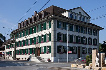
Local government

Kornhaus

Blue house

Farmhouse


fauna and Flora
The area around Aarwangen is the habitat of the dragonfly species Helmet-Azurjungfer, which is very rare in Switzerland . This location is part of the European nature network Smaragd . This extends over the numerous small streams that still occur in the community. These run u. a. in the fields between Aarwangen and Meiniswil and from there towards the Aare.
Personalities
- Jakob Egger (1821–1904), educator and school politician
- Gottfried Egger (1830–1913), brewery entrepreneur
- Heinz Egger (* 1937), Swiss illustrator and draftsman
- Thomas Lamparter (* 1978), world champion in the four-man bobsleigh
Attractions
Web links
- Official website of the municipality of Aarwangen
- Anne-Marie Dubler : Aarwangen (municipality). In: Historical Lexicon of Switzerland .
Individual evidence
- ↑ Permanent resident population from STAT-TAB of the BfS , municipalities see also regional portraits 2020 on bfs.admin.ch, accessed on May 29, 2020
- ↑ a b Gabrielle Schmid / Andres Kristol: Aarwangen BE (Aarwangen) in: Dictionnaire toponymique des communes suisses - Lexicon of Swiss community names - Dizionario toponomastico dei comuni svizzeri (DTS | LSG). Center de dialectologie, Université de Neuchâtel, Verlag Huber, Frauenfeld / Stuttgart / Vienna 2005, ISBN 3-7193-1308-5 and Éditions Payot, Lausanne 2005, ISBN 2-601-03336-3 , p. 74.
- ↑ Municipal Council. In: aarwangen.ch. Aarwangen municipal administration, accessed on September 18, 2019 .
Aarwangen | Attiswil | Exit | Bannwil | Berken | Bettenhausen | Bleienbach | Busswil near Melchnau | Eriswil | Farners | Gondiswil | Dig | Heimenhausen | Herzogenbuchsee | Huttwil | Inkwil | Langenthal | Lotzwil | Madiswil | Melchnau | Niederbipp | Niederönz | Oberbipp | Top stake | Ochlenberg | Oeschenbach | Reisiswil | Roggwil | Rohrbach | Rohrbachgraben | Rumisberg | Rütschelen | Black Houses | Seeberg | Foolish | Thunstetten | Ursenbach | Walliswil near Niederbipp | Walliswil near Wangen | Walterswil | Wangen an der Aare | Wangenried | Wiedlisbach | Wynau | Wyssachen
Former municipalities: Bollodingen | Gutenburg | Hermiswil | Kleindietwil | Leimiswil | Oberönz | Röthenbach near Herzogenbuchsee | Shear | Undercut wood | Wanzwil | Wolfisberg
Canton of Bern | Administrative districts of the canton of Bern | Municipalities of the Canton of Bern