Wetteren: Difference between revisions
Content deleted Content added
embed {{Authority control}} with wikidata information |
cat |
||
| Line 62: | Line 62: | ||
{{Authority control}} |
{{Authority control}} |
||
[[Category:Municipalities of East Flanders]] |
[[Category:Municipalities of East Flanders]] |
||
[[Category:Populated places in East Flanders]] |
|||
[[Category:Populated places in Belgium]] |
|||
{{EastFlanders-geo-stub}} |
{{EastFlanders-geo-stub}} |
||
Revision as of 12:57, 11 December 2015
Wetteren | |
|---|---|
 | |
| Country | |
| Community | Flemish Community |
| Region | Flemish Region |
| Province | East Flanders |
| Arrondissement | Dendermonde |
| Government | |
| • Mayor | Alain Pardaen (CD&V) |
| • Governing party/ies | CD&V, VLD |
| Area | |
| • Total | 37.02 km2 (14.29 sq mi) |
| Population (2018-01-01)[1] | |
| • Total | 25,477 |
| • Density | 690/km2 (1,800/sq mi) |
| Postal codes | 9230 |
| NIS code | 42025 |
| Area codes | 09 |
| Website | www.wetteren.be |
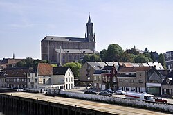
Wetteren (Dutch pronunciation: [ˈʋɛtərə(n)]) is a municipality located in the Belgian province of East Flanders. The municipality comprises the towns of Massemen, Westrem and Wetteren proper. On January 1, 2006, Wetteren had a total population of 23,209. The total area is 36.68 km² which gives a population density of 633 inhabitants per km².

Notable people
- Julien De Wilde (b. Wetteren, 7 January 1967), businessman
- Émile Pierre Joseph Storms (1846-1918) Explorer of Congo Free State, General
References
- ^ "Wettelijke Bevolking per gemeente op 1 januari 2018". Statbel. Retrieved 9 March 2019.
External links
 Media related to Wetteren at Wikimedia Commons
- Official website Template:Nl icon
- Chiro Overschelde Wetteren Liefkenshoek 24, Wetteren
- Scouts & Gidsen Vlaanderen Wetteren (St.-Jan) Groenstraat 33, Wetteren
- Scouts & Gidsen Vlaanderen Wetteren (Prins Boudewijn) Groene Wegel, Wetteren
- Chess Club De Wetterse Vrijpion Warandelaan 14, Wetteren


