
Židovice
| Židovice | |||||
|---|---|---|---|---|---|
|
|||||
| Basic data | |||||
| State : |
|
||||
| Region : | Královéhradecký kraj | ||||
| District : | Jičín | ||||
| Area : | 332 ha | ||||
| Geographic location : | 50 ° 18 ′ N , 15 ° 19 ′ E | ||||
| Height: | 237 m nm | ||||
| Residents : | 124 (Jan. 1, 2019) | ||||
| Postal code : | 507 32 - 507 33 | ||||
| traffic | |||||
| Street: | Jičín - Městec Králové | ||||
| structure | |||||
| Status: | local community | ||||
| Districts: | 1 | ||||
| administration | |||||
| Mayor : | Petr Berný (as of 2019) | ||||
| Address: | Židovice 7 507 32 Kopidlno |
||||
| Municipality number: | 573841 | ||||
| Website : | www.obeczidovice.cz | ||||


Židovice (German Schidowitz ) is a municipality in the Czech Republic . It is located 15 kilometers south of Jičín and belongs to the Okres Jičín .
geography
The place is located in the south of the Okres Jičín, on the district border to the Okres Nymburk . Neighboring towns are Vršce in the north, Slavhostice in the northeast, Žlunice in the east, Chroustov in the southeast, Dubečno and Nová Ves in the south, Chotěšice in the southwest, Běchárky in the west and Běchary in the northwest.
history
Židovice was first mentioned in 1361. After the end of patrimonial , Židovice became an independent municipality in the Jičin district and belonged to the Libáň judicial district . The inhabitants lived mainly from agriculture. On the southern outskirts there are remains of the former narrow-gauge railway line from Kopidlno to Češov .
Attractions
- Statue of St. John of Nepomuk in the village square.
Individual evidence
- ↑ Český statistický úřad - The population of the Czech municipalities as of January 1, 2019 (PDF; 7.4 MiB)

Židovice
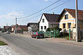
Main road

crossroads


