
Chaves (Portugal)
| Chaves | ||||||
|---|---|---|---|---|---|---|
|
||||||
| Basic data | ||||||
| Region : | Norte | |||||
| Sub-region : | Alto Tâmega | |||||
| District : | Vila Real | |||||
| Concelho : | Chaves | |||||
| Coordinates : | 41 ° 44 ′ N , 7 ° 28 ′ W | |||||
| Residents: | 41,243 (as of June 30, 2011) | |||||
| Surface: | 591.24 km² (as of January 1, 2010) | |||||
| Population density : | 70 inhabitants per km² | |||||
| Chaves County | ||||||
|
||||||
| Residents: | 41,243 (as of June 30, 2011) | |||||
| Surface: | 591.24 km² (as of January 1, 2010) | |||||
| Population density : | 70 inhabitants per km² | |||||
| Number of municipalities : | 39 | |||||
| administration | ||||||
| Administration address: | Município de Chaves Largo de Camões 5400-150 Chaves |
|||||
| President of the Câmara Municipal: | João Gonçalves Martins Batista ( PSD ) | |||||
| Website: | www.chaves.pt | |||||


Chaves is a city in Portugal and the second largest city in the Vila Real district . The city is twelve kilometers south of the Spanish border and 22 kilometers south of Verín . Vila Real can be reached 60 km south on the national road 02.
history

The city is of historical and strategic importance. An important Roman garrison was established here in the early days . In the 5th century , Hydatius was bishop of the city, which bore the Roman name Aquae Flaviae . During the Napoleonic invasion in the early 19th century, Chaves was a significant nest of resistance. Chaves appears twice as a battle site in the history of war: the battle of Chaves against the French troops in 1807 and the attack of the royalists in 1912.
Chaves was fortified early on. A medieval castle and the ruins of two fortresses, Forte São Francisco and Forte São Neutel , from the 17th century crown the city. The Roman bridge over the Tâmega with its stone arches is still standing and is one of the most important sights of the city. The thermal springs of Chaves have been known since Roman times and Chaves is still a water health resort today. In 1929 Chaves was promoted to town.
economy
Agriculture and services are the main industries in the region. The area of the Tâmegatal , known as the Veigatal , is very fertile. Potatoes, corn and vegetables are grown. Several quarries are in the area, as are mineral water wells near Vidago . Many residents of the area have emigrated to more northern Europe, particularly to France . In August the emigrants return to their villages and towns, so that the population of Chaves doubles.
administration
circle
Chaves is the seat of a district of the same name that borders Spain in the north . The neighboring districts are (starting clockwise in the north): Vinhais , Valpaços , Vila Pouca de Aguiar , Boticas and Montalegre .
With the regional reform in September 2013, several municipalities were merged into new municipalities, so that the number of municipalities decreased from 51 to 39.
The following parishes ( freguesias ) are in the Chaves county:

| local community | Population (2011) |
Area km² |
Density of population / km² |
LAU code |
|---|---|---|---|---|
| Águas Frias | 746 | 28.78 | 26th | 170301 |
| Anelhe | 476 | 12.49 | 38 | 170302 |
| Bustelo | 519 | 9.35 | 55 | 170305 |
| Calvão e Soutelinho da Raia | 503 | 28.36 | 18th | 170356 |
| Cimo de Vila da Castanheira | 479 | 16.42 | 29 | 170309 |
| Curalha | 469 | 7.82 | 60 | 170310 |
| Eiras, São Julião de Montenegro e Cela | 970 | 22.79 | 43 | 170355 |
| Ervededo | 646 | 20.21 | 32 | 170312 |
| Faiões | 873 | 8.09 | 108 | 170313 |
| Lama de Arcos | 316 | 13.69 | 23 | 170314 |
| Loivos e Póvoa de Agrações | 739 | 19.01 | 39 | 170357 |
| Madalena e Samaiões | 2,669 | 13.99 | 191 | 170354 |
| Mairos | 344 | 11.67 | 29 | 170316 |
| Moreiras | 273 | 9.23 | 30th | 170317 |
| Nogueira da Montanha | 529 | 16.67 | 32 | 170318 |
| Oura | 602 | 14.51 | 41 | 170320 |
| Outeiro Seco | 938 | 15.21 | 62 | 170321 |
| Paradela | 262 | 8.22 | 32 | 170322 |
| Planalto de Monforte | 299 | 18.98 | 16 | 170353 |
| Redondelo | 527 | 18.71 | 28 | 170324 |
| Sanfins | 236 | 17.69 | 13 | 170327 |
| Santa Cruz / Trindade e Sanjurge | 3,430 | 13.38 | 256 | 170358 |
| Santa Leocádia | 324 | 13.10 | 25th | 170329 |
| Santa Maria Maior | 12,019 | 5.63 | 2.134 | 170350 |
| Santo Antonio de Monforte | 454 | 11.78 | 39 | 170330 |
| Santo Estêvão | 607 | 8.67 | 70 | 170331 |
| Sao Pedro de Agostém | 1,419 | 26.70 | 53 | 170333 |
| Sao Vicente | 227 | 31.26 | 7th | 170334 |
| Soutelo e Seara Velha | 515 | 18.12 | 28 | 170359 |
| Travancas e Roriz | 566 | 21.86 | 26th | 170360 |
| Tronco | 218 | 8.54 | 26th | 170340 |
| Vale de Anta | 1,543 | 10.18 | 152 | 170341 |
| Vidago | 1.991 | 24.57 | 81 | 170361 |
| Vila Verde da Raia | 993 | 9.77 | 102 | 170343 |
| Vilar de Nantes | 2,084 | 7.28 | 286 | 170344 |
| Vilarelho da Raia | 558 | 18.03 | 31 | 170345 |
| Vilas Boas | 195 | 6.86 | 28 | 170347 |
| Vilela do Tâmega | 409 | 9.61 | 43 | 170349 |
| Vilela Seca | 276 | 14.01 | 20th | 170348 |
| Chaves County | 41,243 | 591.24 | 70 | 1703 |
Town twinning
-
 Mozambique : Nampula (since 2000)
 -
 Guinea-Bissau : Bafatá (since 2001)
 -
 Luxembourg : Differdange (since 2003)
 -
 France : Talence (since 2005)
Population development
| Population in Chaves County (1801–2011) | |||||||||
|---|---|---|---|---|---|---|---|---|---|
| 1801 | 1849 | 1864 | 1900 | 1930 | 1960 | 1981 | 1991 | 2001 | 2011 |
| 31,651 | 17,356 | 31,815 | 36,781 | 40,702 | 57,243 | 45,883 | 40,940 | 43,667 | 41,444 |
sons and daughters of the town
- José Celestino da Silva (1849–1911), officer and colonial administrator, 1894–1908 Governor of Portuguese Timor
- Manuel Maria Coelho (1857–1943), officer, politician and Prime Minister of the First Republic
- António Joaquim Granjo (1881–1921), lawyer and politician
- Francisco da Costa Gomes (1914–2001), Marshal and President of Portugal
- Nadir Afonso (1920–2013), painter and architect
- Carlos Vieira Reis (* 1935), doctor and author
- Fernando Pascoal das Neves , (called: Pavão) (1947–1973), football player
- Fernando Pereira (1950–1985), photographer and Greenpeace activist
- João Alves (* 1980), football player
- Pedro Gonçalves (* 1998), football player
Sports
The city is home to the football club GD Chaves , which currently plays in the Primeira Liga .
Culinary specialties

Pastel de Chaves (confectionery)

Presunto de Chaves (ham)
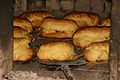
Folar de Chaves (pastries)

Pão de Chaves (bread)


literature
- Thomas G. Schattner (Ed.): Archaeological guide through Portugal (= cultural history of the ancient world . Vol. 74). Philipp von Zabern, Mainz 1998, ISBN 3-8053-2313-1 p. 77
Web links
swell
- ↑ a b www.ine.pt - indicator resident population by place of residence and sex; Decennial in the database of the Instituto Nacional de Estatística
- ↑ a b Overview of code assignments from Freguesias on epp.eurostat.ec.europa.eu
- ^ Publication of the administrative reorganization in the Diário da República gazette of January 28, 2013, accessed on March 16, 2014
- ↑ www.anmp.pt , accessed December 30, 2012
