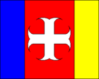
Avelgem
| Avelgem | ||
|---|---|---|

|

|
|
|
|
||
| State : |
|
|
| Region : | Flanders | |
| Province : | West Flanders | |
| District : | Kortrijk | |
| Coordinates : | 50 ° 46 ′ N , 3 ° 26 ′ E | |
| Area : | 21.75 km² | |
| Residents: | 10,158 (Jan 1, 2019) | |
| Population density: | 467 inhabitants per km² | |
| Post Code: | 8580-8583 | |
| Prefix: | 056 | |
| Mayor: | Lieven Vantieghem ( CD&V ) | |
Local government address : |
Gemeentehuis Kortrijkstraat 8 8580 Avelgem |
|
| Website: | www.avelgem.be | |
Avelgem is a municipality in the province of West Flanders in Belgium . It is located on the Scheldt and has 10,158 inhabitants (as of January 1, 2019). It consists of the main town Avelgem and the districts Bossuit , Kerkhove , Outrijve and Waarmaarde .
Ronse is 11 kilometers east, Kortrijk 13 km west-northwest, Oudenaarde 14 km northeast, Ghent 35 km northeast and Brussels 64 km east (all information as the crow flies from the core to the respective city centers).
The next motorway exits are in the west at Kortrijk-Oost and Deerlijk on the A14 / E17 and in the south-west at Dottignies on the A17 .
The nearest regional train stations are in Kortrijk, Ronse and Oudenaarde , and national express trains stop in Ghent and Brussels.
There is an international airport near the capital, Brussels.
Town twinning
Sons and daughters of the church
- Gérard Favere (1903–1975), composer and conductor
- Ulrich Libbrecht (1928–2017), philosopher and author
- Jaak Vandemeulebroucke (* 1943), politician
- Marc Demeyer (1950–1982), racing cyclist

