
Bünzen AG
| AG is the abbreviation for the canton of Aargau in Switzerland and is used to avoid confusion with other entries of the name Bünzen . |
| Coins | |
|---|---|
 |
|
| State : |
|
| Canton : |
|
| District : | Muri |
| BFS no. : | 4229 |
| Postal code : | 5624 |
| Coordinates : | 666 955 / 240374 |
| Height : | 442 m above sea level M. |
| Height range : | 425–484 m above sea level M. |
| Area : | 5.78 km² |
| Residents: | 1104 (December 31, 2019) |
| Population density : | 191 inhabitants per km² |
|
Proportion of foreigners : (residents without citizenship ) |
16.5% (December 31, 2019) |
| Website: | www.buenzen.ch |
 Bünzen from the west |
|
| Location of the municipality | |
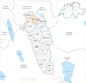  |
|
Bünzen ( Swiss German : ˈbʏntsə ) is a municipality in the Swiss canton of Aargau . It belongs to the Muri district and is located in the upper Bünztal . In 1940 Waldhäusern was incorporated.
geography
Bünzen is located on the Bünz , a partially canalized river that flows in a north-westerly direction. The village itself is located in the very south of the municipality and has almost merged with Boswil . More than two kilometers north is at 433 m above sea level. M. the village of Waldhäusern . The Wagenrain , a wooded ridge that forms the natural border with the Reuss Valley , extends to the northeast . The center of the village is at the end of a moraine that protrudes into the otherwise largely flat plain.
The area of the municipality is 578 hectares , of which 166 hectares are forested and 63 hectares are built over. The highest point is at 478 m above sea level. M. in Hüslirain northeast of Waldhäusern, the deepest at 426 m above sea level. M. at the Bünz. Neighboring communities are Bremgarten in the northeast, Besenbüren in the east, Boswil in the south and west and Waltenschwil in the northwest.
history
The area around Bünzen was already settled during the Neolithic Age. Around 14,000 years ago there was a lake 2.2 kilometers long, 1.5 kilometers wide and up to 4 meters deep, on the banks of which hunters and fishermen lived. This lake then silted up around 8,000 years ago and was displaced by a moor that shaped the landscape well into the 19th century.
Bunzina was first mentioned in a document in 1259. The name comes from the Latin Pontina and means "bridge place". The residents of Bünzen were subject to the Lords of Reussegg (near Sins ). However, they accumulated large debts and had to sell their property to the Muri monastery in 1321 , which also took over the lower jurisdiction . The residents of Waldhäusern, on the other hand, were free farmers and had their own property. The sovereignty and the high level of jurisdiction were in the hands of the Habsburgs .

In 1415 the Swiss conquered Aargau, and from then on Bünzen was part of the Hermetschwil Office in the Free Offices , a common rule ; Forest houses belonged to the Boswil office . In 1529 the inhabitants of both villages converted to the Reformation . However, this was reversed in 1531 after the Second Kappel War .
In March 1798 the French took Switzerland and proclaimed the Helvetic Republic . Bünzen was initially a municipality in the Muri district of the short-lived canton of Baden , while Waldhäusern belonged to the Sarmenstorf district . In 1803 both communities came to the newly founded canton of Aargau. The landscape changed completely in the second half of the 19th century. After the peat had been exploited, the swamps on the Bünz were drained and made available for agriculture .
In 1940, the Great Council decided to forcibly merge the community of Waldhäusern, which at that time had almost 130 residents, with Bünzen, after the closer Waltenschwil had successfully resisted taking over the impoverished community. Nevertheless, the population of Bünzen fell slightly in the following decades. However, it has increased by almost half since 1980.
Attractions

As a replacement for a church built at the beginning of the 16th century and demolished because it was too small, the parish decided to build a new one in 1850. The well-known architect Joseph Caspar Jeuch was awarded the contract to design the new St. Georg parish church . The inauguration of this neo-Gothic hall church took place on October 26, 1862.
coat of arms
The blazon of the municipal coat of arms reads: "In white over a blue river torn green beech." The oldest representation of the coat of arms dates from 1734, whereby the tree was modeled on a beech. The municipal seal of 1811 also showed a beech tree. The stylized form used today was introduced in 1955.
population
The number of inhabitants developed as follows (until 1930 without forest houses) :
| year | 1749 | 1803 | 1850 | 1900 | 1930 | 1950 | 1960 | 1970 | 1980 | 1990 | 2000 | 2010 |
| Residents | 205 | 352 | 440 | 474 | 693 | 759 | 782 | 718 | 683 | 850 | 865 | 1'009 |
On December 31, 2019, 1,104 people lived in Bünzen, the proportion of foreigners was 16.5%. In the 2015 census, 52.9% described themselves as Roman Catholic and 21.2% as Reformed ; 25.9% were non-denominational or of other faiths. In the 2000 census, 93.4% stated German as their main language, 1.5% Italian , 1.0% Serbo-Croatian and 0.8% each of French and Albanian .
photos

Forest houses

Ensign house in forest houses

Freienhof
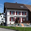
Residential building Dorfstrasse 4

Chapel of the Holy Helpers

At the Bünz
_106.jpg)


Politics and law
The assembly of those entitled to vote, the municipal assembly , exercises legislative power. The executing authority is the five-member municipal council . He is elected by the people in the majority procedure, his term of office is four years. The parish council leads and represents the parish. To this end, it implements the resolutions of the municipal assembly and the tasks assigned to it by the canton. The District Court of Muri is primarily responsible for legal disputes . Bünzen belongs to the Friedensrichterkreis XIII (Muri).
economy
According to the corporate structure statistics (STATENT) collected in 2015, Bünzen has around 260 jobs, 21% of them in agriculture, 32% in industry and 47% in the service sector. Among other things, packaging machines, roller shutters and orthopedic devices are manufactured. The majority of those in employment are commuters and work in the surrounding communities.
traffic
Although the village is away from through traffic, it is well developed in terms of traffic. Hauptstrasse 25 runs around one kilometer to the west between Lenzburg and Sins . Side roads lead to Wohlen and Rottenschwil . A post bus line runs from Wohlen train station via Waldhäusern and Bünzen to Muri . About one kilometer southwest of the train station is Bünzen Boswil-Bünzen at the SBB -distance Aarau - Arth-Goldau .
education
The community has a kindergarten . The primary school is run as the Bünz district school, with two school locations in Bünzen and Besenbüren. The secondary school and the Realschule can be attended in Boswil , the district school in Muri . The closest grammar school is the Cantonal School in Wohlen .
Personalities
- Carl Roman Abt (1850–1933), designer of rack railways
- Heinrich Eugen Abt (1854–1937), National Councilor and agricultural politician
- Heinrich Roman Abt (1883–1942), National Councilor
- Martin Rosenberg (1908–1976), journalist and party manager
literature
- Anton Wohler: Bünzen. In: Historical Lexicon of Switzerland .
- Georg Germann : The art monuments of the canton Aargau . Ed .: Society for Swiss Art History . Volume V: The Muri District. Birkhäuser Verlag, Basel 1967, DNB 457321970 .
Web links
Individual evidence
- ↑ Cantonal population statistics 2019. Department of Finance and Resources, Statistics Aargau, March 30, 2020, accessed on April 2, 2019 .
- ↑ Cantonal population statistics 2019. Department of Finance and Resources, Statistics Aargau, March 30, 2020, accessed on April 2, 2019 .
- ↑ a b Beat Zehnder: The community names of the canton of Aargau . In: Historical Society of the Canton of Aargau (Ed.): Argovia . tape 100 . Verlag Sauerländer, Aarau 1991, ISBN 3-7941-3122-3 , p. 117-118 .
- ^ National map of Switzerland, sheet 1110, Swisstopo.
- ↑ Standard area statistics - municipalities according to 4 main areas. Federal Statistical Office , November 26, 2018, accessed on May 10, 2019 .
- ^ Germann: The art monuments of the Canton of Aargau, Volume V: District of Muri.
- ^ Joseph Galliker, Marcel Giger: Municipal coat of arms of the Canton of Aargau . Lehrmittelverlag des Kantons Aargau, book 2004, ISBN 3-906738-07-8 , p. 135 .
- ↑ Population development in the municipalities of the Canton of Aargau since 1850. (Excel) In: Eidg. Volkszählung 2000. Statistics Aargau, 2001, archived from the original on October 8, 2018 ; accessed on May 8, 2019 .
- ^ Church in numbers. Bünzen municipality, December 31, 2018, accessed on May 10, 2019 .
- ↑ Resident population by religious affiliation, 2015. (Excel) In: Population and Households, Community Tables 2015. Statistics Aargau, accessed on May 10, 2019 .
- ↑ Swiss Federal Census 2000: Economic resident population by main language as well as by districts and municipalities. (Excel) Statistics Aargau, archived from the original on August 10, 2018 ; accessed on May 8, 2019 .
- ↑ circles of justice of the peace. Canton of Aargau, accessed on June 20, 2019 .
- ↑ Statistics of the corporate structure (STATENT). (Excel, 157 kB) Statistics Aargau, 2016, accessed on May 8, 2019 .
Abtwil | Aristau | Auw | Beinwil (Freiamt) | Besenbüren | Bettwil | Boswil | Coins | Buttwil | Dietwil | Geltwil | Kallern | Merenschwand | Mühlau | Muri | Oberrüti | Rottenschwil | Sins | Waltenschwil
Former municipality: Benzenschwil | Forest houses | Will
Canton of Aargau | Districts of the Canton of Aargau | Municipalities in the Canton of Aargau