
Merenschwand
| Merenschwand | |
|---|---|
 |
|
| State : |
|
| Canton : |
|
| District : | Muri |
| BFS no. : | 4234 |
| Postal code : | 5634 Merenschwand 5636 Benzenschwil |
| UN / LOCODE : | CH MSD |
| Coordinates : | 670 864 / 234699 |
| Height : | 393 m above sea level M. |
| Height range : | 379-549 m above sea level M. |
| Area : | 13.51 km² |
| Residents: | 3616 (December 31, 2019) |
| Population density : | 268 inhabitants per km² |
|
Proportion of foreigners : (residents without citizenship ) |
19.2% (December 31, 2019) |
| Website: | www.merenschwand.ch |
 |
|
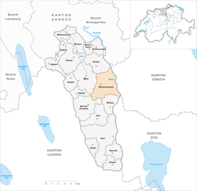
| Location of the municipality | |
  |
|
Merenschwand ( Swiss German : ˈmɛriˌʃʋɑnt ) is a municipality in the Swiss canton of Aargau . It belongs to the Muri district and is located in the Reuss Valley on the border with the cantons of Zurich and Zug . The district of Benzenschwil to the south-west was an independent municipality from 1813 to 2011.
geography
_kaj_Obfelden_218.jpg)
The community consists of several settlements. The main settlement of Merenschwand is on the edge of the wide Reuss plain , around one and a half kilometers west of the river on the southernmost foothills of the Wagenrain , which separates the Reuss and Bünztal valleys . To the southwest of it lies the second largest district, Benzenschwil ( 459 m above sea level ) on the foothills of the Lindenberg . To the east of Merenschwand lies the third largest district, Rickenbach, on the river, with an industrial zone in between. One kilometer north of Merenschwand is Unterrüti, about one and a half kilometers east-southeast of the hamlet of Hagnau (directly on the Reuss).
The terrain is predominantly characterized by the completely flat alluvial plain of the Reuss, which used to meander here , often overflowing its banks and flooding the fields. Since the last stage of the improvement in the 1970s, the course of the Reuss has been straightened and completely delimited by flood protection dams. In the south-west the terrain rises steeply towards Benzenschwil and then turns into undulating terrain. The municipality is traversed by the Wissenbach from southwest to northeast . This rises on Lindenberg, runs shortly after Benzenschwil through a ravine , then enters the Reuss plain and finally flows into the Reuss Canal. The man-made canal runs along the Reuss at a distance of 20 to 250 meters and drains the plain, which has numerous ponds , moats and swamps . A large part of the plain is under nature protection and thus offers habitat for threatened animal and plant species. The protected area of national importance is over 100 hectares in size.
The area of the municipality is 1351 hectares, of which 197 hectares are forested and 169 hectares are built over. The highest point is at 550 m above sea level. M. on the western boundary of the municipality, the deepest at 383 m above sea level. M. on the Reuss. Neighboring communities in the canton of Aargau are Aristau in the north, Muri and Geltwil in the west, Beinwil (Freiamt) in the southwest and Mühlau in the south. Merenschwand borders in the east on the municipalities of Ottenbach and Obfelden in the canton of Zurich and in the southeast on the municipality of Hünenberg in the canton of Zug .
history
Between Hagnau and the hamlet of Schoren, which belongs to Mühlau, a grave from the early Bronze Age (approx. 1500 to 1800 BC) was discovered during construction work for a high-voltage line . From the Late Bronze Age around 800 BC A small settlement comes from the 4th century BC and was discovered near Unterrüti during peat extraction in 1944 ; this settlement was on the bank of a lake that no longer exists today. The Alemanni settled in the 8th century. The smaller hamlets were built up to the 12th century, as were the oldest parts of today's parish church. Meriswanden was first mentioned in a document in 1189. The place name comes from the Old High German (ze) Merinswantun and means "during the clearing of the Mero".
The Lords of Hünenberg acquired Merenschwand from the Counts of Homberg in 1293. They added the village to their small territory between Lake Zug and Lake Lucerne and exercised both lower and blood jurisdiction . The monasteries of Muri and Frauenthal were also important landlords . After the Battle of Sempach in 1386, when the Hünenbergers fought on the side of the defeated Habsburgs , the city of Lucerne rose to become the dominant power in the region. The residents of Benzenschwil , Merenschwand and Mühlau bought themselves out of the Hünenbergers in 1394 and voluntarily submitted to the rule of Lucerne. Although they were not on an equal footing with the townspeople, they had more rights than the other Lucerne subjects. They were allowed to choose the judges and subordinates themselves and enjoyed tax privileges.
In 1415 the Lucerne people conquered the neighboring Habsburg office of Meienberg , which they had to return to the common property of the Confederates in 1425. Merenschwand was again a Lucerne exclave , separated by the common rule of the free offices . In 1426 there was talk of an office in Merenschwand for the first time. The following centuries were mainly characterized by frequent flooding of the Reuss. The residents of the office were obliged, among other things, to maintain the protective dams. In the 18th century, Lucerne felt less and less bound by the old treaties and led an increasingly authoritarian regime. This resulted in a minor revolt in 1765, which was quickly suppressed.

In March 1798 the French took Switzerland and proclaimed the Helvetic Republic . The Merenschwand office was now an exclave of the Hochdorf district in the canton of Lucerne . With Merenschwand (including Rickenbach), Benzenschwil (including Unterrüti) and Mühlau, three agencies were created. In October 1802 the Merenschwand office joined the canton of Zug on its own initiative , until Napoleon Bonaparte decided to join the canton of Aargau in February 1803. The large community did not last long and disintegrated: Mühlau separated in 1810, Benzenschwil followed in 1813. The remaining area was also divided into the three local citizenships Merenschwand, Unterrüti (with Hagnau and Rickenbach) and Schoren-Kestenberg. Although these formed a political unit, they were autonomous in the areas of streets, schools and the poor.
Over time, the Catholic residents of the Freiamt felt more and more oppressed by the Aargau government, which was dominated by the Reformed. Several petitions calling for a lower tax burden went unheard in 1830. Finally, Johann Heinrich Fischer , member of the Grand Council and landlord of the Schwanen Inn, called for the Freiämtersturm . On December 6, 1830, the insurgents first moved to Wohlen , where 6,000 armed men gathered, and then to Aarau, the capital of the canton . Government forces did not offer any resistance and the government was overthrown. The constitution, which was then revised, was not in the interests of the conservative free offices because the liberal forces from the reformed part of the canton were able to enforce their demands.
After the Baden Articles were passed in 1835 and during the unrest that preceded the Aargau monastery dispute of 1841, Merenschwand was under military occupation. During the Sonderbund War , on November 12, 1847, a battle broke out on the Reuss near Rickenbach between the troops of the Sonderbund and the Confederation. From 1867 the residents of the local citizenship of Schoren-Kestenberg demanded the separation from Merenschwand. The connection to Mühlau could only be completed in 1879 after numerous complaints and appeals. The local citizenship of Unterrüti dissolved in 1914 and merged with the municipality of Merenschwand.
A major concern was the taming of the free-flowing Reuss, which often overflowed its banks. The drainage canal along the river was completed in 1861, and the drainage of the plain was completed by 1863. Nevertheless, in the following decades there were repeated dam breaks and floods. Only the second Reuss valley renovation from 1972 to 1983 finally solved the problem. Almost 14 km of new dams and around 36 km of drainage channels were built, and the new Zufikon power plant created a backwater and thus a slower flow rate.
In 1864 two bridges were built over the Reuss, which replaced the centuries-old ferries . The Aargauische Südbahn was opened in 1881, but it only touched the Merenschwander municipality far to the southwest. Several projects for a narrow-gauge railway between Muri and Affoltern am Albis failed. Merenschwand remained largely agricultural until well into the 20th century. From 1950 industrial companies settled here and the population showed a slight upward trend. Since 1990, the community has been characterized by brisk construction activity due to its proximity to the cities of Lucerne , Zurich and Zug ; the population has increased by more than half in just under 15 years.
On January 1, 2012, Benzenschwil reunited with Merenschwand. After the municipal assemblies had passed a resolution in December 2008, it was confirmed at the ballot box on February 8, 2009. In Merenschwand, 597 voters spoke out in favor of the merger, 212 were against.
Attractions


The parish church of St. Vitus was first mentioned in a document in 1245, the foundation walls of the church tower date from the 12th century. The church was rebuilt around 1500; the Gothic style choir has been preserved from this period . Under the direction of the St. Gallen architect August Hardegger , the nave was completely rebuilt and expanded in the neo-Gothic style from 1897 to 1899 . The chaplaincy adjacent to the north originally dates from 1491 and was rebuilt in the late Gothic style in 1774. The Wendelinskapelle stands in the hamlet of Hagnau and the Mariahilfkapelle in the hamlet of Unterrüti .
The most important secular building is the Schwanen inn . The two-story building with a hipped gable roof and two mighty roof extensions dates from 1615; the upper part was rebuilt in 1681. Until 1798 the inn was the official and court house of the Lucerne office of Merenschwand. In 1830 the Freiämtersturm began here under Johann Heinrich Fischer, the innkeeper at the time.
The local museum is housed in the 17th century Postlonzihus . The last subordinate of Merenschwand lived here. The name comes from the 1870s, when Leonz Burkart ran the post office here in addition to his agricultural business.
coat of arms
The blazon of the municipal coat of arms reads: "In blue on a green hill, white, yellow armored swan, holding its protruding beak over two black cattails with green leafed stems." The municipality and the Merenschwand office have had the white swan in their coat of arms since 1518, in memory of the heraldic animal of the Lords of Hünenberg. The cattails were added in 1533. In the course of time, several graphic variants existed. The current depiction dates from 1955. Benzenschwil continues its former municipal coat of arms as the village coat of arms.
population
The population developed as follows:
| year | 1798 | 1850 | 1900 | 1930 | 1950 | 1960 | 1970 | 1980 | 1990 | 2000 | 2010 |
| Residents | 618 | 1,212 | 1'230 | 1'190 | 1,196 | 1,266 | 1,351 | 1,418 | 1'519 | 2,171 | 2,617 |
The following statistical information includes Benzenschwil.
On December 31, 2019, 3,616 people lived in Merenschwand, the proportion of foreigners was 19.2%. In the 2015 census, 53.3% described themselves as Roman Catholic and 14.8% as Reformed ; 31.9% were non-denominational or of other faiths. 91.4% said German as their main language in the 2000 census , 3.7% Albanian , 1.6% Serbo-Croatian , 0.7% Italian and 0.6% Portuguese .
Politics and law
The assembly of those entitled to vote, the municipal assembly , exercises legislative power. The executing authority is the five-member municipal council . He is elected by the people in the majority procedure, his term of office is four years. The parish council leads and represents the parish. To this end, it implements the resolutions of the municipal assembly and the tasks assigned to it by the canton. The District Court of Muri is primarily responsible for legal disputes . Merenschwand belongs to the Friedensrichterkreis XIII (Muri).
economy
According to the company structure statistics (STATENT) collected in 2015, there are around 100 jobs in Merenschwand, of which 8% are in agriculture, 57% in industry and 35% in the service sector. The local companies are mainly active in the construction and wood industry, metal processing, plastics production and medical technology. There are also more than 30 farms. A large number of employees are commuters and work in the Muri region or in the agglomerations of Lucerne , Zurich and Zug .
traffic
Merenschwand is on Kantonsstrasse 296 between Bremgarten and Sins , Kantonsstrasse 349 branches off here and leads over the Reuss to Obfelden . In the very north of the municipality, but without a direct road connection, is the second Reuss bridge between Birri and Ottenbach . Main road 25 runs west of Benzenschwil between Lenzburg and Zug . Since November 2009 there has been a motorway exit from the A4 near Affoltern am Albis , making the community easier to reach.
Merenschwand is served by a post bus line between the Muri and Affoltern am Albis stations , Benzenschwil has a stop on the Lenzburg - Rotkreuz railway line ( Aargauische Südbahn ). On weekends there is a night bus from Zug via Sins and Muri to Mühlau . There is no direct public transport connection between the districts of Merenschwand and Benzenschwil.
education
The community has three school complexes with kindergarten , primary school , secondary school and junior high school . The district school can be attended in Muri . The closest grammar school is the Cantonal School in Wohlen .
Personalities
- René Aebischer (1941–2012), politician
- Johann Heinrich Fischer (1790–1861), politician, landlord, leader of the Freiämtersturm
- Leonz Fischer (1874–1953), National Councilor
- Gottlieb Käppeli (1840–1909), Councilor
- Doris Leuthard (* 1963), Federal Councilor
- Leonz Leuthard (1925–2016), politician
- Albert Räber (1901–1990), politician
literature
- Dominik Sauerländer: Merenschwand. In: Historical Lexicon of Switzerland .
- Georg Germann : The art monuments of the canton Aargau . Ed .: Society for Swiss Art History . Volume V: The Muri District. Birkhäuser Verlag, Basel 1967, DNB 457321970 .
- Dominik Sauerländer: The history of the Merenschwand office. Economic and social history of a Lucerne bailiff from the beginning up to 1798 . Baden-Verlag, Baden 1999, ISBN 978-3-85545-124-1 .
- Hugo Müller: History of the Merenschwand community since 1798 . Ed .: Resident and local community of Merenschwand. Merenschwand 1993.
Web links
Individual evidence
- ↑ Cantonal population statistics 2019. Department of Finance and Resources, Statistics Aargau, March 30, 2020, accessed on April 2, 2019 .
- ↑ Cantonal population statistics 2019. Department of Finance and Resources, Statistics Aargau, March 30, 2020, accessed on April 2, 2019 .
- ↑ a b Beat Zehnder: The community names of the canton of Aargau . In: Historical Society of the Canton of Aargau (Ed.): Argovia . tape 100 . Verlag Sauerländer, Aarau 1991, ISBN 3-7941-3122-3 , p. 270-271 .
- ↑ a b National map of Switzerland, sheet 1110, Swisstopo.
- ↑ Standard area statistics - municipalities according to 4 main areas. Federal Statistical Office , November 26, 2018, accessed on May 10, 2019 .
- ↑ Amalgamation of the municipalities of Benzenschwil and Merenschwand to form the municipality of Merenschwand. (PDF, 48 kB) Grand Council (Aargau) , April 29, 2009, archived from the original on April 28, 2016 ; Retrieved August 13, 2012 .
- ^ A b Germann: The art monuments of the Canton of Aargau, Volume V: District of Muri.
- ^ Joseph Galliker, Marcel Giger: Municipal coat of arms of the Canton of Aargau . Lehrmittelverlag des Kantons Aargau, book 2004, ISBN 3-906738-07-8 , p. 213 .
- ↑ Population development in the municipalities of the Canton of Aargau since 1850. (Excel) In: Eidg. Volkszählung 2000. Statistics Aargau, 2001, archived from the original on October 8, 2018 ; accessed on May 8, 2019 .
- ↑ Resident population by religious affiliation, 2015. (Excel) In: Population and Households, Community Tables 2015. Statistics Aargau, accessed on May 10, 2019 .
- ↑ Swiss Federal Census 2000: Economic resident population by main language as well as by districts and municipalities. (Excel) Statistics Aargau, archived from the original on August 10, 2018 ; accessed on May 8, 2019 .
- ↑ circles of justice of the peace. Canton of Aargau, accessed on June 20, 2019 .
- ↑ Statistics of the corporate structure (STATENT). (Excel, 157 kB) Statistics Aargau, 2016, accessed on May 8, 2019 .
Abtwil | Aristau | Auw | Beinwil (Freiamt) | Besenbüren | Bettwil | Boswil | Coins | Buttwil | Dietwil | Geltwil | Kallern | Merenschwand | Mühlau | Muri | Oberrüti | Rottenschwil | Sins | Waltenschwil
Former municipality: Benzenschwil | Forest houses | Will
Canton of Aargau | Districts of the Canton of Aargau | Municipalities in the Canton of Aargau