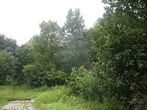
Borner Moor
|
Borner Moor nature reserve
|
||
|
Borner Moor |
||
| location | Northeast Lehnstedt in Lower Saxony Cuxhaven | |
| surface | 92.0 ha | |
| Identifier | NSG LÜ 094 | |
| WDPA ID | 162503 | |
| Geographical location | 53 ° 19 ' N , 8 ° 37' E | |
|
|
||
| Sea level | from 1 m to 16 m | |
| Setup date | June 16, 1984 | |
| administration | NLWKN | |
The Borner Moor is a nature reserve in the Lower Saxony municipality of Hagen in Bremen in the district of Cuxhaven .
The nature reserve with the sign NSG LÜ 094 is 92 hectares in size. The area has been a nature reserve since June 16, 1984. The responsible lower nature conservation authority is the district of Cuxhaven.
The former high moor lies between Hagen in the Bremen region and Uthlede. It borders directly on the A27 and is almost entirely to the west of it. During the construction of the motorway it was used as a rinsing area. The bog vegetation was largely destroyed by the fine sediment that covered the bog. The protection should u. a. ensure that the moor can develop again. Furthermore, the protected status secures the area for succession studies.
In the south, the nature reserve borders on the Kuhfleth, which drains the area over the Aschwarder flood ditch to the Weser.


