Wanhödener Moor
|
Wanhödener Moor
|
||
| location | East of Wanhöden in Lower Saxony Cuxhaven | |
| surface | 39.0 ha | |
| Identifier | NSG LÜ 145 | |
| WDPA ID | 166167 | |
| Geographical location | 53 ° 45 ' N , 8 ° 42' E | |
|
|
||
| Sea level | from 1 m to 6 m | |
| Setup date | July 16, 1986 | |
| administration | NLWKN | |
The Wanhödener Moor is a nature reserve in the Lower Saxony municipality of Wurster North Sea Coast in the district of Cuxhaven .

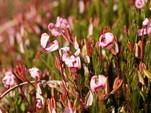
The nature reserve with the sign NSG LÜ 145 is 39 hectares in size. It is located east of Wanhöden in the Westerwannaer Moorgeest. The nature reserve puts the rest of a drained raised bog area under protection, most of which has been peated . A part of the moor has remained uncultivated, the peripheral areas have been cultivated extensively as grassland that is extensively managed. On uncultivated land to grow birches and pines , partially offset by Entkusselung be pushed back to open spaces to provide for marsh vegetation.
The area is drained via trenches and the Wanna / Wanhöden border trench, which also borders the area to the east, to the Emmelke , a tributary of the Medem .
The area has been a nature reserve since July 16, 1986. The responsible lower nature conservation authority is the district of Cuxhaven.


