
Brandenberg (Tyrol)
|
Brandenberg
|
||
|---|---|---|
| coat of arms | Austria map | |
 |
|
|
| Basic data | ||
| Country: | Austria | |
| State : | Tyrol | |
| Political District : | Kufstein | |
| License plate : | KU | |
| Surface: | 130.02 km² | |
| Coordinates : | 47 ° 30 ' N , 11 ° 53' E | |
| Height : | 919 m above sea level A. | |
| Residents : | 1,526 (January 1, 2020) | |
| Postal code : | 6234 | |
| Area code : | 05331 | |
| Community code : | 7 05 04 | |
| NUTS region | AT335 | |
| Address of the municipal administration: |
Brandenberg 8 b 6234 Brandenberg |
|
| Website: | ||
| politics | ||
| Mayor : | Hannes Neuhauser ( LUB ) | |
|
Municipal Council : (2016) (13 members) |
||
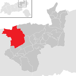
| Location of Brandenberg in the Kufstein district | ||
  |
||

|
||
| Source: Municipal data from Statistics Austria | ||

Brandenberg is a municipality with 1526 inhabitants (as of January 1, 2020) in Tyrol . It consists of the village of Brandenberg and the district of Aschau further to the north, was first mentioned in 1140 and has been an independent community since the beginning of the 19th century.
geography
Brandenberg is located in the valley of the Brandenberger Ache in the judicial district of Rattenberg and borders the Free State of Bavaria in Germany in the north.
Community structure
The municipality consists of the only cadastral municipality Brandenberg and comprises the following two localities (residents as of January 1, 2020)
- Aschau (371)
- Brandenberg (1155)
|
structure
|
||||||
|
Legend for the breakdown table
|
Neighboring communities
Three of the seven neighboring communities are in the Kufstein district, two in the Schwaz district (SZ) and two in the Miesbach district (MB) in Bavaria.
| Steinberg am Rofan (SZ) | Kreuth and Rottach-Egern (MB) | Thiersee |
| Achenkirch (SZ) |
.svg)
|
|
| Kramsach | Breitenbach am Inn |
Population development

politics
- mayor
- until 2010 Albert Ender (community list)
- since 2010 Hans Jürgen Neuhauser (LUB)
Culture and sights

- Parish church hl. George
- Filial church of Our Lady of Sorrows in Aschau
- Hubertus Chapel at the Archduke Johann Klause
economy
Continuous agricultural use has been evident since the High Middle Ages , and today, in addition to tourism , hunting and forestry are particularly important. Relics from the time of the Holztrift can be found in the entire Brandenberger Valley , which was a center of the timber industry until 1966. The best known are the Erzherzog-Johann-Klause , the Tiefenbach- and the Kaiserklamm .
A specialty of the place is the beating cake .
Personalities
- Andrä Rupprechte (* 1961), politician (ÖVP), former Federal Minister for Agriculture, Forestry, Environment and Water Management
Individual evidence
- ↑ Statistics Austria: Population on January 1st, 2020 by locality (area status on January 1st, 2020) , ( CSV )
Web links
- 70801 - Brandenberg. Community data, Statistics Austria .
- Brandenberg , in the history database ofthe association "fontes historiae - sources of history"
Alpbach | Angath | Angerberg | Bad Haring | Brandenberg | Breitenbach am Inn | Brixlegg | Ebbs | Ellmau | Erl | Kirchbichl | Kramsach | Kufstein | Kundl | Langkampfen | Mariastein | Munster | Niederndorf | Niederndorferberg | Radfeld | Rattenberg | Reith im Alpbachtal | Rettenschöss | Scheffau am Wilden Kaiser | Schwoich | Söll | Thiersee | Walchsee | Wildschönau | Worgl