Charente (river)
| Charente | ||
|
River course |
||
| Data | ||
| Water code | FR : R --- 0000 | |
| location | France , Nouvelle-Aquitaine region | |
| River system | Charente | |
| source | in the municipality of Chéronnac , department Haute-Vienne 45 ° 45 ′ 21 ″ N , 0 ° 46 ′ 15 ″ E |
|
| Source height | approx. 308 m | |
| muzzle | near Rochefort in the Bay of Biscay , Atlantic Ocean Coordinates: 45 ° 57 '15 " N , 1 ° 4' 32" W 45 ° 57 '15 " N , 1 ° 4' 32" W |
|
| Mouth height | 0 m | |
| Height difference | approx. 308 m | |
| Bottom slope | approx. 0.81 ‰ | |
| length | 381 km | |
| Catchment area | 9855 km² | |
| Reservoirs flowed through | Lac de Lavaud | |
| Medium-sized cities | Angoulême , Cognac , Saintes , Rochefort | |
| Small towns | Saint-Yrieix-sur-Charente , Jarnac , Tonnay-Charente | |
| Navigable | from the estuary to Angoulême | |
|
Charente at Tonnay |
||
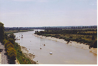
The Charente is a river in western France that runs in the Nouvelle-Aquitaine region . It has its source in the municipality of Chéronnac . It first drains to the northwest, then turns south at Civray and finally reaches Angoulême . There it turns west and flows past Jarnac and Cognac , about to Saintes . Finally it flows to the northwest and flows into the Atlantic Ocean below Rochefort on the Bay of Biscay . The estuary is opposite the Île d'Oléron . The river is 381 kilometers long and about 150 kilometers from the mouth to Angoulême can be used by ships. Below Saint-Savinien , it is already influenced by the tides and forms an estuary . The Charente was once an important transport route for the famous French brandy , which is known as cognac because of its origin . Today the river is mainly used by tourists with pleasure boats and houseboats .
Crossed departments
Tributaries
|
Left tributaries: |
Right tributaries: |
Places on the river
- Chéronnac
- Roumazières-Loubert
- Alloue
- Charroux
- Civray
- Ruffec
- Verteuil-sur-Charente
- Mansle
- Montignac-Charente
- Saint-Yrieix-sur-Charente
- Angoulême
- Nersac
- Châteauneuf-sur-Charente
- Jarnac
- cognac
- Saintes
- Tonnay-Charente
- Rochefort
- Fouras

