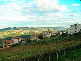
Dogliola
| Dogliola | ||
|---|---|---|

|
|
|
| Country | Italy | |
| region | Abruzzo | |
| province | Chieti (CH) | |
| Coordinates | 41 ° 57 ' N , 14 ° 38' E | |
| height | 445 m slm | |
| surface | 11 km² | |
| Residents | 326 (Dec. 31, 2019) | |
| Population density | 30 inhabitants / km² | |
| Post Code | 66050 | |
| prefix | 0873 | |
| ISTAT number | 069029 | |
| Popular name | Dogliolesi | |
| Patron saint | Rochus of Montpellier | |
| Website | Dogliola | |
Dogliola is a municipality ( comune ) in Italy with 326 inhabitants (as of December 31, 2019) in the province of Chieti in Abruzzo . The municipality is located about 59 kilometers southeast of Chieti , belongs to the Comunità montana Medio Vastese and borders directly on the province of Campobasso ( Molise ). The Trigno forms the eastern boundary of the municipality.
history
Originally - up to Roman antiquity - there was a necropolis on Monte Moro.
The place is mentioned for the first time in 1115.
traffic
The Strada Statale 650 di Fondo Valle del Trigno runs through the municipality from Isernia to San Salvo .
Web links
Commons : Dogliola - collection of images, videos and audio files
Individual evidence
- ↑ Statistiche demografiche ISTAT. Monthly population statistics of the Istituto Nazionale di Statistica , as of December 31 of 2019.


