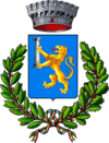
Roccamontepiano
| Roccamontepiano | ||
|---|---|---|

|
|
|
| Country | Italy | |
| region | Abruzzo | |
| province | Chieti (CH) | |
| Coordinates | 42 ° 15 ′ N , 14 ° 8 ′ E | |
| height | 500 m slm | |
| surface | 18.1 km² | |
| Residents | 1,635 (Dec. 31, 2019) | |
| Population density | 90 inhabitants / km² | |
| Post Code | 66010 | |
| prefix | 0871 | |
| ISTAT number | 069073 | |
| Popular name | Roccolani | |
| Patron saint | San Carlo | |
| Website | Roccamontepiano | |
 Roccamontepiano, Chiesa di San Rocco |
||
Roccamontepiano is an Italian commune with 1635 inhabitants (as of December 31, 2019) in the province of Chieti in the Abruzzo region .
geography
Roccamontepiano is about 25 km south of Chieti on the border with the province of Pescara , in the northeast of the Majella and the Majella National Park , to which the municipality does not belong. Roccamontepiano consists of several settlements on the wooded flanks of a plateau (Montepiano) made of travertine rock. The landscape is criss- crossed by numerous rock breaks ( calanchi ) and has many springs. The Alento river crosses the municipality shortly after its source.
The districts ( frazioni ) are the main town and administrative seat of San Rocco as well as Molino, Pomaro, Reginaldo, Francione, Sant'Angelo and Terranova. Roccamontepiano belongs to the administrative community Comunità montana della Maielletta . The neighboring communities are Bucchianico , Casalincontrada , Fara Filiorum Petri , Pretoro and Serramonacesca ( PE ).
history
In Lombard times a fortress was built on the slope of Montepiano. This is attested from the second half of the 9th century. Between the 10th and 11th centuries, Benedictine monks from the neighboring Abbazia di San Liberatore a Maiella built a monastery named after Saint Peter. From 1294 the monastery (San Pietro Celestino) belonged to the Cölestiner order . In the following centuries the area came as a fief to the Orsini family (15th century), the Condottiere Bartolomeo d'Alviano (1507), and in the 18th century to the Roman Colonna family .
The old town was destroyed by a landslide on June 24th, 1765. Today's Roccamontepiano was built in the 19th century below the old settlement.
Culture and sights
- Ruins of the Benedictine monastery of San Pietro Celestino - The building was built in the 12th century in Romanesque style from the local travertine stone.
- Chiesa di San Francesco Caracciolo - The church with attached monastery near San Rocco was built in the 18th century and belonged to the Order of the Minor Regular Clerics (Caracciolini).
Regular events
- Festa di San Giuseppe - Festival on May 1st in the Reginaldo district
- Palio dei fuochi di San Giovanni - Feast on June 25th
- Festa di San Rocco - folk festival in honor of the patron saint Rochus (August 16). The festival attracts many pilgrims as the waters of the grotto and spring of San Rocco are considered medicinal.
- Festa di San Carlo - Festival in honor of the patron saint of the community on November 4th in the Terranova district
- Festa della Madonna delle Grazie - Festival on September 8th in the district of Madonna delle Grazie
economy
The community lives mainly from agriculture (including olive and viticulture), small industry, handicrafts (ceramics, wickerwork, travertine processing) and tourism.
In the municipality of vines are varieties Montepulciano for the DOC - wine Montepulciano d'Abruzzo grown.
Web links
- Monastry San Pietro Celestino (English)
Individual evidence
- ↑ Statistiche demografiche ISTAT. Monthly population statistics of the Istituto Nazionale di Statistica , as of December 31 of 2019.

