Frederiksborg Office

from Wikipedia, the free encyclopedia
Basic data
Administrative headquarters: Hillerød
Surface: 1,347.4 km²
Residents: 378,686 (January 1, 2006)
Population density : 281 inhabitants per km²
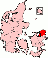
map
Frederiksborg's office
Frederiksborg.png

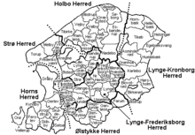
Frederiksborg Amt [ fʀɛðəʀegsˈbɔːʔʀ ] was a Danish commune on North Zealand . The main town was Hillerød . The area has belonged to the Hovedstaden region since 2007 .

From a geological point of view, it was predominantly a ground moraine landscape . From north to south it was crossed by a terminal moraine with the highest elevation Multebjerg ( 89  m above sea  level ) east of Helsinge .

Population development

until 1921 as of February 1, from 1971 as of January 1, exceptions see below :

  • 1769 - 037841 (January 15)
  • 1787 - 041,859 (July 1)
  • 1801 - 047,939
  • 1840 - 070,225
  • 1850 - 074,986
  • 1860 - 079,508
  • 1870 - 081,625
  • 1880 - 082,611
  • 1890 - 084,008
  • 1901 - 089,666
  • 1911 - 096,213
  • 1921 - 105,561
  • 1930 - 113,831 (November 5)
  • 1940 - 123,743 (November 5)
  • 1950 - 147,695 (November 7)
  • 1960 - 181,663 (September 26)
  • 1970 - 259,442 (November 9)
  • 1971 - 260,825
  • 1972 - 269,687
  • 1973 - 279,783
  • 1974 - 290,397
  • 1975 - 298,578
  • 1976 - 306,297
  • 1977 - 313,693
  • 1978 - 320,871
  • 1979 - 325,855
  • 1980 - 329.141
  • 1981 - 329,992
  • 1982 - 329,815
  • 1983 - 331,349
  • 1984 - 332,852
  • 1985 - 334,952
  • 1986 - 337,241
  • 1987 - 339,627
  • 1988 - 339,914
  • 1989 - 340,513
  • 1990 - 341,067
  • 1991 - 342,864
  • 1992 - 344,559
  • 1993 - 346.108
  • 1994 - 348,491
  • 1995 - 350,236
  • 1996 - 353,674
  • 1997 - 356,854
  • 1998 - 359,839
  • 1999 - 363,098
  • 2000 - 365,306
  • 2001 - 368,116
  • 2002 - 370,555
  • 2003 - 372,276
  • 2004 - 373,688
  • 2005 - 375,705
  • 2006 - 378,686

Municipalities

(Residents January 1, 2006)

swell

Web links

Commons : Frederiksborg Amt  - collection of images, videos and audio files

Coordinates: 56 ° 2 ′  N , 12 ° 19 ′  E