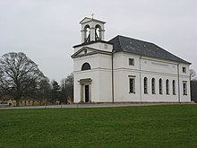
Hørsholm Municipality
|
|
|||
|
|||
| Basic data | |||
|---|---|---|---|
| State : | Denmark | ||
| Region : | Hovedstaden | ||
| Region : | North Sealand | ||
| Educated: | 1970 | ||
| Office (until the end of 2006) : | Frederiksborg Office | ||
|
Harde : (until March 1970) |
Lynge-Kronborg Herred | ||
| Residents : | 24,864 (2020) | ||
| Area : | 31.30 km² (2014) | ||
| Population density : | 794 inhabitants per km² | ||
| Municipality number : | 223 | ||
| Administration headquarters: | Hørsholm | ||
| Address: | Ådalsparkvej 2 2970 Hørsholm |
||
| Mayor: | Morten Slotved ( Det Conservative Folk Party ) |
||
| Website: | www.horsholm.dk | ||
| Sister cities : |
|
||
Hørsholm Kommune [ ˈhœʀshɔlʔm ] is a Danish municipality in the Hovedstaden region . The administrative seat is in the town of the same name, Hørsholm , whose settlement area now extends into the municipalities of Fredensborg and Rudersdal .
The municipality on the Øresund is accessed both by the railway line from Copenhagen to Helsingør and by the almost parallel motorway . The municipality extends over an area of 31.30 km², on which 24,864 inhabitants (as of January 1, 2020) live.
Parish communities and localities in the municipality
The following parish communities ( Danish : Sogn ) and localities with over 200 inhabitants ( byer according to the definition of the Danish statistical office ) are located in the municipality , with a registered population of zero the place had more than 200 inhabitants in the past:
| No. | Parish | Residents | Locality | Residents |
|---|---|---|---|---|
| Blovstrød Sogn | 3,698 | Hørsholm | 24,341 | |
| Hørsholm Sogn | 12,312 | |||
| Kokkedal Sogn | 5,704 | |||
| Rungsted Sogn | 6,422 | Trørød (a) | January 1, 2009: 194 |
population
Development of the population (January 1st) :
- 1980 - 21,585
- 1985 - 22,390
- 1990-23,176
- 1995 - 23,377
- 1999 - 23,469
- 2000 - 23,648
- 2003 - 24,208
- 2005 - 24,292
- 2010 - 24,378
- 2020 - 24,864
economy
VKR-Holding A / S, with the Velux brand , is based in Hørsholm.
Hirschholm Castle
The place already had a small castle in the 15th century, which King Christian VI. inherited from his mother Louise zu Mecklenburg in 1721 . He and his wife Sophie Magdalene von Brandenburg-Kulmbach had it expanded and rebuilt and moved into the new Hirschholm Palace ( Danish: Hirschholm Slot ) in 1739.
After Sophie Magdalene's death (1770), her grandson, Christian VII. Lived there from 1770 to 1771 with his wife Caroline Mathilde and her German personal physician Johann Friedrich Struensee . After the birth of Louise Auguste of Denmark , the departure of the royal couple and the Struensee affair , the castle was no longer inhabited and was demolished in 1810.
Town twinning
Hørsholm maintains a city partnership with Oulainen in Finland .
Daughters and sons
- Louise Auguste of Denmark (* 1771, † 1843), daughter of Christian VII of Denmark and his wife Caroline Mathilde of Great Britain
- Holger Werfel Scheuermann (* 1877; † 1960), orthopedist and radiologist
- Louise Hansen (* 1975), soccer player
- Kristine Roug (* 1975), sailor, Olympic champion and world champion
- Peter Løvenkrands (* 1980), football player
- Morten Green (born 1981), ice hockey player
- Lotte Friis (* 1988), swimmer
Individual evidence
- ↑ a b c Statistics Banks -> Befolkning og valg -> BY1: Folketal January 1st efter byområde, alder og køn (Danish)
- ↑ a b Statistics Banks -> Geografi, miljø og energi -> ARE207: Areal demands efter municipality / region (Danish)
- ↑ danskekommuner.dk: Borgmesterffekta: Hørsholm (Danish), accessed on April 18, 2020
- ↑ Statistics banks -> Befolkning og valg -> KM1: Befolkningen January 1st, April 1st, July 1st and October 1st, so and folkekirkemedlemsskab (Danish)
- ^ Nyt fra Danmarks Statistics - No.160. (PDF, 83 kB) April 15, 2010, accessed November 30, 2010 (Danish).
- ^ LE Hein, EM Sand Ottsen, CM Smidt: Hørsholm i 250 Å . Ed .: Hørsholm Egns Museum. 1989.
Web links
Coordinates: 55 ° 53 ' N , 12 ° 30' E


