
Guttenberg (Upper Franconia)
| coat of arms | Germany map | |
|---|---|---|

|
Coordinates: 50 ° 9 ′ N , 11 ° 34 ′ E |
|
| Basic data | ||
| State : | Bavaria | |
| Administrative region : | Upper Franconia | |
| County : | Kulmbach | |
| Management Community : | Untereinach | |
| Height : | 452 m above sea level NHN | |
| Area : | 10.65 km 2 | |
| Residents: | 474 (Dec. 31, 2019) | |
| Population density : | 44 inhabitants per km 2 | |
| Postal code : | 95358 | |
| Area code : | 09225 | |
| License plate : | KU, EBS , SAN | |
| Community key : | 09 4 77 118 | |
| Community structure: | 14 districts | |
| Address of the municipal administration: |
Main street 33a 95358 Guttenberg |
|
| Website : | ||
| Mayor : | Eugen Hain ( CSU / PWG ) | |
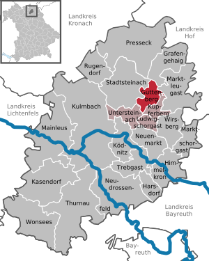
| Location of the Guttenberg community in the Kulmbach district | ||
  |
||

Guttenberg is a municipality in the district of Kulmbach ( Upper Franconia administrative region ). With fewer than 500 inhabitants, it is the smallest independent municipality in Upper Franconia.
geography
Geographical location
The community Guttenberg is located on the southeast edge of the Franconian Forest Nature Park .
Community structure
The Guttenberg community is divided into 14 districts:
|
history
Until the church is planted
The history of the community is closely linked to that of the Guttenberg family . Guttenberg was first mentioned in a document in 1148. Heinrich von Plassenberg built the local Guttenberg castle in 1315 , after which his descendants were named. The Alt- and Neuguttenberg castles were destroyed by the Swabian Federation in 1523 , but were rebuilt (see also Wandereisen woodcuts from 1523 ). The rule of von Guttenberg, who also belonged to the Franconian Knight Circle, was occupied by Bavaria in 1802 , handed over to Prussia in 1804, taken over by France after the Peace of Tilsit in 1807 and finally fell to Bavaria in 1810. In 1818 the Bavarian municipal edict created today's municipality.
Outsourcing
In 1951, the 120 inhabitants of the Neuguttenberg district applied to be reunited with Traindorf . In a vote, 80% voted in favor of the reclassification. On January 1, 1964, the government of Upper Franconia approved the change of area.
Population development
In the period from 1988 to 2018, the population fell from 495 to 484 by 11 or 2.2%. On December 31, 2002 Guttenberg had 583 inhabitants.
- 1961: 657 inhabitants (already without Neuguttenberg)
- 1970: 618 inhabitants
- 1987: 502 inhabitants
- 1991: 530 inhabitants
- 1995: 578 inhabitants
- 2000: 561 inhabitants
- 2005: 579 inhabitants
- 2010: 536 inhabitants
- 2015: 501 inhabitants
- 2016: 488 inhabitants
politics
The community is a member of the Untersteinach administrative community .
mayor
Eugen Hain has been the first mayor since May 1996 (CSU / non-party voter community).
Municipal council
The local elections in 2002, 2008 and 2014 led to the following allocation of seats in the local council:
| 2002 | 2008 | 2014 | |
|---|---|---|---|
| CSU / non-party voter community | 6th | 6th | 6th |
| SPD / Free Voters * | 2 | 2 | 2 |
| total | 8th | 8th | 8th |
* 2002: SPD / Free Voting Community
coat of arms
|
|
Blazon : "Over a silver shield base, inside a continuous red paw cross, in blue a golden heraldic rose with silver sepals." |
Culture and sights

Some stately buildings of the Guttenberg family shape the appearance of the community. The prominently located Guttenberg Castle and the Lower Castle, of which the main building at bee garden No. 2 has been preserved, are particularly striking. The German-Canadian architect Louis Löschner , a representative of the Bauhaus School, lived there from 1951 to 1959 .
Architectural monuments
Soil monuments
Sons and daughters of the church
- Christian Nutzel (1881–1942), folk song collector
Honorary citizen
- Enoch zu Guttenberg (1946–2018), conductor
literature
- Johann Kaspar Bundschuh : Guttenberg . In: Geographical Statistical-Topographical Lexicon of Franconia . tape 2 : El-H . Verlag der Stettinische Buchhandlung, Ulm 1800, DNB 790364298 , OCLC 833753081 , Sp. 447-448 ( digitized version ).
- Pleikard Joseph Stumpf : Guttenberg . In: Bavaria: a geographical-statistical-historical handbook of the kingdom; for the Bavarian people . Second part. Munich 1853, p. 643 ( digitized version ).
Web links
- Guttenberg community
- Statistics municipal 2010 Selection of important statistical data for the Guttenberg municipality, Bavarian State Office for Statistics (PDF; 1.3 MB)
- Guttenberg (Upper Franconia): Official statistics of the LfStat
Individual evidence
- ↑ "Data 2" sheet, Statistical Report A1200C 202041 Population of the municipalities, districts and administrative districts 1st quarter 2020 (population based on the 2011 census) ( help ).
- ↑ http://www.bayerische-landesbibliothek-online.de/orte/ortssuche_action.html ? Anzeige=voll&modus=automat&tempus=+20111031/160040&attr=OBJ&val= 1266
- ↑ Council information. Guttenberg community, accessed on August 9, 2020 .
- ^ Entry on the coat of arms of Guttenberg (Upper Franconia) in the database of the House of Bavarian History

Earl wage | Guttenberg | Harsdorf | Sky crown | Kasendorf | Ködnitz | Kulmbach | Kupferberg | Ludwigschorgast | Mainleus | Marktleugast | Marktschorgast | Neudrossenfeld | Neuenmarkt | Presseck | Rugendorf | Stadtsteinach | Thurnau | Trebgast | Untereinach | Wirsberg | Wonsees