
Hüttermühle (Kranenbach)
| Huttermühle
|
||
|---|---|---|
 The Hüttermühle in Schwalmtal-Amern |
||
| Location and history | ||
|
||
| Coordinates | 51 ° 14 '20 " N , 6 ° 13' 35" E | |
| Location | Germany | |
| Waters | Kranenbach | |
| Built | 1646 in a land map | |
| Shut down | 1925/26 after the stream regulation | |
| technology | ||
| use | Oil mill | |
| Grinder | 1 grind | |
| drive | Watermill | |
| water wheel | undershot | |

The Hüttermühle in the municipality of Schwalmtal was a water mill with an undershot water wheel .
geography
The Hüttermühle was located at Kranenbach , Kranenbruch 32, in the Amern district in the Schwalmtal municipality in the Viersen district. Above the Hüttermühle was the Pletschmühle . The water level of the Kranenbach in this area was 45 m above sea level. The care and maintenance of the Kranenbach is the responsibility of the Schwalm Association , which is based in Brüggen .
history
The Hüttermühle stands at the end of the old Kranenbruch farm row, where the Kranenbach bends to the west. That is "in the huts", which does not mean the houses and farms, but the kink ("hütt" or "hött" = "corner"). As "Mühlgen in der hütten" it was created in 1646 by the Dülken surveyor Georch Heuttmechers Marked land map .
The mill does not appear under the nobility . It was probably a private mill for the Kranenbruch farmers and of no further economic importance. After the brook regulation in 1925/26, electrical grinding continued for a few years . Since the millstone seen on the property is the stone of a pan mill , it can be assumed that the Hüttermühle was an oil mill.
gallery
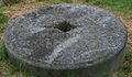
Stone of a pan mill

Bench with signature

Tranchot map from 1806


literature
- Hans Vogt: Lower Rhine water mill guide . Niederrhein Association, 1998, ISBN 978-3-00-002906-6 , p. 456-457 .
Web links
At the Schwalm :
Borner Mühle |
Brempter mill |
Brüggener Mill |
Dilborn Mill |
Frankenmühle |
Jennekes Mill |
Lüttelforster Mühle |
Mühlrath mill |
Breakdown mill |
Papelter mill |
Radermühle |
Vennmühle
An der Niers :
Clörather Mühle |
Gibber mill |
Holtzmühle |
Langendonker Mill |
Mülhausen mill |
Neersdommer Mill |
Oedter Mill |
Schlossmühle Neersen
An der Nette :
Flootsmühle |
Henkenmühle |
Kothmühle |
Leuther Mill |
Lüthemühle |
Mill House Baerlo |
Nelsenmühle |
Neumühle |
Tüschenmühle |
Weuthenmühle
Am Hammer Bach :
Bongartzmühle |
Hammer mill |
Hüstermühle |
Plinzenmühle |
Schnockesmühle |
Sgoedenmühle
Am Dorfer Bach :
Biestenmühle |
Goetersmühle |
Kaisermühle |
Kimmelmühle |
Schricksmühle
Am Kranenbach :
Hausermühle |
Hüttermühle |
Pletschmühle |
Schierer Mühle
Am Mühlenbach :
Weiher Mühle |
Specker Mühle
Am Pletschbach :
Pletschmühle
Am Rintger Bach :
Klostermühle