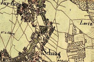
Specker Mill
| Specker Mill
|
||
|---|---|---|
|
Tranchot card No. 34 1802/04 |
||
| Location and history | ||
|
|
||
| Coordinates | 51 ° 17 '11 " N , 6 ° 14' 47" E | |
| Location | Germany | |
| Waters | Mühlenbach | |
| Built | 1503 documentary mention | |
| Shut down | laying down before 1700 | |
| technology | ||
| use | Flour mill | |
| Grinder | 1 grind | |
| drive | Watermill | |
| water wheel | 1 undershot | |
The Specker mill was at the mill creek located watermill in Nettetal - Schaag with an undershot water wheel .
geography
The Specker Mühle stood on the Mühlenbach, a tributary of the Nette, and was located in the Schaag district of the city of Nettetal. The area has a height of approx. 46 m above sea level . The maintenance and upkeep of the Mühlbach is the responsibility of the Netteverband .
history
The Specker Mühle was located on the upper reaches of the Mühlenbach and was mentioned in a document in 1503. The mill was an accessory to the Spilburg feudal estate and was owned by the von Kessel family. It lay at the bend in the mill stream from Speck to Berg. The mill was of little importance and suffered from a lack of water. The grinding mill was shut down before 1700 due to its dilapidation.
literature
- Hans Vogt: Niederrheinischer Wassermühlenführer 2nd edition. Niederrhein Association, Krefeld 1998, ISBN 3-00-002906-0 , pp. 462-464.
- Josef Funken: Die Breyeller Mühlen Heimatbuch des Kreis Kempen-Krefeld 1965, pp. 154–163.
Individual evidence
- ↑ An overview of rivers ( memento of the original dated November 24, 2015 in the Internet Archive ) Info: The archive link was inserted automatically and has not yet been checked. Please check the original and archive link according to the instructions and then remove this notice. on the website of the Netteverband, accessed on June 6, 2012

