
Floot mill
| Floot mill
|
||
|---|---|---|
 The Flootsmühle in Nettetal-Hinsbeck |
||
| Location and history | ||
|
||
| Coordinates | 51 ° 21 '24 " N , 6 ° 16' 33" E | |
| Location | Germany | |
| Waters | Nice | |
| Built | 1556 first mention | |
| Shut down | 1875 resignation | |
| technology | ||
| use | Grain mill | |
| Grinder | 1 grind | |
| drive | Watermill | |
| water wheel | undershot | |

The Flootsmühle is a former watermill in Nettetal - Hinsbeck , located on the Nette, with an undershot water wheel .
geography
The Flootsmühle is located on the Nette , on Herscheler Weg in the Hinsbeck district , a district of the city of Nettetal in the Viersen district in North Rhine-Westphalia. The Nette has a height of approx. 41 m above sea level here . The care and maintenance of the water is the responsibility of the Netteverband , which is based in Nettetal.
history
The Flootsmühle on the old Roman road was first mentioned in a Grenzweisum from 1556 "ghet aen op Vloevarts muelen". The names and spellings of the mill were also "Vlovartse-", "Florts-", "Fluerts-", up to "Flootsmühle" today. The mill had belonged to Count Schaesberg since 1706 and was operated as a grain mill. The mill was closed in 1875. Today there is a small, neat residential building here. The current pilgrim cross in the front garden is a traditional resting place for Kevelaer pilgrims. It stands in the place of an older cross that was set up centuries ago for an injured carter.
gallery

Memory of the floot mill

The bridge at the Flootsmühle
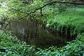
The nice one in the Flootsmühle area

The memorial cross at the Flootsmühle

Tranchot card No. 34 1802/04


literature
- Hans Vogt: Lower Rhine water mill guide. 2nd Edition. Niederrhein Association, Krefeld 1998, ISBN 3-00-002906-0 , pp. 469-470.
Web links
Individual evidence
At the Schwalm :
Borner Mühle |
Brempter mill |
Brüggener Mill |
Dilborn Mill |
Frankenmühle |
Jennekes Mill |
Lüttelforster Mühle |
Mühlrath mill |
Breakdown mill |
Papelter mill |
Radermühle |
Vennmühle
An der Niers :
Clörather Mühle |
Gibber mill |
Holtzmühle |
Langendonker Mill |
Mülhausen mill |
Neersdommer Mill |
Oedter Mill |
Schlossmühle Neersen
An der Nette :
Flootsmühle |
Henkenmühle |
Kothmühle |
Leuther Mill |
Lüthemühle |
Mill House Baerlo |
Nelsenmühle |
Neumühle |
Tüschenmühle |
Weuthenmühle
Am Hammer Bach :
Bongartzmühle |
Hammer mill |
Hüstermühle |
Plinzenmühle |
Schnockesmühle |
Sgoedenmühle
Am Dorfer Bach :
Biestenmühle |
Goetersmühle |
Kaisermühle |
Kimmelmühle |
Schricksmühle
Am Kranenbach :
Hausermühle |
Hüttermühle |
Pletschmühle |
Schierer Mühle
Am Mühlenbach :
Weiher Mühle |
Specker Mühle
Am Pletschbach :
Pletschmühle
Am Rintger Bach :
Klostermühle