
Vennmühle
| Vennmühle
|
||
|---|---|---|
 Vennmühle |
||
| Location and history | ||
|
||
| Coordinates | 51 ° 14 '23 " N , 6 ° 11' 41" E | |
| Location |
Germany
|
|
| Waters | Schwalm | |
| Built | 1473 | |
| Shut down | 1928 after a fire | |
| technology | ||
| use | Oil mill | |
| Grinder | 1 oil press | |
| drive | Watermill | |
| water wheel | undershot | |
| Website | Vennmühle website | |

The Vennmühle was a water mill in the municipality of Brüggen that was operated as an oil mill .
geography
The Vennmühle is located on the Schwalm on Vennmühlenweg in the municipality of Brüggen in the district of Viersen . Above is the Borner Mühle , below the Brüggener Mühle . The water level of the Schwalm is 42 m above sea level.
history
The Vennmühle was an oil mill that was first named after a fire in 1473 and belonged to the property of St. Pantaleon. The mill was on the edge of the Laarer Bruch, in which peat was cut until the 19th century . It burned down again in 1750, but was rebuilt and came into the possession of the Printzen family from Amern in 1821 . They converted the mill into a paper mill in 1836 . In 1928 the Vennmühle burned down again. This third fire accident also meant the end of the mill. Between 1934 and 1942, the building served as a warehouse for the Reich Labor Service , which was involved in the Schwalm regulation . The main building now serves as a kindergarten .
Monument description
19th century house, 2-storey in 4: 2 axes, brick , grouted, hipped roof .
(List of monuments No. 41, entry: June 21, 1990)
gallery
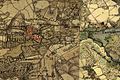
Tranchot map 1806

literature
- Hans Vogt: Lower Rhine water mill guide. Krefeld 1998, pages 443-445.
- Horst Jungbluth, Helmuth Elsner: The Schwalm - valley of the mills. Schwalmtal 1989, page 60.
Web links
Individual evidence
At the Schwalm :
Borner Mühle |
Brempter mill |
Brüggener Mill |
Dilborn Mill |
Frankenmühle |
Jennekes Mill |
Lüttelforster Mühle |
Mühlrath mill |
Breakdown mill |
Papelter mill |
Radermühle |
Vennmühle
An der Niers :
Clörather Mühle |
Gibber mill |
Holtzmühle |
Langendonker Mill |
Mülhausen mill |
Neersdommer Mill |
Oedter Mill |
Schlossmühle Neersen
An der Nette :
Flootsmühle |
Henkenmühle |
Kothmühle |
Leuther Mill |
Lüthemühle |
Mill House Baerlo |
Nelsenmühle |
Neumühle |
Tüschenmühle |
Weuthenmühle
Am Hammer Bach :
Bongartzmühle |
Hammer mill |
Hüstermühle |
Plinzenmühle |
Schnockesmühle |
Sgoedenmühle
Am Dorfer Bach :
Biestenmühle |
Goetersmühle |
Kaisermühle |
Kimmelmühle |
Schricksmühle
Am Kranenbach :
Hausermühle |
Hüttermühle |
Pletschmühle |
Schierer Mühle
Am Mühlenbach :
Weiher Mühle |
Specker Mühle
Am Pletschbach :
Pletschmühle
Am Rintger Bach :
Klostermühle