
Holenberg
| coat of arms | Germany map | |
|---|---|---|

|
Coordinates: 51 ° 55 ' N , 9 ° 35' E |
|
| Basic data | ||
| State : | Lower Saxony | |
| County : | Holzminden | |
| Joint municipality : | Bevern | |
| Height : | 220 m above sea level NHN | |
| Area : | 7.36 km 2 | |
| Residents: | 405 (Dec. 31, 2019) | |
| Population density : | 55 inhabitants per km 2 | |
| Postal code : | 37642 | |
| Area code : | 05532 | |
| License plate : | HOL | |
| Community key : | 03 2 55 021 | |
| Association administration address: | Angerstrasse 13 a 37639 Bevern |
|
| Website : | ||
| Mayoress : | Beate Lönnecker ( CDU ) | |
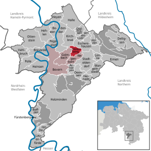
| Location of the community of Holenberg in the Holzminden district | ||
  |
||

Holenberg is a municipality in the Holzminden district in Lower Saxony ( Germany ) and is part of the Bevern municipality .
geography
Geographical location
Holenberg is a place on the southern slope of the Vogler . Immediately to the west of the place rises the Krümmecke, north of the place the Mollerbach, which passes the place in the east. Both waters flow into the Forstbach . Holenberg is surrounded on three sides by mountains of the Voglers, which belong to the municipality, in the south the area slopes down to the Forstbachtal. In the west, the 302.4 m above sea level rises . NN high vineyard, which is designated as a nature reserve, in the northwest of the Himbeerbrink ( 400.5 m above sea level. NN ), in the north of the Bax mountain as a foothill of the Kohlhai, which is 440.8 m above sea level. NN is the highest elevation of the municipality, in the northeast the Tollburg, which is also a mountain spur of the cabbage shark, and in the east the Bützeberg ( 352.6 m above sea level ).
history
It is not known since when Holenberg was continuously settled. The first written mention can be found in a document of the Hildesheim Monastery before 1007 as "Holanberg". The name probably goes back to the location in a depression between the foothills of the Vogler . Later documents show that Holenberg belonged completely to the Amelungsborn monastery since 1493 . In a document from 1556, the place is then described as "newly built", so it was probably completely or partially devastated in the 15th century. It is assessed differently whether this was the case due to late medieval feuds or through conversion into an Amelungsborner Vorwerk .
Until the end of 2010, Holenberg was a state-approved resort .
Place name
Old variations of the place name are around 1007 Holanberg, 1197 Holenberg, 1197 Holemberghe and around 1217 Holenberge.
Word formation with the basic word "mountain". In the first part of the word, see Old Saxon, Middle Low German “hol” or “hollow”. That should mean the "trough-shaped, sunk". The motif for the naming is likely to be a depression surrounded by the foothills of the Vogler. Especially seen from the south with a view of Holenberg, relatively steep hills rise to the west, north and east, so that the settlement area is clearly depressed.
politics
Municipal council
After the local elections on September 11, 2016 , the municipal council consists of:
- CDU: 4 seats
- SPD 1 seat
- Green 1 seat
- Individual applicant Bodo Marten: 1 seat
mayor
Beate Lönnecker has been mayor since November 2016. Volker Marten ( Bündnis 90 / Die Grünen ) held the office of mayor from March 2015 to October 2016. Before that, Matthias Moersener (SPD) held the office from September 2011 to March 2015. From 2001 to 2011 the current district administrator Angela Schürzenberg (SPD) was mayor.
Coats of arms, colors and official seals

The coat of arms of the municipality of Holenberg shows three upright two-to-one golden triangles in green.
The colors of the parish are green and yellow.
The official seal contains the coat of arms and the inscription: "Gemeinde Holenberg Landkreis Holzminden".
Culture
Religions
81% of the population of Holenberg are Protestant , 5% are Catholic ,
14% belong to another or no religious community.
societies
- TSV Holenberg
Individual evidence
- ↑ State Office for Statistics Lower Saxony, LSN-Online regional database, Table 12411: Update of the population, as of December 31, 2019 ( help ).
- ↑ Lower Saxony State Administration Office - State Surveying -: Topographical Map 1: 25000, sheet 4023 Eschershausen , Hanover 1995, ISBN 3-89435-394-5
- ↑ Kirstin Casemir and Uwe Ohainski: The place names of the district of Holzminden . Publishing house for regional history, Bielefeld 2007. ISBN 978-3-89534-671-2 , p. 116f
- ^ Jürgen Udolph (research): The "place name researcher". In: website NDR 1 Lower Saxony . Archived from the original on November 27, 2015 ; accessed on August 4, 2019 .
-
↑ § 2 of the main statute of the municipality of Holenberg of December 15, 2011,
printed in the official gazette for the district of Holzminden no. 1/2012 ( page no longer available , search in web archives ) Info: The link was automatically marked as defective. Please check the link according to the instructions and then remove this notice. (PDF; 4.1 MB) of January 18, 2012, page 19 The description of the coat of arms printed there ("The coat of arms shows three upright golden triangles, two next to each other and one above them on a green background.") Does not correspond to the rules of one heraldically correct blazon .
Web links
Arholzen | Bevern | Bodenwerder | Boffzen | Brevörde | Deensen | Delligsen | Derental | Dielmissen | Buckets | Eschershausen | Fürstenberg | Golmbach | Hall | Caves | Heinade | Heinsen | Heyen | Holenberg | Wood | Holzminden | Kirchbrak | Lauenförde | Lenne | Lüerdissen | Negenborn | Ottenstein | Pegestorf | Pollen | Stadtoldendorf | Vahlbruch | Wangelnstedt
Unregulated areas in the district of Holzminden
Boffzen |
Buckets |
Eschershausen |
Green plan |
Holzminden |
Merxhausen |
Wenzen